Related Research Articles

Knoxville is a city in and the county seat of Knox County in the U.S. state of Tennessee. As of July 1, 2019, Knoxville's population was 187,603, making it the largest city in the East Tennessee Grand Division, and the state's overall third largest city after Nashville and Memphis. Knoxville is the principal city of the Knoxville Metropolitan Statistical Area, which had an estimated population of 869,046 in 2019.
U.S. Route 11E is a divided highway of US 11 in the U.S. states of Tennessee and Virginia. The U.S. Highway, which is complemented by US 11W to the north and west, runs 120.9 miles (194.6 km) from US 11, US 11W, and US 70 in Knoxville, Tennessee north and east to US 11, US 11W, US 19, and US 421 in Bristol, Virginia. US 11E connects Knoxville and the twin cities of Bristol, Virginia and Bristol, Tennessee with the East Tennessee communities of Morristown, Greeneville, and Johnson City. The U.S. Highway runs concurrently with US 70 and US 25W east of Knoxville, US 321 from Greeneville and Johnson City, and both US 19W and US 19 between Johnson City and Bristol. US 11E also has an unsigned concurrency with Tennessee State Route 34 for almost all of its course in Tennessee.
The following is a list of neighborhoods and commercial districts in Sioux City, Iowa.

Morningside/Lenox Park is an intown neighborhood in Atlanta, Georgia founded in 1923. It is located north of Virginia-Highland, east of Ansley Park and west of Druid Hills. Approximately 3,500 households comprise the neighborhood that includes the original subdivisions of Morningside, Lenox Park, University Park, Noble Park, Johnson Estates and Hylan Park.
Chilhowee Park is a public park, fairgrounds and exhibition venue in Knoxville, Tennessee, United States, located off Magnolia Avenue in East Knoxville. Developed in the late 19th century, the park is home to the Tennessee Valley Fair and hosts several dozen expositions annually. The park covers 81 acres (33 ha), and includes a 57,100-square-foot (5,300 m2) exposition center, a 1910-era bandstand, a 4,500-seat amphitheater, and a 3-acre (1.2 ha) lake, Lake Ottosee. The park is also home to The Muse Knoxville, a children's science museum formerly known as the East Tennessee Discovery Center.

Chilhowee was a prehistoric and historic Native American site in present-day Blount and Monroe counties in Tennessee, in what were the Southeastern Woodlands. Although now submerged by the Chilhowee Lake impoundment of the Little Tennessee River, the Chilhowee site was home to a substantial 18th-century Overhill Cherokee town. It may have been the site of the older Creek village "Chalahume" visited by Spanish explorer Juan Pardo in 1567. The Cherokee later pushed the Muscogee Creek out of this area.
West Knoxville is a section of Knoxville, Tennessee, west of the city's downtown area. It stretches from Sequoyah Hills on the east to the city's border with Farragut on the west. West Knoxville is concentrated around Kingston Pike (US-70/US-11), and along with Sequoyah Hills includes the neighborhoods of Lyons View, Forest Hills, Bearden, West Hills, Westmoreland Heights, Cedar Bluff, and Ebenezer.
North Knoxville is the section of Knoxville, Tennessee, USA, that lies north of the city's downtown area. It is concentrated around Broadway (US-441), Clinton Highway (US-25W), Tazewell Pike (TN-331), Washington Pike, and adjacent roads, and includes the neighborhoods of Fountain City, Inskip-Norwood, Oakwood-Lincoln Park, Old North Knoxville, Fourth and Gill, North Hills, and Whittle Springs. North Knoxville is bisected by Sharp's Ridge, a 7-mile (11 km) elongate ridge that rises prominently above the surrounding terrain.
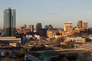
Downtown Knoxville is the downtown area of Knoxville, Tennessee, United States. It contains the city's central business district and primary city and county municipal offices. It is also home to several retail establishments, residential buildings, and the city's convention center, and World's Fair Park. The downtown area contains the oldest parts of Knoxville, and is home to the city's oldest buildings.
Bearden, also known as Bearden Village, is a neighborhood in Knoxville, Tennessee, United States, located along Kingston Pike in West Knoxville. Developed primarily as an agrarian community in the 19th century, this neighborhood now lies at the heart of one of Knoxville's major commercial corridors. Named for former Knoxville mayor and Tennessee state legislator, Marcus De Lafayette Bearden (1830–1885), the community was annexed by Knoxville in 1962.

Fourth and Gill is a neighborhood in Knoxville, Tennessee, United States, located north of the city's downtown area. Initially developed in the late nineteenth century as a residential area for Knoxville's growing middle and professional classes, the neighborhood still contains most of its original Victorian-era houses, churches, and streetscapes. In 1985, 282 houses and other buildings in the neighborhood were added to the National Register of Historic Places as the Fourth and Gill Historic District.
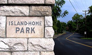
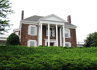
Island Home Park is a neighborhood in Knoxville, Tennessee, United States, located in the southeastern part of the city along the Tennessee River. Developed as a streetcar suburb in the early 1900s, the neighborhood retains most of its original houses and streetscapes, and is home to the city's largest concentration of Bungalow-style houses. In 1994, several dozen houses in Island Home Park were added to the National Register of Historic Places as the Island Home Park Historic District.

Oakwood-Lincoln Park is a residential and commercial neighborhood in Knoxville, Tennessee, United States that was developed in the early 20th century as two suburban neighborhoods.
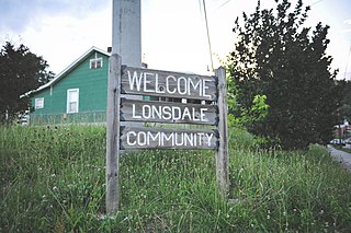
Lonsdale is a neighborhood in Knoxville, Tennessee, United States, located northwest of the city's downtown area. Established in the late-19th century as a land development project, Lonsdale incorporated as a separate city in 1907, and was annexed by Knoxville in 1917. After a period of decline in the latter half of the 20th century, Lonsdale has recently undergone several major revitalization efforts.
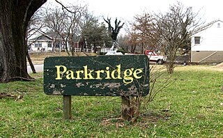
Parkridge is a neighborhood in Knoxville, Tennessee, United States, located off Magnolia Avenue east of the city's downtown area. Developed as a streetcar suburb for Knoxville's professional class in the 1890s, the neighborhood was incorporated as the separate city of Park City in 1907, and annexed by Knoxville in 1917. In the early 1900s, the neighborhood provided housing for workers at the nearby Standard Knitting Mills factory.

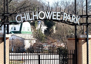
Chilhowee Park is a residential neighborhood in Knoxville, Tennessee, United States, located off Magnolia Avenue in the East Knoxville area. Developed as a streetcar suburb in the 1890s, this neighborhood was initially part of Park City, which was incorporated as a separate city in 1907, and annexed by Knoxville in 1917. Chilhowee Park lies adjacent to one of Knoxville's largest municipal parks, as well as Zoo Knoxville. The neighborhood contains a notable number of early-20th-century houses.
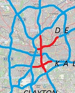
There have been multiple freeway revolts in Atlanta, Georgia. The longest and most famous examples of Interstate opposition were against I-485 and the Stone Mountain Freeway through Intown Atlanta, lasting over 30 years, from the early 1960s until the final construction of Freedom Parkway on a small portion of the contested routes in 1994.
References
- ↑ City of Knoxville - Parks Archived 2011-08-24 at the Wayback Machine (parks in or near these neighborhoods are listed in "East"). Retrieved: 29 June 2011.
- 1 2 John Wooldridge, George Mellen, William Rule (ed.), Standard History of Knoxville, Tennessee (Chicago: Lewis Publishing Company, 1900; reprinted by Kessinger Books, 2010), pp. 137-138.
- ↑ William MacArthur, Lucile Deaderick (ed.), "Knoxville's History: An Interpretation," Heart of the Valley: A History of Knoxville, Tennessee (Knoxville, Tenn.: East Tennessee Historical Society, 1976), p. 50.
- ↑ About Parkridge Community Organization. Retrieved: 29 June 2011.
- ↑ Stambaugh, J.J. (June 28, 2009). "Addictions to drugs, thrills keep Knoxville prostitutes on the streets". Knoxville News Sentinel . Retrieved October 5, 2020.
- ↑ Magnolia Avenue Corridor Plan, 2009, pp. 1-8. Retrieved: 29 June 2011.