Eildon, Victoria

Last updated

Eildon
Victoria
Australia Victoria Murrindindi Shire location map.svg
Red pog.svg
Eildon
Coordinates 37°14′0″S145°55′0″E / 37.23333°S 145.91667°E / -37.23333; 145.91667
Population974 (2016 census) [1]
Postcode(s) 3713
Elevation232 m (761 ft)
Location
LGA(s) Shire of Murrindindi
State electorate(s) Eildon
Federal division(s) Indi
Mean max tempMean min tempAnnual rainfall
20.5 °C
69 °F
8.0 °C
46 °F
850.7 mm
33.5 in

Eildon is a town in central Victoria, Australia. It is located near Lake Eildon, on the Goulburn Valley Highway, in the Shire of Murrindindi local government area. At the 2016 census, Eildon had a population of 974. [1]

Contents

Taungurung people are the traditional owners of the land around Eildon (which stretches north-east beyond Mansfield, Victoria and to the west nearly to Bendigo). Taungurung country is part of the Kulin nation. [2]

The name Eildon was given to the township by some of the first white settlers in the area, Mr and Mrs Archibald Thom in 1846, and was so named for its similarities to Mrs Thom's birthplace in the Eildon Hills near Abottsford in Scotland. [3]

History

Lake Eildon National Park from above. March 2021. Lake Eildon National Park from above. March 2021.jpg
Lake Eildon National Park from above. March 2021.

Eildon as a township came about due to the construction of the Sugarloaf Reservoir. The township of Darlingford (which was located near the junction of Big River and the Goulburn River) was established in the 1860s, when gold was discovered nearby, however when the construction of the reservoir commenced in 1915, which would ultimately flood the land behind the dam wall, including the township of Darlingford and Eildon Station (a run of 25,000 hectares owned by the Thoms). The town of Darlingford was moved closer to where the current township is now located. The Sugarloaf Dam was completed in 1929, and the original town of Darlingford is now completely underwater. [4]

Workers were brought into the town by the State Rivers and Water Supply Commission to work on the building of the reservoir, and the shanty town called Eildon began to develop. Many lived in tents.

The original Sugarloaf Dam could only hold around 10% of the capacity of the current dam, and so construction of the Eildon Dam commenced in 1951 and was completed by 1956 to increase the size and capacity of the lake. The Sugarloaf Reservoir Dam Wall sits about 100 metres behind the current dam wall, and is visible when the water level drops very low.

Around 4,000 workers were required to complete the 1950s construction, and these workers were brought in, but required housing. The new township of Eildon relocated to the present position, and comprises a series of 300 semi-permanent houses in 14 different styles. Materials for the houses were pre-cut and fabricated in England and assembled onsite. Temporary houses and hostels were built to accommodate more workers. If you drive around Eildon today, you will see many houses are still the original pre-fabricated houses erected for workers in the 1950s. [4]

A Post Office named Eildon opened on 14 November 1890 and closed in 1893. Later a Post Office named Eildon Weir opened on 23 August 1915 and was renamed Eildon in about 1950. [5]

Climate

Lake Eildon is most notable for its extraordinary cloud cover in winter (measuring only 69.0 sunshine hours in June); this is especially cloudy for a location at only 37 degrees of latitude.

Climate data for Lake Eildon (1970–2022, rainfall to 1887); 230 m AMSL; 37.23° S, 145.91° E
MonthJanFebMarAprMayJunJulAugSepOctNovDecYear
Record high °C (°F)43.3
(109.9)
45.4
(113.7)
39.1
(102.4)
34.1
(93.4)
26.9
(80.4)
20.5
(68.9)
21.0
(69.8)
24.5
(76.1)
28.5
(83.3)
34.2
(93.6)
38.9
(102.0)
40.4
(104.7)
45.4
(113.7)
Average high °C (°F)29.2
(84.6)
29.0
(84.2)
25.8
(78.4)
20.9
(69.6)
16.1
(61.0)
12.6
(54.7)
12.1
(53.8)
13.7
(56.7)
16.6
(61.9)
20.1
(68.2)
23.6
(74.5)
26.6
(79.9)
20.5
(69.0)
Average low °C (°F)12.9
(55.2)
12.8
(55.0)
10.7
(51.3)
7.9
(46.2)
6.0
(42.8)
4.1
(39.4)
3.7
(38.7)
4.2
(39.6)
5.6
(42.1)
7.3
(45.1)
9.4
(48.9)
11.1
(52.0)
8.0
(46.4)
Record low °C (°F)2.8
(37.0)
3.2
(37.8)
2.1
(35.8)
0.0
(32.0)
−1.8
(28.8)
−3.6
(25.5)
−4.3
(24.3)
−4.1
(24.6)
−1.8
(28.8)
−1.1
(30.0)
0.7
(33.3)
2.1
(35.8)
−4.3
(24.3)
Average precipitation mm (inches)48.1
(1.89)
42.0
(1.65)
52.0
(2.05)
60.2
(2.37)
78.1
(3.07)
92.1
(3.63)
93.0
(3.66)
99.1
(3.90)
81.7
(3.22)
78.6
(3.09)
67.2
(2.65)
57.5
(2.26)
850.7
(33.49)
Average precipitation days (≥ 0.2mm)5.85.16.58.312.114.316.016.213.311.79.27.6126.1
Average afternoon relative humidity (%)41404553667573655953484355
Mean monthly sunshine hours 269.7245.8226.3177.0108.569.077.5114.7156.0220.1234.0244.92,143.5
Source: [6]

Eildon Fire Tower to the west-northwest is higher in altitude and located on an exposed hilltop. Snowfalls are common here and cloud cover is extremely heavy.

Climate data for Eildon Fire Tower (1996–2022); 637 m AMSL; 37.21° S, 145.84° E
MonthJanFebMarAprMayJunJulAugSepOctNovDecYear
Record high °C (°F)41.0
(105.8)
41.7
(107.1)
36.1
(97.0)
29.4
(84.9)
22.5
(72.5)
17.5
(63.5)
17.2
(63.0)
19.3
(66.7)
26.1
(79.0)
30.6
(87.1)
36.2
(97.2)
38.5
(101.3)
41.7
(107.1)
Average high °C (°F)27.4
(81.3)
26.6
(79.9)
23.2
(73.8)
18.3
(64.9)
13.2
(55.8)
10.2
(50.4)
9.3
(48.7)
10.5
(50.9)
13.6
(56.5)
17.0
(62.6)
20.9
(69.6)
24.0
(75.2)
17.9
(64.1)
Average low °C (°F)13.7
(56.7)
13.6
(56.5)
11.7
(53.1)
9.3
(48.7)
6.6
(43.9)
4.7
(40.5)
3.9
(39.0)
4.2
(39.6)
5.7
(42.3)
7.5
(45.5)
9.7
(49.5)
11.4
(52.5)
8.5
(47.3)
Record low °C (°F)4.0
(39.2)
5.0
(41.0)
4.0
(39.2)
1.4
(34.5)
−0.4
(31.3)
−0.5
(31.1)
−1.3
(29.7)
−1.4
(29.5)
−0.6
(30.9)
−0.9
(30.4)
1.3
(34.3)
2.4
(36.3)
−1.4
(29.5)
Average precipitation mm (inches)43.2
(1.70)
38.2
(1.50)
39.9
(1.57)
50.9
(2.00)
55.0
(2.17)
66.6
(2.62)
66.3
(2.61)
75.9
(2.99)
64.8
(2.55)
54.6
(2.15)
58.5
(2.30)
50.6
(1.99)
672.8
(26.49)
Average precipitation days (≥ 0.2mm)7.16.38.09.115.718.120.119.416.013.210.78.6152.3
Average afternoon relative humidity (%)38404454707980756960524359
Source: [7]

Recreation

Lake Eildon, which sits to the north-east of the township, is used for water sports, including skiing, wakeboarding, kayaking, canoeing, and camping and fishing.

Together with its neighbouring township Thornton, Eildon used to have an Australian Rules football team (Thornton-Eildon) competing in the Yarra Valley Mountain District Football League. [8]

Golfers play at the course of the Eildon Golf Club on Jamieson Road. [9]

There are plenty of hiking and mountain bike trails [10] around the town and Lake Eildon that offer excellent views of the lake and surrounding mountains.

Fishing

Lake Eildon is a scenic destination for avid fisherpeople, and some of the more common species of fish found in the lake includes Redfin, Murray Cod, Carp and Golden Perch. [11] The lake benefits from the Snobs Creek Fish Hatchery Native Fish Stocking program, which in 2020 restocked the lake with more than 500,000 Murray Cod and more than 200,000 Golden Perch. [12]

Points of interest

See also

Related Research Articles

<span class="mw-page-title-main">Lake Eildon National Park</span> Protected area in Victoria, Australia

The Lake Eildon National Park is a national park in the Central Highlands region of Victoria, Australia. The 27,750-hectare (68,600-acre) national park is set in the northern foothills of the Central Highlands, approximately 111 kilometres (69 mi) northeast of Melbourne and abuts the shores of Lake Eildon.

<span class="mw-page-title-main">Yarra River</span> River in Victoria, Australia

The Yarra River or historically, the Yarra Yarra River, is a perennial river in south-central Victoria, Australia.

<span class="mw-page-title-main">Hume Dam</span> Dam in Riverina, New South Wales

Hume Dam, formerly the Hume Weir, is a major dam across the Murray River downstream of its junction with the Mitta River in the Riverina region of New South Wales, Australia. The dam's purpose includes flood mitigation, hydro-power, irrigation, water supply and conservation. The impounded reservoir is called Lake Hume, formerly the Hume Reservoir. It is a gated concrete gravity dam with four earth embankments and twenty-nine vertical undershot gated concrete overflow spillways.

<span class="mw-page-title-main">Mansfield, Victoria</span> Town in Victoria, Australia

Mansfield is a small town in the foothills of the Victorian Alps in the Australian state of Victoria. It is approximately 180 kilometres (110 mi) north-east of Melbourne by road. The population around Mansfield was 4,787 as at the 2016 census. The town itself has 3410 persons.

<span class="mw-page-title-main">Goulburn River</span> River in Victoria, Australia

The Goulburn River, a major inland perennial river of the Goulburn Broken catchment, part of the Murray-Darling basin, is located in the Alpine, Northern Country/North Central, and Southern Riverina regions of the Australian state of Victoria. The headwaters of the Goulburn River rise in the western end of the Victorian Alps, below the peak of Corn Hill before descending to flow into the Murray River near Echuca, making it the longest river in Victoria at 654 kilometres (406 mi). The river is impounded by the Eildon Dam to create Lake Eildon, the Eildon Pondage, the Goulburn Weir and Waranga Basin.

<span class="mw-page-title-main">Eildon Dam</span> Dam in Victorian Alps, Victoria

The Eildon Dam is a rock and earth-fill embankment dam with a controlled spillway across the Goulburn River, is located between the regional towns of Mansfield and Eildon within Lake Eildon National Park, in the Alpine region of Victoria, Australia. The dam's purpose is for the supply of potable water, irrigation, and the generation of hydroelectricity. The impounded reservoir is called Lake Eildon.

Christmas Hills is a town in Victoria, Australia, 35 km north-east of Melbourne's Central Business District, located within the Shire of Nillumbik local government area. Christmas Hills recorded a population of 365 at the 2021 census.

The Waranga Dam is a major earthfill embankment dam with an uncontrolled spillway located approximately 150 kilometres (93 mi) north of Melbourne in the North Central region of the Australian state of Victoria. The impounded off-stream reservoir is Waranga Basin and forms part of the Goulburn River irrigation system, irrigating an area of 626 square kilometres (242 sq mi). The dam and reservoir are located in Shire of Campaspe near the City of Greater Shepparton and is located 8 kilometres (5 mi) north-east of Rushworth, 12 kilometres (7.5 mi) south-west of Tatura, and near Murchison. When full, the reservoir covers an area of 58.5 square kilometres (22.6 sq mi).
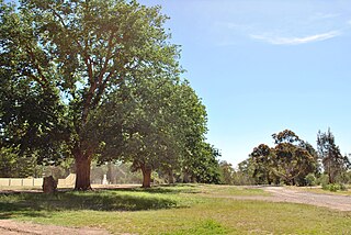
<span class="mw-page-title-main">Bonnie Doon, Victoria</span> Town in Victoria, Australia

Bonnie Doon is a town in Victoria, Australia. It is located on the Maroondah Highway, in the Shire of Mansfield. Bonnie Doon is 168 kilometres north-east from Melbourne. At the 2016 census, Bonnie Doon township had a population of 570.

<span class="mw-page-title-main">Alexandra, Victoria</span> Town in Victoria, Australia

Alexandra is a town in north-east Victoria, Australia, 130 kilometres north-east of the State Capital, Melbourne. It is located at the junction of the Goulburn Valley Highway (B340) and Maroondah Highway (B360), in the Shire of Murrindindi local government area. At the 2016 census, the town had a population of 2,695 and the broader area a population of 6420.

<span class="mw-page-title-main">Lake Eppalock</span> Dam in North central region, Victoria

Lake Eppalock is an Australian reservoir in North Central Victoria about 130 kilometres (81 mi) northwest of Melbourne. It was formed by the construction of a major earth and rockfill embankment dam, known as Eppalock Dam, with a controlled chute spillway across the Campaspe and the Coliban rivers. The lake is situated between the regional population centres of Bendigo and Heathcote and serves as a major water storage facility for both places, as well as the Campaspe irrigation district. The lake also serves as a popular sports and recreational facility.

<span class="mw-page-title-main">Jamieson, Victoria</span> Town in Victoria, Australia

Jamieson is a small town in Victoria, Australia. It is located at the junction of the Goulburn River and Jamieson River, 193 kilometres (120 mi) north-east of Melbourne. The name is believed to have been derived from George Jamieson, a shepherd who grazed sheep in the area in the 1850s. At the time of the 2016 census, Jamieson had a population of 301.

<span class="mw-page-title-main">Nagambie</span> Town in Victoria, Australia

Nagambie is a town in the Goulburn Valley region of Victoria, Australia. The city is on the Goulburn Valley Freeway north of Seymour and in the Shire of Strathbogie. As of 2021 census, Nagambie had a population of 2,254.
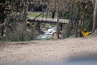
<span class="mw-page-title-main">Delatite River</span> River in Victoria, Australia

The Delatite River, an inland perennial river of the Goulburn Broken catchment, part of the Murray-Darling basin, is located in the lower South Eastern Highlands bioregion and Northern Country/North Central regions of the Australian state of Victoria. The headwaters of the Delatite River rise on the western slopes of the Victorian Alps and descend to flow into the Goulburn River within Lake Eildon.

<span class="mw-page-title-main">Rubicon Hydroelectric Scheme</span> Hydroelectric scheme in Victoria, Australia

The Rubicon Hydroelectric Scheme is a small run-of-the-river hydroelectric scheme located on the Rubicon and Royston Rivers, north east of Melbourne, 40 km (25 mi) south-west of Alexandra, Victoria, Australia. The scheme commenced in 1922, and was the first state-owned hydroelectric scheme to generate electricity in mainland Australia, and among the first in the world to be remotely controlled. For the first ten years of its operation it supplied on average 16.9% of electricity generated by the State Electricity Commission of Victoria. It is now owned and operated by AGL Energy and contributes approximately 0.02% of Victoria's energy supply.

The Mansfield railway line is a closed 121-kilometre (75 mi) branch railway line situated in the Hume region of Victoria, Australia. Constructed by the Victorian Railways, it branches from the Seymour line at Tallarook station, and runs east from the town of Tallarook to Mansfield. The line was primarily built to provide a general goods and passenger service to townships in the area.

<span class="mw-page-title-main">Sugarloaf Reservoir</span> Dam in Victoria , Australia

Sugarloaf Reservoir is a reservoir at Christmas Hills 35 km north-east of Melbourne's central business district.

<span class="mw-page-title-main">Howqua River</span> River in Victoria, Australia

The Howqua River, a minor inland perennial river of the Goulburn Broken catchment, part of the Murray-Darling basin, is located in the Alpine region of the Australian state of Victoria. The headwaters of the Howqua River rise below Mount Howitt in the western slopes of the Victorian Alps, and descend to flow into the Goulburn River within Lake Eildon.

The Thornton-Eildon District Football & Netball Club, nicknamed "The Shinboners" or "Boners" for short, is an Australian rules football team which competes in the Outer East Football Netball League.

Water management in Victoria deals with the management of water resources in and by the Australian State of Victoria.
References

  1. 1 2 Australian Bureau of Statistics (27 June 2017). "Eildon (State Suburb)". 2016 Census QuickStats. Retrieved 8 August 2017. OOjs UI icon edit-ltr-progressive.svg
  2. "Taungurung Registered Aboriginal Party – Map – Taungurung Land & Waters Council" . Retrieved 13 November 2021.
  3. "The History of Lake Eildon and Surrounds | Tourist Information". Lake Eildon. Retrieved 13 November 2021.
  4. 1 2 "The History of Lake Eildon and Surrounds | Tourist Information". Lake Eildon. Retrieved 15 November 2021.
  5. Phoenix Ausctions History, Post Office List , retrieved 20 February 2021
  6. "Climate statistics for Lake Eildon, 1970-2022". Bureau of Meteorology. Retrieved 6 June 2023.
  7. "Climate statistics for Eildon Fire Tower, 1996-2022". Bureau of Meteorology. Retrieved 6 June 2023.
  8. Full Points Footy, Yarra Valley Mountain District, archived from the original on 24 July 2008, retrieved 25 July 2008
  9. Golf Select, Eildon , retrieved 11 May 2009
  10. "Eildon Mountain Bike Park". Lake Eildon. Retrieved 15 November 2021.
  11. "Lake Eildon Fishing Guide | Fishing Melbourne & Victoria". Fishing Mad. Retrieved 12 November 2021.
  12. Authority, Victorian Fisheries (2 June 2020). "Native Fish Releases 2020". VFA. Retrieved 12 November 2021.