Related Research Articles

A lagoon is a shallow body of water separated from a larger body of water by a narrow landform, such as reefs, barrier islands, barrier peninsulas, or isthmuses. Lagoons are commonly divided into coastal lagoons and atoll lagoons. They have also been identified as occurring on mixed-sand and gravel coastlines. There is an overlap between bodies of water classified as coastal lagoons and bodies of water classified as estuaries. Lagoons are common coastal features around many parts of the world.

A coral reef is an underwater ecosystem characterized by reef-building corals. Reefs are formed of colonies of coral polyps held together by calcium carbonate. Most coral reefs are built from stony corals, whose polyps cluster in groups.

Biscayne National Park is an American national park in southern Florida, south of Miami. The park preserves Biscayne Bay and its offshore barrier reefs. Ninety-five percent of the park is water, and the shore of the bay is the location of an extensive mangrove forest. The park covers 172,971 acres and includes Elliott Key, the park's largest island and northernmost of the true Florida Keys, formed from fossilized coral reef. The islands farther north in the park are transitional islands of coral and sand. The offshore portion of the park includes the northernmost region of the Florida Reef, one of the largest coral reefs in the world.
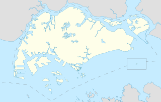
Pulau Hantu is located to the south of the main island of Singapore, off the Straits of Singapore. Pulau Hantu is actually made up of two islets: Pulau Hantu Besar and Pulau Hantu Kechil, with a total area of 12.6 hectares. At low tide, it is possible to wade across the shallow lagoon between the two islands, but not at high tide.

The Federal Dependencies of Venezuela encompass most of Venezuela's offshore islands in the Caribbean Sea and the Gulf of Venezuela, excluding those islands that form the State of Nueva Esparta and some Caribbean coastal islands that are integrated with nearby states. These islands, with a total area of 342 square kilometres, are sparsely populated – according to the preliminary results of the 2011 Census only 2,155 people live there permanently, with another hundred from Margarita Island who live there seasonally to engage in fishing. Local government is officially under the authority of Central government in Caracas, although de facto power is often held in the heads of the sparse and somewhat isolated communities that decorate the territories.

Marine ecosystems are the largest of Earth's aquatic ecosystems and exist in waters that have a high salt content. These systems contrast with freshwater ecosystems, which have a lower salt content. Marine waters cover more than 70% of the surface of the Earth and account for more than 97% of Earth's water supply and 90% of habitable space on Earth. Seawater has an average salinity of 35 parts per thousand of water. Actual salinity varies among different marine ecosystems. Marine ecosystems can be divided into many zones depending upon water depth and shoreline features. The oceanic zone is the vast open part of the ocean where animals such as whales, sharks, and tuna live. The benthic zone consists of substrates below water where many invertebrates live. The intertidal zone is the area between high and low tides. Other near-shore (neritic) zones can include mudflats, seagrass meadows, mangroves, rocky intertidal systems, salt marshes, coral reefs, lagoons. In the deep water, hydrothermal vents may occur where chemosynthetic sulfur bacteria form the base of the food web.

Toke Atoll or Taka Atoll is a small, uninhabited coral atoll in the Ratak Chain of the Marshall Islands. It is one of the smaller atolls in the Marshalls and located at 11°17′N169°37′E. It is visited regularly by the residents of nearby Utirik Atoll.
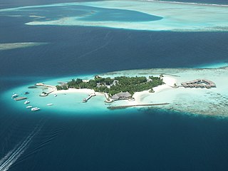
The fishing industry in the Maldives is the island's second main industry. According to national tradition in the words of former President Maumoon Abdul Gayoom, "Fishing is the lifeblood of our nation, it is inborn. From the soil on which we live, to the sea around us, it remains an integral part of our existence. Fishing, and our country and its people, [are] one and shall remain inseparable forever." The Maldives has an abundance of aquatic life and species of fish. Common are tuna, groupers, dolphin fish, barracuda, rainbow runner, trevally and squirrelfish and many more. Aside from being of essential importance to the economy, fishing is also a popular recreational activity in the Maldives, not only among locals but by tourists. The islands have numerous fishing resorts which cater for these activities.

Coastal fish, also called inshore fish or neritic fish, inhabit the sea between the shoreline and the edge of the continental shelf. Since the continental shelf is usually less than 200 metres (660 ft) deep, it follows that pelagic coastal fish are generally epipelagic fish, inhabiting the sunlit epipelagic zone. Coastal fish can be contrasted with oceanic fish or offshore fish, which inhabit the deep seas beyond the continental shelves.
Orange Island is the earliest emergent landmass of Florida dating from the middle Rupelian ~33.9—28.4 Ma. geologic stage of the Early Oligocene epoch and named for Orange County, Florida, United States of America.

The Okeechobean Sea was a Cenozoic eutropical subsea, which along with the Choctaw Sea, occupied the eastern Gulf of Mexico basin system bounding Florida.
A pseudo-atoll, like an atoll, is an island that encircles a lagoon, either partially or completely. A pseudo-atoll differs from an atoll as established by several authorities, such as how it is formed. It is considered a preferable term to "near-atoll". There is a need for rigorous definition of "pseudo-atoll" before it can be accepted as a general term.

Marine habitats are habitats that support marine life. Marine life depends in some way on the saltwater that is in the sea. A habitat is an ecological or environmental area inhabited by one or more living species. The marine environment supports many kinds of these habitats. Marine habitats can be divided into coastal and open ocean habitats. Coastal habitats are found in the area that extends from as far as the tide comes in on the shoreline out to the edge of the continental shelf. Most marine life is found in coastal habitats, even though the shelf area occupies only seven percent of the total ocean area. Open ocean habitats are found in the deep ocean beyond the edge of the continental shelf.
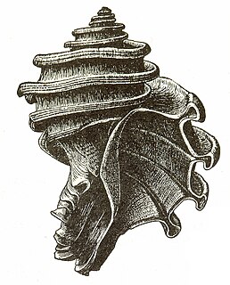
Ecphora is the common name for a group of extinct predatory marine gastropod mollusks within the family Muricidae, the rocks snails or murexes. The common name is based on the first officially described genus, Ecphora. The entire lineage of these ocenebrinid murexes are descended from the Eocene murex, Tritonopsis. Ecphoras are indigenous to the North American Eastern Seaboard, being found in marine strata from the Late Eocene until their extinction during the Pliocene. Many ecphora species are important index fossils.
Ecphora is a genus of extinct predatory ocenebrinid murexes indigenous to the North American Eastern Seaboard from Miocene until their extinction during the Pliocene. The common name for this genus and a group of related genera is "ecphora"(s).

The Everglades & Dry Tortugas Biosphere Reserve is a UNESCO Biosphere Reserve in Florida and the Gulf of Mexico. The 636,411 hectares (2,457.20 sq mi) reserve encompasses Everglades National Park and Dry Tortugas National Park, including historic Fort Jefferson and the seven Dry Tortugas islands.

Milford Haven Waterway, is a Site of Special Scientific Interest (SSSI) on Milford Haven Waterway in Pembrokeshire, South Wales, designated since 2002. The site is protected for a wide range of reasons, including its geology, marine environment and ecosystems, and to protect a diversity of flora and fauna.

The coral reefs of Tuvalu consist of three reef islands and six atolls, containing approximately 710 km2 (270 sq mi) of reef platforms. The islands of the Tuvalu archipelago are spread out between the latitude of 5° to 10° south and longitude of 176° to 180°, west of the International Date Line. The islands of Tuvalu are volcanic in origin. On the atolls, an annular reef rim surrounds the lagoon, and may include natural reef channels. The reef islands have a different structure to the atolls, and are described as reef platforms as they are smaller tabular reef platforms that do not have a salt-water lagoon, although they may have a completely closed rim of dry land, with the remnants of a lagoon that has no direct connection to the open sea or that may be drying up.

The Coral reefs of Kiribati consists of 32 atolls and one raised coral island, Banaba, which is an isolated island between Nauru and the Gilbert Islands. The islands of Kiribati are dispersed over 3.5 million km2 (1.4 million sq mi) of the Pacific Ocean and straddle the equator and the 180th meridian, extending into the eastern and western hemispheres, as well as the northern and southern hemispheres. 21 of the 33 islands are inhabited. The groups of islands of Kiribati are:

The Coral reefs of the Solomon Islands consists of six major islands and over 986 smaller islands, in Oceania, to the east of Papua New Guinea and northwest of Vanuatu. The Solomon Islands lie between latitudes 5° and 13°S, and longitudes 155° and 169°E. The distance between the westernmost and easternmost islands is about 1,500 km (930 mi). The Santa Cruz Islands are situated north of Vanuatu and are especially isolated at more than 200 km (120 mi) from the other islands. The Solomon Islands has the 22nd largest Exclusive Economic Zone of 1,589,477 km2 (613,701 sq mi) of the Pacific Ocean.
References
- ↑ "Florida Bowl: An Everglades asteroid?". Time . June 21, 2005.
- Petuch, Edward J. (December 29, 2003). Cenozoic Seas: The View from Eastern North America, CRC Press; 1st edition. ISBN 0-8493-1632-4