Felda
Location of Felda in Florida
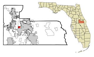
Felda is an unincorporated community in Hendry County, Florida, United States, located east of Fort Myers, on State Road 29. The name is a portmanteau of Felix and Ida Taylor's first names. [1]
Felda is an unincorporated community in Hendry County, Florida, United States, located east of Fort Myers, on State Road 29. The name is a portmanteau of Felix and Ida Taylor's first names. [1]
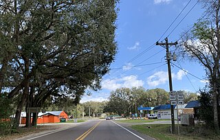
Felda is located at 26°32′22″N81°26′09″W / 26.5394°N 81.4358°W [2] , is on the Florida State Road 29, and is north of Immokalee.
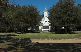
The area was once known for its tomato and cucumber production. [3]

Putnam County is a county located in the northern part of the state of Florida. As of the 2020 census, the population was 73,321. Its county seat is Palatka.

DeSoto County is a county located in the Florida Heartland region of the U.S. state of Florida. As of the 2020 census, the population was 33,976. Its county seat is Arcadia.

Flagler County is a county located in the northeastern portion of the U.S. state of Florida. As of the 2020 census, the population was 115,378. Its county seat is Bunnell, and the largest city is Palm Coast. Created in 1917 from portions of Saint Johns and Volusia Counties, it was named for Henry Flagler, who built the Florida East Coast Railway.

Hendry County is a county in the Florida Heartland region of the U.S. state of Florida. As of the 2020 census, the population was 39,619, down from 42,022 at the 2010 census. Its county seat is LaBelle.
Orlo Vista is an unincorporated community and census-designated place in Orange County, Florida, United States. While the spelling "Orlo Vista" is used by the U.S. Postal Service, the community is shown as Orlovista on federal maps. The population of the Orlovista census-designated place was 6,123 at the 2010 census. It is part of the Orlando–Kissimmee Metropolitan Statistical Area. The boundaries of the Orlovista CDP are West Colonial Drive on the north, Pine Hills Road on the east, Old Winter Garden Road and Carter Street at the Orlando city limits on the south, and Hiawassee Road on the west.

East Palatka is a census-designated place (CDP) in Putnam County, Florida, United States. It is located on the east side of the City of Palatka at the intersection of U.S. Route 17/State Road 20/State Road 100 and the southwestern terminus of State Road 207. The population was 1,654 at the 2010 census.

DeLeon Springs is a census-designated place (CDP) in Volusia County, Florida, United States. The population was 2,614 at the 2010 census. De Leon Springs State Park is located in DeLeon Springs, as is the Strawn Historic Citrus Packing House District.

Orange City is a city in Volusia County, Florida, United States. As of the 2010 United States Census, the city had a population of 10,599. It is a part of the Deltona–Daytona Beach–Ormond Beach metropolitan area, which was home to 590,289 people in 2010.

Elkton is an unincorporated community in St. Johns County, Florida, United States. It is located at the intersection of State Road 207 and County Road 305. The most prominent landmark is the Post Office, which delivers mail to the rural southwest section of the county.
Boulogne is an unincorporated community in Nassau County, Florida, United States. Boulogne is located in the northern part of the county, near the St. Marys River. Highways passing through the town are US 1/US 23/US 301/State Road 15 and CR 121.

Armstrong is an unincorporated community in St. Johns County, Florida, United States, located off State Road 207. It was established in 1886 and became an African American community along a rail line. Potatoes and turpentine were among the products produced commercially in the area.

Spuds is an unincorporated community in St. Johns County, Florida, United States. The community is situated in a region that depends economically on potato growing and other agriculture. As well as potatoes, the land around Spuds provides gladioli. A camp for German prisoners of war was built in Spuds during World War II, close to the intersection between State Roads 206 and 207.

Vermont Heights is an unincorporated community in St. Johns County, Florida, United States. It is located on State Road 207, west of I-95.

Florahome is an unincorporated community in Putnam County, Florida, United States, located on State Road 100. The town was established in 1899 by the Georgia Southern and Florida Railway. The streets are laid in a grid system. Streets north and south are named for trees or shrubs. Streets east and west are named for states or provinces. Early in the town's history, it was surrounded by swamps. These were drained when canals were dredged by the Etoniah Canal and Drainage Company. Florahome was also once an island and was drained of all its water to make way for crops, animals, and homes. The town is built upon a sandy hill rising from the swampy areas.
Grandin is an unincorporated community in Putnam County, Florida, United States. It is located near the State Road 100/County Road 315 intersection. As of the 2000 census, its population was 192.
Putnam Hall is an unincorporated community in Putnam County, Florida, United States. It is located near the State Road 100/State Road 26 intersection.

The environment of Florida in the United States yields an array of land and marine life in a mild subtropical climate. This environment has drawn millions of people to settle in the once rural state over the last hundred years. Florida's population increases by about 1,000 residents each day. Land development and water use have transformed the state, primarily through drainage and infill of the wetlands that once covered most of the peninsula.

Candler is an unincorporated community in Marion County, Florida, United States. It is located on County Road 464 between Silver Springs Shores and Lake Weir. The community is part of the Ocala Metropolitan Statistical Area. Candler's Zip Code is 32111.

San Mateo is an unincorporated community in Putnam County, Florida, United States, located just southeast of the city of Palatka. It is on the east shore of the St. Johns River between buoys 12 and 15; stretching from Buzzard Island to the entrance to Dunn's Creek. The main road through San Mateo is US Route 17, with a southern terminus of the overlap with Florida State Roads 20 and 100.
Okeelanta is an unincorporated community in Palm Beach County, Florida, United States, located approximately 4 miles (7 km) south of South Bay on U.S. Route 27 at County Road 827. It was originally developed as a planned community in the 1910s, but had effectively disappeared by the end of the 1920s. The name is a portmanteau of Lake Okeechobee and Atlantic Ocean.
Municipalities and communities of Hendry County, Florida, United States | ||
|---|---|---|
| Cities |  | |
| CDPs | ||
| Indian reservation | ||
| Unincorporated community | ||
| Footnotes | ‡This populated place also has portions in an adjacent county or counties | |
| | This article about a location in Hendry County, Florida is a stub. You can help Wikipedia by expanding it. |