Related Research Articles

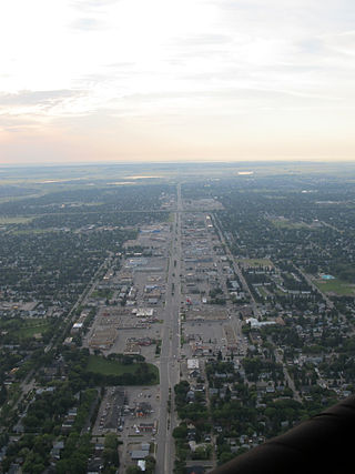
Saskatoon is the largest city in the Canadian province of Saskatchewan. It straddles a bend in the South Saskatchewan River in the central region of the province. It is located along the Trans-Canada Yellowhead Highway, and has served as the cultural and economic hub of central Saskatchewan since its founding in 1882 as a Temperance colony.
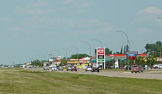
Martensville is a city located in Saskatchewan, Canada, just 8 kilometres (5.0 mi) north of Saskatoon, 10 kilometres (6.2 mi) west of the city of Warman and 14 kilometres (8.7 mi) southwest of Clarkboro Ferry which crosses the South Saskatchewan River. It is a bedroom community of Saskatoon. It is surrounded by the Rural Municipality of Corman Park No. 344. The community is served by the Saskatoon/Richter Field Aerodrome located immediately west of the city across Highway 12, as well as by Saskatoon's John G. Diefenbaker International Airport, only a few miles to the south.

Langham is a town in Saskatchewan, Canada. It is located on Highway 16, 35 kilometres northwest of the city of Saskatoon. The 2011 census reported a population of 1,290, with 489 homes in the community.

The Rural Municipality of Corman Park No. 344 is a rural municipality (RM) in the Canadian province of Saskatchewan within Census Division No. 11 and SARM Division No. 5. Located in the central portion of the province, the RM surrounds the City of Saskatoon.
Saskatchewan Highway 7 is a major paved undivided provincial highway in the Canadian province of Saskatchewan, running from the Alberta border to Saskatoon. Highway 7 continues west into Alberta where it becomes Alberta Highway 9.
Highway 1 is the Saskatchewan section of the Trans-Canada Highway mainland route. The total distance of the Trans-Canada Highway in Saskatchewan is 654 kilometres (406 mi). The highway traverses Saskatchewan from the western border with Alberta, from Highway 1, to the Manitoba border where it continues as PTH 1. The Trans-Canada Highway Act was passed on December 10, 1949. The Saskatchewan segment was completed August 21, 1957, and completely twinned on November 6, 2008. The speed limit along the majority of the route is 110 kilometres per hour (70 mph) with urban area thoroughfares slowing to a speed of 80–100 kilometres per hour (50–62 mph). Portions of the highway—the section through Swift Current, an 8-kilometre (5 mi) section east of Moose Jaw, and a 44-kilometre (27 mi) section between the West Regina Bypass and Balgonie—are controlled-access. Highway 1 serves as a major east–west transport route for commercial traffic. It is the main link between southern Saskatchewan's largest cities, and also serves as the province's main link to the neighbouring provinces of Alberta and Manitoba.

The Rural Municipality of Vanscoy No. 345 is a rural municipality (RM) in the Canadian province of Saskatchewan within Census Division No. 12 and SARM Division No. 5. Located in the central portion of the province, it is southwest of the city of Saskatoon.
Wilkie is a town in the Canadian province of Saskatchewan, located at Section 5, Township 40, Range 19, west of the 3rd Meridian. The town is at the junctions of Highways 14, 29, and 784.

Highway 11 is a major north-south highway in Saskatchewan, Canada that connects the province's three largest cities: Regina, Saskatoon and Prince Albert. It is a structural pavement major arterial highway which is approximately 391 kilometres (243 mi) long. It is also known as the Louis Riel Trail (LRT) after the 19th century Métis leader. It runs from Highway 1 in Regina until Highway 2 south of Prince Albert. Historically the southern portion between Regina and Saskatoon was Provincial Highway 11, and followed the Dominion Survey lines on the square, and the northern portion between Saskatoon and Prince Albert was Provincial Highway 12.
Highway 394, also known as Patience Lake Road, is an unsigned provincial highway in the Canadian province of Saskatchewan. It starts near an intersection between Highway 16 and Zimmerman Road near Saskatoon, and goes eastward to Highway 316 north of Clavet. It is about 10.5 kilometres (6.5 mi) long.
Highway 305 is a provincial highway in the Canadian province of Saskatchewan. It runs from Highway 16 near Langham to Highway 11 near Warman. It is about 30 kilometres (19 mi) long.

Saskatchewan, the middle of Canada's three prairie provinces, has an area of 588,276.09 square kilometres (227,134.67 sq mi) and population of 1,150,632, mostly living in the southern half of the province.

The Blairmore Suburban Centre is a community service/commercial/residential community currently under development in western Saskatoon, Saskatchewan. It is part of the city's Blairmore Suburban Development Area, a large region annexed from the Rural Municipality of Corman Park No. 344 in 2005. Ultimately, the SDA will consist of seven new neighbourhoods, plus the Blairmore Suburban Centre, which is the first component of the SDA to be developed.
8th Street East is an arterial road serving the city of Saskatoon, Saskatchewan. It begins as a continuation of a minor residential street at Lorne Avenue in Saskatoon, and runs through the eastern part of city, eventually exiting the city limits as a country road.

Highway 41 is a highway in the Canadian province of Saskatchewan. It runs from Highway 5 in Saskatoon to Highway 3/Highway 6 in Melfort. Highway 41 is about 163 kilometres (101 mi) long.
Pacific Heights is geographically located in north west Saskatoon. The main construction boom for this community was the 1970s, during which the City of Saskatoon annexed the land. Following elementary school, students usually attend Tommy Douglas Collegiate or Bethlehem Catholic High School on Bowlt Crescent a part of Blairmore SDA community. According to MLS data, the average sale price of a home as of 2013 was $279,500.

The Willows Residential Community and Golf Club, is a residential community in the Nutana Suburban Development Area in the city of Saskatoon, Saskatchewan. The Willows is south of Circle Drive which is concurrent with Saskatchewan Highway 16. Its northern boundary is the CN Rail line and the former Cartwright Street right-of-way ; to the east is Clarence Avenue and to the west is Lorne Avenue. The 36-hole Willows Golf & Country Club winds its way around the subdivision which when construction of homes began in 2004 became the city's first golf course community. Home construction began almost immediately after the land for the subdivision and the golf course was annexed from the rural municipality of Corman Park No. 344, Saskatchewan. The golf course, however, had been in operation for more than a decade before residential development began.

The Saskatoon region is the greater metropolitan area of Saskatoon, Saskatchewan. As of 2021 the Statistics Canada estimates the region's population to be 317,480 people.
Holmwood Suburban Development Area (SDA) is an area in Saskatoon, Saskatchewan (Canada). It is a part of the east side community of Saskatoon. It lies at the far east end of the city boundaries with the Rural Municipality of Corman Park No. 344. The area was annexed by the city on August 1, 2010 and the SDA development plan was approved on April 16, 2012. Land preparation worked started in 2012. Prior to development into a SDA the area was predominantly agricultural land and also housed the Sundown Drive-in that operated off Highway 5 from 1963.
References
- ↑ "R.M. Corman Maps". R.M. Corman Park. Archived from the original on December 9, 2014. Retrieved October 28, 2014.
- 1 2 Trelle Burdeniuk (September 11, 2013). "Saskatchewan Ghost Towns Part 3: Floral". News Talk 650 CKOM . Rawlco Communications. Archived from the original on October 29, 2014. Retrieved October 28, 2014.
- ↑ "Saskatchewan GIC Ortho Imagery" (PDF). Saskatchewan Information Services Corporation. Retrieved October 28, 2014.
{{cite web}}: Check|url=value (help)[ permanent dead link ] - 1 2 "Postal Heritage and Philately, Post Offices and Postmasters, Item 19762, Floral". Library and Archives Canada . Retrieved October 28, 2014.
- 1 2 "R.M. Corman Community Centres". Archived from the original on December 9, 2014. Retrieved October 28, 2014.
- ↑ "Contacts". Prairie Swine Centre. Retrieved October 28, 2014.
Places adjacent to Floral, Saskatchewan | |
|---|---|