Florida State Road 69

Last updated

Florida 69.svg

State Road 69

Florida State Road 69
Route information
Maintained by FDOT
Length35.226 mi [1]  (56.691 km)
Major junctions
South endFlorida 71.svg SR 71 in Blountstown
Major intersectionsI-10.svg I-10 near Grand Ridge
US 90.svg US 90 in Grand Ridge
North endFlorida 71.svg SR 71 in Greenwood
Location
Country United States
State Florida
Counties Calhoun, Jackson
Highway system
Florida 68.svg SR 68 Florida 70.svg SR 70

State Road 69 (SR 69) is a road running through Calhoun and Jackson counties in northwest Florida. The road is almost entirely two-lanes wide.

Contents

Route description

State Road 69 begins at an unnamed connecting road between State Road 71 (North Main Street) and North Pear Street in Blountstown. After passing by the Blountstown Elementary School, [2] a civic center and the intersection of Finlay Street, the route crosses a bridge over Simmons Creek and runs through Pine Island, where it intersects the southern terminus of CR 549 (John G. Bryant Road). North of there, it passes by the Nettle Ridge Cemetery and the church across from it, before crossing another bridge over a tributary of Simmons Creek where the route leaves Pine Island. The next moderate intersection is with CR 69A which branches off to the northwest and has its own intersection with CR 549 merely feet from the southern terminus. SR 69 curves to the northeast, passing over a low bridge over Stafford Creek and then some grass farms north of Parrish Lake Road. North of a bridge over Graves Creek, it enters Selman where it encounters the eastern terminus of CR 194. After the intersection of Jody Field Road the route turns straight north again, then approaches an intersection that serves as the twin termini of CRs 274 and 286. The road then curves towards the northwest as it passes beneath a power-line right-of-way, and then dips toward a low culvert over Flowers Creek. As it straightens out again it crosses the Calhoun-Jackson County Line.

The route continues to run primarily through forestland, although farmland exists north of the county line, then again north of Bone Yard Road, and again at a point where the road briefly curves to the northwest. Past the intersection with Raylene Road, the route turns more northerly again as it passes by a smaller parcel of private property lined with pine trees in the front yard. The first moderate intersection over the county line is another dual termini, this time of County Roads 278 & 69A, both of which are named Birchwood Road and apparently shared in a concurrency with County Road 280. From there it takes another curve to the northwest that's not as drastic as the previous one, only to turn back the northeast at the intersection of another dirt road. The road becomes a divided highway as it approaches Interstate 10 at Exit 152, and makes a slight curve back to the northwest, but even then remains two-lanes wide until north of the interchange where the approaches to the westbound off and on ramps transform it into a four lane highway, and even that segment ends north of Chips Drive before the divided section does. North of a dirt road leading to an antenna tower, it curves to the northeast, where it encounters a full intersection with a dirt road named Brushey Pond Road, then side roads such as Betty Road, an access road to a sewage treatment plant and Tobe Way. Somewhere north of a dirt road named Scarlet Road, SR 69 picks up the street name "Porter Avenue," and turns straight north. From there it encounters the northwestern terminus of County Road 69A (Shady Grove Road), which some maps show as being part of CR 280. Officially entering Grand Ridge SR 69's first intersection is with the Old Spanish Trail, which is also named Florida Street. Less than three and a half block later, it has a grade crossing with CSX's P&A Subdivision, Its time in Grand Ridge ends right after it passes the Town Hall across from the Grand Ridge Baptist Church. The road still remains two-lanes wide even as it approaches a blinker-light intersection with US 90, although it does contain separated turning ramps on the southeast and northwest corners of the intersection.

Beyond US 90 State Road 69 runs past some local and/or private dirt roads, as well as the local Grand Ridge Church of God. North of Shady Oak Lane, Porter Avenue becomes Porter Street, where it briefly runs through some forestland before approaching the temporary eastern terminus of County Road 164A (Reddoch Road), which has an unpaved and unmarked extension along Providence Church Road. Past that intersection, a power line right-of-way crosses the road and a substation on the northwest corner of that right of way marks the beginning of a series of power lines that follow the route. Farmland becomes much more prevalent north of this point. At a dirt road named Columbus Street, the name of State Road 69 changes from Porter Street to Spurlock Road, but after two other dirt roads State Road 69 curves northwest from Spurlock Road, which becomes a dirt road, and the route has no official name other than State Road 69. Around Dellwood the power lines that run along the road branch off to the right onto a former section of the road before the intersection of Bateau Pond Road, and then the route intersects Messer Road, just before the intersection of County Road 164 (Blue Springs Road/Sweet Pond Road), an unfinished county road that spans from southwestern Jackson County to Chattahoochee State Park in Alabama. North of the intersection of Northside Church Road, the power lines return to the street. After three more random intersections with dirt roads, the route enters the farming community of Two Egg just under where that previously mentioned power line branches off onto its own right-of-way, and after this the southern terminus of County Road 69A (Wintergreen Road) veers off to the right and State Road 69 adopts the name Fort Road. A block after this as the road turns more toward the west (although not entirely in that direction, Green Road mergers with SR 69. Between the parallel intersections with Joey and Peters Roads and Kimbell Road SR 69 finally runs straight west. Century Road is the next and last intersection along the road. Entering Greenwood, State Road 69 ends at State Road 71 but Fort Road becomes westbound County Road 162 as it heads for Jacob City, and Holmes County.

Major intersections

CountyLocationmi [1] kmDestinationsNotes
Calhoun Blountstown 0.0000.000Florida 71.svg SR 71 (North Main Street)
Pine Island 1.7442.807North plate county.svg
CR 549 jct.svg
CR 549 north (John G. Bryant Road)
3.0054.836North plate county.svg
CR 69A jct.svg
CR 69A north
Selman 5.9249.534West plate county.svg
CR 194 jct.svg
CR 194 west (Macedonia Road)
Ocheesee 8.98114.454West plate county.svg
CR 274 jct.svg
East plate county.svg
CR 286 jct.svg
CR 274 west / CR 286 east
Jackson 13.88922.352North plate county.svg
CR 69A jct.svg
West plate county.svg
CR 278 jct.svg
CR 69A north / CR 278 west (Birchwood Road)
14.9124.00I-10.svg I-10 (SR 8) Pensacola, Tallahassee I-10 exit 152
Grand Ridge 18.52529.813South plate county.svg
CR 69A jct.svg
CR 69A south (Shady Grove Road)
19.58931.525US 90.svg US 90 (SR 10) Marianna, Sneads
20.37932.797West plate county.svg
CR 164A jct.svg
CR 164A west (Reddoch Road)
Dellwood 27.40144.098West plate county.svg
CR 164 jct.svg
CR 164 west (Messer Road)
Two Egg 29.93248.171North plate county.svg
CR 69A jct.svg
CR 69A north (Wintergreen Road)
Greenwood 35.22656.691Florida 71.svgWest plate county.svg
CR 162 jct.svg
SR 71 (Bryan Street) / CR 162 west (Fort Road) Marianna, Malone
1.000 mi = 1.609 km; 1.000 km = 0.621 mi

County Road 69

Calhoun County 69.svg

County Road 69

Location Marysville-South of Blountstown

County Road 69 is a county extension route of SR 69. It runs from CR 275 in Marysville, through New Hope, past the Calhoun Correctional Institution, and ends at the intersection of SR 71 and Barfield Road, southwest of Blountstown. [3]

County Road 69A (Calhoun County)

Calhoun County 69A.svg

County Road 69A

LocationNorth of Pine Island-Alliance

County Road 69A is a county suffixed alternate route of SR 69. It is paved until it approaches the County Line Airstrip, where it then becomes a dirt road named Orlando Road before crossing the Calhoun-Jackson County Line.

County Road 69A (Jackson County)

Jackson County 69A.svg

County Road 69A

LocationEastern Jackson County

County Road 69A is one of two county suffixed alternate routes of SR 69. The first one begins at SR 69 at the eastern terminus of CR 278, from which it acquires a concurrency with CR 280. The CR 69A/280 concurrency crosses a bridge over I-10 with no access and exists until the route reach Shady Grove, where CR 280 turns right, while CR 69A turns left. CR 69A winds toward the northwest until it returns to SR 69 south of Grand Ridge.

The second CR 69A begins at the State Road 69 as Wintergreen Road in Two Egg, then runs north until it turns east onto Lovedale Lane where it ends at County Road 164.

A third CR 69A which has no connection to SR 69 is described by Florida Department of Transportation maps as being Inwood Road, El Bethel Church Road, and Sandridge Church Road between McKeown Mill Road southeast of Grand Ridge and Welcome Church Road east of Dellwood. No other evidence of the route exists. [4]

Related Research Articles

<span class="mw-page-title-main">U.S. Route 331</span> Highway in the United States

U.S. Route 331 is a spur of U.S. Route 31. It currently runs for 150 miles (240 km) from Santa Rosa Beach, Florida east of Fort Walton Beach at US 98 to Montgomery, Alabama at US 80 and US 82. Unlike US 131, US 231, and US 431, US 331 never intersects with its "parent" route, US 31; however, the two routes do come within 4 miles (6.4 km) of each other in Montgomery.

<span class="mw-page-title-main">Florida State Road 50</span> Highway in Florida

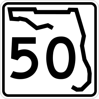
State Road 50 runs across the center of the U.S. state of Florida through Orlando, with its termini at SR 55 at Weeki Wachee and SR 5 in Titusville.

<span class="mw-page-title-main">Florida State Road 145</span> State highway in Florida, United States

State Road 145 runs north from US 90 and State Road 53 in Madison to the Georgia border, where it becomes State Route 31. It is also a short route in Fort Walton Beach between US 98 and State Road 85.

<span class="mw-page-title-main">U.S. Route 29 in Alabama</span> Segment of American highway

U.S. Route 29 (US 29), internally designated by the Alabama Department of Transportation (ALDOT) as State Route 15 (SR 15), is a southwest–northeast state highway across the southeastern part of the U.S. state of Alabama. US 29 and SR 15 traverse Alabama in a general northeast–southwest slope. It has never been a major route in the state; its significance was completely overshadowed with the completion of Interstate 65 (I-65) and I-85 during the 1970s. Today, US 29 and SR 15 serve primarily to connect numerous smaller towns and cities in the southwest, south-central, and eastern parts of Alabama.

<span class="mw-page-title-main">Florida State Road 77</span> State highway in Florida, United States

State Road 77 is a major north–south artery in Florida's Panhandle, connecting Panama City to the south with Alabama State Route 109 and Dothan, Alabama to the north.

<span class="mw-page-title-main">Florida State Road 19</span> Highway in Florida

State Road 19 is a Florida State Road in Putnam, Marion, and Lake counties. It runs from Groveland to Palatka through Ocala National Forest. Along with SR 33, SR 19 provides a mostly rural north-south corridor through central Florida from Lakeland to Palatka.

<span class="mw-page-title-main">U.S. Route 19 in Florida</span> Highway in Florida

U.S. Highway 19 (US 19) runs about 262 miles (422 km) along Florida's west coast from an interchange with US 41 in Memphis, south of Tampa, and continues to the Georgia border north of Monticello.

<span class="mw-page-title-main">U.S. Route 90 in Florida</span> United States historic place

U.S. Route 90 (US 90) in the state of Florida is the northernmost east–west United States Numbered Highway in the state. US 90 passes through the county seats of all 15 counties on its course in Florida, and it is also the road upon which many of the county courthouses are located. It is never more than six miles (9.7 km) from Interstate 10 (I-10) throughout the state. It runs as a two-lane highway through most of the sparsely populated inland areas of the Florida Panhandle, widening to four lanes through and near several towns. The speed limit is 55 mph (89 km/h) for all rural points west of Monticello, and it is 60 mph (97 km/h) on all rural points from where it enters Madison County as far as Glen St. Mary.

<span class="mw-page-title-main">U.S. Route 231 in Florida</span> Highway in Florida

U.S. Route 231 (US 231) in Florida is a north–south United States Highway. It runs 52 miles (84 km) from Panama City north to the Alabama State Line in Bay and Jackson Counties. The entire route is also unsigned State Road 75, and is a four-lane highway throughout the state whether the road is divided or not.

<span class="mw-page-title-main">U.S. Route 301 in Florida</span> Highway in Florida

U.S. Route 301 in Florida runs from the Sarasota-Bradenton-Venice, Florida Metropolitan Statistical Area northeast to the Greater Jacksonville Metropolitan Area. The road is a spur of U.S. Route 1, which it intersects in Callahan.

<span class="mw-page-title-main">Florida State Road 83</span> State highway in Florida, United States

State Road 83 is the state designation for U.S. Route 331 between US 98(SR 30) in Santa Rosa Beach and US 90(SR 10) in DeFuniak Springs. It also includes an independent route from DeFuniak Springs to the Florida-Alabama State Line. The entire route is in Walton County.

<span class="mw-page-title-main">Florida State Road 49</span> Highway in Florida

State Road 49 is the state designation for US 19/98/27 Alternate(SR 55) in Chiefland, and US 27(SR 20) in Hildreth east of Branford, Florida. It also includes a county extension in Suwannee County, Florida from Hildreth to the outskirts of Live Oak, Florida.

<span class="mw-page-title-main">Florida State Road 71</span> State highway in Florida, United States

State Road 71 is a highway in western Florida that runs 95.4 miles (153.5 km) from the Gulf Coast and the Gulf of Mexico, through the panhandle of Florida to the Alabama border.

<span class="mw-page-title-main">Florida State Road 81</span> State highway in Florida, United States

State Road 81 is a state highway linking State Road 20 at Bruce with Alabama State Route 87.

<span class="mw-page-title-main">Florida State Road 73</span> State highway in Florida, United States

State Road 73, the Wayne Mixson State Highway, is a state highway in northwest Florida that runs through Calhoun and Jackson Counties, although it runs through more of the former county than the latter one. The road is always on the west side of the Chipola River, and is almost entirely two-lanes wide, except with its concurrency with US 90 in Marianna where it is four-lanes wide. It was named in honor of former Florida governor Wayne Mixson.

<span class="mw-page-title-main">Florida State Road 273</span> State highway in Florida, United States

State Road 273 is a north–south highway in the panhandle in the U.S. state of Florida that extends from State Road 77 in Chipley to U.S. Route 231 in Campbellton. SR 273 runs through both Washington and Jackson counties, and most, if not all of the road is a two-lane undivided highway. Between its termini, SR 273 intersects with no state roads other than former ones. A former section of the road south of Chipley is now County Road 273.

<span class="mw-page-title-main">Florida State Road 276</span> State highway in Florida, United States

State Road 276 is a state road in the panhandle of Florida. It runs west to east from former State Road 167 into U.S. Route 90 in and around Marianna entirely within Jackson County, although a bi-county extension exists between State Road 277 southwest of Chipley in Washington County that runs south then east into CR 167 which is signed as County Road 276 (CR 276). Most of the road is a two-lane undivided highway, with exceptions in the vicinity of Interstate 10, and if you count the bi-county portion, the overlapped segment with U.S. 231 where it changes from a four-lane undivided highway to a four-lane divided highway between Alford and Steele City.

<span class="mw-page-title-main">Florida State Road 277</span> State highway in Florida, United States

State Road 277 is a north-south state and county highway in the panhandle in the U.S. state of Florida that extends from State Road 79 in Vernon to U.S. Route 90 in Hulaw west of Chipley. SR 277 runs entirely through Washington County, although one of the two county extensions runs through both Washington and Jackson Counties, Most, if not all of the road is a two-lane undivided highway. Between its termini, SR 277 intersects with no state roads other than former ones, and shares a concurrency with at least one of those county roads. A sizeable portion of the road runs in close proximity to the east side of Holmes Creek.

References

  1. 1 2 FDOT straight line diagrams Archived March 6, 2014, at the Wayback Machine , accessed February 2014
  2. "Blountstown Elementary School". Blountstown Elementary School.
  3. "FDOT Map of Calhoun County including CR 69" (PDF). Archived from the original (PDF) on 2013-10-07. Retrieved 2013-09-02.
  4. FDOT Map of Jackson County, including SR 69 and all CR 69A's Archived February 14, 2013, at the Wayback Machine
Template:Attached KML/Florida State Road 69
KML is not from Wikidata