Florida State Road 81

Last updated

Florida 81.svg

State Road 81

Florida State Road 81
Florida State Road 81 highlighted in red
Route information
Maintained by FDOT
Length39.466 mi [1]  (63.514 km)
Major junctions
South endFlorida 20.svg SR 20 at Bruce
Major intersectionsI-10.svg I-10 in Ponce de Leon
US 90.svg US 90 in Ponce de Leon
North endAlabama 87.svg SR 87 towards Samson, AL
Location
Country United States
State Florida
Counties Walton, Holmes
Highway system
Florida 80.svg SR 80 Florida 82.svg SR 82

State Road 81 (SR 81) is a state highway linking State Road 20 at Bruce (east of Freeport) with Alabama State Route 87.

Contents

Route description

State Road 81 begins at a wye along State Road 20 in Bruce, which is in rural Walton County, The road curves more toward the east through Dismal Swamp and the turn back to the northeast where it runs along the west coast of Buzzards Roost Swamp before crossing a bridge over Seven Runs River. Later it curves to the west before approaching Mossy Bend Road, an old section of the road and then enters Redbay where it curves back toward the north around the termini of two local streets; westbound Rock Hill Road and southbound North Tram Road. After this, the road turns from northeast to straight north before descending towards a valley named Hunter Branch, then ascends from that area to pass by Redbay Cemetery. It then curves around some ponds as it approaches a pair of bridges over Big Branch Creek and Bruce Creek, followed by a blinker-light intersection with the southeastern terminus of CR 183, and later turns straight north long before approaching the southwestern terminus of CR 181 a bi-county road in Walton and Holmes Counties, [2] [3] that leads to Ponce de Leon Springs State Park. North of there, it runs under a moderately sized power line right-of-way, and after the intersection of C.B. Whitehead Road curves slightly to the northeast.

The road crosses the Walton-Holmes County Line on the south side of the intersections of Hogan Drive and L.D. Anderson Road (two dirt roads) and enters the Town of Ponce de Leon on the north side. Despite entering the town limits, the surroundings are still rural, even as it becomes a divided highway and comes across a couple of gas stations as it approaches Interstate 10 at Exit 96, which contains a rest area on the southeast corner of that interchange which is accessible from SR 81 rather than I-10 itself. North of I-10, the road is named Samson Highway. After the divider ends, the road takes a slight curve to the right that ends at a bridge over Mill Creek, then enters "downtown" Ponce de Leon where it meets an at-grade crossing with the CSX P&A Subdivision. After that crossing and the intersections with Maple Loop and Skelton Street, the road curves to the right again over another bridge over Sandy Creek, then turns straight north again. At US 90 SR 81 intersects at an angle, but north of there it has a connecting spur to and from US 90 on the northeast corner, which is the by-product of a former wye. State Road 81 takes a northwest curve at that connecting road, but after leaving the town limits, the road returns to a straight north trajectory. 0.9 miles (1.4 km) north of the intersections with Sandy Creek Road and White Road, the route curves to the northeast, eventually entering Prosperity where it intersects CR 181, essentially reuniting with the route it encountered south of the Walton-Holmes County Line. Northwest of this intersection, CR 181 will enter Leonia, and cross back into Walton County before reaching Darlington. Meanwhile, SR 81 curves from northeast to northwest before the intersection with Bradley Road. It maintains this trajectory as it enters the community of Hobbs Crossroads where it meets the western terminus of CR 160, and then approaches what would seem to be the western terminus of State Road 2 (Hog and Hominy Road). Instead, SR 2 follows SR 81 in an obvious concurrency, which then takes a sharper northwestern curve as it approaches the intersection of CR 185 (Petty X Road), a bi-county road spanning from Glendale in Walton County, and Alabama State Route 27. SR 81 continues northwest through some farmland that's briefly interrupted by a culvert over Hurricane Creek, then rises to approach an intersection with two dirt roads, one of which is partially named after the aforementioned creek. Roughly 0.4 miles (0.64 km) after that intersection, it turns straight north again [4] before the concurrency with SR 2 ends at the blinker-light intersection of CR 2 and CR 2A in Royal Crossroads, and stays at this trajectory permanently. The road takes one last dip into some low-lying forestland before emerging at some sparse farmland, which includes a small fruit and vegetable store on the southbound side. This farmland ends as State Road 81 approaches a wooded embankment along the east bank of Camp Creek before it finally ends at the Florida-Alabama state line, becoming Alabama State Route 87 in Geneva County, Alabama. [5]

Major intersections

CountyLocationmi [1] kmDestinationsNotes
Walton Bruce 0.0000.000Florida 20.svg SR 20  Ebro, Freeport
Redbay 9.85315.857Rock Hill Road
13.11121.100North plate county.svg
CR 183 jct.svg
CR 183 north
14.90123.981North plate county.svg
CR 181 jct.svg
CR 181 north
Holmes Ponce de Leon 18.6129.95I-10.svg I-10 (SR 8) Pensacola, Tallahassee Exit 96 (I-10)
19.54331.451US 90.svg US 90 (SR 10) DeFuniak Springs, Westville, Ponce de Leon Springs State Park
Prosperity 28.80946.364CR 181 jct.svg CR 181
Hobbs Crossroads 33.36953.702East plate county.svg
CR 160 jct.svg
CR 160 east
34.56955.633East plate.svg
Florida 2.svg
SR 2 east Graceville
South end of SR 2 overlap
35.60557.301CR 185 jct.svg CR 185 (Petty Crossroads) Leonia, Sweet Gum Head
Royals Crossroads 38.28761.617West plate county.svg
CR 2 jct.svg
East plate county.svg
CR 2A jct.svg
CR 2 west / CR 2A east Darlington, Geneva
North end of SR 2 overlap
39.46663.514North plate.svg
Alabama 87.svg
SR 87 north Samson
Alabama state line
1.000 mi = 1.609 km; 1.000 km = 0.621 mi

Related Research Articles

<span class="mw-page-title-main">U.S. Route 331</span>

U.S. Route 331 is a spur of U.S. Route 31. It currently runs for 150 miles (240 km) from Santa Rosa Beach, Florida east of Fort Walton Beach at US 98 to Montgomery, Alabama at US 80 and US 82. Unlike US 131, US 231, and US 431, US 331 never intersects with its "parent" route, US 31; however, the two routes do come within 4 miles (6.4 km) of each other in Montgomery.

<span class="mw-page-title-main">Florida State Road 16</span> Highway in Florida

State Road 16 (SR 16) runs from northwest to southeast between Raiford and St. Augustine. It passes through the towns of Starke and Green Cove Springs in addition to providing access to Camp Blanding. Major roads and/or highways that SR 16 crosses include: US 301, SR 21, US 17, SR 13, Interstate 95 and US 1.

<span class="mw-page-title-main">Florida State Road 100</span> Highway in Florida

State Road 100 is a 153-mile-long (246 km) east–west highway serving northeast Florida. Its western terminus is at the Georgia-Florida border four miles (6.4 km) north of Avoca, Florida ; its eastern terminus is an intersection with Shore Scenic Highway in Flagler Beach. The portion west of Lake City is only signed as portions of US 41 and US 129, both of which run north–south.

<span class="mw-page-title-main">Florida State Road 415</span> State highway in Florida, United States

State Road 415 is a north–south route in Central Florida running between State Road 44 in Volusia County and SR 46 in Seminole County.

<span class="mw-page-title-main">Florida State Road 65</span> State highway in Florida, United States

State Road 65 is a north–south route in the eastern panhandle, running from a junction with US 98/319 near Eastpoint northwards through the Apalachicola National Forest to SR 12 west of Quincy, near US 90.

<span class="mw-page-title-main">Florida State Road 145</span> State highway in Florida, United States

State Road 145 runs north from US 90 and State Road 53 in Madison to the Georgia border, where it becomes State Route 31. It is also a short route in Fort Walton Beach between US 98 and State Road 85.

<span class="mw-page-title-main">Florida State Road 292</span> State highway in Florida, United States

State Road 292 is a major thoroughfare in the Pensacola, Florida metropolitan area. Locally, it is known as Pace Boulevard, Barrancas Avenue, Gulf Beach Highway, Sorrento Road, and Perdido Key Drive.

<span class="mw-page-title-main">U.S. Route 29 in Alabama</span>

U.S. Route 29 (US 29), internally designated by the Alabama Department of Transportation (ALDOT) as State Route 15 (SR 15), is a southwest–northeast state highway across the southeastern part of the U.S. state of Alabama. US 29 and SR 15 traverse Alabama in a general northeast–southwest slope. It has never been a major route in the state; its significance was completely overshadowed with the completion of Interstate 65 (I-65) and I-85 during the 1970s. Today, US 29 and SR 15 serve primarily to connect numerous smaller towns and cities in the southwest, south-central, and eastern parts of Alabama.

<span class="mw-page-title-main">Florida State Road 77</span> State highway in Florida, United States

State Road 77 is a major north–south artery in Florida's Panhandle, connecting Panama City to the south with Alabama State Route 109 and Dothan, Alabama to the north.

<span class="mw-page-title-main">U.S. Route 90 in Florida</span> United States historic place

U.S. Route 90 (US 90) in the state of Florida is the northernmost east–west United States Numbered Highway in the state. US 90 passes through the county seats of all 15 counties on its course in Florida, and it is also the road upon which many of the county courthouses are located. It is never more than six miles (9.7 km) from Interstate 10 (I-10) throughout the state. It runs as a two-lane highway through most of the sparsely populated inland areas of the Florida Panhandle, widening to four lanes through and near several towns. The speed limit is 55 mph (89 km/h) for all rural points west of Monticello, and it is 60 mph (97 km/h) on all rural points from where it enters Madison County as far as Glen St. Mary.

<span class="mw-page-title-main">U.S. Route 231 in Florida</span> Highway in Florida

U.S. Route 231 (US 231) in Florida is a north–south United States Highway. It runs 52 miles (84 km) from Panama City north to the Alabama State Line in Bay and Jackson Counties. The entire route is also unsigned State Road 75, and is a four-lane highway throughout the state whether the road is divided or not.

<span class="mw-page-title-main">Florida State Road 64</span> State highway in Florida, United States

State Road 64 extends from City Road 789 near the Gulf of Mexico in Holmes Beach on Anna Maria Island in Manatee County to US 27/US 98 in Avon Park in Highlands County. State Road 64 travels from west to east through the counties of Manatee, Hardee and Highlands. It is a mostly rural two-lane highway going through only two cities, Bradenton and Zolfo Springs. It crosses the Gulf Intracoastal Waterway as well as the Braden River, Lake Manatee, and the Myakka River. East of Avon Park, a bi-county extension runs northeast into Polk County which runs through Lake Wales Ridge State Forest and terminates at the Avon Park US Air Force Base. It is designated as the Florida Cracker Trail from Bradenton to the Hardee County Line.

<span class="mw-page-title-main">Florida State Road 18</span> Highway in Florida

State Road 18 is a short state road in the U.S. state of Florida. It begins in Worthington Springs in southern Union County and travels eastward for 6.60 miles (10.62 km) into Bradford County until it becomes County Road 18 at Brooker. It also has county road extensions, one of which is between Fort White and Worthington Springs, and the other between Brooker and SR 100 north of Theressa.

<span class="mw-page-title-main">Florida State Road 83</span> State highway in Florida, United States

State Road 83 is the state designation for U.S. Route 331 between US 98(SR 30) in Santa Rosa Beach and US 90(SR 10) in DeFuniak Springs. It also includes an independent route from DeFuniak Springs to the Florida-Alabama State Line. The entire route is in Walton County.

<span class="mw-page-title-main">Florida State Road 69</span> State highway in Florida, United States

State Road 69 is a road running through Calhoun and Jackson counties in northwest Florida. The road is almost entirely two-lanes wide.

<span class="mw-page-title-main">Florida State Road 71</span> State highway in Florida, United States

State Road 71 is a highway in western Florida that runs 95.4 miles (153.5 km) from the Gulf Coast and the Gulf of Mexico, through the panhandle of Florida to the Alabama border.

<span class="mw-page-title-main">Florida State Road 73</span> State highway in Florida, United States

State Road 73, the Wayne Mixson State Highway, is a state highway in northwest Florida that runs through Calhoun and Jackson Counties, although it runs through more of the former county than the latter one. The road is always on the west side of the Chipola River, and is almost entirely two-lanes wide, except with its concurrency with US 90 in Marianna where it is four-lanes wide. It was named in honor of former Florida governor Wayne Mixson.

<span class="mw-page-title-main">Florida State Road 235</span> State highway in Florida, United States

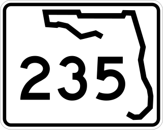
State Road 235 is a south–north state highway in Alachua County, Florida. It runs from U.S. Route 441 in Alachua to Brooker, and has county-maintained segments in Alachua and Bradford Counties, which were once part of SR 235.

<span class="mw-page-title-main">Florida State Road 277</span> State highway in Florida, United States

State Road 277 is a north-south state and county highway in the panhandle in the U.S. state of Florida that extends from State Road 79 in Vernon to U.S. Route 90 in Hulaw west of Chipley. SR 277 runs entirely through Washington County, although one of the two county extensions runs through both Washington and Jackson Counties, Most, if not all of the road is a two-lane undivided highway. Between its termini, SR 277 intersects with no state roads other than former ones, and shares a concurrency with at least one of those county roads. A sizeable portion of the road runs in close proximity to the east side of Holmes Creek.

References

Template:Attached KML/Florida State Road 81
KML is not from Wikidata