Florida State Road 83

Last updated

Florida 83.svg

State Road 83

Florida State Road 83
Florida State Road 83, signed (red) and unsigned (blue)
Route information
Maintained by FDOT
Length45.327 mi [1]  (72.947 km)
Major junctions
South endUS 98.svg US 98 near Santa Rosa Beach
Major intersectionsUS 90.svgUS 331.svg US 90  / US 331 in DeFuniak Springs
North endAlabama 153.svg SR 153 towards Samson, AL
Location
Country United States
State Florida
Counties Walton
Highway system
Florida 82.svg SR 82 Florida 84.svg SR 84

State Road 83 (SR 83) is the state designation for U.S. Route 331 between US 98(SR 30) in Santa Rosa Beach and US 90(SR 10) in DeFuniak Springs. It also includes an independent route from DeFuniak Springs to the Florida-Alabama State Line. The entire route is in Walton County.

Contents

Route description

State Road 83 begins at U.S. Route 98 in Santa Rosa Beach. From there it runs north towards a long concrete slab bridge over Choctawhatchee Bay. The bridge ends at Wheeler Point, and the road makes a sharp curve to the northeast where it encounters an intersection with County Road 3280, and then turns straight north again. Running along the eastern edge of Mallery Bayou, and LaGrange Bayou, the road makes a less drastic northeastern curve at the bridge over Ramsey Brook, and it eventually intersects State Road 20 on the eastern edge of Freeport. The road continues on this trajectory thanks to a 2007 FDOT construction project, but eventually straightens before approaching the northern terminus of State Road 883 (former US 331/SR 83) in Owl's Head. From that point it runs along the eastern edge of Eglin Air Force Base, which includes the Eglin Wildlife Management Area. This territory ends across the street from the intersection of Edgewood Circle. After the intersection with Indian Creek Ranch Road, US 331/SR 83 makes a slight northwest curve to meet the southern end of County Road 278 (Coy Burgess Loop). The road runs straight north from there and becomes a divided highway as it approaches the north end of CR 278 just south of Interstate 10 at Exit 85 in DeFuniak Springs. Within the city, US 331/SR 83 remains a divided highway running in the same trajectory, where the only intersection of any level of importance is CR 280(Bob Sikes Road). After the intersection with Myrtle Avenue, it takes another slight curve to the northeast. Two more local intersections will be encountered before the road runs beneath a bridge for the CSX P&A Subdivision, and a parallel bridge with Baldwin Avenue just before the intersection with U.S. Route 90, where both U.S. Route 331 and SR 83 split into two separate concurrencies; US 331 turns left while SR 83 turns right. US 90/SR 83 then intersects 12th Street where they enter the DeFuniak Springs Historic District until it heads north onto North Ninth Street. US 90 doesn't leave the historic district until the intersection of Second Street, but SR 83 leaves the district immediately.

With the exception of some random turn lanes, all of which are in DeFuniak Springs, independent State Road 83 is entirely two-lanes wide. Part of the road runs along the DeFuniak Springs city line between Burlich Avenue and Walton Road. North of there, it passes by the site of the Walton County Fair, and later a driveway shared by the Walton County Landfill, and Walton Corrections Institute. After intersecting roads of only local importance, SR 83 encounters the southern terminus of CR 1883, which is also shared with the intersection of Sunrise Drive. Shortly after this, it passes the 10 Lakes housing development and then an intersection with the eastern terminus of CR 192.

Entering Glendale, SR 83 encounters a blinker-light intersection with CR 185, which runs northeast toward Leonia in Holmes County, and then to Geneva, Alabama. After crossing a bridge over Gum Creek, it serves as the eastern terminus of CR 1084, which also shares an intersection with Bartlett Road. Other than a Presbyterian Church, and a local gas station, nearly every structure along Route 83 is residential. The last moderate intersection is with CR 183B(Main Street) which runs southeast to County Road 10A. North of Glendale, SR 83 becomes surrounded by an increase in forestland and a decrease in farmland, and later encounters its only other major intersection, specifically State Road 2, which has another blinker-light intersection. The road straightens out again, and encounters just two local intersections until it reaches Gaskin, where the last intersection of any importance is with CR 181. The last intersection in the state in general is with Phillips Drive, a dead end/dirt road off to the east side. The road ends at the Florida-Alabama State Line and becomes Alabama State Route 153. [2]

Major intersections

The entire route is in Walton County.

Locationmi [1] kmDestinationsNotes
0.0000.000US 98.svg US 98 (SR 30) Blue Mountain Beach, Santa Rosa Beach, Fort Walton Beach, Seaside, Grayton Beach, Seagrove Beach, Grayton Beach State Recreation Area, Eden State Gardens, Henderson Beach State Recreation Area, Topsail Hill State Preserve
see US 331 (mile 0.000-25.908)
DeFuniak Springs 25.90841.695West plate.svg
US 90.svg
North plate.svg
US 331.svg
Airport Sign.svg US 90 west / US 331 north (SR 10 west) Crestview, Airport
north end of US 331 overlap; south end of US 90 / SR 10 overlap
26.21142.183East plate.svg
US 90.svg
US 90 east (Nelson Avenue / SR 10) Ponce de Leon
north end of US 90 / SR 10 overlap
30.86649.674North plate county.svg
CR 1883 jct.svg
CR 1883 north Walton County Jail
32.29751.977West plate county.svg
CR 192 jct.svg
CR 192 west
34.08054.846North plate county.svg
CR 185 jct.svg
CR 185 north (Gum Creek Church Road) Leonia, Geneva
34.84256.073West plate county.svg
CR 1084 jct.svg
CR 1084 west
Glendale 36.13158.147South plate county.svg
CR 183B jct.svg
CR 183B south
39.40763.419CR 2 jct.svg CR 2  Darlington
Gaskin 43.78070.457CR 181 jct.svg CR 181  Darlington
45.32772.947North plate.svg
Alabama 153.svg
SR 153 north Samson
Alabama state line
1.000 mi = 1.609 km; 1.000 km = 0.621 mi

County Road 83

Walton County 83.svg

County Road 83

Location Santa Rosa Beach

West of the southern terminus of SR 83 is a de facto extension along Old Blue Mountain Road known as County Road 83. It begins in Blue Mountain Beach where it crosses CR 30A, and then heads north where it ends at US 98.

County Road 83A

Walton County 83A.svg

County Road 83A

Location Freeport

County Road 83A is a suffixed alternate of SR 83 located in Freeport, however due to the realignment of US 331 and SR 83 between Freeport and Owl's Head, it no longer has contact with SR 83.

Related Research Articles

<span class="mw-page-title-main">U.S. Route 331</span>

U.S. Route 331 is a spur of U.S. Route 31. It currently runs for 150 miles (240 km) from Santa Rosa Beach, Florida east of Fort Walton Beach at US 98 to Montgomery, Alabama at US 80 and US 82. Unlike US 131, US 231, and US 431, US 331 never intersects with its "parent" route, US 31; however, the two routes do come within 4 miles (6.4 km) of each other in Montgomery.

<span class="mw-page-title-main">Florida State Road 16</span> Highway in Florida

State Road 16 (SR 16) runs from northwest to southeast between Raiford and St. Augustine. It passes through the towns of Starke and Green Cove Springs in addition to providing access to Camp Blanding. Major roads and/or highways that SR 16 crosses include: US 301, SR 21, US 17, SR 13, Interstate 95 and US 1.

<span class="mw-page-title-main">Florida State Road 100</span> Highway in Florida

State Road 100 is a 153-mile-long (246 km) east–west highway serving northeast Florida. Its western terminus is at the Georgia-Florida border four miles (6.4 km) north of Avoca, Florida ; its eastern terminus is an intersection with Shore Scenic Highway in Flagler Beach. The portion west of Lake City is only signed as portions of US 41 and US 129, both of which run north–south.

<span class="mw-page-title-main">Florida State Road 20</span> Highway in Florida

State Road 20 is a 358.154-mile-long (576.393 km) east-to-west route across northern Florida and the Florida Panhandle in the United States.

<span class="mw-page-title-main">Florida State Road 40</span> Highway in Florida

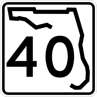
State Road 40 is a 91.8-mile-long (147.7 km) east–west highway across northern and east-central Florida, running from U.S. Highway 41 (US 41) in Rainbow Lakes Estates eastwards through Ocala over the Ocklawaha River and through the heart of the Ocala National Forest to SR A1A in Ormond Beach. Names of the road include Silver Springs Boulevard in Ocala, Fort Brooks Road from Silver Springs through Astor, Butler Road in Astor, and Granada Boulevard in Ormond Beach. Former sections in Ormond Beach are named "Old Tomoka Road" and "Old Tomoka Avenue."

<span class="mw-page-title-main">Florida State Road 145</span> State highway in Florida, United States

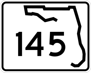
State Road 145 runs north from US 90 and State Road 53 in Madison to the Georgia border, where it becomes State Route 31. It is also a short route in Fort Walton Beach between US 98 and State Road 85.

<span class="mw-page-title-main">Florida State Road 24</span> Highway in Florida

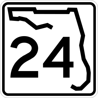
State Road 24 is an east–west state highway that runs between Cedar Key on the Gulf of Mexico and Waldo, Florida, at US 301. State Road 24 runs along a former branch of the Seaboard Air Line Railroad. This branch was originally owned by the Florida Railway and Navigation Company, and used to lead to ferries to both Pensacola, Florida and New Orleans, Louisiana. It also passes through Rosewood, site of the infamous 1923 massacre.

<span class="mw-page-title-main">Florida State Road 26</span> Highway in Florida

State Road 26 is a 62.172-mile-long (100.056 km) east–west route across North Central Florida.

<span class="mw-page-title-main">Florida State Road 292</span> State highway in Florida, United States

State Road 292 is a major thoroughfare in the Pensacola, Florida metropolitan area. Locally, it is known as Pace Boulevard, Barrancas Avenue, Gulf Beach Highway, Sorrento Road, and Perdido Key Drive.

<span class="mw-page-title-main">U.S. Route 29 in Alabama</span>

U.S. Route 29 (US 29), internally designated by the Alabama Department of Transportation (ALDOT) as State Route 15 (SR 15), is a southwest–northeast state highway across the southeastern part of the U.S. state of Alabama. US 29 and SR 15 traverse Alabama in a general northeast–southwest slope. It has never been a major route in the state; its significance was completely overshadowed with the completion of Interstate 65 (I-65) and I-85 during the 1970s. Today, US 29 and SR 15 serve primarily to connect numerous smaller towns and cities in the southwest, south-central, and eastern parts of Alabama.

<span class="mw-page-title-main">U.S. Route 19 in Florida</span> Highway in Florida

U.S. Highway 19 (US 19) runs about 262 miles (422 km) along Florida's west coast from an interchange with US 41 in Memphis, south of Tampa, and continues to the Georgia border north of Monticello.

<span class="mw-page-title-main">U.S. Route 29 in Florida</span> Highway in Florida

U.S. Highway 29 (US 29) in the state of Florida is the westernmost north–south United States Numbered Highway in the state. It runs 43.6 miles (70.2 km) from downtown Pensacola north to the Alabama state line entirely within Escambia County. US 29 runs as a four-lane highway through much of the Florida Panhandle, becoming six lanes through and near several towns. The highway's hidden state road designation is entirely State Road 95 (SR 95).

<span class="mw-page-title-main">U.S. Route 90 in Florida</span> United States historic place

U.S. Route 90 (US 90) in the state of Florida is the northernmost east–west United States Numbered Highway in the state. US 90 passes through the county seats of all 15 counties on its course in Florida, and it is also the road upon which many of the county courthouses are located. It is never more than six miles (9.7 km) from Interstate 10 (I-10) throughout the state. It runs as a two-lane highway through most of the sparsely populated inland areas of the Florida Panhandle, widening to four lanes through and near several towns. The speed limit is 55 mph (89 km/h) for all rural points west of Monticello, and it is 60 mph (97 km/h) on all rural points from where it enters Madison County as far as Glen St. Mary.

<span class="mw-page-title-main">Florida State Road 121</span> Highway in Florida

State Road 121 is a major state highway that runs north and south in northern Florida. The road is part of a long multi-state route that also goes through Georgia and South Carolina.

<span class="mw-page-title-main">Florida State Road 69</span> State highway in Florida, United States

State Road 69 is a road running through Calhoun and Jackson counties in northwest Florida. The road is almost entirely two-lanes wide.

<span class="mw-page-title-main">Florida State Road 71</span> State highway in Florida, United States

State Road 71 is a highway in western Florida that runs 95.4 miles (153.5 km) from the Gulf Coast and the Gulf of Mexico, through the panhandle of Florida to the Alabama border.

<span class="mw-page-title-main">Florida State Road 81</span> State highway in Florida, United States

State Road 81 is a state highway linking State Road 20 at Bruce with Alabama State Route 87.

<span class="mw-page-title-main">Florida State Road 235</span> State highway in Florida, United States

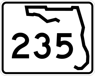
State Road 235 is a south–north state highway in Alachua County, Florida. It runs from U.S. Route 441 in Alachua to Brooker, and has county-maintained segments in Alachua and Bradford Counties, which were once part of SR 235.

<span class="mw-page-title-main">Florida State Road 273</span> State highway in Florida, United States

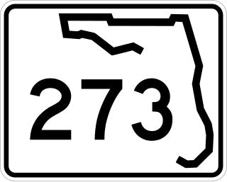
State Road 273 is a north–south highway in the panhandle in the U.S. state of Florida that extends from State Road 77 in Chipley to U.S. Route 231 in Campbellton. SR 273 runs through both Washington and Jackson counties, and most, if not all of the road is a two-lane undivided highway. Between its termini, SR 273 intersects with no state roads other than former ones. A former section of the road south of Chipley is now County Road 273.

<span class="mw-page-title-main">Florida State Road 277</span> State highway in Florida, United States

State Road 277 is a north-south state and county highway in the panhandle in the U.S. state of Florida that extends from State Road 79 in Vernon to U.S. Route 90 in Hulaw west of Chipley. SR 277 runs entirely through Washington County, although one of the two county extensions runs through both Washington and Jackson Counties, Most, if not all of the road is a two-lane undivided highway. Between its termini, SR 277 intersects with no state roads other than former ones, and shares a concurrency with at least one of those county roads. A sizeable portion of the road runs in close proximity to the east side of Holmes Creek.

References

  1. 1 2 FDOT straight line diagrams Archived March 6, 2014, at the Wayback Machine , accessed February 2014
  2. Google (2012-09-16). 83+N&hl=en&ll=30.431506,-86.113586&spn=0.42805,0.614548&sll=30.728187,-86.113586&sspn=0.026672,0.038409&geocode=Fev1zgEd0q3c-g%3BFfBB0QEdEOXd-ikXexyzbd2TiDHUIBQLlLuYfQ%3BFW7F1AEd4Pvd-inr2865v9GTiDFL8AOCt_MlWw%3BFdLp2AEd1rfd-g&mra=dvme&mrsp=2&sz=15&via=1,2&t=m&z=11 "Overview of State Road 83" (Map). Google Maps . Google. Retrieved 2012-09-16.{{cite map}}: Check |url= value (help)
Template:Attached KML/Florida State Road 83
KML is not from Wikidata