Flowella, Texas

Last updated

Flowella, Texas
TXMap-doton-Flowella.PNG
Location of Flowella, Texas
Brooks County Flowella.svg
Coordinates: 27°13′9″N98°3′58″W / 27.21917°N 98.06611°W / 27.21917; -98.06611
Country United States
State Texas
County Brooks
Area
  Total1.0 sq mi (2.6 km2)
  Land1.0 sq mi (2.6 km2)
  Water0.0 sq mi (0.0 km2)
Elevation
95 ft (29 m)
Population
 (2020)
  Total117
  Density120/sq mi (45/km2)
Time zone UTC-6 (Central (CST))
  Summer (DST) UTC-5 (CDT)
ZIP code
78355
Area code 361
FIPS code 48-26220 [1]
GNIS feature ID1335980 [2]

Flowella (also known as "La Parrita") is a census-designated place (CDP) in Brooks County, Texas, United States. The population was 117 at the 2020 census.

Contents

Geography

Flowella is located at 27°13′9″N98°3′58″W / 27.21917°N 98.06611°W / 27.21917; -98.06611 (27.219277, -98.066155) [3] near the intersection of State Highway 285 and FM 2191 in northeastern Brooks County. It is situated approximately 5 miles (8 km) east of Falfurrias, the Brooks County seat.

According to the United States Census Bureau, the CDP has a total area of 1.0 square mile (2.6 km2), all land. [4]

History

Flowella was founded in 1909 by promoters Burton and Danforth. [5] The community was planned with a flowing well as its centerpiece. [6] A post office was established in Flowella in 1910. It remained in operation for the next 13 years. Sixty people were living in the community in 1914. The town also had a hotel and general store.

The growth of nearby Falfurrias kept the population of Flowella small. [6] It exists today as a rural, dispersed community.

Demographics

Historical population
CensusPop.Note
2000 134
2010 118−11.9%
2020 117−0.8%
US Decennial Census [3]
2020 Census [7]

As of the census [1] of 2000, there were 134 people, 46 households, and 35 families residing in the CDP. The population density was 130.5 inhabitants per square mile (50.4/km2). There were 56 housing units at an average density of 54.6 per square mile (21.1/km2). The racial makeup of the CDP was 55.97% White, 43.28% from other races, and 0.75% from two or more races. Hispanic or Latino of any race were 97.01% of the population.

There were 46 households, out of which 34.8% had children under the age of 18 living with them, 47.8% were married couples living together, 15.2% had a female householder with no husband present, and 23.9% were non-families. 23.9% of all households were made up of individuals, and 10.9% had someone living alone who was 65 years of age or older. The average household size was 2.91 and the average family size was 3.31.

In the CDP, the population was spread out, with 25.4% under the age of 18, 7.5% from 18 to 24, 28.4% from 25 to 44, 20.9% from 45 to 64, and 17.9% who were 65 years of age or older. The median age was 38 years. For every 100 females, there were 119.7 males. For every 100 females age 18 and over, there were 117.4 males.

The median income for a household in the CDP was $11,250, and the median income for a family was $12,404. Males had a median income of $13,750 versus $9,844 for females. The per capita income for the CDP was $5,560. There were 50.9% of families and 37.9% of the population living below the poverty line, including 32.8% of under eighteens and 53.1% of those over 64.

Education

Public education in the community of Flowella is provided by the Brooks County Independent School District.

Related Research Articles

<span class="mw-page-title-main">Pawnee, Texas</span> Census-designated place in Texas, United States

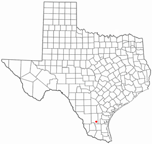
Pawnee is a census-designated place (CDP) in Bee County, Texas, United States. The population was 140 at the 2020 census.

<span class="mw-page-title-main">Airport Road Addition, Texas</span> Place in Texas, United States

Airport Road Addition is an unincorporated community and census-designated place (CDP) in Brooks County, Texas, United States. The population was 96 at the 2020 census.

<span class="mw-page-title-main">Cantu Addition, Texas</span> Census-designated place in Texas, United States

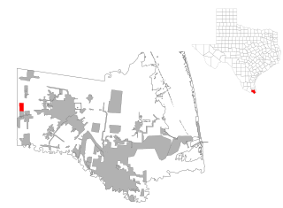
Cantu Addition is a census-designated place (CDP) in Brooks County, Texas, United States. Its population was 191 at the 2020 census.

<span class="mw-page-title-main">Encino, Texas</span> Census-designated place in Texas, United States

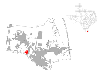
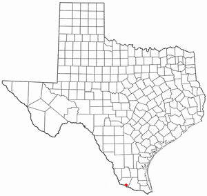
Encino is a census-designated place (CDP) in Brooks County, Texas, United States. It is 18 miles (29 km) south of the county seat of Falfurrias. The population was 109 at the 2020 census. It is the site of a United States Border Patrol interior checkpoint.

<span class="mw-page-title-main">Arroyo Colorado Estates, Texas</span> CDP in Texas, United States

Arroyo Colorado Estates is a census-designated place (CDP) in Cameron County, in the U.S. state of Texas. The population was 997 at the 2010 census. It is part of the Brownsville–Harlingen Metropolitan Statistical Area.

<span class="mw-page-title-main">Encantada-Ranchito-El Calaboz, Texas</span> Census-designated place in Texas, United States

Encantada-Ranchito-El Calaboz, also known as El Calaboz Rancheria in the San Pedro de Carricitos Land Grant, is a census-designated place (CDP) in Cameron County, Texas, United States. The population was 1,981 at the 2020 census. It is part of the Brownsville–Harlingen Metropolitan Statistical Area.

<span class="mw-page-title-main">Laureles, Texas</span> CDP in Texas, United States

Laureles is a census-designated place (CDP) in Cameron County, Texas, United States. The population was 4,111 at the 2020 census. It is part of the Brownsville–Harlingen Metropolitan Statistical Area. Laureles is an area between Los Fresnos and San Benito.

<span class="mw-page-title-main">Olmito, Texas</span> Census-designated place in Texas, United States

Olmito is a census-designated place (CDP) in Cameron County, Texas, United States. Olmito is Spanish for "little elm". The population was 1,021 at the 2020 census. It is part of the Brownsville–Harlingen Metropolitan Statistical Area. Olmito is the self-described "mesquite capital of the world."

<span class="mw-page-title-main">Ratamosa, Texas</span> Census-designated place in Texas, United States

Ratamosa is a census-designated place (CDP) in Cameron County, Texas, United States. The population was 197 at the 2020 census. It is part of the Brownsville–Harlingen Metropolitan Statistical Area.

<span class="mw-page-title-main">Concepcion, Texas</span> Census-designated place in Texas, United States

Concepcion is an unincorporated community and census-designated place (CDP) in Duval County, Texas, United States. The population was 42 at the 2020 census.

<span class="mw-page-title-main">Cuevitas, Texas</span> Census-designated place in Texas

Cuevitas is a census-designated place (CDP) in Hidalgo County, Texas, United States. The population was 40 at the 2010 United States Census. Rated the poorest community in Texas, it is part of the McAllen–Edinburg–Mission Metropolitan Statistical Area.

<span class="mw-page-title-main">Muniz, Texas</span> Census-designated place in Texas

Muniz is a census-designated place (CDP) in Hidalgo County, Texas, United States. The population was 1,593 at the 2020 United States Census. It is part of the McAllen–Edinburg–Mission Metropolitan Statistical Area.

<span class="mw-page-title-main">North Alamo, Texas</span> Census-designated place in Texas, United States

North Alamo is a census-designated place (CDP) in Hidalgo County, Texas, United States. The population was 3,722 at the 2020 United States Census. It is part of the McAllen–Edinburg–Mission Metropolitan Statistical Area.

<span class="mw-page-title-main">San Carlos, Texas</span> Census-designated place in Texas

San Carlos is a community and census-designated place (CDP) in Hidalgo County, Texas. The population was 3,087 at the 2020 United States Census. It is part of the McAllen–Edinburg–Mission Metropolitan Statistical Area.

<span class="mw-page-title-main">Linn, Texas</span> Census-designated place in Hidalgo County, Texas, United States

Linn, formerly San Manuel-Linn, is a census-designated place (CDP) in Hidalgo County, Texas, United States. The population was 801 at the 2010 census, down from 958 at the 2000 census. It is part of the McAllen–Edinburg–Mission Metropolitan Statistical Area.

<span class="mw-page-title-main">South Alamo, Texas</span> Census-designated place in Texas

South Alamo is a census-designated place (CDP) in Hidalgo County, Texas, United States. The area is known locally as "Little Mex (Mexico)". The population was 3,414 at the 2020 United States Census. It is part of the McAllen–Edinburg–Mission Metropolitan Statistical Area.

<span class="mw-page-title-main">West Alto Bonito, Texas</span> CDP in Texas, United States

West Alto Bonito is a census-designated place (CDP) in Starr County, Texas, United States. The population was 615 in 2020 census. Prior to the 2010 census, West Alto Bonito CDP was known as Alto Bonito CDP.

<span class="mw-page-title-main">El Refugio, Texas</span> CDP in Texas, United States

El Refugio is a census-designated place (CDP) in Starr County, Texas, United States. The population was 407 at the 2020 census. El Refugio gained area in the 2010 census.

<span class="mw-page-title-main">Windemere, Texas</span> Former CDP in Texas, United States

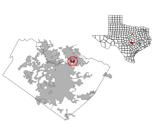
Windermere is a former census-designated place (CDP) in Travis County, Texas, United States. The population was 1,037 at the 2010 census. It has since largely been annexed by the city of Pflugerville.

<span class="mw-page-title-main">Bruni, Texas</span> CDP in Texas, United States

Bruni is a census-designated place (CDP) in Webb County, Texas, United States. The population was 379 at the 2010 census.

References

  1. 1 2 "U.S. Census website". United States Census Bureau . Retrieved January 31, 2008.
  2. "US Board on Geographic Names". United States Geological Survey. October 25, 2007. Retrieved January 31, 2008.
  3. 1 2 "US Gazetteer files: 2010, 2000, and 1990". United States Census Bureau. February 12, 2011. Retrieved April 23, 2011.
  4. "Geographic Identifiers: 2010 Demographic Profile Data (G001): Flowella CDP, Texas". U.S. Census Bureau, American Factfinder. Archived from the original on February 12, 2020. Retrieved April 22, 2014.
  5. "Flowella, Texas". The Handbook of Texas online. Retrieved May 10, 2008.
  6. 1 2 "Flowella, Texas". Texas Escapes Online Magazine. Retrieved May 10, 2009.
  7. "Census Bureau profile: Flowella, Texas". United States Census Bureau. May 2023. Retrieved June 9, 2024.