Fort Coffee, Oklahoma

Last updated

Fort Coffee, Oklahoma
OKMap-doton-FortCoffee.PNG
Location of Fort Coffee, Oklahoma
Coordinates: 35°17′39″N94°34′23″W / 35.29417°N 94.57306°W / 35.29417; -94.57306
Country United States
State Oklahoma
County Le Flore
Government
  TypeTown
Area
[1]
  Total6.53 sq mi (16.91 km2)
  Land6.53 sq mi (16.91 km2)
  Water0.00 sq mi (0.01 km2)
Elevation
[2]
449 ft (137 m)
Population
 (2020)
  Total335
  Density51.33/sq mi (19.82/km2)
Time zone UTC-6 (Central (CST))
  Summer (DST) UTC-5 (CDT)
FIPS code 40-27150 [3]
GNIS feature ID2412639 [2]

Fort Coffee is a town in Le Flore County, Oklahoma, United States. Originally constructed as a U. S. Army fort in 1834, it was named for U. S. General John Coffee, a veteran of the Seminole Wars. [4] It is part of the Fort Smith, Arkansas-Oklahoma Metropolitan Statistical Area. The population was 424 at the 2010 census, a gain of 2.9 percent over the figure of 412 in 2000. [5]

Contents

History

The town of Fort Coffee traces its beginnings to 1832, when the Choctaw Indian tribe was removed from the southeastern United States and transported to land in the eastern part of Indian Territory (now in the state of Oklahoma). Most of the travel was by water, and the site of Fort Coffee became a port on the Arkansas River. [4]

In 1834, the Choctaw Nation petitioned the U.S. War Department to construct a fort that would stop the flow of alcohol and other illegal items from flowing into their territory along the Arkansas River. The garrison succeeded in its mission and also built roads connecting Fort Smith, Arkansas, Fort Gibson, and Fort Towson. The army abandoned Fort Coffee in 1838 when Fort Smith was reestablished. The site of Fort Coffee was located in Skullyville County, a part of the Moshulatubbee District of the Choctaw Nation. [6]

In 1843, the Choctaw nation allowed the Methodist Episcopal church to establish the Fort Coffee Choctaw Boys Academy in the buildings. This school continued until the outbreak of the Civil War, when Confederate forces commanded by General Stand Watie occupied the site. The Union Army recaptured the fort in 1863. Most of the buildings were burned during this time. Several small houses were built using the foundation stones. [4]

The Choctaw were required to release their slaves by the Reconstruction Treaty of 1866. Many of the freed men remained in the Choctaw Nation lands. Many of these were legally adopted into the Choctaw Nation in 1885, thus qualifying for land allotments by the Dawes Commission. [4]

The local economy has largely been based on agriculture. Major crops included cotton, livestock and soybeans. There was a cotton gin in Fort Coffee to handle locally grown crops. The Fort Smith and Western Railroad and the Kansas City, Pittsburg and Gulf Railway (bought by the Kansas City Southern Railway in 1900) transported the products to outside markets. [4]

The town of Fort Coffee did not incorporate until 1998. [4]

Geography

Fort Coffee is located 6 miles (9.7 km) northeast of Spiro. [4]

According to the United States Census Bureau, the town has a total area of 6.4 square miles (17 km2), of which 6.4 square miles (17 km2) is land and 0.16% is water.

The town is just south of a bend of the Arkansas River, downstream from the Robert S. Kerr Reservoir, and north of U.S. Route 271, [7] about 11 miles from the Arkansas border. [8]

Demographics

Historical population
CensusPop.Note
2000 412
2010 4242.9%
2020 335−21.0%
U.S. Decennial Census [9]

At the 2000 census, [3] there were 412 people, 163 households and 109 families residing in the town. The population density was 64.1 inhabitants per square mile (24.7/km2). There were 176 housing units at an average density of 27.4 per square mile (10.6/km2). The racial makeup of the town was 26.21% White, 62.86% African American, 3.88% Native American, and 7.04% from two or more races.

There were 163 households, of which 30.1% had children under the age of 18 living with them, 45.4% were married couples living together, 14.7% had a female householder with no husband present, and 33.1% were non-families. 31.9% of all households were made up of individuals, and 11.7% had someone living alone who was 65 years of age or older. The average household size was 2.53 and the average family size was 3.17.

Age distribution was 23.8% under the age of 18, 9.7% from 18 to 24, 24.0% from 25 to 44, 28.6% from 45 to 64, and 13.8% who were 65 years of age or older. The median age was 41 years. For every 100 females, there were 104.0 males. For every 100 females age 18 and over, there were 106.6 males.

The median household income was $26,827, and the median family income was $31,528. Males had a median income of $26,094 versus $22,344 for females. The per capita income for the town was $14,039. About 25.6% of families and 30.6% of the population were below the poverty line, including 36.9% of those under age 18 and 50.0% of those age 65 or over.

Points of interest

Despite the Spiro, Oklahoma mailing address, the Spiro Mounds and the Spiro Mounds Archaeological Center are in Fort Coffee. [10] [11]

W. D. Mayo Lock and Dam, part of the McClellan–Kerr Arkansas River Navigation System, is just northeast of town, [12] while a boat ramp with access to the river above W. D. Mayo Lock and Dam is just north of town. [13]

Related Research Articles

<span class="mw-page-title-main">Pushmataha County, Oklahoma</span> County in Oklahoma, United States

Pushmataha County is a county in the southeastern part of the U.S. state of Oklahoma. As of the 2020 census, the population was 10,812. Its county seat is Antlers.

<span class="mw-page-title-main">LeFlore County, Oklahoma</span> County in Oklahoma, United States

LeFlore County is a county along the eastern border of the U.S state of Oklahoma. As of the 2020 census, the population was 48,129. Its county seat is Poteau. The county is part of the Fort Smith metropolitan area and the name honors a Choctaw family named LeFlore. The United States District Court for the Eastern District of Oklahoma is the federal district court with jurisdiction in LeFlore County.

<span class="mw-page-title-main">Fort Towson, Oklahoma</span> Town in Oklahoma, United States

Fort Towson is a town in Choctaw County, Oklahoma, United States. The population was 510 at the 2010 census, a 15.1 percent decline from the figure of 611 recorded in 2000. It was named for nearby Fort Towson, which had been established in May 1824 and named for General Nathan Towson, a hero of the War of 1812. The town of Fort Towson was established in 1902, after the Arkansas and Choctaw Railway reached eastern Choctaw County.

<span class="mw-page-title-main">Sawyer, Oklahoma</span> Town in Oklahoma, United States

Sawyer is a town in Choctaw County, Oklahoma, United States. The population was 321 at the 2010 census.

Keota is a town in southeastern Haskell County, Oklahoma, United States. The population was 438 at the 2020 census, a 22.3 percent decrease over the figure of 564 recorded in 2010.

Tamaha is a town in Haskell County, Oklahoma, United States. The population was 152 at the time of the 2020 United States census. Tamaha is a Choctaw word meaning "town."

<span class="mw-page-title-main">Wilburton, Oklahoma</span> City in Oklahoma, United States

Wilburton is a city in Latimer County, Oklahoma, United States. It is the county seat of Latimer County. The city had a population of 2,285 as of the 2020 Census. Robbers Cave State Park is 5 miles (8.0 km) north of Wilburton.

<span class="mw-page-title-main">Arkoma, Oklahoma</span> Town in Oklahoma, United States

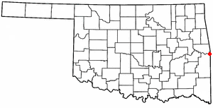
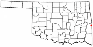
Arkoma is a town in LeFlore County, Oklahoma, United States. It is part of the Fort Smith, Arkansas-Oklahoma Metropolitan Statistical Area. The population was 1,989 at the 2010 census, a decline from 2,180 in 2000. The name of the town is a portmanteau of Arkansas and Oklahoma. Throughout its history, Arkoma has served as a "bedroom community" because many residents commuted to work in Fort Smith.

<span class="mw-page-title-main">Cowlington, Oklahoma</span> Town in Oklahoma, United States

Cowlington is a town in LeFlore County, Oklahoma. It is part of the Fort Smith metropolitan area. The population was 155 at the time of the 2010 census, a gain of 16.5 percent over the figure of 133 recorded in 2000.

<span class="mw-page-title-main">Howe, Oklahoma</span> Town in Oklahoma, United States

Howe is a town in Le Flore County, Oklahoma, United States. It is part of the Fort Smith, Arkansas-Oklahoma Metropolitan Statistical Area. The population was 802 at the 2010 census, a gain of 15.1 percent over the figure of 697 recorded in 2000. The town was once noted for producing coal and coke, but today is chiefly supported by agriculture.

<span class="mw-page-title-main">Pocola, Oklahoma</span> Town in Oklahoma, United States

Pocola is a town in Le Flore County, Oklahoma, United States. It is part of the Fort Smith, Arkansas-Oklahoma metropolitan area. The population was 4,056 in 2010, a gain of 1.6 percent over the figure of 3,994 recorded in 2000. Pocola is a Choctaw word meaning "ten", the approximate distance in miles from Fort Smith, Arkansas.

<span class="mw-page-title-main">Rock Island, Oklahoma</span> Town in Oklahoma, United States

Rock Island is a town in Le Flore County, Oklahoma, United States. It is part of the Fort Smith, Arkansas-Oklahoma Metropolitan Statistical Area. The population was 646 at the 2010 census, a decline of 8.9 percent from the figure of 709 recorded in 2000.

<span class="mw-page-title-main">Spiro, Oklahoma</span> Town in Oklahoma, United States

Spiro is a town in Le Flore County, Oklahoma, United States. It is part of the Fort Smith, Arkansas-Oklahoma Metropolitan Statistical Area. The population was 2,164 at the 2010 census, a 2.8 percent decline from the figure of 2,227 recorded in 2000.

<span class="mw-page-title-main">Talihina, Oklahoma</span> Town in Oklahoma, United States

Talihina is a town in LeFlore County, Oklahoma, United States, its name originating from two Choctaw words, tully and hena, meaning "iron road," a reference to the railroad around which the town was built. It is part of the Fort Smith, Arkansas–Oklahoma Metropolitan Statistical Area. The population was 925 at the time of the 2020 Census.

<span class="mw-page-title-main">Wister, Oklahoma</span> Town in Oklahoma, United States

Wister is a town in Le Flore County, Oklahoma, United States. It is part of the Fort Smith metropolitan area. The population was 1,102 at the 2010 census. Wister is named for Gutman G. Wister, an official with the Choctaw, Oklahoma and Gulf Railroad.

<span class="mw-page-title-main">Idabel, Oklahoma</span> City in Oklahoma, United States

Idabel is a city in and the county seat of McCurtain County, Oklahoma, United States. The population was 7,010 at the 2010 census. It is in Oklahoma's southeast corner, a tourist area known as Choctaw Country.

<span class="mw-page-title-main">Valliant, Oklahoma</span> Town in Oklahoma, United States

Valliant is a town in McCurtain County, Oklahoma, United States. The population was 754 at the 2010 census.

<span class="mw-page-title-main">Antlers, Oklahoma</span> City in Oklahoma, United States

Antlers is a city in and the county seat of Pushmataha County, Oklahoma, United States. The population was 2,221 as of the 2020 United States census. The town was named for a kind of tree that becomes festooned with antlers shed by deer, and is taken as a sign of the location of a spring frequented by deer.

<span class="mw-page-title-main">Sallisaw, Oklahoma</span> City in Oklahoma, United States

Sallisaw is a city and county seat in Sequoyah County, Oklahoma, United States. As of the 2010 Census, it had a population of 8,880, an 11.2 percent increase over the figure of 7,891 recorded in 2000. Sallisaw is part of the Fort Smith, Arkansas–Oklahoma Metropolitan Statistical Area.

<span class="mw-page-title-main">Fanshawe, Oklahoma</span> Town in Oklahoma, United States

Fanshawe is a town in Latimer and Le Flore counties in the U.S. state of Oklahoma. As of the 2020 Census, the town had a total population of 317. The Le Flore County portion of Fanshawe is part of the Fort Smith, Arkansas-Oklahoma Metropolitan Statistical Area.

References

  1. "ArcGIS REST Services Directory". United States Census Bureau. Retrieved September 20, 2022.
  2. 1 2 U.S. Geological Survey Geographic Names Information System: Fort Coffee, Oklahoma
  3. 1 2 "U.S. Census website". United States Census Bureau . Retrieved January 31, 2008.
  4. 1 2 3 4 5 6 7 Dennis Peterson. "Fort Coffee." Encyclopedia of Oklahoma History and Culture. Retrieved September 16, 2012.
  5. Archived June 15, 2013, at the Wayback Machine CensusViewer:Fort Coffee, Oklahoma Population. Retrieved September 14, 2012.
  6. Morris, John W. Historical Atlas of Oklahoma (Norman: University of Oklahoma, 1986), plate 38.
  7. "Fort Coffee, Oklahoma". Google Maps. Retrieved September 16, 2020.
  8. "US271 to Fort Coffee, Oklahoma". Google Maps. Retrieved September 16, 2020.
  9. "Census of Population and Housing". Census.gov. Retrieved June 4, 2015.
  10. "Spiro Mounds Archaeological Center". TravelOK.com. Retrieved September 16, 2020.
  11. "Spiro Mounds Archaeological Center". Google Maps. Retrieved September 16, 2020.
  12. "W. D. Mayo Lock and Dam Number 14". Google Maps. Retrieved September 16, 2020.
  13. "Boat Ramp Above WD Mayo Dam". Google Maps. Retrieved September 16, 2020.