
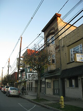
Wilkes-Barre is a city in and the county seat of Luzerne County, Pennsylvania, United States. Located at the center of the Wyoming Valley in Northeastern Pennsylvania, it had a population of 44,328 in the 2020 census. It is the second-largest city, after Scranton, in the Scranton–Wilkes-Barre–Hazleton, PA Metropolitan Statistical Area, which had a population of 567,559 as of the 2020 census, making it the fifth-largest metropolitan area in Pennsylvania after the Delaware Valley, Greater Pittsburgh, the Lehigh Valley, and Greater Harrisburg.

Luzerne County is a county in the Commonwealth of Pennsylvania. According to the United States Census Bureau, the county has a total area of 906 square miles (2,350 km2), of which 890 square miles (2,300 km2) is land and 16 square miles (41 km2) is water. It is Northeastern Pennsylvania's second-largest county by total area. As of the 2020 census, the population was 325,594, making it the most populous county in the northeastern part of the state. The county seat and largest city is Wilkes-Barre. Other populous communities include Hazleton, Kingston, Nanticoke, and Pittston. Luzerne County is included in the Scranton–Wilkes-Barre–Hazleton Metropolitan Statistical Area, which has a total population of 555,426 as of 2017.

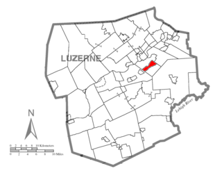
Franklin Township is a township in Luzerne County, Pennsylvania, United States. It is part of the Back Mountain, a 118 square mile region in northern Luzerne County. The population was 1,712 at the 2020 census.

Plains Township is a township in Luzerne County, Pennsylvania, United States. The population was 9,816 at the 2020 census. The municipality is the birthplace of Chicago White Sox hall of famer Ed Walsh and John J. Yeosock, a United States Army general who commanded the 3rd U.S. Army during Operation Desert Shield and Operation Desert Storm. Mohegan Pennsylvania is a casino in Plains Township.
Plymouth is a borough in Luzerne County, Pennsylvania, United States, located 4 miles (6 km) west of Wilkes-Barre, along the Susquehanna River. The population was 5,763 as of the 2020 census.

Plymouth Township is located in Luzerne County, Pennsylvania, United States. The population was 1,712 at the 2020 census.
Tobyhanna Township is a township in Monroe County, Pennsylvania, United States. The population was 8,290 at the 2020 census. Tobyhanna Township has Tobyhanna Elementary Center and Locust Lake Village.
Wilkes-Barre Township is a township with home rule status in Luzerne County, Pennsylvania, United States. It is adjacent to the city of Wilkes-Barre. The population of the township was 3,219 at the 2020 census.

The State of Westmoreland was a proposed self-proclaimed state that would have seceded from Pennsylvania in 1784, after the Congress of the Confederation had ruled that the territory belonged to Pennsylvania rather than Connecticut.
Forty Fort was a stronghold built by settlers from Connecticut, on the Susquehanna River in what is now Luzerne County, Pennsylvania. Before the American Revolutionary War, both Connecticut and Pennsylvania claimed this territory, as Connecticut had laid claim to a wide swath of land to its west based on its colonial charter. These competing claims triggered the Pennamite-Yankee Wars but were resolved after the Revolutionary War when the federal government awarded the contested territory to Pennsylvania.

The Battle of Wyoming, also known as the Wyoming Massacre, was a military engagement during the American Revolutionary War between Patriot militia and a force of Loyalist soldiers and Iroquois warriors. The battle took place in the Wyoming Valley of Pennsylvania on July 3, 1778 in what is now Luzerne County. The result was an overwhelming defeat for the Americans. There were roughly 300 Patriot casualties, many of whom were killed by the Iroquois as they fled the battlefield or after they had been taken prisoner.
Westmoreland County, Connecticut was a county established by the State of Connecticut in October 1776, encompassing the present-day area of Wyoming Valley, in northeastern Pennsylvania. Both colonies claimed this territory and the issue was further confused by the Six Nations selling the territory to both Connecticut in 1754 and again to Pennsylvania in 1768. The first of the Yankee-Pennamite Wars were fought in and around the County, from 1771 through 1775.

According to historian Kevin Kenny, the Paxton Boys were Pennsylvania's most aggressive colonists. This group of vigilantes from Lancaster and Cumberland counties formed in 1763 to defend themselves from attacks by the Lenape and Shawnee during Pontiac's War.

The Wyoming Valley is a historic industrialized region of Northeastern Pennsylvania. The region is historically notable for its influence in helping fuel the American Industrial Revolution with its many anthracite coal-mines. As a metropolitan area, it is known as the Scranton/Wilkes-Barre metropolitan area, after its principal cities, Scranton and Wilkes-Barre. With a population of 567,559 as of the 2020 United States census, it is the fifth-largest metropolitan area in Pennsylvania, after the Delaware Valley, Greater Pittsburgh, the Lehigh Valley, and the Harrisburg–Carlisle metropolitan statistical areas.

The Pennamite–Yankee Wars or Yankee–Pennamite Wars were a series of conflicts consisting of the First Pennamite War (1769–1770), the Second Pennamite War (1774), and the Third Pennamite War (1784), in which settlers from Connecticut (Yankees) and Pennsylvania (Pennamites) disputed for control of the Wyoming Valley along the North Branch of the Susquehanna River. Both colonies and later states declared that their original land grants gave them control of this territory.

The 52nd Pennsylvania Infantry was a volunteer infantry regiment in the Union Army during the American Civil War.
Captain Lazarus Stewart was an 18th-century Pennsylvanian frontiersman, a leader of the Paxton Boys, and a prominent commander on the Yankee side in the Pennamite–Yankee War. He met his death during the Revolutionary War in battle with Loyalists and Iroquois at the Battle of Wyoming.
Fort Dick or Fort Dix may refer to:
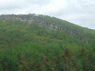
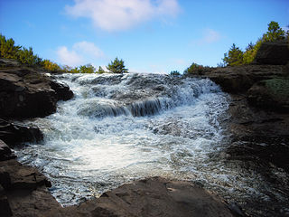
Campbell's Ledge is a geographical feature in Duryea, Luzerne County, Pennsylvania. It is about 1,280 feet (390 m) above sea level. It is located about 0.3 miles (0.48 km) south of the center of the nearby Campbell's Ledge Reservoir. It features a multipurpose antenna for emergency services.

The Luzerne County Courthouse is a historic county courthouse located in Wilkes-Barre, Luzerne County, Pennsylvania. The building houses the government of Luzerne County.
