Modoc County is a county in the far northeast corner of the U.S. state of California. Its population is 8,700 as of the 2020 census, down from 9,686 from the 2010 census. This makes it California's third-least populous county. The county seat and only incorporated city is Alturas. Previous county seats include Lake City and Centerville. The county borders Nevada and Oregon.

Siskiyou County is a county located in the northwestern part of the U.S. state of California. As of the 2020 census, the population was 44,076. Its county seat is Yreka and its highest point is Mount Shasta. It falls within the Cascadia bioregion.
Klamath County is one of the 36 counties in the U.S. state of Oregon. As of the 2020 census, the population was 69,413. The county seat is Klamath Falls. The county was named for the Klamath, the tribe of Native Americans living in the area at the time the first European explorers entered the region. Klamath County comprises the Klamath Falls, OR Micropolitan Statistical Area.

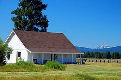
Lakeview is a town in Lake County, Oregon, United States. The population was 2,418 at the 2020 census. It is the county seat of Lake County. The city bills itself as the "Tallest Town in Oregon" because of its elevation, 4,757 feet (1,450 m) above sea level. Lakeview is situated in the Goose Lake Valley at the foot of the Warner Mountains and at the edge of Oregon's high desert country. Its economy is based on agriculture, lumber production, and government activities. In addition, tourism is an increasingly important part of the city's economy. Oregon's Outback Scenic Byway passes through Lakeview.

Lava Beds National Monument is located in northeastern California, in Siskiyou and Modoc counties. The monument lies on the northeastern flank of Medicine Lake Volcano, which is the largest volcano by area in the Cascade Range.

Kintpuash, also known as Kientpaush, Kientpoos, and Captain Jack, was a chief of the Modoc tribe of California and Oregon. Kintpuash's name in the Modoc language meant 'Strikes the water brashly.'

The Modoc War, or the Modoc Campaign, was an armed conflict between the Native American Modoc people and the United States Army in northeastern California and southeastern Oregon from 1872 to 1873. Eadweard Muybridge photographed the early part of the US Army's campaign.

The Modoc are an Indigenous American people who historically lived in the area which is now northeastern California and central Southern Oregon. Currently, they include two federally recognized tribes, the Klamath Tribes in Oregon and the Modoc Tribe of Oklahoma, now known as the Modoc Nation.

Upper Klamath Lake is a large, shallow freshwater lake east of the Cascade Range in south-central Oregon in the United States. The largest body of fresh water by surface area in Oregon, it is approximately 25 miles (40 km) long and 8 miles (13 km) wide and extends northwest from the city of Klamath Falls. It sits at an average elevation of 4,140 feet (1,260 m).
The Snake War (1864–1868) was an irregular war fought by the United States of America against the "Snake Indians," the settlers' term for Northern Paiute, Bannock and Western Shoshone bands who lived along the Snake River. Fighting took place in the states of Oregon, Nevada, and California, and in Idaho Territory. Total casualties from both sides of the conflict numbered 1,762 dead, wounded, or captured.

This is a list of properties and historic districts in Oregon that are listed on the National Register of Historic Places. There are listings in all of Oregon's 36 counties.

Algoma is an unincorporated community on the east shore of Upper Klamath Lake, in Klamath County, Oregon, United States. It is about 8 miles (13 km) north of the city of Klamath Falls on U.S. Route 97. Algoma was named for the Algoma Lumber Company.
Fort Bowie was a 19th-century outpost of the United States Army located in southeastern Arizona near the present day town of Willcox, Arizona. The remaining buildings and site are now protected as Fort Bowie National Historic Site.
The Klamath Tribes, formerly the Klamath Indian Tribe of Oregon, are a federally recognized Native American Nation consisting of three Native American tribes who traditionally inhabited Southern Oregon and Northern California in the United States: the Klamath, Modoc, and Yahooskin. The tribal government is based in Chiloquin, Oregon.

The Vancouver Barracks was the first United States Army base located in the Pacific Northwest, established in 1849, in what is now contemporary Vancouver, Washington. It was built on a rise 20 feet (6.1 m) above the Fort Vancouver fur trading station established by the Hudson's Bay Company (HBC). Its buildings were formed in a line adjacent to the Columbia River approximately 2,000 yards (1,800 m) from the riverbank.

The Wood River is a short river in the southern region of the U.S. state of Oregon, and part of the Klamath Basin drainage. It flows 18 miles (29 km) through the Fremont-Winema National Forests, Bureau of Land Management land, and private property in southern Oregon. Its watershed consists of 220 square miles (570 km2) of conifer forest, rural pasture land, and marsh. The river provides habitat for many species of wildlife including an adfluvial (migratory) and resident populations of native Great Basin redband trout.

Lindsay Applegate was an American pioneer known for his participation in blazing the Applegate Trail, an alternative route of the Oregon Trail. The trail was blazed with his brothers Charles and Jesse in 1846, though Charles was not a member of the party that blazed the section of the Applegate Trail from the Willamette Valley to the Humboldt River. According to an original manuscript written by Lindsay Applegate in 1877, the members of the expedition were: Capt. Levi Scott, John Scott, Henry Boygus, Lindsay Applegate, Jesse Applegate, Benjamin Burch, John Owens, John Jones, Robert Smith, Samuel Goodhue, Moses "Black" Harris, David Goff, Benit Osburn, William Sportsman, and William Parker.
The Stone Bridge is a causeway built by the United States Army in 1867. It crosses the marshy channel that connects Hart Lake and Crump Lake in a remote area of Lake County in eastern Oregon, United States. It was later incorporated into the Oregon Central Military Wagon Road which was completed in 1872. The wagon road eventually became the subject of scandal and litigation ending with a United States Supreme Court decision in 1893. The Stone Bridge and the Oregon Central Military Wagon Road were listed together on the National Register of Historic Places in 1974. Today, the Stone Bridge is located on land claimed by the State of Oregon under riparian rights. The wagon road adjacent to the Stone Bridge is owned by the United States Government and is administered by Bureau of Land Management.