Fort Lawn, South Carolina

Last updated

Fort Lawn, South Carolina
Fort's Lawn
SCMap-doton-FortLawn.PNG
Location of Fort Lawn, South Carolina
Coordinates: 34°42′3″N80°53′47″W / 34.70083°N 80.89639°W / 34.70083; -80.89639
Country United States
State South Carolina
County Chester
Incorporated1887 [1]
Government
  MayorCarlton Martin
Area
[2]
  Total1.39 sq mi (3.61 km2)
  Land1.39 sq mi (3.61 km2)
  Water0.00 sq mi (0.00 km2)
Elevation
[3]
532 ft (162 m)
Population
 (2020) [4]
  Total962
  Density690.60/sq mi (266.73/km2)
Time zone UTC-5 (Eastern (EST))
  Summer (DST) UTC-4 (EDT)
ZIP code
29714
Area code(s) 803, 839
FIPS code 45-26845 [5]
GNIS feature ID1222502 [3]

Fort Lawn is a town in Chester County, South Carolina. The population was 895 at the 2010 census. [6]

Contents

History

John A. G. Walker owned a 1,000-acre (400 ha) plantation in Chester County. After Walker died in the 1870s, his widow wanted a town built, which would be named Walkerville. She offered the Chester and Cheraw Railroad land to build a line through the proposed town, which they did. The Walkers' daughter married a Dr. Fort, who had a large home with a lawn next to the railroad. The story is that the railroad's conductor would say, "Everybody off for Fort's Lawn!" [7]

After Southern Power built a dam in 1907, the nearby town of Great Falls saw considerably more growth than Fort Lawn. In 1959, area leaders worked to attract industry, and over the next three years, companies including Springs Industries spent $18 million. [7]

Geography and climate

Fort Lawn is in eastern Chester County at 34°42′3″N80°53′47″W / 34.70083°N 80.89639°W / 34.70083; -80.89639 (34.700811, -80.896469), [8] about 2 miles (3 km) west of the Catawba River. U.S. Route 21 passes through the town, leading north 20 miles (32 km) to Rock Hill and south 9 miles (14 km) to Great Falls. South Carolina Highway 9 crosses US 21 in the center of Fort Lawn, leading east across the Catawba River 8 miles (13 km) to Lancaster and west 10 miles (16 km) to Interstate 77 north of Richburg.

Fort Lawn has a total area of 1.4 square miles (3.6 km2), all of it land. [6]

Demographics

Historical population
CensusPop.Note
1900 126
1910 20461.9%
1920 23113.2%
1930 180−22.1%
1940 168−6.7%
1950 21628.6%
1960 192−11.1%
1970 510165.6%
1980 471−7.6%
1990 71852.4%
2000 86420.3%
2010 8953.6%
2020 9627.5%
U.S. Decennial Census [9] [4]

2020 census

Fort Lawn racial composition [10]
RaceNum.Perc.
White (non-Hispanic)55757.9%
Black or African American (non-Hispanic)32934.2%
Native American 30.31%
Asian 30.31%
Pacific Islander 10.1%
Other/Mixed 565.82%
Hispanic or Latino 131.35%

As of the 2020 United States census, there were 962 people, 358 households, and 242 families residing in the town.

2000 census

As of the census [5] of 2000, there were 864 people, 326 households, and 227 families residing in the town. The population density was 626.0 inhabitants per square mile (241.7/km2). There were 348 housing units at an average density of 252.1 per square mile (97.3/km2). The racial makeup of the town was 67.13% White, 30.44% African American, 1.04% Native American, 0.23% Asian, 0.69% from other races, and 0.46% from two or more races. Hispanic or Latino of any race were 1.39% of the population.

There were 326 households, of which 38.7% had children under the age of 18 living with them, 45.1% were married couples living together, 21.2% had a female householder with no husband present, and 30.1% were non-families. 25.2% of all households were made up of individuals, and 6.4% had someone living alone who was 65 years of age or older. The average household size was 2.65, and the average family size was 3.14.

In the town, the population was spread out, with 29.3% under the age of 18, 11.3% from 18 to 24, 33.3% from 25 to 44, 19.1% from 45 to 64, and 6.9% who were 65 years of age or older. The median age was 30 years. For every 100 females, there were 89.9 males. For every 100 females age 18 and over, there were 86.3 males.

The median income for a household in the town was $35,694, and the median income for a family was $36,042. Males had a median income of $30,882 versus $20,813 for females. The per capita income for the town was $14,463. About 15.6% of families and 15.8% of the population were below the poverty line, including 22.8% of those under age 18 and 25.7% of those age 65 or over.

Places of interest

Landsford Canal State Park, home of the world's largest population of Rocky Shoals spider lilies, is 9 miles (14 km) north of the town.

The Fort Lawn Community Center hosts various events throughout the year. It is home to a 9/11 memorial constructed from pieces of a steel beam removed from the World Trade Center site. [11]

Related Research Articles

<span class="mw-page-title-main">Chester County, South Carolina</span> County in South Carolina, United States

Chester County is a county located in the U.S. state of South Carolina. As of the 2020 census, its population was 32,294. Its county seat is Chester.

<span class="mw-page-title-main">Catawba County, North Carolina</span> County in North Carolina, United States

Catawba County is a county in the U.S. state of North Carolina. As of the 2020 census, the population was 160,610. Its county seat is Newton, and its largest community is Hickory.

<span class="mw-page-title-main">Clarkton, North Carolina</span> Town in North Carolina, United States

Clarkton is a town in Bladen County, North Carolina, United States. The population was 837 at the 2010 census.

<span class="mw-page-title-main">Connelly Springs, North Carolina</span> Town in North Carolina, United States

Connelly Springs is a town in Burke County, North Carolina, United States. The population was 1,669 at the 2010 census. It is part of the Hickory–Lenoir–Morganton Metropolitan Statistical Area.

<span class="mw-page-title-main">Granite Falls, North Carolina</span> Town in North Carolina, United States

Granite Falls is a town in Caldwell County, North Carolina, United States. The population was 4,722 at the 2010 census. It is part of the Hickory–Lenoir–Morganton Metropolitan Statistical Area.

<span class="mw-page-title-main">Catawba, North Carolina</span> Town in North Carolina, United States

Catawba is a town in Catawba County, North Carolina, United States. The population was 603 at the 2010 census. It is part of the Hickory–Lenoir–Morganton Metropolitan Statistical Area. As with the county, the name recalls the Catawba people, the indigenous people who once inhabited the area.

<span class="mw-page-title-main">Claremont, North Carolina</span> City in North Carolina, United States

Claremont is a city in Catawba County, North Carolina, United States. The population was 1,352 at the 2010 census. It is part of the Hickory–Lenoir–Morganton Metropolitan Statistical Area.

<span class="mw-page-title-main">Moncks Corner, South Carolina</span> Town in South Carolina, United States

Moncks Corner is a town in and the county seat of Berkeley County, South Carolina, United States. The population was 7,885 at the 2010 census. As defined by the U.S. Census Bureau, Moncks Corner is included within the Charleston-North Charleston, SC Metropolitan Statistical Area.

<span class="mw-page-title-main">Chester, South Carolina</span> City in South Carolina, United States

Chester is a small rural city in Chester County, South Carolina, United States. The population was 5,607 at the 2010 census, down from 6,476 at the 2000 census. It is the county seat of Chester County.

<span class="mw-page-title-main">Great Falls, South Carolina</span> Town in South Carolina, United States

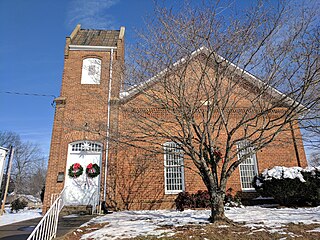
Great Falls is a town in Chester County, South Carolina, United States and is located fourteen miles southwest of Lancaster, South Carolina. The population was 1,951 at the 2020 census.

<span class="mw-page-title-main">Lowrys, South Carolina</span> Town in South Carolina, United States

Lowrys is a small rural town in Chester County, South Carolina, United States. The population was 200 at the 2010 census.

<span class="mw-page-title-main">Richburg, South Carolina</span> Town in South Carolina, United States

Richburg is a town in Chester County, South Carolina, United States. The population was 275 at the 2010 census, down from 332 at the 2000 census.

<span class="mw-page-title-main">Ruby, South Carolina</span> Town in South Carolina, United States

Ruby is a town in Chesterfield County, South Carolina, United States. The population was 360 at the 2010 census.

<span class="mw-page-title-main">Ridgeway, South Carolina</span> Town in South Carolina, United States

Ridgeway is a town in Fairfield County, South Carolina, United States. The population was 319 at the 2010 census. It is part of the Columbia, SC Metropolitan Statistical Area.

<span class="mw-page-title-main">Bethune, South Carolina</span> Town in South Carolina, United States

Bethune is a small town in Kershaw County, South Carolina, United States. The population was 334 at the 2010 census. It is part of the Columbia, South Carolina Metropolitan Statistical Area.

Elgin is an unincorporated community and census-designated place (CDP) in Lancaster County, South Carolina, United States. The population was 2,607 at the 2010 census.

Springdale is an unincorporated community and census-designated place (CDP) in Lancaster County, South Carolina, United States. The population was 2,574 at the 2010 census, down from 2,864 at the 2000 census.

<span class="mw-page-title-main">Troutdale, Virginia</span> Town in Virginia, United States

Troutdale is a town in Grayson County, Virginia, United States. The population was 140 at the 2020 census.

<span class="mw-page-title-main">Maiden, North Carolina</span> Town in North Carolina, United States

Maiden is a town in Catawba and Lincoln counties in the U.S. state of North Carolina. The population was 3,310 at the 2010 census.

<span class="mw-page-title-main">Silerton, Tennessee</span> Town in Tennessee, United States

Silerton is a town in Hardeman and Chester counties in the western part of Tennessee. The population was 111 at the 2010 census.

References

  1. Billy Westbrook (July 21, 2002). "Trains brought a boom of activity to Fort Lawn". The Herald (Rock Hill) . p. 1 (Special Sections).
  2. "ArcGIS REST Services Directory". United States Census Bureau. Retrieved October 15, 2022.
  3. 1 2 U.S. Geological Survey Geographic Names Information System: Fort Lawn, South Carolina
  4. 1 2 "Census Population API". United States Census Bureau. Retrieved October 15, 2022.
  5. 1 2 "U.S. Census website". United States Census Bureau . Retrieved January 31, 2008.
  6. 1 2 "Geographic Identifiers: 2010 Census Summary File 1 (G001): Fort Lawn town, South Carolina". U.S. Census Bureau, American Factfinder. Archived from the original on February 13, 2020. Retrieved July 1, 2015.
  7. 1 2 Pettus, Louise (August 24, 1996). "Late-Blooming Fort Lawn Grew Quickly in Early '60s". The Charlotte Observer. p. 2Y.
  8. "US Gazetteer files: 2010, 2000, and 1990". United States Census Bureau. February 12, 2011. Retrieved April 23, 2011.
  9. "Census of Population and Housing". Census.gov. Retrieved June 4, 2015.
  10. "Explore Census Data". data.census.gov. Retrieved December 14, 2021.
  11. "Tiny Fort Lawn gets pieces of WTC beam for memorial in Chester County". Archived from the original on July 2, 2015. Retrieved August 6, 2023.