
Huttonsville is a town in Randolph County, West Virginia, United States, along the Tygart Valley River. The population was 221 at the 2010 census.

Fort Ashby is a historic stockade fort located in Fort Ashby, West Virginia, US. A military installation constructed during the French and Indian War, it is listed on the National Register of Historic Places.

The National Register of Historic Places in the United States is a register including buildings, sites, structures, districts, and objects. The Register automatically includes all National Historic Landmarks as well as all historic areas administered by the U.S. National Park Service. Since its introduction in 1966, more than 90,000 separate listings have been added to the register.

The Grave Creek Mound in the Ohio River Valley in West Virginia is one of the largest conical-type burial mounds in the United States, now standing 62 feet (19 m) high and 240 feet (73 m) in diameter. The builders of the site, members of the Adena culture, moved more than 60,000 tons of dirt to create it about 250–150 BC.
The Fort Mill Ridge Civil War Trenches are battle trenches in West Virginia that were originally dug between 1861 and 1862 to be later used in 1863 for the civil war. These trenches lined with chestnut logs by the Confederate artillery during the American Civil War to defend the approaches to Romney on the Northwestern Turnpike and the South Branch Potomac River. The trenches were then refurbished between March and June 1863 by the 54th Pennsylvania Infantry and the 1st West Virginia Infantry. When Colonel Jacob M. Campbell garrisoned Union forces at Romney, camps were set up at nearby at Mechanicsburg Gap. The Confederates might have created these trenches but all throughout the war the Union had control of these trenches.

Fort Massac was a French colonial and early National-era fort on the Ohio River in Massac County, Illinois, United States.

The Virginia Landmarks Register (VLR) is a list of historic properties in the Commonwealth of Virginia. The state's official list of important historic sites, it was created in 1966. The Register serves the same purpose as the National Register of Historic Places. The nomination form for any Virginia site listed on the VLR is sent forward to the National Park Service for consideration for listing on the National Register.

White Top is a knob and spur of Cheat Mountain in southeastern Randolph County, West Virginia, USA. Sitting at an elevation of 4,085 feet (1,245 m), it is located just west of the Shavers Fork of Cheat River and Cheat Bridge. While White Top was originally crossed by the Staunton-Parkersburg Turnpike, modern-day U.S. Route 250 skirts the base of the knob beside Shavers Fork to the north and east.

This is a list of the National Register of Historic Places listings in Dakota County, Minnesota. It is intended to be a complete list of the properties and districts on the National Register of Historic Places in Dakota County, Minnesota, United States. Dakota County is located in the southeastern part of the U.S. state of Minnesota, bounded on the northeast side by the Upper Mississippi River and on the northwest by the Minnesota River. The locations of National Register properties and districts for which the latitude and longitude coordinates are included below, may be seen in an online map.

This is a list of the National Register of Historic Places listings in Wood County, West Virginia.

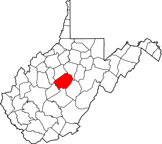
This is a list of the National Register of Historic Places listings in Randolph County, West Virginia.
This is a list of the National Register of Historic Places listings in Hampton, Virginia.

This is a list of the National Register of Historic Places listings in McDowell County, West Virginia.
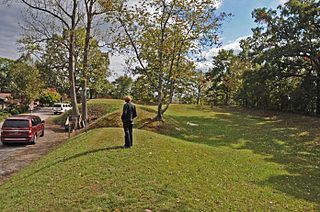
Fort Scammon, also known as Camp White or Fort Hill, is an archaeological site in Charleston in Kanawha County, West Virginia. The site preserves earthenwork battlements that were set up in 1863 in an elliptical pattern. The period of significance during the American Civil War coincides with the period of late summer in 1862 when Confederate artillery fired from the area and the year or so after March 1863 when Union troops fortified the heights.
This is a list of the National Register of Historic Places listings in Manassas, Virginia.

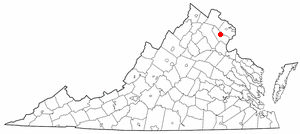
Fort Van Meter — or Fort VanMeter — is a mid-18th century frontier fort in the South Branch Potomac River Valley about 9 miles (14 km) southwest of Romney in Hampshire County, West Virginia, USA. It is located 15 miles (24 km) northeast of Moorefield and about a mile northeast of the former community of Glebe at the northern end of the rugged river gorge known as The Trough.
This is a list of the National Register of Historic Places listings in Braxton County, West Virginia.

This is a list of the National Register of Historic Places listings in Wyoming County, West Virginia.
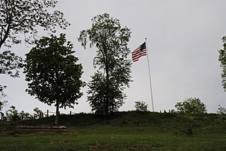
Fort Boreman is a historic archaeological site encompassing a Civil War fortification located near Parkersburg, Wood County, West Virginia. It was built in 1863, by Company A of the 11th West Virginia Volunteer Infantry Regiment. It is a series of paired, approximately four foot deep trenches encircling the top of the hill in a zigzag pattern. It was originally built to ensure that the Baltimore and Ohio Railroad link between Wheeling and Parkersburg was not severed or commandeered by the Confederate army. The fort was named after Arthur I. Boreman, West Virginia's first Governor.

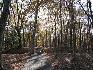
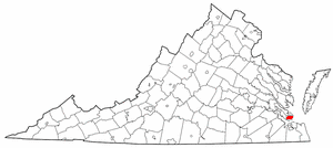
Fort Chiswell Site is a historic archaeological site located at Fort Chiswell, Wythe County, Virginia. It is the site of a frontier fort built in 1758 as an outpost during the French and Indian War. The fort was situated at the junction of the Great Trading Path and the Richmond Road, near the New River. The fort fell into disrepair in the 18th century as both the county seat and courthouse were moved from Fort Chiswell to the county seat of Wytheville, 12 miles to the west. The remaining foundations of the Fort and its surrounding buildings were completely covered over during the construction of I-77 in Wythe County during the 1970s. There is a pyramid shaped historical marker of sandstone situated approximately 200 yards west-northwest of the fort's original location next to the old chicken house.

