Fort Nashborough

Last updated
Fort Nashborough
Fort Nashborough, First Ave. and Church St., Nashville, Tenn (74048).jpg
A historical reconstruction of Fort Nashborough
USA Tennessee location map.svg
Red pog.svg
Usa edcp location map.svg
Red pog.svg
Coordinates 36°9′51″N86°46′28″W / 36.16417°N 86.77444°W / 36.16417; -86.77444
Architect North Carolina Militia (Overmountain Men)
Architectural stylelog stockade
NRHP reference No. 11000454
Significant dates
Added to NRHPJuly 13, 2011
Removed from NRHPNovember 24, 2015

Fort Nashborough, also known as Fort Bluff, Bluff Station, French Lick Fort, Cumberland River Fort and other names, was the stockade established in early 1779 in the French Lick area of the Cumberland River valley, as a forerunner to the settlement that would become the city of Nashville, Tennessee. The fort was not a military garrison. The log stockade was square in shape and covered 2 acres (8,100 m2). It contained 20 log cabins and was protection for the settlers against wild animals and Indians. James Robertson and John Donelson are considered the founders, and colloquially, the "founders of Tennessee". The fort was abandoned in 1794, but the settlement, now the town of Nashville, became the capital of the new state of Tennessee in 1796.

Contents

Background

The American Revolution broke out one month after Richard Henderson's purchase agreement with the Cherokee for the lands of the proposed Transylvania settlement was signed in March, 1775. The purchase included land above the Cumberland River in North Carolina (now north central Tennessee). Though much of the purchase had been invalidated by Virginia in 1778, lands in the vicinity of the Cumberland were still outstanding.

Most Cherokee towns wished to stay neutral in the growing contest between the colonists and Britain, but Chief Dragging Canoe considered the war an opportunity to resist the continual encroachment by frontiersmen on traditional Cherokee territories. American retaliatory raids against his Cherokee towns in eastern Tennessee eventually forced Dragging Canoe to move his people farther to the south and west down the Tennessee River. In 1779 they settled along Chickamauga Creek (near present-day Chattanooga, Tennessee), becoming known as the Chickamauga Cherokees. Later they were forced to move even further west and southwest, where they established the "Five Lower Towns", and were often thereafter referred to as the "Lower Cherokee". Dragging Canoe had admonished the settlers that encroachment would result in "dark and bloody ground", and he would make good on his word.

Establishment

Preparations

Aside from a short-lived trading post established in 1689 by fur trader Martin Chartier, [1] [2] [3] [4] [5] [6] no attempt had previously been made to permanently settle the area then known only as French Lick [7] along the banks of the Cumberland River. In 1779, John Buchanan Sr. migrated with his family from Cumberland County, Pennsylvania, to North Carolina. He first went to the "over-mountain" area of Virginia (modern day eastern Kentucky) in order to leave the party's women and small children in a secure area. The settlers then headed down the Cumberland River and, in early 1779, built a fortified station at French Lick.

In February 1779, Overmountain leader James Robertson set out with a nine-man exploration party to the same area. Robertson had been a member of the Regulator Movement, as well as a founding leader of the Watauga settlement. A 3,000 acre (12 km²) land grant was negotiated with Richard Henderson, a North Carolina land speculator, and arrangements were made for the movement of the group's families to the area. The colonists agreed to pay Henderson 26 pounds of silver per hundred acres, which was then considered an expensive price (equal to approximately $6.20/acre). Robertson charged three of his men to stay behind and plant corn in preparation for the arrival of the much larger group, which had remained behind in the Washington District.

Robertson then journeyed to the Illinois Country (an area claimed by Virginia at the time) to meet with General George Rogers Clark (a land agent of Virginia), who was dispensing "cabin rights" on very favorable terms. Robertson, whose 1772 Watauga settlement had originally been opposed to the control of the area by the Province of North Carolina, thought it possible that the yet-to-be established extended border between the Virginia and North Carolina frontiers might throw control of any new Cumberland River settlement to Virginia. Therefore, he wished to get secure and clear land titles to eliminate any future complications over ownership. After making provisional arrangements with General Clark, Robertson prepared for the colonization of the Cumberland country.

Robertson by land

On 1 November 1779, Robertson led some 200 settlers from Fort Patrick Henry, on Long Island, Kingsport, Tennessee toward Fort Nashborough. These settlers were to prepare for the later arrival of the party's women and children and were led by John Donelson out of the east over waterways. Robertson's brothers, Mark and John, were in the party, as well as his oldest son, 11-year-old Jonathan, who drove the sheep. The men were joined en route by John Rains and a number of his friends and allied families. This group decided to settle at French Lick, rather than continue upriver into that area which later became Kentucky. Their journey ended on Christmas Day, due to delays caused by the winter (described as the coldest one any of them had ever known). [8]

Donelson by river

Starting out in early 1780, Donelson's group was halted after traveling only three miles on their river voyage. Ice, snow and cold had set in and the frozen river made progress impossible. There was no further movement until mid-February, and when the boats were eventually cut loose, they were hampered again by the swell of the river due to incessant heavy rains. Donelson's group also suffered greatly from Dragging Canoe's promise of vengeance. On their way to French Lick they had to pass the Chickamauga towns on the westward flow of the Tennessee River. When the Donelson party had succeeded in that, however, and made the turn to the north (in what is today Hardin County, Tennessee), the natives attacked them as they went past the Tennessee River's "Big Bend" (at Cerro Gordo). The war party captured one boat with 28 people on board. [Note 1] On March 20, 1780, they arrived at the mouth of the Tennessee River and set up camp on a lowland which is now the site of Paducah, Kentucky. Weary, hungry and low on provisions, they were confronted by new difficulties. Their boats, having been constructed to float downstream, were scarcely able to ascend the rapid current of the Ohio, which due to heavy spring rains was particularly high and fast. They were also ignorant of the distance yet to be traveled, and the length of time which would be required to reach their final destination. Some of the company decided to abandon the journey to French Lick. A part of them floated down the Ohio and Mississippi Rivers to Natchez, the rest settling at points in Illinois along the Ohio.

The others, however, were determined to pursue their course up the Ohio from Paducah to the mouth of the Cumberland River, a distance which turned out to be only fifteen miles (24 km). Upon seeing it, they were unsure it was the Cumberland, because it seemed very much smaller in volume than they had expected to find. However, they had heard of no stream flowing into the Ohio between the Tennessee and Cumberland, and, therefore, decided to make the ascent. They were soon assured by the widening channel that they were correct in their conjectures. In order to make progress upstream, Donelson rigged his boat, the Adventure, with a small sail made out of a sheet. To prevent ill effects from any sudden gust of wind, a man was stationed at each lower corner of this sail with instructions to loosen it when the breeze became too strong.[ citation needed ]

Settled

Upon reaching their destination, Donelson reunited with Robertson, and the group cleared the land, building a settlement which they named in honor of General Francis Nash, who had won acclaim fighting in the American Revolution. Together these frontiersmen built other fortified "way-stations" in the vicinity which were named for members of the party; among these were Clover Bottom Mansion (the Donelson family plantation on the Stones River); Freeland's Station; Mansker's Station; Thompson's Station; and Buchanan's Station—many still remembered as neighborhoods or towns in the modern Nashville area.

In 1780, Robertson drew up a constitution called the "Cumberland Compact," and the area began a new phase of autonomy from the government of North Carolina.[ citation needed ]

Fort life

Buffalo, black bear, wild turkeys, white tail deer, beaver, raccoon, fox, elk, wolf, cougar, mink, and otter were abundant in the untamed forests. The pioneer family's most treasured possessions were their guns for hunting, axes for wood-cutting, seeds, and hoes for cultivating. Frontier life was a constant struggle, and without these necessities, survival was at risk. Corn was the most important crop for their daily diet, and corn whiskey was the remedy for all health problems. Henderson, ever the profiteer, arranged to have corn shipped from Kentucky at a cost of $200 a bushel for that first winter in Nashville. Linen, made from flax, or cotton was used for clothes. Animal skins and hides supplemented their wardrobes. The first white child born in the new settlement was James Robertson's son, Felix, on January 11, 1781. He eventually became one of the most influential physicians of the era.

The North Carolina Land Act of 1783 dubbed the "Land Grab Act" offered lots in 100-acre (0.40 km2) tracts for the price of about five dollars. Much property was awarded for honorable military service. Native American lands reserved by treaties and previous claims were not legally available, but in the haste, confusion and greed, there were many squatters and boundary disputes.

Native American attacks

The largest and most numerous tribes in the region were the Muscogee (Creek) to the south, and the Cherokee to the east and over the Cumberland Plateau, who were originally peaceful to the eastern British colonials. But from the beginning, the Cumberland settlements had very little peace, and were continually attacked. The tribes resented past concessions, broken treaties, and further encroachment on their hunting grounds.

War Chief Dragging Canoe's Chickamauga Cherokee, and their Muscogee allies, continued attacks on the frontier settlements for the next fourteen years. The settlers had to be on guard against Indian attacks at all times. On April 2, 1781, a force of Chickamauga Cherokee attacked the fort at the bluffs. In the attack, known as the "Battle of the Bluffs," the Indians succeeded in luring most of the men out of the fort, then cutting them off from the entrance. But the settlers managed to escape back to the fort, while the Cherokee captured their horses. They also had help from the fort's dogs, turned loose by the women. The attacks decreased the following year. [9] [10]

Because of political pressures, the Cherokee allies of the Chickasaw decided to make peace with the Cumberland settlers and the new nation. This was partially because Piominko, an influential chief and leader, considered the pioneers to be less of a threat than the Spanish government. [11] [12]

Incorporation

The settlement was incorporated as the town of Nashville by North Carolina in 1784. It went on to become the capital of Tennessee upon its admission as the 16th state in 1796. It was chartered as a city in 1806, and is the largest city in the state in the modern era.

History Center

Fort Nashborough History Center in 2022 Fort Nashborough History Center 2022.jpg
Fort Nashborough History Center in 2022

A small replica of the fort, located in Downtown Nashville along First Avenue North, several hundred meters from the original site of the fort, was built in the 1930s, fell into disrepair and was demolished in 2015. On July 13, 2017 a ribbon-cutting ceremony was held at the site of the newly renovated Fort Nashborough History Center, where families from Nashville and around the world can learn about Nashville's story. The new History Center is a more inclusive representation of the past, and includes a plaza dedicated to Native American history. [13]

See also

Notes

  1. The settlers had come that way because Donelson and Robertson had mistakenly assumed the Cumberland River to be a tributary of the Tennessee River. The Cumberland is, in fact and like the Tennessee, a tributary of the Ohio River, and the journey by river turned out to be much more difficult, taking three months longer than they had expected.

Related Research Articles

<span class="mw-page-title-main">Transylvania Colony</span> Short-lived extra-legal colony in frontier Kentucky

The Transylvania Colony, also referred to as the Transylvania Purchase, was a short-lived, extra-legal colony founded in early 1775 by North Carolina land speculator Richard Henderson, who formed and controlled the Transylvania Company. Henderson and his investors had reached an agreement to purchase a vast tract of Cherokee lands west of the southern and central Appalachian Mountains through the acceptance of the Treaty of Sycamore Shoals with most leading Cherokee chieftains then controlling these lands. In exchange for the land the tribes received goods worth, according to the estimates of some scholars, about 10,000 British pounds. To further complicate matters, this frontier land was also claimed by the Virginia Colony and a southern portion by Province of North Carolina.

<span class="mw-page-title-main">Southwest Territory</span> Territory of the USA from 1790 to 1796

The Territory South of the River Ohio, more commonly known as the Southwest Territory, was an organized incorporated territory of the United States that existed from May 26, 1790, until June 1, 1796, when it was admitted to the United States as the State of Tennessee. The Southwest Territory was created by the Southwest Ordinance from lands of the Washington District that had been ceded to the U.S. federal government by North Carolina. The territory's lone governor was William Blount.

Dragging Canoe was a Cherokee red chief who led a band of Cherokee warriors who resisted colonists and United States settlers in the Upper South. During the American Revolution and afterward, Dragging Canoe's forces were sometimes joined by Upper Muskogee, Chickasaw, Shawnee, and Indians from other tribes, along with British Loyalists, and agents of France and Spain. The Cherokee American Wars lasted more than a decade after the end of the American Revolutionary War.

<span class="mw-page-title-main">James Robertson (explorer)</span> Explorer and pioneer, born 1742

James Robertson was an American explorer, soldier and Indian agent, and one of the founding fathers of what became the State of Tennessee. An early companion of explorer Daniel Boone, Robertson helped establish the Watauga Association in the early 1770s, and to defend Fort Watauga from an attack by Cherokee in 1776. In 1779, he co-founded what is now Nashville, and was instrumental in the settlement of Middle Tennessee. He served as a brigadier general in the Southwest Territory militia in the early 1790s, and as an Indian Commissioner in later life.

<span class="mw-page-title-main">Wilderness Road</span> Historic highway in Kentucky, US

The Wilderness Road was one of two principal routes used by colonial and early national era settlers to reach Kentucky from the East. Although this road goes through the Cumberland Gap into southern Kentucky and northern Tennessee, the other is sometimes called the "Cumberland Road" because it started in Fort Cumberland in Maryland. Despite Kentucky Senator Henry Clay's advocacy of this route, early in the 19th century, the northern route was selected for the National Road, connecting near Washington, Pennsylvania into the Ohio Valley of northern Kentucky and Ohio.

<span class="mw-page-title-main">John Donelson</span> American explorer and adventurer

John Donelson (1718–1785) was an American frontiersman, ironmaster, politician, city planner, and explorer. After founding and operating what became Washington Iron Furnace in Franklin County, Virginia for several years, he moved with his family to Middle Tennessee which was on the developing frontier.

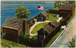
This article pertains to the history of Nashville, the state capital of Tennessee. Native Americans had not lived in the area in the century before a frontier post of Fort Nashborough was built here in 1779 by pioneers from North Carolina. In 1784 it was incorporated as a town by the North Carolina legislature; it became a city in 1806. In 1843 it became the state capital. In the Civil War Nashville was seized by Federal troops in 1862 and became a major Union military base. Confederate General J. B. Hood was decisively defeated in the Battle of Nashville in 1864. The city became the political, transportation, business and cultural center of the Middle Tennessee region. Besides the state government, it is best known for its educational, musical and religious establishments. In 1963 Nashville and Davidson County were consolidated under a single charter and are administered by a mayor and a council.

<span class="mw-page-title-main">Richard Henderson (jurist)</span> American pioneer (1735-1785)

Richard Henderson was an American jurist, land speculator and politician who was best known for attempting to create the Transylvania Colony in frontier Kentucky. Henderson County and its seat Henderson, Kentucky are named for him. He also sold land to an early settlement that went on to become Nashville, Tennessee.

Kasper Mansker or Casper Mansker also, spelled Mäintzger and Minsker (1750–1820) was a longhunter and one of Middle Tennessee's first European explorers and settlers.

<span class="mw-page-title-main">Sycamore Shoals</span> River rapids along the Watauga River in Elizabethton, Tennessee, US

The Sycamore Shoals of the Watauga River, usually shortened to Sycamore Shoals, is a rocky stretch of river rapids along the Watauga River in Elizabethton, Tennessee. Archeological excavations have found Native Americans lived near the shoals since prehistoric times, and Cherokees gathered there. As Europeans began settling the Trans-Appalachian frontier, the shoals proved strategic militarily, as well as shaped the economies of Tennessee and Kentucky. Today, the shoals are protected as a National Historic Landmark and are maintained as part of Sycamore Shoals State Historic Park.

<span class="mw-page-title-main">Cherokee–American wars</span> Indian wars in the Old Southwest

The Cherokee–American wars, also known as the Chickamauga Wars, were a series of raids, campaigns, ambushes, minor skirmishes, and several full-scale frontier battles in the Old Southwest from 1776 to 1794 between the Cherokee and American settlers on the frontier. Most of the events took place in the Upper South region. While the fighting stretched across the entire period, there were extended periods with little or no action.

Avery's Trace was the principal road used by settlers travelling from the Knoxville area in East Tennessee to the Nashville area from 1788 to the mid-1830s.

<span class="mw-page-title-main">Bledsoe's Station</span> United States historic place

Bledsoe's Station, also known as Bledsoe's Fort, was an 18th-century fortified frontier settlement located in what is now Castalian Springs, Tennessee. The fort was built by longhunter and Sumner County pioneer Isaac Bledsoe in the early 1780s to protect Upper Cumberland settlers and migrants from hostile Native American attacks. While the fort is no longer standing, its location has been verified by archaeological excavations. The site is now part of Bledsoe's Fort Historical Park, a public park established in 1989 by Sumner County residents and Bledsoe's descendants.

John Watts, also known as Young Tassel, was one of the leaders of the Chickamauga Cherokee during the Cherokee–American wars. Watts became particularly active in the fighting after frontiersmen murdered his uncle, Old Tassel Carpenter (1708–1788), in 1788, while he traveled with Cherokee delegates to a peace conference.

Turtle-at-Home, or Selukuki Wohelengh, was a Cherokee warrior and leader, brother and chief lieutenant of Dragging Canoe, a war-chief in the Cherokee–American wars.

The Cherokee people of the southeastern United States, and later Oklahoma and surrounding areas, have a long military history. Since European contact, Cherokee military activity has been documented in European records. Cherokee tribes and bands had a number of conflicts during the 18th century with Europeans, primarily British colonists from the Southern Colonies. The Eastern Band and Cherokees from the Indian Territory fought in the American Civil War, with bands allying with the Union or the Confederacy. Because many Cherokees allied with the Confederacy, the United States government required a new treaty with the nation after the war. Cherokees have also served in the United States military during the 20th and 21st centuries.

The Chickamauga Cherokee were a Native American group that separated from the greater body of the Cherokee during the American Revolutionary War and up to the early 1800s.

<span class="mw-page-title-main">John Buchanan (frontiersman)</span> American frontiersman (1759–1832)

Major John Buchanan was an American frontiersman and one of the founders of present-day Nashville, Tennessee. He is best known for defending his fort, Buchanan's Station, from an attack by a combined force of roughly 300 Chickamauga Cherokee, Muscogee Creek, and Shawnee warriors on September 30, 1792. The defenders of the stockade included fifteen gunmen and his wife, Sally Buchanan, who was heavily pregnant with their first child.

The following is a timeline of the history of the US state of Tennessee.

<span class="mw-page-title-main">Buchanan's Station</span> Historic former stockade in Nashville, Tennessee

Buchanan's Station was a fortified stockade established around 1784 in Tennessee. Founded by Major John Buchanan, the settlement was located in what is today the Donelson neighborhood of Nashville, Tennessee. On September 30, 1792, it was the site of the critical Battle of Buchanan's Station during the Cherokee–American wars of the late eighteenth century. The assault by a combined force of around 300 Chickamauga Cherokee, Muscogee Creek, and Shawnee, nominally led by Chief John Watts, was repelled by 15 gunmen under Major Buchanan defending the station. Although smaller raids continued in the region, it was the last major Native American attack on the American settlements in the Cumberland.

References

  1. Robert Trail, "Livingston County, Kentucky: Stepping Stone to Illinois," The Register of the Kentucky Historical Society, Vol. 69, No. 3 (July, 1971), pp. 239-272.
  2. "Alvin Wirt, "The Upper Cumberland of Pioneer Times," 1954" (PDF). Archived from the original (PDF) on 2015-10-10. Retrieved 2018-07-23.
  3. Chartier Family Association family tree "CHARTIER Family Association - the Descendants of Guillaume CHARTIER". Archived from the original on 2014-05-12. Retrieved 2018-07-23.
  4. Martin Chartier Historical Marker
  5. Sherman Day, Historical Collections of the State of Pennsylvania: Containing a Copious Selection of the Most Interesting Facts... G. W. Gorton, 1843; p. 391.
  6. Martin Chartier, Nashville's First White Person
  7. French Lick History
  8. Founders Museum
  9. Haywood, John (1823). Civil and Political History of Tennessee. Reprinted by Overmountain Press, 1999. pp. 131–133. ISBN   9781570721052.
  10. "Charlotte Reeves Robertson". Tennessee Encyclopedia of History and Culture.
  11. "The Last of the Chickasaw Kings" archived
  12. Chickasaws Visit President Washington (1794); "The President's House in Philadelphia;" Green, Richard; tribal historian; "The Chickasaw Times;" (July 2009); [ via WebPage; at USHistory.org, by kind permission ]; retrieved March 2023
  13. Marissa Lea, Gaston. "Mayor Barry hacks the ribbon on new Fort Nashborough". The Tennessean. Retrieved 6 January 2018.