Related Research Articles

Whidbey Island is the largest of the islands composing Island County, Washington, in the United States. Whidbey is about 30 miles (48 km) north of Seattle, and lies between the Olympic Peninsula and the I-5 corridor of western Washington. The island forms the northern boundary of Puget Sound. It is home to Naval Air Station Whidbey Island. The state parks and natural forests are home to numerous old growth trees.

Coupeville is a town on Whidbey Island, in Island County, Washington, United States.

Fort Monroe, managed by partnership between the Fort Monroe Authority for the Commonwealth of Virginia, the National Park Service as the Fort Monroe National Monument, and the City of Hampton, is a former military installation in Hampton, Virginia, at Old Point Comfort, the southern tip of the Virginia Peninsula, United States. Along with Fort Wool, Fort Monroe originally guarded the navigation channel between the Chesapeake Bay and Hampton Roads—the natural roadstead at the confluence of the Elizabeth, the Nansemond and the James rivers. Union General George B. McClellan landed his forces at The fort during Peninsula campaign of 1862 during the American Civil War. Until disarmament in 1946, the areas protected by the fort were the entire Chesapeake Bay and Potomac River regions, including the water approaches to the cities of Washington, D.C. and Baltimore, Maryland, along with important shipyards and naval bases in the Hampton Roads area. Surrounded by a moat, the six-sided bastion fort is the largest fort by area ever built in the United States.
Fort Totten is a former active United States Army installation in the New York City borough of Queens. It is located on the Willets Point peninsula on the north shore of Long Island. Fort Totten is at the head of Little Neck Bay, where the East River widens to become Long Island Sound. While the U.S. Army Reserve continues to maintain a presence at the fort, the property is now owned by the City of New York.

Ebey's Landing National Historical Reserve is a unit of the National Park Service on Whidbey Island in the Puget Sound, near Coupeville in Island County, Washington.

Fort Worden Historical State Park is located in Port Townsend, Washington, on 433 acres originally known as Fort Worden, a United States Army Coast Artillery Corps base constructed to protect Puget Sound from invasion by sea. Fort Worden was named after U.S. Navy Rear Admiral John Lorimer Worden, commander of USS Monitor during the famous Battle of Hampton Roads during the American Civil War.

Colonel Isaac Neff Ebey was the first permanent white resident of Whidbey Island, Washington.

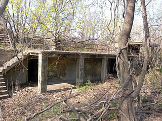
Fort Casey State Park is located on Whidbey Island, in Island County, Washington state. It is a Washington state park and a historic district within the U.S. Ebey's Landing National Historical Reserve.

Fort Taber District or the Fort at Clark's Point is a historic American Civil War-era military fort on Wharf Road within the former Fort Rodman Military Reservation in New Bedford, Massachusetts. The fort is now part of Fort Taber Park, a 47-acre town park located at Clark's Point. Fort Taber was an earthwork built nearby with city resources and garrisoned 1861-1863 until Fort Rodman was ready for service.

Odiorne Point State Park is a public recreation area located on the Atlantic seacoast in the town of Rye near Portsmouth, New Hampshire. Among the park's features are the Seacoast Science Center and the remains of the World War II Fort Dearborn. The park offers opportunities for hiking, cycling, picnicking, fishing, and boating.

Fort Ebey State Park is a public recreation area occupying the site of former Fort Ebey on the west side of Whidbey Island, five miles (8.0 km) west of Coupeville in Island County, Washington, United States. The state park covers 651 acres (263 ha) overlooking the Strait of Juan de Fuca and lies within the Ebey's Landing National Historical Reserve. It is managed by the Washington State Parks and Recreation Commission.

Fort Andrews was created in 1897 as part of the Coast Defenses of Boston, Massachusetts. Construction began in 1898 and the fort was substantially complete by 1904. The fort was named after Major General George Leonard Andrews, an engineer and Civil War commander, who assisted in the construction of nearby Fort Warren in Boston Harbor. It occupies the entire northeast end of Peddocks Island in Boston Harbor, and was originally called the Peddocks Island Military Reservation. Once an active Coast Artillery post, it was manned by hundreds of soldiers and bristled with mortars and guns that controlled the southern approaches to Boston and Quincy Bay. The fort also served as a prisoner-of-war camp for Italian prisoners during World War II, who were employed as laborers following the Italian surrender to the Allies in 1943. Today, the fort is abandoned, and is managed by the Massachusetts Department of Conservation and Recreation, as part of the Boston Harbor Islands National Recreation Area.

One of the oldest residential buildings in Washington, the Ferry House was built in 1860 by Winfield Scott Ebey as an inn to provide financial stability for his brother’s children, who were orphaned when Isacc Neff Ebey was brutally murdered and beheaded by Canadian natives. Once completed and opened for business, the building was named The Ebey Inn. The prime location across Admiralty Inlet from Port Townsend meant a steady flow of travelers and income for the three Ebey children. With no other nearby accommodations, the Inn — which housed a post office, a tavern, and rooms for overnight guests — quickly became an important place for sailors and other travelers to rest before continuing their journeys to Coupeville, Whidbey Island, La Conner, Washington, and points further north. Travelers and locals could also purchase merchandise and groceries at the Inn, which served ferry traffic to and from Port Townsend until a new ferry dock was constructed near Fort Casey at the turn of the 20th century. The house stayed in the Ebey family for 57 years, until Isaac Ebey’s grandson sold the old Inn in 1917.

The U.S. Army Coast Artillery Corps (CAC) was an administrative corps responsible for coastal, harbor, and anti-aircraft defense of the United States and its possessions between 1901 and 1950. The CAC also operated heavy and railway artillery during World War I.
The 14th Coast Artillery Regiment was a Coast Artillery regiment in the United States Army. It served as the Regular Army component of the Harbor Defenses (HD) of Puget Sound, Washington state from 1924 through October 1944, when it was broken up and disbanded as part of an Army-wide reorganization. The 248th Coast Artillery Regiment was the Washington National Guard component of those defenses.
Admiralty Inlet Natural Area Preserve in Island County, Washington is part of the Washington Natural Areas Program. It lies along Admiralty Inlet within Ebey's Landing National Historical Reserve on land owned by the Whidbey Camano Land Trust with a conservation easement owned by the Washington Department of Natural Resources. Admiralty Inlet NAP is home to one of only 11 remaining populations of golden paintbrush, a flowering plant listed as threatened under the Endangered Species Act. The preserve's 46 acres (19 ha) includes old-growth forest, a rare remnant prairie, and shoreline.
The Battle of Port Gamble was an isolated engagement between the United States and the Tlingit. It occurred during, but was not a part of, the Yakima War. Though a minor incident, it is historically notable for the first U.S. Navy battle death in the Pacific Ocean.

Fort Barry is a former United States Army installation on the West Coast of the United States, located in the Marin Headlands of Marin County, California, north of San Francisco. Opened 114 years ago in 1908, the fort was part of the Coast Artillery Corps and operated throughout the 20th century, before its closure and eventual transfer to the National Park Service.
The 248th Coast Artillery Regiment was a Coast Artillery Corps regiment in the Washington National Guard. Including its predecessor battalion, it garrisoned the Harbor Defenses of Puget Sound, Washington 1924–1944.
References
- ↑ "Fort Whitman". CDSG.org. Coast Defense Study Group. Archived from the original on 23 December 2015. Retrieved 20 December 2015.
- ↑ Kaufmann, J (Sep 1, 2007). Fortress America: The Forts That Defended America, 1600 to the Present. Da Capo Press, Sep 1, 2007. p. 338.
- ↑ "Fort Whitman". Coast Defense Study Group. Coast Defense Study Group. Retrieved 19 July 2017.
- ↑ Evans-Hatch, Gail; Hatch, D. Michael (2005). Ebey's Landing National Historical Reserve (Wash.): historic resources study. U.S. Dept. of the Interior, National Park Service. p. 243.
- ↑ Evans-Hatch, Gail; Hatch, D. Michael (2005). Ebey's Landing National Historical Reserve (Wash.): historic resources study. U.S. Dept. of the Interior, National Park Service. p. 247.