
Lincoln County is a county in the U.S. state of New Mexico. As of the 2020 census, the population was 20,269. Its county seat is Carrizozo, while its largest community is Ruidoso.

Carrizozo is a town in Lincoln County, New Mexico, United States. It is the county seat, with a population of 996 at the 2010 census. Founded in 1899, the town provided the main railroad access for Lincoln County, and the town experienced significant population growth in the early decades of the 1900s. However, with declining relevance of the railroad, the population of the town has gradually declined. The town is located at the intersection of U.S. Routes 54 and 380.

Ruidoso is a village in Lincoln County, New Mexico, United States, adjacent to the Lincoln National Forest. The population was 8,029 at the 2010 census. The city of Ruidoso Downs and the unincorporated area of Alto are suburbs of Ruidoso, and contribute to the Ruidoso Micropolitan Statistical Area's population of 21,223.

Ruidoso Downs is a city in Lincoln County, New Mexico, United States, located within the Lincoln National Forest. The population was 1,824 at the 2000 census and 2,815 at the 2010 census. Originally incorporated as a village, it became a city in May 2002. Known locally as "the Downs", Ruidoso Downs is a suburb of adjacent Ruidoso and is a part of the Ruidoso Micropolitan Statistical Area. The city, located along U.S. Route 70, is named after the Ruidoso Downs Race Track, which is located in the city along with the Billy the Kid Casino and the Hubbard Museum of the American West.
Lincoln is an unincorporated village in Lincoln County, New Mexico, United States.

The Tularosa Basin is a graben basin in the Basin and Range Province and within the Chihuahuan Desert, east of the Rio Grande in southern New Mexico and West Texas, in the Southwestern United States.

Lincoln National Forest is a unit of the U.S. Forest Service located in southern New Mexico. The Lincoln National Forest covers an extensive 1.1 million acres in southeastern New Mexico. Established by Presidential Proclamation in 1902 as the Lincoln Forest Reserve, the 1,103,897 acres (4,467.31 km2) forest begins near the Texas border and contains lands in parts of Chaves, Eddy, Lincoln, and Otero counties. The Lincoln National Forest is home to three major mountain ranges: Sacramento, Guadalupe and Capitan. The three Ranger Districts within the forest contain all or part of a total of four mountain ranges, and include a variety of different environmental areas, from desert to heavily forested mountains and sub-alpine grasslands. Clean air, water, and soil are necessary elements that the National Forests contribute to the environment. Established to balance conservation, resource management, and recreation, the lands of the Lincoln National Forest include important local timber resources, protected wilderness areas, and popular recreation and winter sports areas. The forest headquarters is located in Alamogordo, N.M. with local offices in Carlsbad, Cloudcroft, and Ruidoso.

Hollywood is a neighborhood of Ruidoso, in Lincoln County, New Mexico, United States and is part of the Lincoln National Forest. It is located along State Road 48 and U.S. Route 70 in the eastern end of the village, adjacent to Ruidoso Downs. The town was originally named after Hollywood, Florida, and includes a post office, homes, hotels, and retail outlets.
San Patricio is a very small community in Lincoln County, in the U.S. state of New Mexico. It is located on the Rio Ruidoso and U.S. Highway 70, between the communities of Hondo and Glencoe. It is just east of the Lincoln National Forest.
The Battle of Lincoln, New Mexico, so-called Five-Day Battle or Five-Day Siege, was a five-day-long firefight between the Murphy-Dolan Faction and the Regulators that took place between July 15–19, 1878, in Lincoln, New Mexico. It was the largest armed battle of the Lincoln County War in the New Mexico Territory. The firefight was interrupted and suppressed by United States Cavalry led by Lt. Col. Nathan Dudley from Fort Stanton.
Ruidoso Downs is a horse racing track in Ruidoso Downs, New Mexico. The track hosts both Thoroughbred and Quarter Horse racing, notably the All American Futurity, the richest race in Quarter Horse racing with a purse of $3,000,000.
The Rio Bonito is a small river in the Sierra Blanca mountains of southern New Mexico, United States. The headwaters of the river start in the Lincoln National Forest on the slopes of Sierra Blanca and travel eastward until they merge with the south fork of the Rio Bonito just west of Bonito Lake, a man-made reservoir. After passing through the reservoir, the river continues in a generally eastward direction passing alongside the historic Fort Stanton and the home of Billy the Kid, Lincoln, New Mexico. The Rio Bonito merges 10 miles (16 km) past Lincoln with the Rio Ruidoso in the town of Hondo, New Mexico where the two rivers join to form the Rio Hondo which then flows towards the Pecos River, though not reaching the Pecos except during floods.
The White Mountain Wilderness is a 46,963 acre designated wilderness area managed by the United States Forest Service. Located in the Smokey Bear Ranger District of the Lincoln National Forest, the White Mountain Wilderness lies in the Sierra Blanca mountains of south central New Mexico, approximately 15 miles (24 km) north northwest of the town of Ruidoso.
Hondo is an unincorporated community in Lincoln County, New Mexico, United States. It is located about thirty-five miles downstream (east) from Ruidoso Downs, where the Rio Bonito and Rio Ruidoso rivers join together to form the Rio Hondo. It is located at the point where U.S. Route 70 is joined by U.S. Route 380, which conjoined route continues eastward. It has had a post office since 1900.

The Ruidoso River Museum is located in Ruidoso, New Mexico. The collection features artifacts, photographs and documents relating to the notable figures of the Old West and those involved in the Lincoln County War, including Billy the Kid, sheriffs William Brady and Pat Garrett and lawyer and businessman Alexander McSween. It houses the world's largest collection of Billy the Kid and Pat Garrett items. The museum also houses a range of archaeological relics and celebrity memorabilia. Notable museum items include Pat Garrett's solid gold sheriff's badge, Billy the Kid's rifle, and Pat Garrett's original Colt Model 1877 Thunderer revolver.
Glencoe is an unincorporated community in Lincoln County, New Mexico, United States. Its ZIP code is 88324.
Noisy Water Winery is an American winery in Ruidoso, New Mexico, founded in 2009 by the Riddle Family. In 2014, its wines won 15 awards at the Finger Lakes International Wine Competition, including a Double Gold for its Ruidoso Bubbly Moscato, 2 Gold medals, and 5 Silver medals. According to co-owner Jasper Riddle, it is the only winery in Ruidoso that authentically produces its own wines.
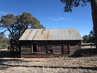
Jicarilla is a ghost town in Lincoln County, in the U.S. state of New Mexico. It became a boomtown in 1892 following the discovery of gold and coal in the nearby Jicarilla Mountains.

Placitas, also known as La Placita and Las Placitas del Rio Bonito, in Lincoln County, New Mexico is a now abandoned village along the frontier between the New Mexico Territory and Confederate Arizona that was the site of the Battle of Placito, between Apache and native New Mexicans aided by Confederate soldiers from Fort Stanton, ten miles away to the north. The village was originally called La Placita del Rio Bonito, Placitas is now known as Lincoln. The village has historical ties to Billy the Kid.
Carrizo Creek is a stream in Otero and Lincoln counties in the U.S. state of New Mexico. It forms to the southwest of, and feeds into, Mescalero Lake, just inside the north central border of the Mescalero Reservation. The creek then continues east of the lake. It turns north and then east again, shadowed by Carrizo Canyon Road, before feeding into the Rio Ruidoso south-southeast of Ruidoso, New Mexico.
