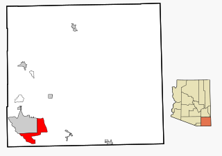
McNary is a census-designated place (CDP) in Apache and Navajo counties in the U.S. state of Arizona, on the Fort Apache Indian Reservation. The population was 528 at the 2010 census. It is a 30-minute drive from Show Low and a 10-minute drive from Pinetop-Lakeside.
Sierra Vista Southeast, often referred to as Hereford or Nicksville, is a census-designated place (CDP) in Cochise County, Arizona, United States. The population was 14,797 at the 2010 census. It includes the neighborhoods Ramsey Canyon, and Sierra Vista Estates within its boundaries.

Kaibeto is a census-designated place (CDP) in Coconino County, Arizona, United States. The population was 1,522 at the 2010 census.

Whiteriver is a census-designated place (CDP) located on the Fort Apache Indian Reservation in Navajo County, Arizona, United States. The population was 4,104 at the 2010 census, making it the largest settlement on the Reservation.

Alma is a statutory town located in Park County, Colorado, United States. The town population was 270 at the 2010 United States Census.

Wisdom is a small town in Beaverhead County, Montana, United States. The population was 98 at the 2010 census. The ZIP Code of the area is 59761. The town includes three tourist lodgings, service station, grocery, school (K-8), post office and a Forestry Service office. It is also included within the boundaries of the Wisdom, Montana, Census Designated Place, which is named after the town.

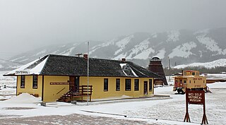
Cooke City-Silver Gate is a census-designated place (CDP) in Park County, Montana, United States. The population was 140 at the 2000 census. It sits toward the northeast of Yellowstone National Park on a road remaining open during the winter connecting through Tower Junction to Mammoth and north to Livingston, Montana. During the summer the road opens eastward to connect to Red Lodge, Montana via the Beartooth Highway on a scenic route climbing to 10,947 feet in elevation through the Beartooth Mountains and across the Beartooth Plateau. Its chief industry is tourism, which during the winter includes skiing and snowmobiling.

Searchlight is an unincorporated town and census-designated place (CDP) in Clark County, Nevada, United States, at the topographic saddle between two mountain ranges. As of the 2010 census it had a population of 539.
Newberg is a city in Yamhill County, Oregon, United States. Located in the Portland metropolitan area, the city is home to George Fox University. As of the 2010 census, the city population was 22,110 making it the second most populous city in the county.

Albany is a census-designated place (CDP) in Albany County, Wyoming, United States. The population was 55 at the 2010 census.
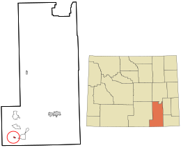
Centennial is a census-designated place (CDP) in Albany County, Wyoming, United States. The population was 270 at the 2010 census.

Woods Landing-Jelm is a census-designated place (CDP) in Albany County, Wyoming, United States. The population was 97 at the 2010 census.

Atlantic City is a census-designated place (CDP) in Fremont County, Wyoming, United States. The population was 37 at the 2010 census. The community is a small mining settlement in a gulch near South Pass in southwestern Wyoming. It was founded as a mining camp following the 1867 gold rush in the region. The town declined following the end of the placer gold rush in the early 1870s, but continued to exist as advances in mining technology allowed further extraction of gold. From the 1960s until 1983, it was the location of US Steel iron ore mine. The town is accessible by gravel roads from nearby Wyoming Highway 28.

Fox Farm-College is a census-designated place (CDP) in Laramie County, Wyoming, United States. It is part of the Cheyenne, Wyoming Metropolitan Statistical Area. The population was 3,647 at the 2010 census.

Fontenelle is a census-designated place (CDP) in Lincoln County, Wyoming, United States. The population was 13 at the 2010 census.
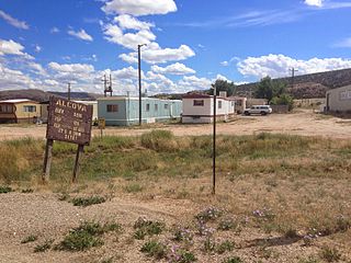
Alcova is a census-designated place (CDP) in Natrona County, Wyoming, United States. It is part of the Casper, Wyoming Metropolitan Statistical Area. The population was 76 at the 2010 census. The center of population for the CDP is located in the small Town of Alcova. Alcova and the nearby reservoir, Alcova Lake, are popular vacation spots with many seasonal residents.

Bondurant is a census-designated place (CDP) in Sublette County, Wyoming, United States. The population was 93 at the 2010 census. The town was named after B. F. Bondurant.

Cora is a census-designated place (CDP) in Sublette County, Wyoming, United States. The population was 142 at the 2010 census.
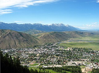
Jackson is a small city in the Jackson Hole valley of Teton County, Wyoming, United States. The population was 9,577 at the 2010 census, up from 8,647 in 2000. It is the largest town in Teton County and its county seat. Jackson is the principal town of the Jackson, WY-ID Micropolitan Statistical Area, which includes Teton County in Wyoming and Teton County in Idaho. The city, often mistakenly called Jackson Hole, derives its name from the valley in which it is located. Jackson is a popular tourist destination due to its proximity to the ski resorts Jackson Hole Mountain, Snow King Mountain, and Grand Targhee, as well as Grand Teton National Park and Yellowstone National Park.

Beulah is a census-designated place (CDP) in eastern Crook County, Wyoming, United States, along Sand Creek, a tributary of the Belle Fourche River. According to local residents, the population is 33. When the 2010 census reported the population as 73, the highway sign at the town entrance was changed. In 2012, Beulah residents succeeded in appealing to the Wyoming Governor to remove the new sign and replace it with one that proclaimed the population to be 33.