French Camp, California

Last updated

French Camp
San Joaquin County California Incorporated and Unincorporated areas French Camp Highlighted.svg
Location in San Joaquin County and the state of California
Usa edcp location map.svg
Red pog.svg
French Camp
Location in the United States
Coordinates: 37°52′58″N121°16′47″W / 37.88278°N 121.27972°W / 37.88278; -121.27972
Country Flag of the United States (23px).png  United States
State Flag of California.svg  California
County San Joaquin
Government
   Senate Susan Eggman (D)
   Assembly Carlos Villapudua (D)
   U. S. Congress Josh Harder (D) [1]
Area
[2]
  Total3.143 sq mi (8.140 km2)
  Land3.142 sq mi (8.138 km2)
  Water0.001 sq mi (0.002 km2)  0.03%
Elevation
20 ft (6 m)
Population
 (2020)
  Total3,770
  Density1,200/sq mi (460/km2)
Time zone UTC−8 (PST)
  Summer (DST) UTC−7 (PDT)
ZIP code
95231
Area code 209
FIPS code 06-26028
GNIS feature ID1658581
Reference no.668 [3]

French Camp (from Campo de los Franceses, Spanish for "Field of the Frenchmen") is an unincorporated community in San Joaquin County, California, United States. The population was 3,770 as of the 2020 census. Up from 3,376 at the 2010 census, and down from 4,109 at the 2000 census. For statistical purposes, the United States Census Bureau has defined French Camp as a census-designated place (CDP). The census definition of the area may not precisely correspond to local understanding of the area with the same name.

Contents

French Camp is the location of the U.S. Army Sharpe Depot and the GSA Western Distribution Center, and is the oldest settlement in San Joaquin County. [4] San Joaquin General Hospital is located in French Camp. It is also the location of the county jail, the county juvenile hall and the county children's shelter, which combine to form a sizable percentage of the place's population.

Geography

French Camp is located at 37°52′58″N121°16′47″W / 37.88278°N 121.27972°W / 37.88278; -121.27972 (37.882742, -121.279788). [5]

According to the United States Census Bureau, the CDP has a total area of 3.1 square miles (8.0 square kilometers), 99.97 percent of it land and 0.03 percent of it water.

Climate

According to the Köppen Climate Classification system, French Camp has a warm-summer Mediterranean climate, abbreviated "Csa" on climate maps. [6]

History

French Camp was the southernmost regular camp site of the Hudson's Bay Company southern fur brigades sent from Fort Vancouver (now Vancouver, Washington), established by Michel Laframboise in 1832. Its Spanish name was preserved in a land grant dated January 13, 1844 as Rancho Campo de los Franceses. [7] It is commemorated as California State Historic Landmark 668:

Here was the terminus of the Oregon-California trail used by the French-Canadian trappers employed by the Hudson's Bay Company from about 1832 to 1845. Michel Laframboise, among others, met fur hunters here annually, where they camped with their families. In 1844 Charles Maria Weber and William Gulnac promoted the first white settlers' colony on "Rancho del Campo de Los Franceses" which included French Camp and the site of Stockton.

French Camp was also known as Castoria, the Latin word for "beaver" being "castor", reflecting its central role in the California Fur Rush. [8]

French Camp was strategically sited at the southern end of the southernmost slough (which became known as French Camp Slough) of the Sacramento-San Joaquin Delta, maximizing the use of the waterway for ease of transportation. A trail led off from the site to the southeast into the foothills of the Sierra Nevada Mountains. It was subsequently used as an alternate route for the Mariposa Road, part of the Stockton-Los Angeles Road, especially favored during the rainy season because of its exceptional drainage. The route was eventually paved and exists to this day as "French Camp Road".

During WWII, Japanese Americans that lived in French Camp were relocated to civilian assembly centers and relocation centers overseen by the War Relocation Authority (WRA) in accordance with Executive Order 9066. Japanese Americans from French Camp were sent to the Turlock Assembly Center at the Stanislaus County Fair, Manzanar War Relocation Center, and the Gila River War Relocation Center. [9] [10] Accounts of the relocation and life in the camps are detailed through letters from former students of the French Camp Grammar School. [11]

Notable people

Demographics

Historical population
CensusPop.Note
U.S. Decennial Census [18]

2010

At the 2010 census French Camp had a population of 3,376. The population density was 1,074.2 inhabitants per square mile (414.8/km2). The racial makeup of French Camp was 1,678 (49.7%) White, 410 (12.1%) African American, 31 (0.9%) Native American, 163 (4.8%) Asian, 11 (0.3%) Pacific Islander, 920 (27.3%) from other races, and 163 (4.8%) from two or more races. Hispanic or Latino of any race were 1,748 persons (51.8%). [19]

The census reported that 1,622 people (48.0% of the population) lived in households, 336 (10.0%) lived in non-institutionalized group quarters, and 1,418 (42.0%) were institutionalized.

There were 509 households, 202 (39.7%) had children under the age of 18 living in them, 262 (51.5%) were opposite-sex married couples living together, 64 (12.6%) had a female householder with no husband present, 46 (9.0%) had a male householder with no wife present. There were 46 (9.0%) unmarried opposite-sex partnerships, and 3 (0.6%) same-sex married couples or partnerships. 104 households (20.4%) were one person and 43 (8.4%) had someone living alone who was 65 or older. The average household size was 3.19. There were 372 families (73.1% of households); the average family size was 3.71.

The age distribution was 731 people (21.7%) under the age of 18, 604 people (17.9%) aged 18 to 24, 1,145 people (33.9%) aged 25 to 44, 660 people (19.5%) aged 45 to 64, and 236 people (7.0%) who were 65 or older. The median age was 30.1 years. For every 100 females, there were 193.1 males. For every 100 females age 18 and over, there were 208.6 males.

There were 575 housing units at an average density of 183.0 per square mile, of the occupied units 276 (54.2%) were owner-occupied and 233 (45.8%) were rented. The homeowner vacancy rate was 3.5%; the rental vacancy rate was 13.4%. 872 people (25.8% of the population) lived in owner-occupied housing units and 750 people (22.2%) lived in rental housing units.

2000

At the 2000 census there were 4,109 people, 576 households, and 438 families in the CDP. The population density was 1,324.5 inhabitants per square mile (511.4/km2). There were 598 housing units at an average density of 192.8 per square mile (74.4/km2). The racial makeup of the CDP was 44.20% White, 11.97% African American, 0.80% Native American, 4.45% Asian, 0.46% Pacific Islander, 32.12% from other races, and 5.99% from two or more races. Hispanic or Latino of any race were 44.95%. [20]

Of the 576 households 37.8% had children under the age of 18 living with them, 51.4% were married couples living together, 15.1% had a female householder with no husband present, and 23.8% were non-families. 19.3% of households were one person and 7.8% were one person aged 65 or older. The average household size was 3.14 and the average family size was 3.57.

The age distribution was 24.5% under the age of 18, 14.9% from 18 to 24, 39.2% from 25 to 44, 15.2% from 45 to 64, and 6.1% 65 or older. The median age was 30 years. For every 100 females, there were 182.6 males. For every 100 females age 18 and over, there were 192.1 males.

The median household income was $28,295 and the median family income was $29,034. Males had a median income of $30,556 versus $17,083 for females. The per capita income for the CDP was $9,945. About 27.1% of families and 40.8% of the population were below the poverty line, including 40.3% of those under age 18 and 12.9% of those age 65 or over.

Related Research Articles

<span class="mw-page-title-main">San Lorenzo, California</span> Unincorporated community in California, United States

San Lorenzo is a census-designated place (CDP) located in the East Bay of the San Francisco Bay Area in Alameda County, California, United States. The population was 29,581 at the 2020 census. It is an unincorporated community, located at the banks of San Lorenzo Creek. It was originally named Squattersville in 1851, but later renamed to San Lorenzo.

<span class="mw-page-title-main">Byron, California</span> Census designated place in California, United States

Byron is a census designated place (CDP) in Contra Costa County, California, United States.

<span class="mw-page-title-main">Mountain View, Contra Costa County, California</span> Census designated place in California, United States

Mountain View is a census designated place (CDP) in Contra Costa County, California, United States. The population was 2,372 at the 2010 census.

<span class="mw-page-title-main">Friant, California</span> Census-designated place in California, United States

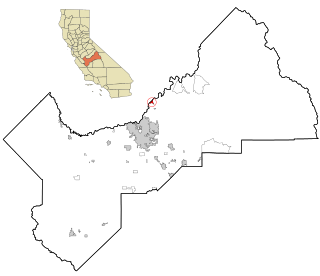
Friant is a census-designated place (CDP) in Fresno County, California, United States. The population was 549 at the 2010 census, down from 778 at the 2000 census. Friant is located 11.5 miles (19 km) north of Clovis, at an elevation of 344 feet.

<span class="mw-page-title-main">Bayview, Humboldt County, California</span> Census-designated place in California, United States

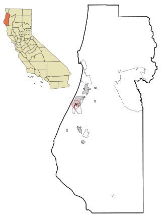
Bayview is a census-designated place (CDP) located adjacent to the City of Eureka in Humboldt County, California, United States. Its population is 2,619 as of the 2020 census, up from 2,510 from the 2010 census. Many locals consider this area as part of "Pine Hill."

<span class="mw-page-title-main">Clearlake Oaks, California</span> Census-designated place in California, United States

Clearlake Oaks is a census-designated place (CDP) in Lake County, California, United States. It is located on the northeast of Clear Lake, 8 miles (13.8 km) northwest of the town of Clearlake, at an elevation of 1,335 feet. The population was 2,359 at the 2010 census, down from 2,402 at the 2000 census.

<span class="mw-page-title-main">Le Grand, California</span> Census-designated place in California, United States

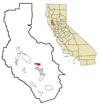
Le Grand is an unincorporated community and census-designated place (CDP) in Merced County, California, United States. Le Grand is 14 miles (23 km) east-southeast of Merced, the county seat at an elevation of 253 feet (77 m). The population was 1,592 at the 2020 census, down from 1,659 at the 2010 census.

<span class="mw-page-title-main">Nuevo, California</span> Census-designated place in California, United States

Nuevo is a rural community located east of Lake Perris and the city of Perris in Riverside County, California. The population of the census-designated place (CDP) is 7,033 according to the 2020 census, up from 6,447 at the 2010 census.

<span class="mw-page-title-main">Big Bear City, California</span> Unincorporated community in California, United States

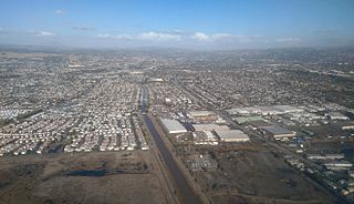
Big Bear City is an unincorporated community in San Bernardino County, California, United States along the east shore of Big Bear Lake and surrounded by the San Bernardino National Forest. It is 27 miles (43 km) northeast of the city of San Bernardino, and immediately east of the incorporated city of Big Bear Lake. For statistical purposes, the United States Census Bureau has defined Big Bear City as a census-designated place (CDP). Its population was 12,304 at the 2010 census, up from 5,779 at the 2000 census. Big Bear City is mostly residential, with smaller houses and cabins laid out in typical square block fashion. Big Bear is on the Pacific Crest Trail.

<span class="mw-page-title-main">Bluewater, California</span> Census-designated place in California, United States

Bluewater is a census-designated place (CDP) in San Bernardino County, California, United States. The population was 172 at the 2010 census, down from 265 at the 2000 census.

<span class="mw-page-title-main">Spring Valley, San Diego County, California</span> Census-designated place in California, United States

Spring Valley is a census-designated place (CDP) in the East County region of San Diego County, California. The population was 28,205 at the time of the 2010 census.

<span class="mw-page-title-main">Winter Gardens, California</span> Census-designated place in California, United States

Winter Gardens is a census-designated place (CDP) in San Diego County, California. The population was 20,631 at the 2010 census, up from 19,771 at the 2000 census.

<span class="mw-page-title-main">Morada, California</span> Census-designated place in California, United States

Morada is a census-designated place (CDP) in San Joaquin County, California, United States. The population was 3,166 at the 2020 census, down from 3,828 at the 2010 census.

<span class="mw-page-title-main">Taft Mosswood, California</span> Census-designated place in California, United States

Taft Mosswood is a census-designated place (CDP) in San Joaquin County, California, United States. The population was 1,530 at the 2010 census, up from 1,388 at the 2000 census. It comprises an unincorporated "island" within the City of Stockton.

<span class="mw-page-title-main">Felton, California</span> Census-designated place in California, United States

Felton is a census-designated place (CDP) in Santa Cruz County, California, United States. The population was 4,489 as of 2020 census and according to the United States Census Bureau, the CDP has a total area of 4.6 square miles (12 km2), all of it land.

<span class="mw-page-title-main">Forestville, California</span> Census-designated place in California, United States

Forestville is a census-designated place (CDP) in Sonoma County, California, United States. It was settled during the late 1860s and was originally spelled Forrestville after one of its founders. The spelling long ago became standardized with one "r". The population was 3,293 at the 2010 census, an increase of nearly 1,000 since the 2000 census.

<span class="mw-page-title-main">Westley, California</span> Census-designated place in California, United States

Westley is a census-designated place (CDP) in Stanislaus County, California. The population was 603 at the 2010 census, down from 747 at the 2000 census. It is part of the Modesto Metropolitan Statistical Area.

<span class="mw-page-title-main">Tipton, California</span> Census-designated place in California, United States

Tipton is a census-designated place (CDP) in Tulare County, California, United States. The population was 2,543 at the 2010 census, up from 1,790 at the 2000 census.

<span class="mw-page-title-main">Lakehills, Texas</span> CDP in Texas, United States

Lakehills is a census-designated place (CDP) in Bandera County, Texas, United States. The population was 5,150 at the 2010 census, making it the most populous place in Bandera County. It is part of the San Antonio Metropolitan Statistical Area.

Thornton is a census-designated place (CDP) in San Joaquin County, California, United States. Thornton is located along Interstate 5 7 miles (11 km) west-southwest of Galt. Thornton has a post office with ZIP code 95686.

References

  1. "California's 9th Congressional District - Representatives & District Map". Civic Impulse, LLC. Retrieved October 7, 2014.
  2. U.S. Census Archived 2012-07-02 at the Wayback Machine
  3. "French Camp". Office of Historic Preservation, California State Parks. Retrieved October 14, 2012.
  4. Fowlie, Kate. "Time Stops in French Camp". Record. Retrieved September 13, 2017.
  5. "US Gazetteer files: 2010, 2000, and 1990". United States Census Bureau. February 12, 2011. Retrieved April 23, 2011.
  6. Climate Summary for French Camp, California
  7. Richard Somerset Mackie (1997). Trading beyond the mountains: the British fur trade on the Pacific, 1793-1843. UBC Press. p. 116. ISBN   978-0-7748-0613-8 . Retrieved December 30, 2011.
  8. U.S. Geological Survey Geographic Names Information System: French Camp
  9. "Student's work helps honor Japanese-Americans interned during World War II". www.recordnet.com. Retrieved February 20, 2021.
  10. "Yolo at war: Internment changed many lives". www.davisenterprise.com. Retrieved February 20, 2021.
  11. "Claire B. Sprague Collection". scholarlycommons.pacific.edu. Retrieved February 14, 2021.
  12. Anderson, Jason. "French Camp native a leader by example". The Stockton Record. Retrieved December 18, 2023.
  13. "From migrant farmworker to astronaut: a true story is now a movie". NBC News. September 19, 2023. Retrieved December 18, 2023.
  14. "Gilbert 'Magu' Lujan, Chicano artist, dies in Arcadia hospital at 70". Daily Breeze. July 27, 2011. Retrieved December 18, 2023.
  15. "Phil Spector, Famed Music Producer and Convicted Murderer, Dies at 81 - The New York Times | Ghostarchive". ghostarchive.org. Archived from the original on December 26, 2021. Retrieved December 18, 2023.{{cite web}}: CS1 maint: bot: original URL status unknown (link)
  16. "JoAnn Trejo - CV" (PDF). University of California, San Diego. Retrieved April 6, 2024.
  17. "San Joaquin". CA State Parks. Retrieved December 18, 2023.
  18. "Census of Population and Housing". Census.gov. Retrieved June 4, 2016.
  19. "2010 Census Interactive Population Search: CA - French Camp CDP". U.S. Census Bureau. Archived from the original on July 15, 2014. Retrieved July 12, 2014.
  20. "U.S. Census website". United States Census Bureau . Retrieved January 31, 2008.