Fruitdale, South Dakota

Last updated

Fruitdale, South Dakota
Town
Butte County South Dakota Incorporated and Unincorporated areas Fruitdale Highlighted.svg
Location in Butte County and the state of South Dakota
Coordinates: 44°40′09″N103°41′44″W / 44.66917°N 103.69556°W / 44.66917; -103.69556
CountryUnited States
State South Dakota
County Butte
Founded1910 [1]
Area
[2]
  Total0.27 sq mi (0.71 km2)
  Land0.27 sq mi (0.71 km2)
  Water0.00 sq mi (0.00 km2)
Elevation
[3]
2,956 ft (901 m)
Population
 (2020) [4]
  Total73
  Density266.42/sq mi (102.69/km2)
Time zone UTC-7 (Mountain (MST))
  Summer (DST) UTC-6 (MDT)
ZIP code
57717
Area code 605
FIPS code 46-23140 [5]
GNIS feature ID1267397 [3]

Fruitdale is a town in Butte County, South Dakota, United States. The population was 73 at the 2020 census. [6]

Contents

Fruitdale was laid out in 1911, and named for a fruit orchard near the original town site. [7]

Geography

According to the United States Census Bureau, the town has a total area of 0.27 square miles (0.70 km2), all land. [8]

Demographics

Historical population
CensusPop.Note
1920 40
1930 113182.5%
1940 89−21.2%
1950 70−21.3%
1960 7912.9%
1970 74−6.3%
1980 8818.9%
1990 43−51.1%
2000 6244.2%
2010 643.2%
2020 7314.1%
U.S. Decennial Census [9] [4]

2010 census

As of the census [10] of 2010, there were 64 people, 29 households, and 18 families residing in the town. The population density was 237.0 inhabitants per square mile (91.5/km2). There were 32 housing units at an average density of 118.5 per square mile (45.8/km2). The racial makeup of the town was 98.4% White and 1.6% from two or more races. Hispanic or Latino of any race were 4.7% of the population.

There were 29 households, of which 17.2% had children under the age of 18 living with them, 58.6% were married couples living together, 3.4% had a male householder with no wife present, and 37.9% were non-families. 31.0% of all households were made up of individuals, and 10.3% had someone living alone who was 65 years of age or older. The average household size was 2.21 and the average family size was 2.78.

The median age in the town was 45.8 years. 15.6% of residents were under the age of 18; 7.9% were between the ages of 18 and 24; 21.9% were from 25 to 44; 39% were from 45 to 64; and 15.6% were 65 years of age or older. The gender makeup of the town was 48.4% male and 51.6% female.

2000 census

As of the census [5] of 2000, there were 62 people, 23 households, and 18 families residing in the town. The population density was 195.2 inhabitants per square mile (75.4/km2). There were 29 housing units at an average density of 91.3 per square mile (35.3/km2). The racial makeup of the town was 93.55% White, and 6.45% from two or more races.

There were 23 households, out of which 47.8% had children under the age of 18 living with them, 65.2% were married couples living together, 8.7% had a female householder with no husband present, and 21.7% were non-families. 17.4% of all households were made up of individuals, and 4.3% had someone living alone who was 65 years of age or older. The average household size was 2.70 and the average family size was 3.11.

In the town, the population was spread out, with 29.0% under the age of 18, 4.8% from 18 to 24, 33.9% from 25 to 44, 25.8% from 45 to 64, and 6.5% who were 65 years of age or older. The median age was 39 years. For every 100 females, there were 113.8 males. For every 100 females age 18 and over, there were 100.0 males.

The median income for a household in the town was $26,250, and the median income for a family was $28,125. Males had a median income of $33,750 versus $14,500 for females. The per capita income for the town was $10,932. None of the families and about 2.8% of the population were below the poverty line.

Related Research Articles

<span class="mw-page-title-main">Fruitdale, San Jose</span> Place in California, United States

Fruitdale is a district of San Jose, California, located in West San Jose, though some portions are still unincorporated as a census-designated place. The population of the CDP was 935 at the 2010 census.

<span class="mw-page-title-main">North River, North Dakota</span> City in North Dakota, United States

North River is a city in Cass County, North Dakota, United States. The population was 55 at the 2020 census. North River was founded in 1973. It is a suburb/bedroom community directly adjacent to the city of Fargo.

<span class="mw-page-title-main">Gackle, North Dakota</span> City in North Dakota, United States

Gackle is a city in Logan County, North Dakota, United States. The population was 281 at the 2020 census.

<span class="mw-page-title-main">Hoople, North Dakota</span> City in North Dakota, United States

Hoople is a city in Walsh County, North Dakota, United States. The population was 247 at the 2020 census. Hoople, named for early settler Alan Hoople, was founded in 1889. Hoople's nickname is "Tater Town."

<span class="mw-page-title-main">Harbeck-Fruitdale, Oregon</span> Unincorporated community in the state of Oregon, United States

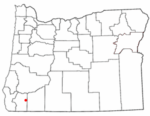
Harbeck-Fruitdale was formerly a census-designated place (CDP) in Josephine County, Oregon, United States, near Grants Pass. As of the 2000 census, the CDP population was 3,780. It includes the community of Fruitdale.

<span class="mw-page-title-main">Stickney, South Dakota</span> Town in South Dakota, United States

Stickney is a town in Aurora County, South Dakota, United States. The population was 321 at the 2020 census.

<span class="mw-page-title-main">Claremont, South Dakota</span> Town in South Dakota, United States

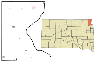
Claremont is a town in Brown County, South Dakota, United States. The population was 108 at the 2020 census.

<span class="mw-page-title-main">Stratford, South Dakota</span> Town in South Dakota, United States

Stratford is a town in southern Brown County, South Dakota, United States. The population was 57 at the 2020 census.

<span class="mw-page-title-main">Westport, South Dakota</span> Town in South Dakota, United States

Westport is a town in western Brown County, South Dakota, United States. The population was 88 at the 2020 census.

<span class="mw-page-title-main">Mound City, South Dakota</span> Town in South Dakota, United States

Mound City is a town in and the county seat of Campbell County, South Dakota, United States. The population was 69 at the 2020 census.

<span class="mw-page-title-main">Florence, South Dakota</span> Town in South Dakota, United States

Florence is a town in northwestern Codington County, South Dakota, United States. It is part of the Watertown, South Dakota Micropolitan Statistical Area. The population was 337 at the 2020 census.

<span class="mw-page-title-main">Fairburn, South Dakota</span> Town in South Dakota, United States

Fairburn is a town in Custer County, South Dakota, United States. The population was 60 at the 2020 census.

<span class="mw-page-title-main">Onaka, South Dakota</span> Town in South Dakota, United States

Onaka is a town in Faulk County, South Dakota, United States. The population was 13 at the 2020 census.

<span class="mw-page-title-main">Albee, South Dakota</span> Unincorporated community in South Dakota, United States

Albee is a town in Grant County, South Dakota, United States. The population was 7 at the 2020 census.

<span class="mw-page-title-main">Revillo, South Dakota</span> Town in South Dakota, United States

Revillo is a town in southeastern Grant County, South Dakota, United States. The population was 99 at the 2020 census.

<span class="mw-page-title-main">Midland, South Dakota</span> Town in South Dakota, United States

Midland is a rural small town in the southeastern corner of Haakon County, South Dakota, United States. The population was 112 at the 2020 census.

<span class="mw-page-title-main">Lake City, South Dakota</span> Town in South Dakota, United States

Lake City is a town in Marshall County, South Dakota, United States. The population was 45 at the 2020 census. Fort Sisseton Historic State Park, whose fort is listed on the National Register of Historic Places, is located nearby.

<span class="mw-page-title-main">Crooks, South Dakota</span> City in South Dakota, United States

Crooks is a city in Minnehaha County, South Dakota, United States and is a suburb of Sioux Falls. The population was 1,362 at the 2020 census. Crooks was named New Hope until 1904. The town's present name honors W. A. Crooks, a local politician.

<span class="mw-page-title-main">Rosholt, South Dakota</span> Town in South Dakota, United States

Rosholt is a town in Roberts County, South Dakota, United States. The population was 379 at the 2020 census.

<span class="mw-page-title-main">Lesterville, South Dakota</span> Town in South Dakota, United States

Lesterville is a town in Yankton County, South Dakota, United States. The population was 115 at the 2020 census.

References

  1. "SD Towns" (PDF). South Dakota State Historical Society. Archived from the original (PDF) on February 10, 2010. Retrieved February 12, 2010.
  2. "ArcGIS REST Services Directory". United States Census Bureau. Retrieved October 15, 2022.
  3. 1 2 U.S. Geological Survey Geographic Names Information System: Fruitdale, South Dakota
  4. 1 2 "Census Population API". United States Census Bureau. Retrieved October 15, 2022.
  5. 1 2 "U.S. Census website". United States Census Bureau . Retrieved January 31, 2008.
  6. "U.S. Census Bureau: Fruitdale town, South Dakota". www.census.gov. United States Census Bureau. Retrieved May 28, 2022.
  7. Federal Writers' Project (1940). South Dakota place-names, v.1-3. University of South Dakota. p. 38.
  8. "US Gazetteer files 2010". United States Census Bureau. Archived from the original on July 2, 2012. Retrieved June 21, 2012.
  9. "Census of Population and Housing". Census.gov. Retrieved June 4, 2015.
  10. "U.S. Census website". United States Census Bureau . Retrieved June 21, 2012.