Fulton, South Dakota

Last updated

Fulton, South Dakota
Hanson County South Dakota Incorporated and Unincorporated areas Fulton Highlighted.svg
Location in Hanson County and the state of South Dakota
Coordinates: 43°43′44″N97°49′21″W / 43.72889°N 97.82250°W / 43.72889; -97.82250
Country United States
State South Dakota
County Hanson
Area
[1]
  Total0.85 sq mi (2.21 km2)
  Land0.85 sq mi (2.21 km2)
  Water0.00 sq mi (0.00 km2)
Elevation
[2]
1,332 ft (406 m)
Population
 (2020) [3]
  Total87
  Density101.87/sq mi (39.34/km2)
Time zone UTC-6 (Central (CST))
  Summer (DST) UTC-5 (CDT)
ZIP code
57340
Area code 605
FIPS code 46-23220 [4]
GNIS feature ID1267398 [2]

Fulton is a town in Hanson County, South Dakota, United States. It is part of the Mitchell, South Dakota Micropolitan Statistical Area. The population was 87 at the 2020 census. [5]

Contents

History

The town was laid out in 1887. Some say that the town was named for Robert Fulton, inventor of the first commercially successful steamboat, [6] while others believe the town has the name of a railroad employee. [7] A post office has been in operation in Fulton since 1887. [8]

Geography

According to the United States Census Bureau, the town has a total area of 0.85 square miles (2.20 km2), all land. [9]

Demographics

Historical population
CensusPop.Note
1920 214
1930 171−20.1%
1940 168−1.8%
1950 139−17.3%
1960 135−2.9%
1970 101−25.2%
1980 1086.9%
1990 70−35.2%
2000 8622.9%
2010 915.8%
2020 87−4.4%
U.S. Decennial Census [3]

2010 census

As of the census [10] of 2010, there were 91 people, 38 households, and 26 families residing in the town. The population density was 107.1 inhabitants per square mile (41.4/km2). There were 44 housing units at an average density of 51.8 per square mile (20.0/km2). The racial makeup of the town was 100.0% White.

There were 38 households, of which 28.9% had children under the age of 18 living with them, 60.5% were married couples living together, 2.6% had a female householder with no husband present, 5.3% had a male householder with no wife present, and 31.6% were non-families. 28.9% of all households were made up of individuals, and 5.3% had someone living alone who was 65 years of age or older. The average household size was 2.39 and the average family size was 2.77.

The median age in the town was 42.8 years. 27.5% of residents were under the age of 18; 3.3% were between the ages of 18 and 24; 20.9% were from 25 to 44; 24.2% were from 45 to 64; and 24.2% were 65 years of age or older. The gender makeup of the town was 58.2% male and 41.8% female.

2000 census

As of the census [4] of 2000, there were 86 people, 38 households, and 29 families residing in the town. The population density was 100.7 inhabitants per square mile (38.9/km2). There were 41 housing units at an average density of 48.0 per square mile (18.5/km2). The racial makeup of the town was 100.00% White.

There were 38 households, out of which 23.7% had children under the age of 18 living with them, 76.3% were married couples living together, 2.6% had a female householder with no husband present, and 21.1% were non-families. 21.1% of all households were made up of individuals, and 7.9% had someone living alone who was 65 years of age or older. The average household size was 2.26 and the average family size was 2.60.

In the town, the population was spread out, with 17.4% under the age of 18, 3.5% from 18 to 24, 25.6% from 25 to 44, 29.1% from 45 to 64, and 24.4% who were 65 years of age or older. The median age was 48 years. For every 100 females, there were 100.0 males. For every 100 females age 18 and over, there were 82.1 males.

The median income for a household in the town was $26,875, and the median income for a family was $30,000. Males had a median income of $26,875 versus $22,813 for females. The per capita income for the town was $13,062. There were 15.6% of families and 24.7% of the population living below the poverty line, including 77.8% of under eighteens and 10.0% of those over 64.

Related Research Articles

Osborn is a town in Hancock County, Maine, United States. The population was 65 at the 2020 census.

<span class="mw-page-title-main">Glenfield, North Dakota</span> City in North Dakota, United States

Glenfield is a rural city in Foster County, North Dakota, United States. The population was 94 at the 2020 census. Glenfield was founded in 1912.

<span class="mw-page-title-main">Venturia, North Dakota</span> City in North Dakota, United States

Venturia is a city in McIntosh County, North Dakota, United States. The population was 21 at the 2020 census. Venturia was founded in 1901.

<span class="mw-page-title-main">Lawton, North Dakota</span> City in North Dakota, United States

Lawton is a city in Ramsey County, North Dakota, United States. The population was 15 at the 2020 census. Lawton was founded in 1902.

<span class="mw-page-title-main">Mantador, North Dakota</span> City in North Dakota, United States

Mantador is a city in Richland County, North Dakota, United States. The population was 67 at the 2020 census. Mantador was founded in 1893. It is part of the Wahpeton, ND-MN Micropolitan Statistical Area.

<span class="mw-page-title-main">Cayuga, North Dakota</span> City in North Dakota, United States

Cayuga is a city in Sargent County, North Dakota, United States. It sits on the banks of the Wild Rice River. The population was 40 at the 2020 census. Cayuga was founded in 1887.

<span class="mw-page-title-main">Cleveland, North Dakota</span> City in North Dakota, United States

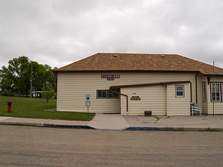
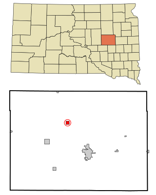
Cleveland is a city in Stutsman County, North Dakota, United States. The population was 57 at the 2020 census.

<span class="mw-page-title-main">Buxton, North Dakota</span> City in North Dakota, United States

Buxton is a city in Traill County, North Dakota, United States. The population was 348 at the 2020 census. Buxton was founded in 1880.

<span class="mw-page-title-main">Ryder, North Dakota</span> City in North Dakota, United States

Ryder is a city in Ward County, North Dakota, United States. The population was 108 at the 2020 census. It is part of the Minot Micropolitan Statistical Area. Ryder was founded in 1906.

<span class="mw-page-title-main">Fox Township, Sullivan County, Pennsylvania</span> Township in Pennsylvania, United States

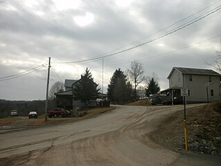
Fox Township is a township in Sullivan County, Pennsylvania, United States. The population was 310 at the 2020 census.

<span class="mw-page-title-main">Broadland, South Dakota</span> Town in South Dakota, United States

Broadland is a town in Beadle County, South Dakota, United States. The population was 27 at the 2020 census.

<span class="mw-page-title-main">White, South Dakota</span> City in South Dakota, United States

White is a city in Brookings County, South Dakota, United States. The population was 537 at the 2020 census.

<span class="mw-page-title-main">Stratford, South Dakota</span> Town in South Dakota, United States

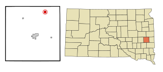
Stratford is a town in southern Brown County, South Dakota, United States. The population was 57 at the 2020 census.

<span class="mw-page-title-main">Onaka, South Dakota</span> Town in South Dakota, United States

Onaka is a town in Faulk County, South Dakota, United States. The population was 13 at the 2020 census.

<span class="mw-page-title-main">Dimock, South Dakota</span> Town in South Dakota, United States

Dimock is a town in Hutchinson County, South Dakota, United States. The population was 137 at the 2020 census.

<span class="mw-page-title-main">Kadoka, South Dakota</span> City in South Dakota, United States

Kadoka is a city in, and the county seat of, Jackson County, South Dakota, United States. The population was 543 at the 2020 census. The town occupies about 2.3 square miles.

<span class="mw-page-title-main">Nunda, South Dakota</span> Town in South Dakota, United States

Nunda is a village in Lake County, South Dakota, United States. The population was 46 at the 2020 census. Located there are a post office, grainery, bar and grill, and an American Legion post.

<span class="mw-page-title-main">Pine Ridge, South Dakota</span> CDP in South Dakota, United States

Pine Ridge is a census-designated place (CDP) and the most populous community in Oglala Lakota County, South Dakota, United States. The population was 3,138 at the 2020 census. It is the tribal headquarters of the Oglala Sioux Tribe on the Pine Ridge Indian Reservation.

<span class="mw-page-title-main">Monroe, South Dakota</span> Town in South Dakota, United States

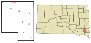
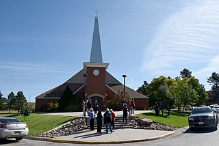
Monroe is a town in Turner County, South Dakota, United States. The population was 159 at the 2020 census.

<span class="mw-page-title-main">Reedy, West Virginia</span> Town in West Virginia, United States

Reedy is a town in Roane County, West Virginia, United States. The population was 152 at the 2020 census.

References

  1. "ArcGIS REST Services Directory". United States Census Bureau. Retrieved October 15, 2022.
  2. 1 2 U.S. Geological Survey Geographic Names Information System: Fulton, South Dakota
  3. 1 2 "Census Population API". United States Census Bureau. Retrieved October 15, 2022.
  4. 1 2 "U.S. Census website". United States Census Bureau . Retrieved January 31, 2008.
  5. "U.S. Census Bureau: Fulton town, South Dakota". www.census.gov. United States Census Bureau. Retrieved June 27, 2022.
  6. Chicago and North Western Railway Company (1908). A History of the Origin of the Place Names Connected with the Chicago & North Western and Chicago, St. Paul, Minneapolis & Omaha Railways. p. 176.
  7. Federal Writers' Project (1940). South Dakota place-names, v.1-3. University of South Dakota. p. 38.
  8. "Hanson County". Jim Forte Postal History. Retrieved April 4, 2015.
  9. "US Gazetteer files 2010". United States Census Bureau. Archived from the original on July 2, 2012. Retrieved June 21, 2012.
  10. "U.S. Census website". United States Census Bureau . Retrieved June 21, 2012.