Funston, Georgia

Last updated

Funston, Georgia
Funston City Hall.JPG
Funston City Hall
Colquitt County Georgia Incorporated and Unincorporated areas Funston Highlighted.svg
Location in Colquitt County and the state of Georgia
Coordinates: 31°11′55″N83°52′23″W / 31.19861°N 83.87306°W / 31.19861; -83.87306
Country United States
State Georgia
County Colquitt
Area
[1]
  Total1.16 sq mi (3.02 km2)
  Land1.14 sq mi (2.96 km2)
  Water0.02 sq mi (0.06 km2)
Elevation
351 ft (107 m)
Population
 (2020)
  Total402
  Density352.01/sq mi (135.89/km2)
Time zone UTC-5 (Eastern (EST))
  Summer (DST) UTC-4 (EDT)
ZIP code
31753
Area code 229
FIPS code 13-31684 [2]
GNIS feature ID0314461 [3]

Funston is a town in Colquitt County, Georgia, United States. The population was 402 in 2020.

Contents

History

The Georgia General Assembly incorporated Funston in 1970. [4]

Geography

Funston is located at 31°11′55″N83°52′23″W / 31.19861°N 83.87306°W / 31.19861; -83.87306 (31.198593, -83.873051). [5] According to the United States Census Bureau, the town has a total area of 1.2 square miles (3.1 km2), all land.

The climate in this area is characterized by relatively high temperatures and evenly distributed precipitation throughout the year. According to the Köppen Climate Classification system, Funston has a humid subtropical climate, abbreviated "Cfa" on climate maps. [6]

Climate data for Funston, Georgia
MonthJanFebMarAprMayJunJulAugSepOctNovDecYear
Mean daily maximum °C (°F)17
(63)
19
(66)
23
(73)
27
(80)
30
(86)
33
(91)
33
(92)
33
(91)
31
(88)
27
(80)
22
(71)
18
(64)
26
(79)
Mean daily minimum °C (°F)4
(40)
6
(43)
9
(48)
12
(54)
17
(62)
20
(68)
22
(71)
21
(70)
19
(66)
13
(56)
8
(47)
5
(41)
13
(56)
Average precipitation mm (inches)110
(4.3)
110
(4.2)
130
(5.2)
97
(3.8)
84
(3.3)
130
(5)
150
(5.9)
130
(5.3)
100
(4.1)
61
(2.4)
66
(2.6)
94
(3.7)
1,260
(49.7)
Source: Weatherbase [7]

Demographics

Historical population
CensusPop.Note
1910 236
1920 157−33.5%
1930 144−8.3%
1940 19938.2%
1950 23317.1%
1960 29325.8%
1970 2930.0%
1980 33715.0%
1990 248−26.4%
2000 42671.8%
2010 4495.4%
2020 402−10.5%
U.S. Decennial Census [8]

As of the census [2] of 2000, there were 426 people, 155 households, and 121 families residing in the town. By 2020, its population was 402.

Related Research Articles

<span class="mw-page-title-main">Morgan County, Georgia</span> County in Georgia, United States

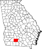
Morgan County is a county located in the north central Piedmont region and the lake country region of the U.S. state of Georgia. As of the 2020 census, the population was 20,097. The county seat is Madison.

<span class="mw-page-title-main">Chatom, Alabama</span> City in and county seat of Washington County, Alabama

Chatom is a town in Washington County, Alabama, United States. It incorporated in 1949. Chatom is the county seat of Washington County, holding the distinction since 1907. The town's population was 1,288 At the 2010 census, up from 1,193 in 2000.

<span class="mw-page-title-main">Quitman, Georgia</span> City in Georgia, United States

Quitman is a city in and the county seat of Brooks County, Georgia, United States. The population was 4,064 in 2020. The Quitman Historic District is listed on the National Register of Historic Places.

<span class="mw-page-title-main">Argyle, Georgia</span> Town in Georgia, United States

Argyle is a town in Clinch County, Georgia, United States. As of the 2020 census, the city had a population of 190.

<span class="mw-page-title-main">Ellenton, Georgia</span> Town in Georgia, United States

Ellenton is a town in Colquitt County, Georgia, United States. Its population was 281 at the 2010 census. It was incorporated in 1970 by the Georgia General Assembly. It is located at 31°10′36″N83°35′17″W.

<span class="mw-page-title-main">Adel, Georgia</span> City in Georgia, United States

Adel is a city in and the county seat of Cook County, Georgia, United States, located fifty-two miles (84 km) southeast of Albany. As of the 2020 census, the city had a population of 5,571.

<span class="mw-page-title-main">Stapleton, Georgia</span> City in Georgia, United States

Stapleton is a city in Jefferson County, Georgia, United States. The population was 402 in 2020.

<span class="mw-page-title-main">Montrose, Georgia</span> Town in Georgia, United States

Montrose is a town in Laurens County, Georgia, United States. The population was 203 in 2020.

<span class="mw-page-title-main">Dasher, Georgia</span> Town in Georgia, United States

Dasher is a town in Lowndes County, Georgia, United States. The population was 890 in 2020.

<span class="mw-page-title-main">Ailey, Georgia</span> City in Georgia, United States

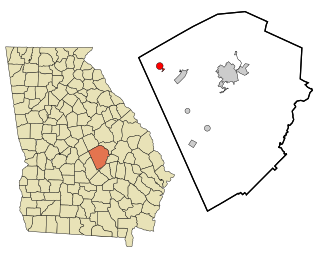
Ailey is a city in Montgomery County, Georgia, United States. As of the 2020 census, the city had a population of 519, up from 432 in 2010.

<span class="mw-page-title-main">Patterson, Georgia</span> City in Georgia, United States

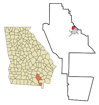
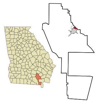
Patterson is a city in Pierce County, Georgia, United States. The population was 749 in 2020.

<span class="mw-page-title-main">Plains, Georgia</span> City in Georgia, United States

Plains is a city in Sumter County, Georgia, United States. The population was 573 at the 2020 census and it is a part of the Americus Micropolitan Statistical Area. It is best known as the birthplace of Jimmy Carter and his wife Rosalynn, who were the president and first lady of the United States respectively from 1977 to 1981. They lived in Plains both before and after their time in the White House.

<span class="mw-page-title-main">Deenwood, Georgia</span> Place in Georgia, United States

Deenwood is an unincorporated community and census-designated place (CDP) in Ware County, Georgia, United States. The population was 2,207 at the 2020 census. It is part of the Waycross micropolitan statistical area. Deenwood Baptist Church is named after this geographical area.

<span class="mw-page-title-main">Sunnyside, Georgia</span> Place in Georgia, United States

Sunnyside is an unincorporated community and census-designated place (CDP) in Ware County, Georgia, United States. The population was 1,472 in 2020. It is part of the Waycross micropolitan statistical area.

<span class="mw-page-title-main">Mayville, Michigan</span> Village in Michigan, United States

Mayville is a village in Tuscola County, in the U.S. state of Michigan. The population was 948 at the 2010 census. The village is within Fremont Township along the boundary with Dayton Township.

<span class="mw-page-title-main">Frankston, Texas</span> Town in Texas, United States

Frankston is a town in Anderson County, Texas, United States. With a population of 1,126 at the 2020 United States census, it is one of the most populous communities of the county area.

<span class="mw-page-title-main">Italy, Texas</span> Town in Texas, United States

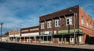
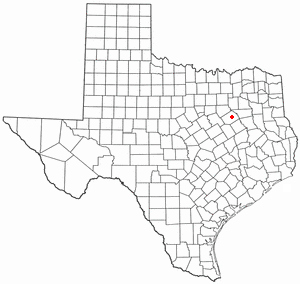
Italy is a town in Ellis County, Texas, United States. Its population was 1,926 in 2020. The community was named after Italy by a settler who had visited the European country.

<span class="mw-page-title-main">Powell, Texas</span> Town in Texas, United States

Powell is a town in Navarro County, Texas, United States. The population was 136 at the 2010 census.

<span class="mw-page-title-main">Pennington Gap, Virginia</span> Town in Virginia, United States

Pennington Gap is a town in Lee County, Virginia, United States. The population was 1,624 at the 2020 census.

<span class="mw-page-title-main">Beech Bottom, West Virginia</span> Village in West Virginia, United States

Beech Bottom is a village in Brooke County, West Virginia, United States, situated along the Ohio River. The population was 523 at the 2010 census. It is part of the Weirton–Steubenville metropolitan area.

References

  1. "2020 U.S. Gazetteer Files". United States Census Bureau. Retrieved December 18, 2021.
  2. 1 2 "U.S. Census website". United States Census Bureau . Retrieved January 31, 2008.
  3. "US Board on Geographic Names". United States Geological Survey. October 25, 2007. Retrieved January 31, 2008.
  4. "Funston". GeorgiaGov. Retrieved July 1, 2019.
  5. "US Gazetteer files: 2010, 2000, and 1990". United States Census Bureau. February 12, 2011. Retrieved April 23, 2011.
  6. Climate Summary for Funston, Georgia
  7. "Weatherbase.com". Weatherbase. 2013. Retrieved on September 28, 2013.
  8. "Census of Population and Housing". Census.gov. Retrieved June 4, 2015.