Montgomery County is the most populous county in the U.S. state of Maryland. As of the 2020 census, the county's population was 1,062,061, increasing by 9.3% from 2010. The county seat and largest municipality is Rockville, although the census-designated place of Germantown is the most populous place within the county. Montgomery County, which adjoins Washington, D.C., is part of the Washington–Arlington–Alexandria, DC–VA–MD–WV metropolitan statistical area, which in turn forms part of the Baltimore–Washington combined statistical area. Most of the county's residents live in unincorporated locales, of which the most urban are Silver Spring and Bethesda, although the incorporated cities of Rockville and Gaithersburg are also large population centers, as are many smaller but significant places.

Rockville is a city in and the county seat of Montgomery County, Maryland, United States, and is part of the Baltimore–Washington metropolitan area. The 2020 census tabulated Rockville's population at 67,117, making it the fourth-largest community in Maryland.

Gaithersburg, officially the City of Gaithersburg, is a city in Montgomery County, Maryland, United States. At the time of the 2020 U.S. Census, Gaithersburg had a population of 69,657, making it the ninth-largest community in the state. Gaithersburg is located to the northwest of Washington, and is considered a suburb and a primary city within the Washington–Arlington–Alexandria, DC–VA–MD–WV Metropolitan Statistical Area. Gaithersburg was incorporated as a town in 1878 and as a city in 1968.

Darnestown is a United States census-designated place (CDP) and an unincorporated area in Montgomery County, Maryland. The CDP is 17.70 square miles (45.8 km2) with the Potomac River as its southern border and the Muddy Branch as much of its eastern border. Seneca Creek borders portions of its north and west sides. The Travilah, North Potomac, and Germantown census-designated places are adjacent to it, as is the city of Gaithersburg. Land area for the CDP is 16.39 square miles (42.4 km2). As of the 2020 census, the Darnestown CDP had a population of 6,723, while the village of Darnestown is considerably smaller in size and population. Downtown Washington, D.C. is about 22 miles (35 km) to the southeast.

North Potomac is a census-designated place and unincorporated area in Montgomery County, Maryland, United States. It is located less than 5 miles (8.0 km) north of the Potomac River, and is about 20 miles (32 km) from Washington, D.C. It has a population of 23,790 as of 2020.

Travilah is a United States census-designated place and an unincorporated area in Montgomery County, Maryland. It is 17.28 square miles (44.8 km2) located along the north side of the Potomac River, and surrounded by the communities of Potomac, North Potomac, and Darnestown—all census-designated places. It had a population of 11,985 as of the 2020 census.

The Washington–Baltimore combined metropolitan statistical area is a statistical area including two overlapping metropolitan areas, Washington, D.C., and Baltimore, Maryland. The region includes Central Maryland, Northern Virginia, three counties in the Eastern Panhandle of West Virginia, and one county in South Central Pennsylvania. It is the most educated, highest-income, and third-largest combined statistical area in the United States behind New York–Newark and Los Angeles–Long Beach.

Rockville station is an intermodal train station located in downtown Rockville, Maryland, United States. It is served by the Washington Metro Red Line, MARC Brunswick Line commuter trains, and Amtrak Capitol Limited intercity trains.
Montgomery County Public Schools (MCPS) is a public school district that serves Montgomery County, Maryland. With 210 schools in 2023, it is the largest school district in the state of Maryland. For the 2022–23 school year, the district had about 160,554 students taught by about 13,994 teachers, 86.4 percent of whom had a master's degree or equivalent. The district receives about half of the county's budget: 46% in 2022.

Interstate 270 (I-270) is a 34.7-mile (55.8 km) auxiliary Interstate Highway in the U.S. state of Maryland that travels from I-495 just north of Bethesda in Montgomery County north to I-70 in the city of Frederick in Frederick County. It consists of the 32.6-mile (52.5 km) mainline as well as a 2.1-mile (3.4 km) spur that provides access to and from southbound I-495. I-270 is known as the Washington National Pike, and makes up the easternmost stretch of the Dwight D. Eisenhower Highway. Most of the southern part of the route in Montgomery County passes through suburban areas around Rockville and Gaithersburg that are home to many biotech firms. This portion of I-270 is up to 12 lanes wide and consists of a local–express lane configuration as well as high-occupancy vehicle lanes that are in operation during peak travel times. North of the Gaithersburg area, the road continues through the northern part of Montgomery County, passing Germantown and Clarksburg as a six- to eight-lane highway with an HOV lane in the northbound direction only. North of here, I-270 continues through rural areas into Frederick County and toward the city of Frederick as a four-lane freeway.

The Montgomery County Police Department (MCPD), officially the Montgomery County Department of Police (MCP), is a nationally accredited agency and the primary law enforcement agency of Montgomery County, Maryland, providing the full spectrum of policing services to the entire county, including the Potomac River.

Maryland Route 355 (MD 355) is a 36.75-mile (59.14 km) north–south road in western central Maryland in the United States. The southern terminus of the route, Wisconsin Avenue, is located in Bethesda in Montgomery County, at the county's border with Washington, D.C. It continues south into Washington, D.C. as Wisconsin Avenue NW. The northern terminus is just north of a bridge over Interstate 70 (I-70)/U.S. Route 40 (US 40) in the city of Frederick in Frederick County, where the road continues north as Market Street through Frederick towards MD 26.
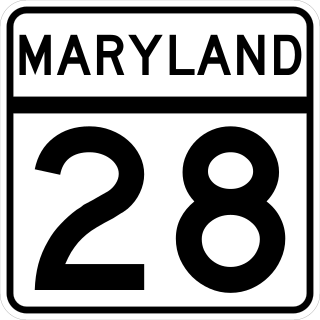
Maryland Route 28 is a state highway in the U.S. state of Maryland. The state highway runs 37.38 miles (60.16 km) from U.S. Route 15 in Point of Rocks east to MD 182 in Norwood. The western portion of MD 28 is a rural highway connecting several villages in southern Frederick County and western Montgomery County. By contrast, the eastern portion of the state highway is a major east–west commuter route, particularly within Gaithersburg and Rockville.

CASA is a Latino and immigration advocacy-and-assistance organization based in Maryland. It is active throughout the state, but has major foci in Prince George's County, Montgomery County and Baltimore. CASA influences Maryland politics on a wide range of policies, ranging from law-enforcement to education. It also has offices in Virginia, Pennsylvania, and Georgia.
The Takoma Park Police Department (TPPD) is the primary law enforcement agency servicing a population of approximately 17,670, within 2.5 square miles (6.5 km2) of the municipality of Takoma Park, Maryland. Until July 1, 1997, the TPPD was aided by both the Prince George's County Police and the Montgomery County Police as the city was divided within the two counties. After that date, the municipality was moved to become contained entirely within Montgomery County by a move of the Maryland General Assembly.

The Greenbelt Police Department (GPD) is the primary law enforcement agency servicing a population of 21,972 within 6.5 square miles (17 km2) of the city of Greenbelt.

The Rockville City Police Department (RCPD) is a U.S. law enforcement agency responsible for patrolling the city of Rockville, the third largest city in the U.S. state of Maryland. The RCPD patrols the city in cooperation with the Montgomery County Police Department (MCPD). The agency serves a jurisdiction consisting of over 65,000 people and has been a CALEA-accredited agency since 1994. According to the RCPD, its mission is to protect and promote community safety, ensure the safe and orderly movement of traffic, and seek solutions to any problem that creates fear or threatens the quality of life in its jurisdiction.

Maryland Route 119 is a state highway in the U.S. state of Maryland. Also known as Great Seneca Highway, the highway runs 7.47 miles (12.02 km) from MD 28 in Rockville north to Middlebrook Road in Germantown. MD 119 is a four- to six-lane divided highway that connects several residential and commercial neighborhoods in Rockville, Gaithersburg, and Germantown. Great Seneca Highway was planned by Montgomery County in the late 1960s as a local relief route for traffic on parallel Interstate 270 (I-270) between the three communities. By the early 1980s, the highway had become controversial because it was proposed to pass through Seneca Creek State Park. A coalition of civic and environmental groups unsuccessfully pursued litigation to stop the highway. The National Park Service refused permission for the county to build the highway in 1985 but reversed itself two years later, by which time the first segment of the highway in Germantown was nearing completion. The Rockville–Gaithersburg section was completed in 1989 and the controversial segment through the state park was finished in 1990. Almost all of Great Seneca Highway became MD 119 in 1999.
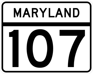
Maryland Route 107 is a state highway in the U.S. state of Maryland. Known for most of its length as Whites Ferry Road, the highway runs 4.79 miles (7.71 km) from MD 109 in Poolesville east to MD 28 in Dawsonville. MD 107 connects the western Montgomery County town of Poolesville with Rockville and Gaithersburg via MD 28. The highway and county-maintained Whites Ferry Road west of Poolesville connect those cities with White's Ferry, a Potomac River ferry north of Leesburg, Virginia. MD 107 was constructed from Dawsonville to Poolesville in the late 1910s. The highway was extended west part of the way to White's Ferry in the late 1920s and early 1930s. The western terminus of MD 107 was truncated at Poolesville in the mid-1970s.

Julie Palakovich Carr is an American politician from Maryland. She is a member of the Democratic Party who currently serves in the Maryland House of Delegates, representing District 17 in Montgomery County. She previously served on the Rockville City Council.