Galena, Kansas

Last updated

Galena, Kansas
Downtown Galena.jpg
Downtown Galena (2008)
Cherokee County Kansas Incorporated and Unincorporated areas Galena Highlighted.svg
Location within Cherokee County and Kansas
Map of Cherokee Co, Ks, USA.png
Coordinates: 37°04′30″N94°38′07″W / 37.07500°N 94.63528°W / 37.07500; -94.63528 [1]
Country United States
State Kansas
County Cherokee
Founded1877
Incorporated 1877
Named for Galena
Area
[2]
  Total4.66 sq mi (12.06 km2)
  Land4.60 sq mi (11.92 km2)
  Water0.05 sq mi (0.14 km2)
Elevation
[1]
925 ft (282 m)
Population
 (2020) [3]
  Total2,761
  Density590/sq mi (230/km2)
Time zone UTC-6 (CST)
  Summer (DST) UTC-5 (CDT)
ZIP code
66739
Area code 620
FIPS code 20-25100
GNIS ID 485578 [1]
Website galenaks.gov

Galena is a city in Cherokee County, Kansas, United States. [1] As of the 2020 census, the population of the city was 2,761. [3]

Contents

History

Galena Museum (2008), former Galena train station for the M-K-T railroad. Galena Museum.jpg
Galena Museum (2008), former Galena train station for the M-K-T railroad.

Although the railroad was built through the territory of Galena in 1871, the community did not start until the discovery of lead there in the spring of 1877. [4] The first post office was established in 1877. [5]

The city was originally platted by the Galena Mining and Smelting Company and was to be known as Cornwall. The city was actually known as Short Creek when first established because of a nearby creek and was known as Bonanza briefly before taking the present name of Galena in 1877, which is named after the lead ore galena found in the area. [6] [7] The city was part of the tri state mining area and had over 30,000 inhabitants. After the mines closed in the 1970s, population decreased.

The Jayhawk Ordnance Works northwest of Galena, built during World War II, was a large ordnance plant producing ammonium nitrate. After the war it was privatized by its operator Kenneth Aldred Spencer and at one point was the world's largest producer of ammonium nitrate fertilizer in the world. It would form the basis for the Spencer Chemical Company's fortune which would eventually be funneled into numerous philanthropies throughout Missouri and Kansas. The Spencer family had been in the area because of their ownership of the Pittsburg & Midway Coal Company mining operation. [8] The plant is still in operation as the Jayhawk Fine Chemicals Corporation now owned by CABB.

Geography

According to the United States Census Bureau, the city has a total area of 4.62 square miles (11.97 km2), of which, 4.57 square miles (11.84 km2) is land and 0.05 square miles (0.13 km2) is water. [9] Galena is the eastern end of the segment of U.S. Route 66 that passes through Kansas.

Superfund site

In 1983 as a result of historic practices involved in the mining and smelting of toxic metals, including the deposition of lead, zinc, antimony and cadmium, the Cherokee County Superfund site was listed on the EPA's National Priorities List (NPL). These sites include the most serious abandoned hazardous waste sites in the United States and represent the priority list for remedial action under the Superfund program. The site consists of approximately 115 square miles, divided into seven subsites including Galena. The Cherokee County site encompasses the Kansas portion of the Tri-State district, the latter including Northeastern Oklahoma and Southwestern Missouri. Acidic waters in mine shafts throughout the site, chat piles, tailings impoundments, and surface waters both in mine pits and streams draining the site contain substantial concentrations of these toxic wastes. [10]

Demographics

Historical population
CensusPop.Note
1880 1,463
1890 2,49670.6%
1900 10,155306.9%
1910 6,096−40.0%
1920 4,712−22.7%
1930 4,7360.5%
1940 4,375−7.6%
1950 4,029−7.9%
1960 3,827−5.0%
1970 3,712−3.0%
1980 3,587−3.4%
1990 3,308−7.8%
2000 3,287−0.6%
2010 3,085−6.1%
2020 2,761−10.5%
U.S. Decennial Census
Galena water tower (2008) Galena Water Tower.jpg
Galena water tower (2008)

The population of Galena has dropped by 73% since 1900.

2020 census

The 2020 United States census counted 2,761 people, 1,096 households, and 699 families in Galena. [11] [12] The population density was 599.8 per square mile (231.6/km2). There were 1,315 housing units at an average density of 285.7 per square mile (110.3/km2). [12] [13] The racial makeup was 85.11% (2,350) white or European American (83.56% non-Hispanic white), 0.76% (21) black or African-American, 3.37% (93) Native American or Alaska Native, 0.29% (8) Asian, 0.18% (5) Pacific Islander or Native Hawaiian, 0.94% (26) from other races, and 9.34% (258) from two or more races. [14] Hispanic or Latino of any race was 3.26% (90) of the population. [15]

Of the 1,096 households, 29.2% had children under the age of 18; 41.0% were married couples living together; 31.1% had a female householder with no spouse or partner present. 30.5% of households consisted of individuals and 14.6% had someone living alone who was 65 years of age or older. [12] The average household size was 2.3 and the average family size was 3.3. [16] The percent of those with a bachelor’s degree or higher was estimated to be 11.4% of the population. [17]

24.6% of the population was under the age of 18, 7.6% from 18 to 24, 24.2% from 25 to 44, 24.4% from 45 to 64, and 19.1% who were 65 years of age or older. The median age was 40.2 years. For every 100 females, there were 107.6 males. [12] For every 100 females ages 18 and older, there were 110.6 males. [12]

The 2016-2020 5-year American Community Survey estimates show that the median household income was $30,649 (with a margin of error of +/- $4,806) and the median family income was $50,462 (+/- $10,225). [18] Males had a median income of $30,745 (+/- $11,631) versus $25,025 (+/- $2,900) for females. The median income for those above 16 years old was $26,133 (+/- $4,284). [19] Approximately, 21.4% of families and 21.6% of the population were below the poverty line, including 26.3% of those under the age of 18 and 15.8% of those ages 65 or over. [20] [21]

2010 census

As of the census [22] of 2010, there were 3,085 people, 1,198 households, and 792 families living in the city. The population density was 675.1 inhabitants per square mile (260.7/km2). There were 1,429 housing units at an average density of 312.7 per square mile (120.7/km2). The racial makeup of the city was 91.0% White, 0.4% African American, 3.0% Native American, 0.3% Asian, 1.3% from other races, and 4.1% from two or more races. Hispanic or Latino of any race were 3.6% of the population.

There were 1,198 households, of which 34.1% had children under the age of 18 living with them, 43.2% were married couples living together, 16.4% had a female householder with no husband present, 6.6% had a male householder with no wife present, and 33.9% were non-families. 29.0% of all households were made up of individuals, and 13% had someone living alone who was 65 years of age or older. The average household size was 2.51 and the average family size was 3.04.

The median age in the city was 39.1 years. 25.9% of residents were under the age of 18; 8.2% were between the ages of 18 and 24; 22.7% were from 25 to 44; 27.2% were from 45 to 64; and 15.9% were 65 years of age or older. The gender makeup of the city was 49.3% male and 50.7% female.

Education

The community is served by Galena USD 499 public school district. Galena is home to Galena High School. In 1916 the Kansas Supreme Court heard a case where the school superintendent separated the African American ("colored") children and had them taught together from various grades by an African American teacher. The court rejected the district's decision making and requires students of different backgrounds be taught together. [23]

In the media

Notable people


Related Research Articles

<span class="mw-page-title-main">Frontenac, Kansas</span> City in Crawford County, Kansas

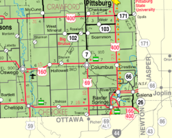
Frontenac is the second largest city in Crawford County, Kansas, United States. As of the 2020 census, the population of the city was 3,382.

<span class="mw-page-title-main">McCune, Kansas</span> City in Crawford County, Kansas

McCune is a city in Crawford County, Kansas, United States. As of the 2020 census, the population of the city was 370.

<span class="mw-page-title-main">Mulberry, Kansas</span> City in Crawford County, Kansas

Mulberry is a city in Crawford County, Kansas, United States. As of the 2020 census, the population of the city was 409.

<span class="mw-page-title-main">Jennings, Kansas</span> City in Decatur County, Kansas

Jennings is a city in Decatur County, Kansas, United States. As of the 2020 census, the population of the city was 81.

<span class="mw-page-title-main">Longton, Kansas</span> City in Elk County, Kansas

Longton is a city in Elk County, Kansas, United States, along the Elk River. As of the 2020 census, the population of the city was 288.

<span class="mw-page-title-main">Gove City, Kansas</span> City in Gove County, Kansas

Gove City, more commonly known as Gove, is a city in and the county seat of Gove County, Kansas, United States. As of the 2020 census, the population of the city was 80.

<span class="mw-page-title-main">Jetmore, Kansas</span> City in Hodgeman County, Kansas

Jetmore is a city in and the county seat of Hodgeman County, Kansas, United States. As of the 2020 census, the population of the city was 770.

<span class="mw-page-title-main">Holton, Kansas</span> City in Jackson County, Kansas

Holton is a city in and the county seat of Jackson County, Kansas, United States. As of the 2020 census, the population of the city was 3,401.

<span class="mw-page-title-main">Edgerton, Kansas</span> City in Kansas, United States

Edgerton is a city in Johnson County, Kansas, United States, and part of the Kansas City metropolitan area. As of the 2020 census, the population of the city was 1,748. It is home to a large BNSF intermodal train facility named Logistics Park Kansas City.

<span class="mw-page-title-main">Kingman, Kansas</span> City in Kingman County, Kansas

Kingman is a city in and the county seat of Kingman County, Kansas, United States. As of the 2020 census, the population of the city was 3,105.

<span class="mw-page-title-main">Norwich, Kansas</span> City in Kingman County, Kansas

Norwich is a city in Kingman County, Kansas, United States. As of the 2020 census, the population of the city was 444.

<span class="mw-page-title-main">Mound City, Kansas</span> City and County seat in Kansas, United States

Mound City is a city in and the county seat of Linn County, Kansas, United States. As of the 2020 census, the population of the city was 647.

<span class="mw-page-title-main">Meade, Kansas</span> City in Meade County, Kansas

Meade is a city in and the county seat of Meade County, Kansas, United States. As of the 2020 census, the population of the city was 1,505.

<span class="mw-page-title-main">Ness City, Kansas</span> City in Ness County, Kansas

Ness City is a city in and the county seat of Ness County, Kansas, United States. As of the 2020 census, the population of the city was 1,329. Ness City is famous for its four-story Old Ness County Bank Building located downtown, and nicknamed Skyscraper of the Plains.

<span class="mw-page-title-main">Lyndon, Kansas</span> City in Osage County, Kansas

Lyndon is a city in, and the county seat of Osage County, Kansas, United States. As of the 2020 census, the population of the city was 1,037.

<span class="mw-page-title-main">Osage City, Kansas</span> City in Osage County, Kansas

Osage City is a city in Osage County, Kansas, United States. As of the 2020 census, the population of the city was 2,861.

<span class="mw-page-title-main">Belleville, Kansas</span> City in Republic County, Kansas

Belleville is a city in and the county seat of Republic County, Kansas, United States. As of the 2020 census, the population of the city was 2,007.

<span class="mw-page-title-main">Ogden, Kansas</span> City in Riley County, Kansas

Ogden is a city in Riley County, Kansas, United States. As of the 2020 census, the population of the city was 1,661. It is located near Fort Riley between Manhattan and Junction City.

<span class="mw-page-title-main">Mount Hope, Kansas</span> City in Sedgwick County, Kansas

Mount Hope is a city in Sedgwick County, Kansas, United States. As of the 2020 census, the population of the city was 806.

<span class="mw-page-title-main">Lebo, Kansas</span> City in Coffey County, Kansas

Lebo is a city in Coffey County, Kansas, United States. As of the 2020 census, the population of the city was 885.

References

  1. 1 2 3 4 U.S. Geological Survey Geographic Names Information System: Galena, Kansas
  2. "2019 U.S. Gazetteer Files". United States Census Bureau. Retrieved July 24, 2020.
  3. 1 2 "Profile of Galena, Kansas in 2020". United States Census Bureau. Archived from the original on November 9, 2022. Retrieved November 9, 2022.
  4. Blackmar, Frank Wilson (1912). Kansas: A Cyclopedia of State History, Embracing Events, Institutions, Industries, Counties, Cities, Towns, Prominent Persons, Etc. Standard Publishing Company. p. 705. ISBN   9780722249055.
  5. "Kansas Post Offices, 1828-1961, page 2". Kansas Historical Society. Retrieved June 6, 2014.
  6. Kansas Place-Names, John Rydjord, University of Oklahoma Press, 1972, p. 77 ISBN   0-8061-0994-7
  7. Gannett, Henry (1905). The Origin of Certain Place Names in the United States. Govt. Print. Off. p. 133.
  8. "Surplus Property: Jayhawk Goes Civilian". Time . June 17, 1946.
  9. "US Gazetteer files 2010". United States Census Bureau. Archived from the original on July 2, 2012. Retrieved July 6, 2012.
  10. Environmental Use Control Work Plan June 1, 2009 to June 1, 2014, Kansas Department of Health and Environment . Retrieved August 12, 2020.
  11. "US Census Bureau, Table P16: HOUSEHOLD TYPE". data.census.gov. Retrieved January 3, 2024.
  12. 1 2 3 4 5 "US Census Bureau, Table DP1: PROFILE OF GENERAL POPULATION AND HOUSING CHARACTERISTICS". data.census.gov. Retrieved January 3, 2024.
  13. Bureau, US Census. "Gazetteer Files". Census.gov. Retrieved December 30, 2023.
  14. "US Census Bureau, Table P1: RACE". data.census.gov. Retrieved January 3, 2024.
  15. "US Census Bureau, Table P2: HISPANIC OR LATINO, AND NOT HISPANIC OR LATINO BY RACE". data.census.gov. Retrieved January 3, 2024.
  16. "US Census Bureau, Table S1101: HOUSEHOLDS AND FAMILIES". data.census.gov. Retrieved January 3, 2024.
  17. "US Census Bureau, Table S1501: EDUCATIONAL ATTAINMENT". data.census.gov. Retrieved January 3, 2024.
  18. "US Census Bureau, Table S1903: MEDIAN INCOME IN THE PAST 12 MONTHS (IN 2020 INFLATION-ADJUSTED DOLLARS)". data.census.gov. Retrieved January 3, 2024.
  19. "US Census Bureau, Table S2001: EARNINGS IN THE PAST 12 MONTHS (IN 2020 INFLATION-ADJUSTED DOLLARS)". data.census.gov. Retrieved January 3, 2024.
  20. "US Census Bureau, Table S1701: POVERTY STATUS IN THE PAST 12 MONTHS". data.census.gov. Retrieved January 3, 2024.
  21. "US Census Bureau, Table S1702: POVERTY STATUS IN THE PAST 12 MONTHS OF FAMILIES". data.census.gov. Retrieved January 3, 2024.
  22. "U.S. Census website". United States Census Bureau . Retrieved July 6, 2012.
  23. Supreme Court, Kansas; Banks, Elliot V.; Webb, William Craw; Randolph, Asa Maxson Fitz; Clemens, Gaspar Christopher; Dewey, Thomas Emmet; Graham, Llewellyn James; Moore, Oscar Leopold; Hatcher, Earl Hilton; McCue, Howard Franklin (1916). "Kansas Reports".
  24. Wallis, Michael; Suzanne Fitzgerald Wallis. "The Art of Cars". Chronicle Books. p. 4.
  25. Shelton, Missy (June 25, 2011). "'Cars' Fans Get Their Rusty Kicks On Route 66". National Public Radio . Retrieved May 5, 2012.
  26. Galena, Kansas on Facebook

Further reading