Galt, California

Last updated

Galt, California
City of Galt
Aerial view of Galt, August 2018.JPG
Aerial view of Galt
Sacramento County California Incorporated and Unincorporated areas Galt Highlighted 0628112.svg
Location of Galt in Sacramento County, California
Usa edcp relief location map.png
Red pog.svg
Galt, California
Location in the contiguous United States
Coordinates: 38°15′39″N121°18′11″W / 38.26083°N 121.30306°W / 38.26083; -121.30306
Country Flag of the United States.svg United States
State Flag of California.svg  California
County Flag of Sacramento County, California.png Sacramento
Incorporated August 16, 1946 [1]
Government
   Mayor Shawn Farmer [2]
   Vice Mayor Paul Sand [2]
   Chief of Police Brian Kalinowski
   City Treasurer Shaun L. Farrell, CCMT
  Fire Chief (Cosumnes CSD)Felipe Rodriguez [3]
Area
[4]
  Total6.78 sq mi (17.57 km2)
  Land6.77 sq mi (17.54 km2)
  Water0.01 sq mi (0.03 km2)  0.23%
Elevation
47 ft (16 m)
Population
 (2010)
  Total23,647
  Estimate 
(2019) [5]
26,536
  Density3,919.07/sq mi (1,513.09/km2)
Time zone UTC-8 (PST)
  Summer (DST) UTC-7 (PDT)
ZIP code
95632
Area code 209
FIPS code 06-28112
GNIS feature ID0277522
Website http://www.ci.galt.ca.us

Galt is a city in Sacramento County, California. It is part of the Sacramento metropolitan area. The population was 23,647 at the 2010 census, up from 19,472 at the 2000 census.

Contents

History

Galt was founded in 1869 by the Central Pacific Railroad as part of the first transcontinental railroad. [6] The town is named after Galt, Ontario, the Canadian home town of local rancher John McFarland.

Geography

Galt is located at 38°15′39″N121°18′11″W / 38.260842°N 121.303122°W / 38.260842; -121.303122 . [7]

According to the United States Census Bureau, the city has a total area of 5.9 square miles (15 km2), of which 5.9 square miles (15 km2) of it is land and 0.23% is water.

The city is bordered entirely by unincorporated areas of both Sacramento and San Joaquin Counties.

Toponymy

Galt was named in 1869 after the former city of Galt in Canada, now part of Cambridge, the hometown of John McFarland. [8]

Climate

According to the Köppen Climate Classification system, Galt has a warm-summer Mediterranean climate, abbreviated "Csa" on climate maps. [9]

Demographics

Historical population
CensusPop.Note
1950 1,333
1960 1,86840.1%
1970 3,20071.3%
1980 5,51472.3%
1990 8,88961.2%
2000 19,472119.1%
2010 23,64721.4%
2019 (est.)26,536 [5] 12.2%
U.S. Decennial Census [10]

2010

At the 2010 census Galt had a population of 23,647. The population density was 3,977.8 inhabitants per square mile (1,535.8/km2). The racial makeup of Galt was 15,639 (66.1%) White, 430 (1.8%) African American, 361 (1.5%) Native American, 815 (3.4%) Asian, 108 (0.5%) Pacific Islander, 4,834 (20.4%) from other races, and 1,460 (6.2%) from two or more races. Hispanic or Latino of any race were 10,113 persons (42.8%). [11]

The census reported that 23,498 people (99.4% of the population) lived in households, 32 (0.1%) lived in non-institutionalized group quarters, and 117 (0.5%) were institutionalized.

There were 7,262 households, 3,516 (48.4%) had children under the age of 18 living in them, 4,431 (61.0%) were opposite-sex married couples living together, 895 (12.3%) had a female householder with no husband present, 465 (6.4%) had a male householder with no wife present. There were 431 (5.9%) unmarried opposite-sex partnerships, and 32 (0.4%) same-sex married couples or partnerships. 1,171 households (16.1%) were one person and 547 (7.5%) had someone living alone who was 65 or older. The average household size was 3.24. There were 5,791 families (79.7% of households); the average family size was 3.62.

The age distribution was 7,347 people (31.1%) under the age of 18, 2,262 people (9.6%) aged 18 to 24, 6,344 people (26.8%) aged 25 to 44, 5,414 people (22.9%) aged 45 to 64, and 2,280 people (9.6%) who were 65 or older. The median age was 32.4 years. For every 100 females, there were 97.4 males. For every 100 females age 18 and over, there were 94.3 males.

There were 7,678 housing units at an average density of 1,291.6 per square mile, of the occupied units 5,344 (73.6%) were owner-occupied and 1,918 (26.4%) were rented. The homeowner vacancy rate was 2.3%; the rental vacancy rate was 5.2%. 17,034 people (72.0% of the population) lived in owner-occupied housing units and 6,464 people (27.3%) lived in rental housing units.

2000

At the 2000 census there were 19,472 people in 5,974 households, including 4,886 families, in the city. The population density was 1,280.8/km2 (3,316.6/mi2). There were 6,211 housing units at an average density of 408.5/km2 (1,057.9/mi2). The racial makeup of the city was 70.49% White, 1.16% African American, 1.05% Native American, 2.84% Asian, 0.16% Pacific Islander, 18.57% from other races, and 5.74% from two or more races. 33.20% of the population were Hispanic or Latino of any race. [12] Of the 5,974 households 49.7% had children under the age of 18 living with them, 65.1% were married couples living together, 11.6% had a female householder with no husband present, and 18.2% were non-families. 14.5% of households were one person and 6.5% were one person aged 65 or older. The average household size was 3.23 and the average family size was 3.57.

The age distribution was 34.5% under the age of 18, 8.1% from 18 to 24, 32.5% from 25 to 44, 16.5% from 45 to 64, and 8.5% who are 65 or older. The median age was 31 years. For every 100 females, there were 98.0 males. For every 100 females age 18 and over, there were 95.5 males.

The median household income was $45,052 and the median family income was $47,845. Males had a median income of $38,258 versus $26,541 for females. The per capita income for the city was $16,620. 10.6% of the population and 8.5% of families were below the poverty line. Out of the total population, 13.7% were under the age of 18 and 6.7% were 65 or older.

Public safety

Fire department

The local fire department is owned and operated by the Cosumnes Community Services District. Founded in 1893, Elk Grove's Fire Department started with a single hose cart and a small group of dedicated volunteers. From these humble beginnings, the Department has forged a lasting presence in the community. Continued growth and innovation in the fire service has prompted a diverse array of new Fire Department projects and responsibilities. Each year, the Fire Prevention Bureau conducts hundreds of new construction inspections and plan reviews and actively implements annual weed abatement and fireworks enforcement campaigns. Moreover, the Public Education Division coordinates a number of safety activities including "Change Your Clock-Change Your Smoke Detector Batteries" Campaign, the Juvenile Firesetters Intervention Program, the Life Jacket Loan-Out Program and Car Seat Safety Inspections. A new Special Operations Division was formed in 2007 that oversees the specialized rescue, hazardous materials, and disaster preparedness needs for the Cosumnes CSD Fire Department.

As they have done for more than 100 years, the members of the Cosumnes CSD Fire Department maintain their commitment to protecting the lives, property and environment from fire and other natural and manmade disasters and emergencies in a courteous, timely and effective manner. In 2010, Tracey M. Hansen, a 17-year veteran of the Cosumnes CSD Fire Department was named the new Fire Chief by CSD General Manager Jeff Ramos, the latest achievement in a career she began as a paramedic. Hansen named John Michelini as her Deputy Chief and the team immediately began developing strategies to effectively manage the Fire Department during the recession. [13]

Government

Galt operates under an elected council form of government. The Mayor of Galt is peer elected by the entire City Council. Currently, the council members (with end of term in parentheses) are: Mayor Shawn Farmer (2022), Vice Mayor Paul Sandhu (2022), Council Member Rich Lazano (2022), Council Member Kevin Papineau (2024) and Council Member Jay Vandenburg (2024). [14]

In the California State Legislature, Galt is in the 5th Senate District , represented by Democrat Susan Eggman, and the 9th Assembly District , represented by Republican Heath Flora. [15]

In the United States House of Representatives, Galt is in California's 9th congressional district , represented by Democrat Josh Harder. [16]

Current Sacramento County Supervisor Don Nottoli served as the youngest member of the Galt City Council in 1978 at just 23 years old, while Andrew J. Meredith served as its youngest Mayor in 2007 at 27 years old.

Media

Galt has had a weekly newspaper, The Galt Herald, since 1909. It has been owned and operated by the same family since 1959, the Herburgers of Herburger Publications, Inc. As of 2020, the Galt Herald Managing Editor is Bonnie Rodriguez.

Education

Galt Joint Union Elementary School District operates the city's public elementary and intermediate schools, and Galt Joint Union High School District operates the city's public high schools.

Community

Galt is home to many civic groups and clubs. The Galt Area Historical Society is very active and has more than 500 members. The Performing Animal Welfare Society is a place where retired, abandoned or abused performing animals and victims of the exotic animal trade can live in peace and contentment. The Galt Lions Club is part of Lions International and helps the local visually impaired repair their vision.

Galt is well known for the Flea Market, also known as Galt Market.

Cosumnes River country holds a very special place among California landscapes. The Cosumnes River Preserve was created to safeguard much of that landscape.

The city hosts an annual winter bird festival, in conjunction with the Cosumnes River Preserve, as many birds winter in and around the city. [17]

Brewster House, on the National Register of Historic Places, is located there.

The Galt Arno Cemetery District is located in Galt.

The California Department of Corrections "Boot Camp" School is located in Galt.

Notable people

Adjacent areas

Related Research Articles

<span class="mw-page-title-main">Sacramento County, California</span> County in California, United States

Sacramento County is a county located in the U.S. state of California. As of the 2020 census, the population was 1,585,055. Its county seat is Sacramento, which has been the state capital of California since 1854.

<span class="mw-page-title-main">Colusa, California</span> City in California, United States

Colusa is a city and county seat of Colusa County, California, located in the Sacramento Valley region of the Central Valley. The population was 5,971 at the 2010 census, up from 5,402 at the 2000 census. Colusi originates from the local Coru Native American tribe, who in the 1840s lived on the opposite side of the Sacramento River.

<span class="mw-page-title-main">Discovery Bay, California</span> Census-designated place in California, United States

Discovery Bay is a census-designated place (CDP) in eastern Contra Costa County, California in the United States, about 60 miles (97 km) from San Francisco. It is located in the San Francisco Bay Area. As of 2020, its population was 15,358, a 15% percent gain from 13,352 at the 2010 census.

<span class="mw-page-title-main">El Dorado Hills, California</span> Census-designated place in California, United States

El Dorado Hills is an unincorporated town and census-designated place in El Dorado County, California. Located in the Greater Sacramento region of Northern California, it had a population of 50,547 at the 2020 census, up from 42,108 at the 2010 census.

<span class="mw-page-title-main">Hamilton City, California</span> Census-designated place in California, United States

Hamilton City is a census-designated place (CDP) in Glenn County, California, United States. The population was 1,759 at the 2010 census, down from 1,903 at the 2000 census. Hamilton City is located 9.5 miles (15 km) east of Orland, and 10 miles west of Chico at an elevation of 151 feet. The community is inside area code 530. The default prefix used for wired telephones in the Hamilton City area is 826. The postal ZIP Code is 95951.

<span class="mw-page-title-main">Willows, California</span> City in California, United States

Willows is a city and the county seat of Glenn County, California, located in the Sacramento Valley region of Northern California. The city is home to regional government offices, including the California Highway Patrol, the California Department of Motor Vehicles, the United States Bureau of Reclamation and the main offices of the Mendocino National Forest, which comprises about one million acres of Federal land located mostly in mountainous terrain west of Willows. The population was 6,293 at the 2020 census.

<span class="mw-page-title-main">La Habra Heights, California</span> City in California, United States

La Habra Heights is a city in Los Angeles County, California, United States. The population was 5,325 at the 2010 census, down from 5,712 at the 2000 census. La Habra Heights is a suburban canyon community located on the border of Orange and Los Angeles counties. The zoning is 1-acre (4,000 m2) lots with a variety of home and ranch style properties. La Habra Heights features open space and there are no sidewalks in the community. La Habra Heights has no commercial activity with few exception. Hacienda Park is the main park in the city and runs along Hacienda Road.

<span class="mw-page-title-main">South El Monte, California</span> City in California, United States

South El Monte is a city in the San Gabriel Valley, in Los Angeles County, California, United States. At the 2010 census, the city had a population of 20,116, down from 21,144 at the 2000 census.

<span class="mw-page-title-main">Brea, California</span> City in California, United States

Brea is a city in northern Orange County, California. The population as of the 2010 census was 39,282. It is 33 miles (53 km) southeast of Los Angeles. Brea is part of the Los Angeles metropolitan area.

<span class="mw-page-title-main">Stanton, California</span> City in California, United States

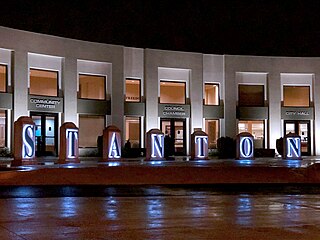
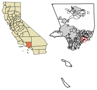
Stanton is a city in northern Orange County, California, United States, within the Los Angeles metropolitan area. The population was 37,962 at the 2020 United States Census. The city was incorporated in 1956 and operates under the council–manager form of government, providing a full range of municipal services. Stanton is bounded by Cypress on the west, Anaheim on the north, and east, and Garden Grove on the east and south.

<span class="mw-page-title-main">Citrus Heights, California</span> City in California, United States

Citrus Heights is a city in Sacramento County, California, United States. As of the 2020 U.S. Census, the city had a population of 87,583, up from 83,301 at the 2010 U.S. Census.

<span class="mw-page-title-main">Elk Grove, California</span> City in California, United States

Elk Grove is a city in Sacramento County, California, United States. Located just south of the state capital of Sacramento, it is part of the Sacramento metropolitan area. As of the 2020 Census, the population of the city was 176,124. A 2021 Census estimate puts the population of the city at 178,997. Elk Grove has many wineries, wine cellars, and vineyards. Elk Grove was the fastest-growing city in the U.S. between July 1, 2004, and July 1, 2005, and is also presently the second-largest city in Sacramento County by population.

<span class="mw-page-title-main">Isleton, California</span> City in California, United States

Isleton is a city in Sacramento County, California, United States. The population was 804 at the 2010 census, down from 828 at the 2000 census. It is located on Andrus Island amid the slough wetlands of the Sacramento-San Joaquin River Delta, on the eastern edge of the Rio Vista Gas Field. The city has many preserved 19th-century era storefronts along its main street, some of which show distinct Chinese influences.

<span class="mw-page-title-main">Rancho Murieta, California</span> Census-designated place in California, United States

Rancho Murieta is a census-designated place (CDP) and guard-gated community in Sacramento County, California, United States. It is part of the Sacramento–Arden-Arcade–Roseville Metropolitan Statistical Area. The population was 5,488 at the 2010 census, up from 4,193 at the 2000 census. It is located in the foothills of the Sierra Nevada range, about 25 miles (40 km) east of Sacramento.

<span class="mw-page-title-main">Wilton, California</span> Census-designated place in California, United States

Wilton is a census-designated place (CDP) in Sacramento County, California, United States. It is part of the Sacramento–Arden-Arcade–Roseville Metropolitan Statistical Area. The population was 5,363 at the 2010 census, up from 4,551 at the 2000 census.

<span class="mw-page-title-main">Highland, California</span> City in California, United States

Highland is a city in San Bernardino County, California, United States. The city's population was 56,999 at the 2020 census.

<span class="mw-page-title-main">Bonsall, California</span> Census-designated place in California, United States

Bonsall is a census-designated place (CDP) in San Diego County, California. The population was 3,982 at the 2010 census, up from 3,401 at the 2000 census.

<span class="mw-page-title-main">Live Oak, Sutter County, California</span> City in California, United States

Live Oak is an incorporated city in Sutter County, California, United States. It is part of the Yuba City Metropolitan Statistical Area within the Greater Sacramento CSA, and includes a hamlet historically named Stafford. The population was 9,106 at the 2020 census, up from 8,392 at the 2010 census.

<span class="mw-page-title-main">Stockport, Iowa</span> City in Iowa, United States

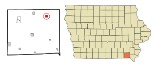
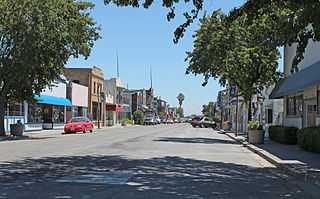
Stockport is a city in Van Buren County, Iowa, United States. The population was 272 at the time of the 2020 census.

<span class="mw-page-title-main">Herald, California</span> Census-designated place in California, United States

Herald is a census-designated place in Sacramento County, California. Herald sits at an elevation of 79 feet (24 m). It is located east of the city of Galt along State Route 104. The ZIP Code is 95638, and the community is inside area code 209. The 2010 United States census reported that Herald's population was 1,184.

References

  1. "California Cities by Incorporation Date". California Association of Local Agency Formation Commissions. Archived from the original (Word) on November 3, 2014. Retrieved August 25, 2014.
  2. 1 2 "City Council". City of Galt, California. Archived from the original on October 12, 2017. Retrieved January 4, 2015.
  3. Macdonald, Cameron. "Rodriguez becomes Cosumnes fire chief". Elk Grove Citizen. Archived from the original on January 26, 2021. Retrieved March 24, 2021.
  4. "2019 U.S. Gazetteer Files". United States Census Bureau. Retrieved July 1, 2020.
  5. 1 2 "Population and Housing Unit Estimates". United States Census Bureau. May 24, 2020. Retrieved May 27, 2020.
  6. https://www.cityofgalt.org/our-city/galt-history [ bare URL ]
  7. "US Gazetteer files: 2010, 2000, and 1990". United States Census Bureau. February 12, 2011. Retrieved April 23, 2011.
  8. Gudde, Edwin G. (2004). California place names: The origin and etymology of current geographical names. Berkeley and Los Angeles, California: University of California Press. p. 140. ISBN   978-0-520-24217-3.
  9. "Galt, California Köppen Climate Classification (Weatherbase)". Weatherbase.
  10. "Census of Population and Housing". Census.gov. Retrieved June 4, 2015.
  11. "2010 Census Interactive Population Search: CA - Galt city". U.S. Census Bureau. Archived from the original on July 15, 2014. Retrieved July 12, 2014.
  12. "U.S. Census website". United States Census Bureau . Retrieved January 31, 2008.
  13. "Fire Department History - CSD Fire". Archived from the original on December 19, 2011. Retrieved November 17, 2011.
  14. "City Council | Galt, CA". www.ci.galt.ca.us.
  15. "Statewide Database". UC Regents. Archived from the original on February 1, 2015. Retrieved January 4, 2015.
  16. "California's 9th Congressional District - Representatives & District Map". Civic Impulse, LLC. Retrieved March 9, 2013.
  17. "12TH Annual Winter Bird Festival | Galt, CA".