Washington County is located in the western part of the U.S. state of Maryland. As of the 2020 census, the population was 154,705. Its county seat is Hagerstown. Washington County was the first county in the United States to be named for the Revolutionary War general George Washington. Washington County is one of three Maryland counties recognized by the Appalachian Regional Commission as being part of Appalachia. The county borders southern Pennsylvania to the north, Northern Virginia to the south, and the Eastern Panhandle of West Virginia to the south and west. Washington County is included in the Hagerstown-Martinsburg, MD-WV Metropolitan Statistical Area, which is also included in the Washington-Baltimore-Arlington, DC-MD-VA-WV-PA Combined Statistical Area.

Windham County is a county located in the northeastern corner of the U.S. state of Connecticut. As of the 2020 census, the population was 116,418, making it the least populous county in Connecticut. It forms the core of the region known as the Quiet Corner. Windham County is included in the Worcester, MA-CT Metropolitan Statistical Area, which is also included in the Boston-Worcester-Providence, MA-RI-NH-CT Combined Statistical Area. The entire county is within the Quinebaug and Shetucket Rivers Valley National Heritage Corridor, as designated by the National Park Service.

Hampshire County is a county in the U.S. state of West Virginia. As of the 2020 census, the population was 23,093. Its county seat is Romney, West Virginia's oldest town (1762). The county was created by the Virginia General Assembly in 1754, from parts of Frederick and Augusta Counties (Virginia) and is the state's oldest county. The county lies in both West Virginia's Eastern Panhandle and Potomac Highlands regions.

Rockingham County is a county located in the U.S. state of Virginia. As of the 2020 census, the population was 83,757. Its county seat is the independent city of Harrisonburg.

Prince William County is located on the Potomac River in the U.S. state of Virginia. As of the 2020 census, the population sits at 482,204, making it Virginia's second-most populous county. Its county seat is the independent city of Manassas.

Highland County is a county located in the Commonwealth of Virginia. As of the 2020 census, the population was 2,232. Its county seat is Monterey. Known as "Virginia's Switzerland" or "Virginia's Little Switzerland", Highland County is the least populous jurisdiction in Virginia, including counties and independent cities. Highland lays claim to being one of the least populous counties and one of the highest average elevations east of the Mississippi River.
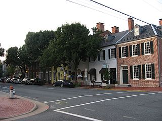
Fredericksburg is an independent city located in the Commonwealth of Virginia in the United States. As of the 2020 census, the population was 27,982. The Bureau of Economic Analysis of the United States Department of Commerce combines the city of Fredericksburg with neighboring Spotsylvania County for statistical purposes.

Northern Virginia, locally referred to as NOVA or NoVA, comprises several counties and independent cities in the Commonwealth of Virginia in the United States. It is a widespread region radiating westward and southward from Washington, D.C. With 3,197,076 people according to the 2020 Census, it is the most populous region of Virginia and the Washington metropolitan area.

Sussex County is a rural county located in the Commonwealth of Virginia. As of the 2020 census, the population was 10,829. Its county seat is Sussex. It was formed in 1754 from Surry County. The county is named after the county of Sussex, England.

Interstate 395 (I-395) in Washington, D.C., and Virginia is a 13.39-mile-long (21.55 km) spur route of I-95 that begins at an interchange with I-95 in Springfield and ends at an interchange with U.S. Route 50 in northwest Washington, D.C. It passes underneath the National Mall near the U.S. Capitol and ends at a junction with US 50 at New York Avenue, roughly one mile (1.6 km) north of the 3rd Street Tunnel. Despite its proximity to I-395 in Maryland, the route is unrelated and unconnected.

Interstate 95 (I-95) runs 179 miles (288 km) within the Commonwealth of Virginia between its borders with North Carolina and Maryland. I-95 meets the northern terminus of I-85 in Petersburg, and is concurrent with I-64 for 3 miles (4.8 km) in Richmond. Although I-95 was originally planned as a highway through Washington, D.C., it was rerouted along the eastern portion of the Capital Beltway. From Petersburg to Richmond, I-95 utilized most of the Richmond–Petersburg Turnpike.
Stone Ridge is a census-designated place in Loudoun County, Virginia, United States. Residences use Aldie mailing addresses, and it is near Washington Dulles International Airport. The population as of the 2010 census was 7,214. As of the 2020 census, the population had increased to 15,039. Stone Ridge is a Van Metre Homes planned, mixed-use community.

U.S. Route 1 (US 1) is a major north–south U.S. Highway that serves the East Coast of the United States. In the U.S. state of Virginia, US 1 runs north–south through South Hill, Petersburg, Richmond, Fredericksburg, and Alexandria on its way from North Carolina to the 14th Street Bridge into the District of Columbia. It is completely paralleled by Interstate Highways in Virginia – Interstate 85 (I-85) south of Petersburg, I-95 north to Alexandria, and I-395 into the District of Columbia – and now serves mainly local traffic. At its north end, on the approach to the 14th Street Bridge, US 1 is concurrent with I-395; the rest of US 1 is on surface roads.
North Stafford High School is one of the five high schools in the Stafford County, Virginia public school system. It instructs students in grades 9 through 12.

State Route 218 is a primary state highway in the U.S. state of Virginia. The state highway runs 30.00 miles (48.28 km) from U.S. Route 1 and US 17 Business in Falmouth east to SR 205 in Tetotum. SR 218 connects suburban communities in Stafford County east of Fredericksburg with rural areas in northern and eastern King George County.
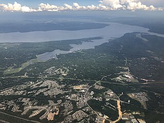
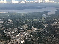
Stafford is a census-designated place in and the county seat of Stafford County in the northern part of the U.S. Commonwealth of Virginia. The population of Stafford County as of the 2010 United States Census was 128,984. It lies 10 miles (16 km) north of Fredericksburg, approximately 40 miles (64 km) south of Washington, D.C., and about 60 miles (97 km) north of Richmond, the state capital. Marine Corps Base Quantico is located north of the community. Stafford Courthouse is located at the intersections of U.S. Route 1 and Courthouse Road.

Chatham Heights is an unincorporated community in Stafford County, in the U.S. state of Virginia.

McNair is a census-designated place located in the Oak Hill section of Fairfax County, Virginia, United States. It is directly to the east of Washington Dulles International Airport. The population as of the 2010 census was 17,513. Much of the population resides in the McNair Farms planned community. The community has a school called McNair Elementary.
Leon Mark Dudenhefer is an American politician. A Republican, he was elected to the Virginia House of Delegates in 2011. He represented the 2nd district, made up of parts of Prince William and Stafford counties in Northern Virginia. Previously, he served 2005–2011 on the Stafford County Board of Supervisors, representing the Garrisonville district. After deciding not to seek re-election to the House of Delegates in 2017, he decided to run for the Stafford County Board of Supervisors again, and was elected by a margin of 12 votes.
Kincora is a census-designated place in Loudoun County, Virginia, United States. The CDP was first drawn prior to the 2020 census.