Budapest is an unincorporated community in Ripley County, in the U.S. state of Missouri.

Kimble is an unincorporated community in northeastern Texas County, Missouri, United States. It is located just east of U.S. Route 63, approximately six miles north of Licking.
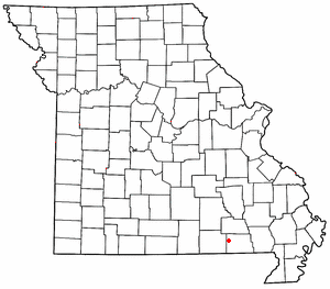
Bardley is an unincorporated community on the Oregon/Ripley county line in the U.S. state of Missouri. It is located on Missouri Route J approximately two miles north of U.S. Route 160 and fourteen miles east of Alton.
Pine is a small unincorporated community in western Ripley County, Missouri, United States. It is located on a county road in the Mark Twain National Forest, approximately sixteen miles northwest of Doniphan.

Poynor is an unincorporated community in southern Ripley County, Missouri, United States. It is located on Route 21, approximately seven miles southwest of Doniphan. It lies about 1.5 miles north of the Missouri-Arkansas border.
Denton is an unincorporated community in Pemiscot County, in the U.S. state of Missouri.
Bennett is an extinct town in western Ripley County, in the U.S. state of Missouri. The GNIS classifies it as a populated place. The community is located on the North Fork Buffalo Creek in the Mark Twain National Forest.
Doyle is an unincorporated community in Ripley County, in the U.S. state of Missouri.
Flatwoods is an unincorporated community in Ripley County, in the U.S. state of Missouri.
Gamburg is an unincorporated community in Ripley County, in the U.S. state of Missouri.
Glenn is an unincorporated community in southeastern Ripley County, in the U.S. state of Missouri.
Handy is an unincorporated community in the northwest corner of Ripley County, in the U.S. state of Missouri.
Leibig is an unincorporated community in southwestern Ripley County, in the U.S. state of Missouri. The community is located approximately eight miles southwest of Doniphan and three miles north of the Missouri-Arkansas border. The Fourche River is just west of the village.
Ponder is an extinct town in southwestern Ripley County, in the U.S. state of Missouri. The GNIS classifies it as a populated place. The community is located on Missouri Route 142 between Doniphan to the east and Gatewood to the west. Fourche Creek passes just east of the site.
Pratt is an unincorporated community in southwest Ripley County, in the U.S. state of Missouri. The community lies six miles south of Doniphan on Missouri Route A, 1.5 miles north of the Arkansas line and one mile west of the Current River.
Torch is an unincorporated community in Ripley County, in the U.S. state of Missouri.
Tucker is an extinct town in southwestern Ripley County, in the U.S. state of Missouri. The GNIS classifies it as a populated place. The community lies on Missouri Route Z, south of Gatewood and three miles north of the Missouri-Arkansas border.
Gatewood Township is an inactive township in Ripley County, in the U.S. state of Missouri.
Pine Township is an inactive township in Ripley County, in the U.S. state of Missouri.
Melva is an extinct town in southern Taney County, in the Ozarks of southwest Missouri. The GNIS classifies it as a populated place. The site was located south of Hollister on the east bank of Turkey Creek along the Missouri Pacific Railroad. On March 11, 1920, the town was destroyed by a deadly tornado that killed 11 people, including 9 children. Some of the remains of Melva, mostly foundations of homes, remain on the site today.

