
In geodesy, the figure of the Earth is the size and shape used to model planet Earth. The kind of figure depends on application, including the precision needed for the model. A spherical Earth is a well-known historical approximation that is satisfactory for geography, astronomy and many other purposes. Several models with greater accuracy have been developed so that coordinate systems can serve the precise needs of navigation, surveying, cadastre, land use, and various other concerns.

The Adventures of Tom Bombadil is a 1962 collection of poetry by J. R. R. Tolkien. The book contains 16 poems, two of which feature Tom Bombadil, a character encountered by Frodo Baggins in The Lord of the Rings. The rest of the poems are an assortment of bestiary verse and fairy tale rhyme. Three of the poems appear in The Lord of the Rings as well. The book is part of Tolkien's Middle-earth legendarium.
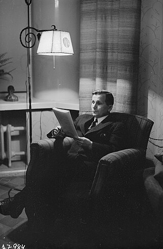
Reino Antero Hirvonen (1908–1989) was a famous Finnish physical geodesist, also well known for contributions in mathematical and astronomical geodesy.
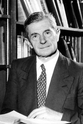
Veikko Aleksanteri Heiskanen was a Finnish geodesist and geophysicist. He was known for his refinement of George Biddell Airy and John Henry Pratt's theories of isostasy into his own, the Heiskanen hypothesis. With Felix Andries Vening Meinesz, he wrote the textbook The Earth and its Gravity Field (1958), and in 1960 a paper by Heiskanen, "The latest achievements of physical geodesy" was discussed in the scientific literature. With Helmut Moritz, Heiskanen wrote the textbook Physical Geodesy (1967), which became a standard text the field of geodesy and for the study of the geoid. Heiskanen's doctoral students include Ivan I. Mueller.
Sydney Chapman was a British mathematician and geophysicist. His work on the kinetic theory of gases, solar-terrestrial physics, and the Earth's ozone layer has inspired a broad range of research over many decades.

Sir Harold Jeffreys, FRS was a British geophysicist who made significant contributions to mathematics and statistics. His book, Theory of Probability, which was first published in 1939, played an important role in the revival of the objective Bayesian view of probability.
Keith Edward Bullen FAA FRS was a New Zealand-born mathematician and geophysicist. He is noted for his seismological interpretation of the deep structure of the Earth's mantle and core. He was Professor of Applied Mathematics at the University of Sydney in Australia from 1945 until 1971.
The Journal of Geophysical Research is a peer-reviewed scientific journal. It is the flagship journal of the American Geophysical Union. It contains original research on the physical, chemical, and biological processes that contribute to the understanding of the Earth, Sun, and Solar System. It has seven sections: A, B, C (Oceans), D (Atmospheres), E (Planets), F, and G (Biogeosciences). All current and back issues are available online for subscribers.

The International Union of Geodesy and Geophysics is an international non-governmental organization dedicated to the scientific study of Earth and its space environment using geophysical and geodetic techniques.

Col Alexander Ross Clarke FRS FRSE (1828–1914) was a British geodesist, primarily remembered for his calculation of the Principal Triangulation of Britain (1858), the calculation of the Figure of the Earth and one of the most important text books of Geodesy (1880). He was an officer of the Royal Engineers employed on the Ordnance Survey.
Karl-Rudolf Koch is a German geodesist and professor at the University of Bonn (FRG). In the global geodetic community, he is well known for his research work in geodetic statistics, particularly robust parameter estimation and in gravity field models.
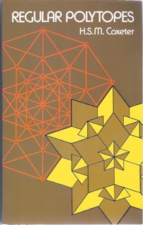
Regular Polytopes is a geometry book on regular polytopes written by Harold Scott MacDonald Coxeter. It was originally published by Methuen in 1947 and by Pitman Publishing in 1948, with a second edition published by Macmillan in 1963 and a third edition by Dover Publications in 1973. The Basic Library List Committee of the Mathematical Association of America has recommended that it be included in undergraduate mathematics libraries.
An Earth ellipsoid or Earth spheroid is a mathematical figure approximating the Earth's form, used as a reference frame for computations in geodesy, astronomy, and the geosciences. Various different ellipsoids have been used as approximations.
The International Association of Geodesy (IAG) is a constituent association of the International Union of Geodesy and Geophysics.

Irene Kaminka Fischer was an Austrian-American mathematician and geodesist. She was a member of the National Academy of Engineering, a Fellow of the American Geophysical Union, and inductee of the National Imagery and Mapping Agency Hall of Fame. Fischer became one of two internationally known women scientists in the field of geodesy during the golden age of the Project Mercury and the Apollo program. Her Mercury datum, as well as her work on the lunar parallax, were instrumental in conducting these missions. "In his preface to the ACSM publication, Fischer's former colleague, Bernard Chovitz, referred to her as one of the most renowned geodesists of the third quarter of the twentieth century. Yet this fact alone makes her one of the most renowned geodesists of all times, because, according to Chovitz, the third quarter of the twentieth century witnessed "the transition of geodesy from a regional to a global enterprise."
Brigadier Guy Bomford was a British geodesist who, at various times in his career, worked for both the Survey of India and the Corps of Royal Engineers. He is best known for Geodesy, a textbook he wrote, as well as his work in military surveying and mapping. From 1963 to 1967 he served as the president of the International Association of Geodesy; the association's Guy Bomford Prize is named for him.
Thomas A. Herring is a geophysicist, known for developing and applying systems of space geodesy to high-precision geophysical measurements and geodynamic research.
Ivan Istvan Mueller was a Hungarian-American geodesist and professor at Ohio State University, a leading training center for geodesy in the USA.
James de Graaff-Hunter was a British geodesist who served as director of Survey of India's Geodetic Branch from 1928 to 1932, and as President of the International Association of Geodesy from 1954 to 1957.
Pierre Antoine Ernest Tardi was a French geophysicist, astronomer, and geographer. From 1946 to 1960, he was the secretary general of the International Association of Geodesy, and editor-in-chief of the Bulletin Géodésique from 1946 to 1951. He also served as president of the Société astronomique de France from 1964 to 1966.
