Geography of Mauritius

Last updated

Mauritius
Native name:
Moris
Nickname: The Star and Key of the Indian Ocean
Mauritius island location.svg
Location of Mauritius
Mauritius Island map-fr.svg
Geography
Location Indian Ocean
Coordinates 20°17′S57°33′E / 20.283°S 57.550°E / -20.283; 57.550
Archipelago Mascarene Islands
Area2,011 km2 (776 sq mi)
Highest elevation828 m (2717 ft)
Highest point Piton de la Petite Rivière Noire
Administration
Largest settlement Port Louis (pop. 147,688)
Demographics
Population1,264,866 (2007)
Pop. density616/km2 (1595/sq mi)
Ethnic groups Indo-Mauritian 68%, Mauritian Creole people 27%, Sino-Mauritian 3%, Franco-Mauritian 2%

Mauritius is an island off Africa's southeast coast located in the Indian Ocean, east of Madagascar. It is geologically located within the Somali plate.

Contents

Statistics

Satellite image of Mauritius L'ile Maurice vue par Sentinel 2 (cropped).jpg
Satellite image of Mauritius

Area (includes Agaléga, Cargados Carajos (St. Brandon), and Rodrigues):
total: 2,011 km2
land: 2,030 km2
water: 10 km2
note: includes Agalega Islands, Cargados Carajos Shoals (St. Brandon), and Rodrigues.

Coastline: 177 km

Maritime claims:territorial sea:12 nmi (22.2 km; 13.8 mi)
continental shelf:200  nmi (370.4 km; 230.2 mi) or to the edge of the continental margin
exclusive economic zone:200 nmi (370.4 km; 230.2 mi)

Elevation extremes:
lowest point: Indian Ocean 0 m
highest point: Piton de la Petite Rivière Noire 828 m

Natural resources: arable land, fish

Land use:
arable land: 38.24%
permanent crops: 1.96%
other: 59.80% (2011)

Irrigated land: 212.2 km2 (2003)

Total renewable water resources: 2.75 km3 (2011)

Environment - current issues: water pollution, degradation of coral reefs, overfishing (Mauritius), sea wreck pollution [1] (Cargados Carajos Shoals), Illegal, unreported and unregulated fishing by foreign, primarily Taiwanese commercial vessels and Mauritian Fishing Cooperatives, invasive alien species, illegal net fishing in the St. Brandon Lagoon by unlicenced, non resident fishing operators.

Environment - international agreements:
party to: Antarctic-Marine Living Resources, Biodiversity, Climate Change, Climate Change-Kyoto Protocol, Desertification, Endangered Species, Environmental Modification, Hazardous Wastes, Law of the Sea, Marine Life Conservation, Ozone Layer Protection, Ship Pollution, Wetlands

Geography - note: The main island is from which the country derives its name, former home of the dodo, a large flightless bird related to pigeons, driven to extinction by the end of the 17th century through a combination of hunting and the introduction of predatory species.

Landscape near Les Mariannes, Mauritius, 2007-09-09.jpg
Landscape near Les Mariannes.

Table of Islands

IslandCapitalOther CitiesArea (km2)Population
Agalega Islands Vingt-Cinq La Fourche, St Rita, Port St James26.0290
Cargados Carajos Île Raphael Avocaré Island, L'île du Sud, L'Île Coco, L'île du Gouvernement 3.263
Islets of Mauritius Port Louis 18711252980
Ile aux Benitiers Ile aux Benitiers 0.710
Ile Aux Cerfs Le Touessrok Resort 1.20
Ile des deux Cocos deux Cocos resort 0.042
Mauritius Island Port Louis Beau-Bassin Rose-Hill, Quatre Bornes, Vacoas-Phoenix, Curepipe 18601252964
More Mauritius Islands Ile aux Aigrettes Ronde Island, Ile de la Passe, Coin du Mire, Ile D’Ambre, Ile Plate, Ilot Gabriel, Grand Port Islets, Ile aux Serpents, Ile de L’Est8.81
Islets of Rodrigues Port Mathurin 11138167
Ile Crabe Rodrigues Port Crabe 0.42
Rodrigues Island Port Mathurin Gabriel, Riviere Cocos, port south east10938164
More Rodrigues Islands Ile aux Cocos Ile Fregate, Ile aux Sables, Ile aux Chats, le Hermitage, Ile Gombrani1.361
Mauritius Port Louis 20111291500

notes: excludes Tromelin and other îles éparses

Climate

A comprehensive map of Mauritius, including the country's outlying islands Mauritius2021OSM.png
A comprehensive map of Mauritius, including the country's outlying islands

The local climate is tropical, modified by southeast trade winds; there is a warm, dry winter from May to November and a hot, wet, and humid summer from November to May. Anticyclones affect the country during May to September.

Cyclones affect Mauritius during November–April. Hollanda (1994) and Dina (2002) were the worst two of the more recent cyclones to have affected the island.

Climate data for Port Louis
MonthJanFebMarAprMayJunJulAugSepOctNovDecYear
Record high °C (°F)35
(95)
33
(91)
32
(90)
31
(88)
29
(84)
28
(82)
27
(81)
27
(81)
28
(82)
31
(88)
33
(91)
35
(95)
35
(95)
Mean daily maximum °C (°F)31.5
(88.7)
31.4
(88.5)
31.5
(88.7)
30.7
(87.3)
29.3
(84.7)
27.6
(81.7)
26.7
(80.1)
26.8
(80.2)
27.7
(81.9)
28.8
(83.8)
30.2
(86.4)
31.1
(88.0)
29.4
(85.0)
Mean daily minimum °C (°F)24.1
(75.4)
24.0
(75.2)
23.8
(74.8)
23.0
(73.4)
21.5
(70.7)
19.9
(67.8)
19.3
(66.7)
19.1
(66.4)
19.4
(66.9)
20.4
(68.7)
21.8
(71.2)
23.2
(73.8)
21.6
(70.9)
Record low °C (°F)17
(63)
18
(64)
17
(63)
14
(57)
13
(55)
11
(52)
11
(52)
10
(50)
11
(52)
13
(55)
14
(57)
17
(63)
10
(50)
Average rainfall mm (inches)131
(5.2)
160
(6.3)
83
(3.3)
87
(3.4)
48
(1.9)
24
(0.9)
18
(0.7)
19
(0.7)
17
(0.7)
15
(0.6)
24
(0.9)
85
(3.3)
711
(27.9)
Average rainy days (≥ 1.0 mm)910876445333668
Mean monthly sunshine hours 2482262172402482102172172402792702792,891
Source 1: World Meteorological Organization. [2]
Source 2: BBC Weather [3]

Terrain

The country's landscape consists of a small coastal plain rising to discontinuous mountains encircling a central plateau. Mauritius is almost completely surrounded by reefs that may pose maritime hazards. The main island is of volcanic origin.

The mountains with the greatest prominence include:

Piton de la Petite Rivière Noire, 828 m, the highest point of the island [4]

Le Morne Brabant, 556 m

Tourelle de Tamarin, 563 m [5]

Corps de Garde, 720 m, prominence 382 m [6]

Le Pouce, 820 m, prominence 352 m [7]

Pieter Both, 820 m, prominence 229 m [8]

Montagne Cocotte, 780 m

Extreme points

This is a list of the extreme points of Mauritius, the points that are farther north, south, east or west than any other location.

See also

Related Research Articles

<span class="mw-page-title-main">Mascarene Islands</span> Group of islands in the Indian Ocean

The Mascarene Islands or Mascarenes or Mascarenhas Archipelago is a group of islands in the Indian Ocean east of Madagascar consisting of islands belonging to the Republic of Mauritius as well as the French department of La Réunion. Their name derives from the Portuguese navigator Pedro Mascarenhas, who first visited them in April 1512. The islands share a common geological origin beneath the Mascarene Plateau known as the Mauritia (microcontinent) which was a Precambrian microcontinent situated between India and Madagascar until their separation about 70 million years ago. They form a distinct ecoregion with unique biodiversityand endemism of flora and fauna.

<span class="mw-page-title-main">Outer Islands of Mauritius</span> Islands administered by, but not parts of the mainland of Mauritius

The Outer Islands of Mauritius is the first-level administrative divisions of the country and consists of the islands of Mauritius and several outlying islands. The Outer Islands of Mauritius are managed under the aegis of the Prime Minister of Mauritius through Prime Minister's Office by the Outer Islands Development Corporation which is the authority empowered under the law to manage the Outer Islands of Mauritius. The Prime Minister is also Minister for Rodrigues, Outer Islands and Territorial Integrity. The Constitution of Mauritius states that the Republic of Mauritius includes the islands of Agaléga, Mauritius, Rodrigues, Saint Brandon, Tromelin Island, and the Chagos Archipelago. The Government of Mauritius claims sovereignty over the Chagos Archipelago, which the United Kingdom split from its territories to create the British Indian Ocean Territory before its independence in 1968. Additionally, France shares a sovereignty claim over Tromelin Island, an uninhabited island between Madagascar and Mauritius's main island.

<span class="mw-page-title-main">St. Brandon</span> Mauritian atoll in the Indian Ocean

Saint Brandon, also known as the Cargados Carajos Shoals, is a southwest Indian Ocean archipelago of sand banks, shoals and islets belonging to the Republic of Mauritius. It lies about 430 km (270 mi) northeast of the island of Mauritius. It consists of five island groups, with about 28-40 islands and islets in total, depending on seasonal storms and related sand movements.

<span class="mw-page-title-main">Mascarene Plateau</span> Submarine plateau in the western Indian Ocean

The Mascarene Plateau is a submarine plateau in the Indian Ocean, north and east of Madagascar. The plateau extends approximately 2,000 km (1,200 mi), from Seychelles in the north to Réunion in the south. The plateau covers an area of over 115,000 km2 (44,000 sq mi) of shallow water, with depths ranging from 8–150 m (30–490 ft), plunging to 4,000 m (13,000 ft) to the abyssal plain at its edges.

The Districts of the Republic of Mauritius are the second-level administrative divisions after the Outer Islands of Mauritius.

<span class="mw-page-title-main">Piton de la Petite Rivière Noire</span> Mountain in Mauritius

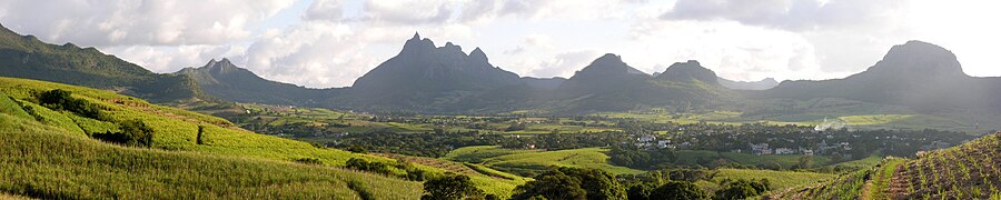
Piton de la Petite Rivière Noire is the highest mountain on the island of Mauritius, in the Indian Ocean. Located in the Rivière Noire District and rising to a height of 828 m (2,717 ft) above sea level, it forms part of the Black River mountain range.

<span class="mw-page-title-main">France Staub</span> Mauritian ornithologist, herpetologist, botanist and conservationist

France Staub was a Mauritian ornithologist, herpetologist, botanist, and conservationist.

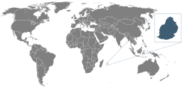
The wildlife of Mauritius consists of its flora and fauna. Mauritius is located in the Indian Ocean to the east of Madagascar. Due to its isolation, it has a relatively low diversity of wildlife; however, a high proportion of these are endemic species occurring nowhere else in the world. Many of these are now threatened with extinction because of human activities including habitat destruction and the introduction of non-native species. Some have already become extinct, most famously the dodo which disappeared in the 17th century.

<span class="mw-page-title-main">Outline of Mauritius</span> Overview of and topical guide to Mauritius

The following outline is provided as an overview of and topical guide to Mauritius:

The following is an index of Mauritius-related topics by alphabetical order. For a list by topic, see list of Mauritius-related topics

<span class="mw-page-title-main">Île Raphael</span> Outer island of Mauritius

Île Raphael is an island in the Saint Brandon archipelago, a group of 30 outer islands of Mauritius. The island is named after Veuve Raphaël. Veuve Raphaël's husband was a sea captain and had installations on the corner of rue (route) des Pamplemousses and rue Fanfaron in Port Louis. Captain Raphaël travelled regularly to Île Raphael, St Brandon from Port Louis and, on 17 May 1816 and November 1817, is on record as bringing back salted fish on a Lugger called 'Le Cheriby'. Île Raphaël is today the headquarters and principal fishing base of the Raphael Fishing Company which is the second oldest commercial company in Mauritius.

<span class="mw-page-title-main">L'île du Sud</span> Island in Cargados Carajos coral reef atoll system

L'île du Sud is an island located in the St. Brandon archipelago. It is one of the three islands used as a base of operations for fishing activities by Raphael Fishing Company, the only resident fishing company in the Cargados Carajos shoals under a 1901 contract with the government of Mauritius.

<span class="mw-page-title-main">Avocaré Island</span>

Avocaré Island is an island located in the St Brandon archipelago.

<span class="mw-page-title-main">Permanent grant</span> Permanent lease by the United Kingdom Privy Council

A 999-year lease, under historic common law, is a permanent lease of property. Permanent lease locations are in Britain, its former colonies and the Commonwealth. A former colony, the Republic of Mauritius established legal precedent on 30 July 2008 in respect of a 1901 'permanent lease' on the following islands of St. Brandon :

<span class="mw-page-title-main">L'Île Coco</span> Island in Mauritius

L'Île Coco is one of the longest islands adjoining the inner lagoon of the St. Brandon archipelago. It is at times inhabited by fishermen as a base for the resident fishing company's fishing activities as well as for fly fishing and fly-casting activities.

<span class="mw-page-title-main">Raphael Fishing Company</span> Raphaël Fishing Company

The Raphaël Fishing Company Ltd is a Mauritian fishing company incorporated on 7 July 1927 in Port Louis, Mauritius. It is the second oldest commercial company in Mauritius, after Mauritius Commercial Bank (1828).

References

  1. "Taiwanese Longliner Goes Aground on Mauritius' Saint Brandon Shoal". oceancrew.org. Retrieved 2024-06-02.
  2. World Weather Information Service-Port Louis, World Meteorological Organization. Retrieved 29 September 2012.
  3. "Average Conditions Port Louis, Mauritius". BBC Weather. Retrieved 29 September 2012.
  4. "Piton de la Petite Rivière Noire - Peakbagger.com". www.peakbagger.com. Retrieved 2020-12-01.
  5. "Tourelle du Tamarin". peakery.com. Retrieved 2020-12-01.
  6. "Corps de Garde - Peakbagger.com". www.peakbagger.com. Retrieved 2020-12-01.
  7. "Le Pouce". peakery.com. Retrieved 2020-12-01.
  8. "Pieter Both - Peakbagger.com". www.peakbagger.com. Retrieved 2020-12-01.

PD-icon.svg This article incorporates public domain material from The World Factbook. CIA.