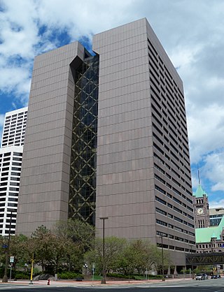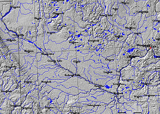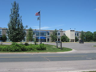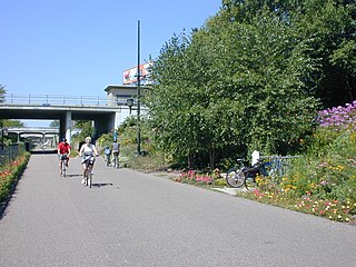
Hennepin County is a county in the U.S. state of Minnesota. Its county seat is Minneapolis, the state's most populous city. The county is named in honor of the 17th-century explorer Father Louis Hennepin. The county extends from Minneapolis to the suburbs and outlying cities in the western part of the county. The county’s natural areas are covered with extensive woods, hills, and lakes.

Minnetonka is a city in Hennepin County, Minnesota, United States. A western suburb of the Twin Cities, Minnetonka is located about 10 miles (16 km) west of downtown Minneapolis. At the 2020 census, the city's population was 53,781.

Saint Anthony Falls, or the Falls of Saint Anthony located at the northeastern edge of downtown Minneapolis, Minnesota, is the only natural major waterfall on the Mississippi River. Throughout the mid-to-late 1800’s, various dams were built atop the east and west faces of the falls to support the milling industry that spurred the growth of the city of Minneapolis. In 1880, the central face of the falls was reinforced with a sloping timber apron to stop the upstream erosion of the falls. In the 1950s, the apron was rebuilt with concrete, which makes up the most visible portion of the falls today. A series of locks were constructed in the 1950s and 1960s to extend navigation to points upstream.

Minnehaha Park is a city park in Minneapolis, Minnesota, United States, and home to Minnehaha Falls and the lower reaches of Minnehaha Creek. Officially named Minnehaha Regional Park, it is part of the Minneapolis Park and Recreation Board system and lies within the Mississippi National River and Recreation Area, a unit of the National Park Service. The park was designed by landscape architect Horace W.S. Cleveland in 1883 as part of the Grand Rounds Scenic Byway system, and was part of the popular steamboat Upper Mississippi River "Fashionable Tour" in the 1800s.

The Grand Rounds National Scenic Byway is a linked series of park areas in Minneapolis, Minnesota, United States, that takes a roughly circular path through the city. The Minneapolis Park and Recreation Board developed the system over many years. The corridors include roads for automobile traffic plus separate paths for pedestrians and bicycles, and extend slightly into neighboring cities. About 50 miles (80 km) of roadway and paths are in the system, and much of it was built in the 1930s as part of Civilian Conservation Corps projects.

The Mississippi National River and Recreation Area is a 72-mile (116 km) and 54,000-acre (22,000 ha) protected corridor along the Mississippi River through the Minneapolis–Saint Paul metro in the U.S. state of Minnesota, from the cities of Dayton and Ramsey, to just downstream of Hastings. This stretch of the upper Mississippi River includes natural, historical, recreational, cultural, scenic, scientific, and economic resources of national significance. This area is the only national park site dedicated exclusively to the Mississippi River. The Mississippi National River and Recreation Area is sometimes abbreviated as MNRRA or MISS, the four letter code assigned to the area by the National Park Service. The Mississippi National River and Recreation Area is classified as one of four national rivers in the United States, and despite its name it is technically not one of the 40 national recreation areas.

The Upper Mississippi River is the portion of the Mississippi River upstream of St. Louis, Missouri, United States, at the confluence of its main tributary, the Missouri River.

The geology of Minnesota comprises the rock, minerals, and soils of the U.S. state of Minnesota, including their formation, development, distribution, and condition.

The glacial history of Minnesota is most defined since the onset of the last glacial period, which ended some 10,000 years ago. Within the last million years, most of the Midwestern United States and much of Canada were covered at one time or another with an ice sheet. This continental glacier had a profound effect on the surface features of the area over which it moved. Vast quantities of rock and soil were scraped from the glacial centers to its margins by slowly moving ice and redeposited as drift or till. Much of this drift was dumped into old preglacial river valleys, while some of it was heaped into belts of hills at the margin of the glacier. The chief result of glaciation has been the modification of the preglacial topography by the deposition of drift over the countryside. However, continental glaciers possess great power of erosion and may actually modify the preglacial land surface by scouring and abrading rather than by the deposition of the drift.

Minneapolis is the largest city by population in the U.S. state of Minnesota, and the county seat of Hennepin County. The origin and growth of the city was spurred by the proximity of Fort Snelling, the first major United States military presence in the area, and by its location on Saint Anthony Falls, which provided power for sawmills and flour mills.
Glacial River Warren, also known as River Warren, was a prehistoric river that drained Lake Agassiz in central North America between about 13,500 and 10,650 BP calibrated years ago. A part of the uppermost portion of the former river channel was designated a National Natural Landmark in 1966.

The River Warren Falls was a massive waterfall on the glacial River Warren initially located in present-day Saint Paul, Minnesota, United States. The waterfall was 2700 feet (823 m) across and 175 feet (53 m) high.

The Eastman tunnel, also called the Hennepin Island tunnel, was a 2,000-foot-long (610 m) underground passage in Saint Anthony, Minnesota, dug beneath the Mississippi River riverbed between 1868 and 1869 to create a tailrace so water-powered business could be located upstream of Saint Anthony Falls on Nicollet Island. The tunnel ran downstream from Nicollet Island, beneath Hennepin Island, and exited below Saint Anthony Falls.

Saint Paul is the second largest city in the U.S. state of Minnesota, the county seat of Ramsey County, and the state capital of Minnesota. The origin and growth of the city were spurred by the proximity of Fort Snelling, the first major United States military installation in the area, as well as by the city's location on the northernmost navigable port of the Upper Mississippi River.

The Minneapolis Park and Recreation Board (MPRB) is an independent park district that owns, maintains, and programs activities in public parks in Minneapolis, Minnesota, United States. It has 500 full-time and 1,300 part-time employees and an $111 million operating and capital budget.

Brownie Lake is a lake in Hennepin County, Minnesota, and within the city limits of Minneapolis. It is the northernmost lake in the Minneapolis Chain of Lakes. It is within Brownie Lake Park, and administered by the Minneapolis Park and Recreation Board (MPRB).

Winchell Trail is a five-mile (8 km) round trip, pedestrian-only trail in Minneapolis, Minnesota, United States, that runs along the west side of the Mississippi River between Franklin Avenue South and East 44th Street. Popular with bird watchers and naturalists, the rustic trail provides Upper Mississippi River gorge access and views. The trail is separate from the adjacent multi-use bicycle path, taking hikers past sandy beaches, an oak savanna restoration project, and the floodplain forest. The trail has multiple access points and the section from East 38th Street to East 44th Street is paved. Described as moderate and for all hiking skill levels, the out-and-back Winchell Trail has total elevation gain of 501 feet (153 m). Portions of the trail can be hiked in near solitude as its age and general destitute make it a widely forgotten place to explore.

Minnehaha Trail is a 1.5-mile (2.4 km) paved, multi-use trail in Minneapolis, Minnesota, United States, that connects Minnehaha Regional Park and Fort Snelling State Park – two of the most popular recreation destinations in the Twin Cities metro area. The trail is considered a segment of a longer, loosely connected bicycle route system along the Mississippi River. Users of Minnehaha Trail traverse under a forest canopy. The trail received local recognition for its natural beauty, but it was criticized for its worn pavement and lack of signage.

Minneapolis is often considered one of the top biking and walking cities in the United States due to its vast network of trails and dedicated pedestrian areas. In 2020, Walk Score rated Minneapolis as 13th highest among cities over 200,000 people. Some bicycling ratings list Minneapolis at the top of all United States cities, while others list Minneapolis in the top ten. There are over 80 miles (130 km) of paved, protected pathways in Minneapolis for use as transportation and recreation. The city's Grand Rounds National Scenic Byway parkway system accounts for the vast majority of the city's shared-use paths at approximately 50 miles (80 km) of dedicated biking and walking areas. By 2008, other city, county, and park board areas accounted for approximately 30 miles (48 km) of additional trails, for a city-wide total of approximately 80 miles (130 km) of protected pathways. The network of shared biking and walking paths continued to grow into the late 2010s with the additions of the Hiawatha LRT Trail gap remediation, Min Hi Line pilot projects, and Samatar Crossing. The city also features several natural-surface hiking trails, mountain-biking paths, groomed cross-country ski trails in winter, and other pedestrian walkways.

Mississippi Gorge Regional Park is a regional park along the east and west bluffs of the Mississippi River in the cities of Minneapolis and Saint Paul in the U.S. state of Minnesota. The two-city park area is between Mississippi river miles 848 and 852, from just south of Northern Pacific Bridge Number 9 to just north of Minnehaha Regional Park, and lies within the Mississippi National River and Recreation Area. The park area protects scenic and natural areas of the Mississippi River gorge, the only true gorge along the entire length of the 2,320-mile (3,730 km) river.


