George Street | |
|---|---|
 | |
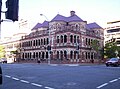
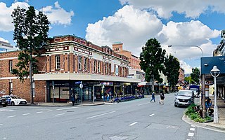
| George Street from Queen Street intersection | |
 | |
 George Street | |
| Coordinates | |
| General information | |
| Type | Street |
| Location | Brisbane |
George Street is a major street located in the Brisbane CBD in Brisbane, Queensland, Australia.
George Street | |
|---|---|
| | |
| George Street from Queen Street intersection | |
| | |
| George Street | |
| Coordinates | |
| General information | |
| Type | Street |
| Location | Brisbane |
George Street is a major street located in the Brisbane CBD in Brisbane, Queensland, Australia.
George Street extends from the Queensland University of Technology's Garden Point campus and City Botanic Gardens at its south-east end ( 27°28′32″S153°01′41″E / 27.4756°S 153.0281°E ), through the commercial centre of Brisbane (Queen Street and Queen Street Mall), through to Roma Street railway station at its north-west end ( 27°28′00″S153°01′11″E / 27.4667°S 153.0196°E ). [1]
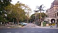
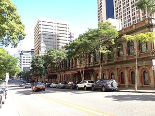
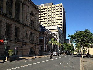
The State Parliament House building for the state of Queensland and Brisbane Square, as well as the Queen Elizabeth II Courts of Law and the State Law Building are found on the street. Queens Gardens, Treasury Building, Lands Administration Building and The Mansions are all located on George Street. Other office towers built on George Street include 111 George Street, 275 George Street and 400 George Street. At the northern end is the Roma Street railway station.

George Street as well as Queen Street, Wickham Street and the area known as Petrie Bight were unsealed and often dusty before 1899. [2] In 1897, the North Brisbane Council held an election on whether a loan should be raised so the streets could be woodblocked. Agreement was given after a close decision by only a third of registered voters, however the results were limited as the surface was very slippery during the rain and buckled during heavy rains. [2]
The first private residence in Brisbane, a weatherboard, low-ceilinged cottage, was built on George Street. [3] The building remained intact into the 1880s but like similar early houses in the central business district they have been demolished and the land redeveloped. [3]

In 1867, the Menzies Private Hotel was established at 28 George Street (corner of Margaret Street and adjacent to the Queensland Club). [4] It was refurbished and re-opened as the Kingsley Private Hotel in July 1922. [5] It has since been demolished.

The Bellevue Hotel opened on the western corner of George and Alice Streets c. 1885. It served for many years as Brisbane's premier hotel. Without any prior public announcement, the Queensland Government demolished the building overnight on 20 April 1979. [6]
In 1911, Queensland belatedly established its first university, the University of Queensland, in the Old Government House at the end of George Street. [7] By the late 1930s, the university outgrew this site, moving its main campus to St Lucia after World War II. [8]
George Street has a number of heritage-listed sites, including:

The Queen's Wharf development of an entertainment precinct will be bounded by Queen Street, George Street, Alice Street and the Brisbane River (including all of William Street). [26] All of the non-heritage buildings on the site will be demolished.


This article contains a bulleted list or table of intersections which should be presented in a properly formatted junction table.(December 2021) |

Kangaroo Point is an inner southern suburb in the City of Brisbane, Queensland, Australia. In the 2016 census, Kangaroo Point had a population of 8,063 people.
Fortitude Valley is an inner suburb of the City of Brisbane, the state capital of Queensland, Australia. In the 2021 census, Fortitude Valley had a population of 9,708 people. The suburb features two pedestrian malls at Brunswick Street Mall and Chinatown, and is one of the hubs of Brisbane's nightlife, renowned for its nightclubs, bars and adult entertainment.

The Mansions is a heritage-listed row of six terrace houses at 40 George Street, Brisbane City, City of Brisbane, Queensland, Australia. It was designed by G.H.M. Addison and built in 1889 by RE Burton. It was added to the Queensland Heritage Register on 21 August 1992.

Queens Gardens is a heritage-listed park located on a city block between George Street, Elizabeth Street and William Street in the Brisbane CBD, City of Brisbane, Queensland, Australia. It was built from c. 1905 to 1990s. It is also known as Executive Gardens and St Johns Church Reserve. It was added to the Queensland Heritage Register on 21 October 1992.

Brisbane City is the central suburb and central business district of Brisbane, the state capital of Queensland, Australia. It is colloquially referred to as the "Brisbane CBD" or "the city". It is located on a point on the northern bank of the Brisbane River, historically known as Meanjin, Mianjin or Meeanjin in the local Aboriginal Australian dialect. The triangular shaped area is bounded by the median of the Brisbane River to the east, south and west. The point, known at its tip as Gardens Point, slopes upward to the north-west where the city is bounded by parkland and the inner city suburb of Spring Hill to the north. The CBD is bounded to the north-east by the suburb of Fortitude Valley. To the west the CBD is bounded by Petrie Terrace, which in 2010 was reinstated as a suburb.

Petrie Terrace is an inner suburb in the City of Brisbane, Queensland, Australia. In the 2016 census, Petrie Terrace had a population of 1,124 people.

Spring Hill is an inner northern suburb in the City of Brisbane, Queensland, Australia. In the 2016 census, Spring Hill had a population of 5,974 people.

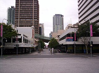
Queen Street is the main street of Brisbane, the capital of Queensland, Australia. It is named after Queen Victoria of the United Kingdom.

Land Administration Building is a heritage-listed former government building at 142 George Street, Brisbane City, City of Brisbane, Queensland, Australia. It was designed by Thomas Pye and built from 1899 to 1905 by Arthur Midson for the Queensland Government. It was also known as the Executive Building or (now) the Old Executive Building. It was added to the Queensland Heritage Register on 21 October 1992.
Ann Street runs parallel to Adelaide Street and is the northernmost street in the Brisbane CBD in Queensland, Australia. The street is named for Anne, Queen of Great Britain, as part of the CBD street naming series of female British royalty. It is a major thoroughfare, linking as a four-lane one-way street the suburb of Fortitude Valley in the northeast with the Riverside Expressway in the southwest; house numbers run the opposite direction.

Edward Street is a busy thoroughfare in the Brisbane central business district, Queensland, Australia. It is a one-way street located between Albert Street and Creek Street, and runs from Upper Edward Street to Alice Street. It is named after Edward VII of the United Kingdom.
Albert Street is a street in the Brisbane central business district, Queensland, Australia. It was named after Prince Albert, the Prince Consort of Queen Victoria of the United Kingdom. Albert Street railway station is being built directly beneath the street and is expected to open in 2024. The station precinct includes partial road closures as planned in the 2014 City Centre Master Plan, for the creation of a new public space.
William Street is a small, relatively quiet road in the uptown part of the Brisbane central business district. The street is historically significant to the city's early development as a penal colony. The first convict buildings were built along William Street in 1825.

Elizabeth Street is a major street in the centre of the city in Brisbane, Queensland, Australia. The street was one of the earliest in Brisbane being established at the beginning of settlement in Brisbane as Moreton Bay penal settlement. Today, most of the street is fronted by low-level retail outlets, with an increase in mixed use skyscrapers being recently constructed.

Alice Street is a street in the Brisbane CBD, Queensland, Australia. It is the most southern major road in the city's central business district, running parallel to the other female-named streets in the city. It was named after Princess Alice of the United Kingdom.
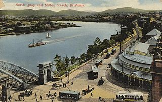
North Quay is a location in the Brisbane central business district and the name of a street in the same area, running along the Brisbane River from an intersection near Makerston Street to the top of the Queen Street mall, linking the Victoria Bridge and the William Jolly Bridge along the river’s northern bank. It was the site of Brisbane’s initial settlement, at a point where a stream flowing from Spring Hill provided fresh water, later collected in a reservoir on Tank Street.

Charlotte Street is a road in the central business district of Brisbane, Queensland, Australia. The street is one of a number that were named after female queens and princesses of the royal family shortly after the penal colony was settled. Mary Street runs parallel to the south and Elizabeth Street is the next street to the north.

Ipswich is the central suburb and central business district of Ipswich in the City of Ipswich, Queensland, Australia. It is also known as Ipswich CBD. In the 2016 census, the suburb had a population of 2,459 people.

Creek Street is a major street in the central business district of Brisbane, Queensland, Australia. The street follows a one-way south–north direction, starting at the beginning of Charlotte Street and cutting through Elizabeth Street, Queen Street, Adelaide Street, and Ann Street before coming to an end at Turbot Street in the northern end of the CBD. Creek Street was named for the filled-in creek over which it was constructed, and is an exception to the convention of parallel streets in the CBD being named after male royals.

The Moreton Bay Penal Settlement operated from 1825 to 1842. It became the city of Brisbane, Queensland, Australia.
![]() Media related to George Street, Brisbane at Wikimedia Commons
Media related to George Street, Brisbane at Wikimedia Commons