
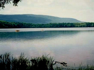
Sullivan County is a county located in the U.S. state of Pennsylvania. As of the 2010 census, the population was 6,428, making it the second-least populous county in Pennsylvania. Its county seat is Laporte. The county was created on March 15, 1847, from part of Lycoming County and named for Charles C. Sullivan, leader of the Pennsylvania Senate at that time.

The Last Glacial Period (LGP) occurred from the end of the Eemian to the end of the Younger Dryas, encompassing the period c. 115,000 – c. 11,700 years ago. The LGP is part of a larger sequence of glacial and interglacial periods known as the Quaternary glaciation which started around 2,588,000 years ago and is ongoing. The definition of the Quaternary as beginning 2.58 million years ago (Mya) is based on the formation of the Arctic ice cap. The Antarctic ice sheet began to form earlier, at about 34 Mya, in the mid-Cenozoic. The term Late Cenozoic Ice Age is used to include this early phase.

The Allegheny Plateau, in the United States, is a large dissected plateau area of the Appalachian Mountains in western and central New York, northern and western Pennsylvania, northern and western West Virginia, and eastern Ohio. It is divided into the unglaciated Allegheny Plateau and the glaciated Allegheny Plateau.

There have been five or six major ice ages in the history of Earth over the past 3 billion years. The Late Cenozoic Ice Age began 34 million years ago, its latest phase being the Quaternary glaciation, in progress since 2.58 million years ago.

The Anglian Stage is the name used in the British Isles for a middle Pleistocene glaciation. It precedes the Hoxnian Stage and follows the Cromerian Stage in the British Isles. The Anglian Stage is correlated to Marine Isotope Stage 12, which started about 478,000 years ago and ended about 424,000 years ago.
The Hoxnian Stage was a middle Pleistocene stage of the geological history of the British Isles. It was an interglacial which preceded the Wolstonian Stage and followed the Anglian Stage. It is equivalent to Marine Isotope Stage 11. Marine Isotope Stage 11 started 424,000 years ago and ended 374,000 years ago. The Hoxnian is divided into sub-stages Ho I to Ho IV.
The Wolstonian Stage is a middle Pleistocene stage of the geological history of Earth that precedes the Ipswichian Stage and follows the Hoxnian Stage in the British Isles. The Wolstonian Stage apparently includes three periods of glaciation. The Wolstonian Stage is temporally analogous to the Warthe Stage and Saalian Stage in northern Europe and the Riss glaciation in the Alps, and temporally equivalent to all of the Illinoian Stage and the youngest part of the Pre-Illinoian Stage in North America. It is contemporaneous with the North American Pre-Illinoian A, Early Illinoian, and Late Illinoian glaciations. The Wolstonian Stage is equivalent to Marine Isotope stages 6 through 10. It started 352,000 years ago and ended 130,000 years ago.
The Kansan glaciation or Kansan glacial was a glacial stage and part of an early conceptual climatic and chronological framework composed of four glacial and interglacial stages.
The Illinoian Stage is the name used by Quaternary geologists in North America to designate the period c.191,000 to c.130,000 years ago, during the middle Pleistocene, when sediments comprising the Illinoian Glacial Lobe were deposited. It precedes the Sangamonian Stage and follows the Pre-Illinoian Stage in North America. The Illinoian Stage is defined as the period of geologic time during which the glacial tills and outwash, which comprise the bulk of the Glasford Formation, accumulated to create the Illinoian Glacial Lobe. It occurs at about the same time as the penultimate glacial period.
The Yarmouthian stage and the Yarmouth Interglacial were part of a now obsolete geologic timescale of the early Quaternary of North America.
The Beestonian Stage is an early Pleistocene stage used in the British Isles. It is named after Beeston Cliffs near West Runton in Norfolk where deposits from this stage are preserved.
The Bull Lake glaciation is the name of a glacial period in North America that is part of the Quaternary Ice Age. The Bull Lake glaciation began about 200,000 years ago and ended about 130,000 years ago, and was concurrent with the Illinoian Stage of the Quaternary Ice Age. There is disagreement over these time frames, however, and further research is necessary.

The glacial history of Minnesota is most defined since the onset of the last glacial period, which ended some 10,000 years ago. Within the last million years, most of the Midwestern United States and much of Canada were covered at one time or another with an ice sheet. This continental glacier had a profound effect on the surface features of the area over which it moved. Vast quantities of rock and soil were scraped from the glacial centers to its margins by slowly moving ice and redeposited as drift or till. Much of this drift was dumped into old preglacial river valleys, while some of it was heaped into belts of hills at the margin of the glacier. The chief result of glaciation has been the modification of the preglacial topography by the deposition of drift over the countryside. However, continental glaciers possess great power of erosion and may actually modify the preglacial land surface by scouring and abrading rather than by the deposition of the drift.

The Geology of Pennsylvania consists of six distinct physiographic provinces, three of which are subdivided into different sections. Each province has its own economic advantages and geologic hazards and plays an important role in shaping everyday life in the state. They are: the Atlantic Coastal Plain Province, the Piedmont Province, the New England Province, the Ridge and Valley Province, the Appalachian Plateau Province, and the Central Lowlands Province.
Camelback Mountain or Big Pocono is a conspicuous geographic feature on the Pocono Plateau. It is not a mountain, but rather a peninsular section of the Pocono Plateau, that when viewed from three sides, appears to be a mountain. The summit of Big Pocono "Mountain" is actually nearly level with land to the west and northwest, together comprising the top of the Glaciated Pocono Plateau, which is part of the larger Allegheny Plateau.
The Huntley Mountain Formation is a late Devonian and early Mississippian mapped bedrock unit in Pennsylvania, in the United States.
The Pre-Illinoian Stage is used by Quaternary geologists for the early and middle Pleistocene glacial and interglacial periods of geologic time in North America from ~2.5–0.2 Ma.

Matthias Kuhle was a German geographer and professor at the University of Göttingen. He edited the book series Geography International published by Shaker Verlag.
The Sangamonian Stage is the term used in North America to designate the last interglacial period. In its most common usage, it is used for the period of time between 75,000 and 125,000 BP. This period of time is equivalent to all of Marine Isotope Stage 5 and the combined Eemian period and early part of the Weichselian glaciation in Europe. Less commonly, the Sangamonian Stage is restricted to the period between 122,000 and 132,000 BP, which is equivalent to Marine Oxygen Isotope Substage 5e and the Eemian period of Europe. It preceded the Wisconsinan (Wisconsin) Stage and followed the Illinoian Stage in North America.

Lake Monongahela was a proglacial lake in western Pennsylvania, West Virginia, and Ohio. It formed during the Pre-Illinoian ice epoch when the retreat of the ice sheet northwards blocked the drainage of these valleys to the north. The lake formed south of the ice front continued to rise until it was able to breach a low divide near New Martinsville, West Virginia. The overflow was the beginning of the process which created the modern Ohio River valley.

