Glen Flora, Wisconsin

Last updated
Glen Flora, Wisconsin
Rusk County Wisconsin Incorporated and Unincorporated areas Glen Flora Highlighted.svg
Location of Glen Flora in Rusk County, Wisconsin.
Coordinates: 45°29′48″N90°53′35″W / 45.49667°N 90.89306°W / 45.49667; -90.89306
Country Flag of the United States.svg  United States
State Flag of Wisconsin.svg  Wisconsin
County Rusk
Area
[1]
  Total0.56 sq mi (1.46 km2)
  Land0.56 sq mi (1.46 km2)
  Water0.00 sq mi (0.00 km2)
Elevation
[2]
1,273 ft (388 m)
Population
 (2010) [3]
  Total92
  Estimate 
(2019) [4]
86
  Density152.21/sq mi (58.73/km2)
Time zone UTC-6 (Central (CST))
  Summer (DST) UTC-5 (CDT)
Area code(s) 715 & 534
FIPS code 55-29475 [5]
GNIS feature ID1565559 [2]

Glen Flora is a village in Rusk County, Wisconsin, United States. The population was 92 at the 2010 census. Originally named Miller's Siding for Frank Miller, who built the first saw mill in the area in the 1880s, the village received its current name in December 1887 when the post office was established. [6] The village is surrounded by the town of True.

Contents

Geography

Glen Flora is located at 45°29′48″N90°53′35″W / 45.49667°N 90.89306°W / 45.49667; -90.89306 (45.496729, -90.893193). [7]

According to the United States Census Bureau, the village has a total area of 0.56 square miles (1.45 km2), all land. [8]

Glen Flora is along U.S. Highway 8 and County Road B.

Demographics

Historical population
CensusPop.Note
1920 174
1930 137−21.3%
1940 1402.2%
1950 91−35.0%
1960 75−17.6%
1970 69−8.0%
1980 8320.3%
1990 10830.1%
2000 93−13.9%
2010 92−1.1%
2019 (est.)86 [4] −6.5%
U.S. Decennial Census [9]

2010 census

As of the census [3] of 2010, there were 92 people, 41 households, and 22 families living in the village. The population density was 164.3 inhabitants per square mile (63.4/km2). There were 47 housing units at an average density of 83.9 per square mile (32.4/km2). The racial makeup of the village was 98.9% White and 1.1% Pacific Islander.

There were 41 households, of which 22.0% had children under the age of 18 living with them, 36.6% were married couples living together, 12.2% had a female householder with no husband present, 4.9% had a male householder with no wife present, and 46.3% were non-families. 43.9% of all households were made up of individuals, and 14.6% had someone living alone who was 65 years of age or older. The average household size was 2.17 and the average family size was 2.91.

The median age in the village was 36.8 years. 22.8% of residents were under the age of 18; 8.6% were between the ages of 18 and 24; 28.2% were from 25 to 44; 25% were from 45 to 64; and 15.2% were 65 years of age or older. The gender makeup of the village was 48.9% male and 51.1% female.

2000 census

As of the census [5] of 2000, there were 93 people, 44 households, and 23 families living in the village. The population density was 164.7 people per square mile (64.1/km2). There were 47 housing units at an average density of 83.2 per square mile (32.4/km2). The racial makeup of the village was 95.70% White, 1.08% Pacific Islander, and 3.23% from two or more races.

There were 44 households, out of which 15.9% had children under the age of 18 living with them, 38.6% were married couples living together, 13.6% had a female householder with no husband present, and 47.7% were non-families. 43.2% of all households were made up of individuals, and 29.5% had someone living alone who was 65 years of age or older. The average household size was 2.11 and the average family size was 2.96.

In the village, the population was spread out, with 20.4% under the age of 18, 11.8% from 18 to 24, 22.6% from 25 to 44, 23.7% from 45 to 64, and 21.5% who were 65 years of age or older. The median age was 43 years. For every 100 females, there were 93.8 males. For every 100 females age 18 and over, there were 85.0 males.

The median income for a household in the village was $20,250, and the median income for a family was $36,667. Males had a median income of $21,250 versus $65,417 for females. The per capita income for the village was $14,280. There were 16.7% of families and 16.9% of the population living below the poverty line, including 40.0% of under eighteens and 30.8% of those over 64.

Notable people

Related Research Articles

<span class="mw-page-title-main">Stockholm, Wisconsin</span> Village in Wisconsin, United States

Stockholm is a village in Pepin County, Wisconsin, United States, founded in 1854 by immigrants from Karlskoga, Sweden, who named it after their country's capital. The population was 78 at the 2020 census. The village is located within the Town of Stockholm.

<span class="mw-page-title-main">Preston Heights, Illinois</span> Census-designated place in Illinois, United States

Preston Heights is a census-designated place (CDP) in Will County, Illinois, United States. As of the 2020 census, the CDP population was 2,898.

<span class="mw-page-title-main">Glen Echo Park, Missouri</span> Village in Missouri, United States

Glen Echo Park is a village in St. Louis County, Missouri, United States. The population was 160 at the 2010 census. The community took its name from the Glen Echo Country Club.

<span class="mw-page-title-main">Parral, Ohio</span> Village in Ohio, United States

Parral is a village in Tuscarawas County, Ohio, United States. The population was 218 at the 2010 census.

<span class="mw-page-title-main">Mount Sterling, Wisconsin</span> Village in Wisconsin, United States

Mount Sterling is a village in Crawford County, Wisconsin, United States. The population was 211 at the 2010 census.

<span class="mw-page-title-main">Tennyson, Wisconsin</span> Village in Wisconsin, United States

Tennyson is a village in Grant County, Wisconsin, United States, originally called Dutch Hollow. The population was 355 at the 2010 census.

<span class="mw-page-title-main">Ingram, Wisconsin</span> Village in Wisconsin, United States

Ingram is a village in Rusk County, Wisconsin, United States. The population was 78 at the 2010 census.

<span class="mw-page-title-main">True, Wisconsin</span> Town in Wisconsin, United States

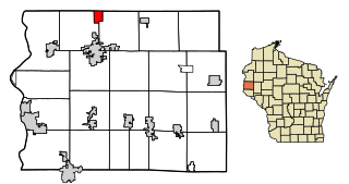
True is a town in Rusk County, Wisconsin, United States. The population was 291 at the 2000 census. The village of Glen Flora is within the town.

<span class="mw-page-title-main">Glenbeulah, Wisconsin</span> Village in Wisconsin, United States

Glenbeulah is a village in Sheboygan County, Wisconsin, United States. The population was 463 at the 2010 census. It is included in the Sheboygan, Wisconsin Metropolitan Statistical Area. Glenbeulah is situated on the Mullet River.

<span class="mw-page-title-main">Lublin, Wisconsin</span> Village in Wisconsin, United States

Lublin is a village in Taylor County, Wisconsin, United States. The population was 118 at the 2010 census.

<span class="mw-page-title-main">Dorchester, Wisconsin</span> Village in Wisconsin, United States

Dorchester is a village in Clark and Marathon counties in the U.S. state of Wisconsin, along the 45th parallel. It is part of the Wausau, Wisconsin Metropolitan Statistical Area. The population was 876 at the 2010 census. Of this, 871 were in Clark County, and only 5 were in Marathon County.

<span class="mw-page-title-main">Birnamwood, Wisconsin</span> Village in Wisconsin, United States

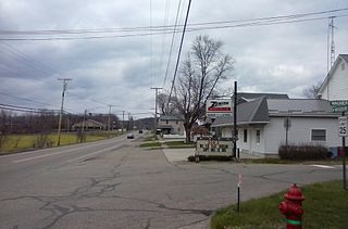
Birnamwood is a village in Marathon and Shawano counties in the U.S. state of Wisconsin. It is part of the Wausau, Wisconsin Metropolitan Statistical Area. The population was 818 at the 2010 census. Of this, 802 were in Shawano County, and 16 were in Marathon County. The village is located mostly within the town of Birnamwood in Shawano County; only a small portion extends into the town of Norrie in adjacent Marathon County. Until the 1990s, Birnamwood was home to the world's largest fiberglass badger. U.S. Route 45 runs through the village.

<span class="mw-page-title-main">Mount Hope, Wisconsin</span> Village in Wisconsin, United States

Mount Hope is a village in Grant County, Wisconsin, United States. The population was 225 at the 2010 census. The village is located within the Town of Mount Hope.

<span class="mw-page-title-main">Wilton, Wisconsin</span> Village in Wisconsin, United States

Wilton is a village in Monroe County, Wisconsin, United States. The population was 504 at the 2010 census. The village is located partially within the Town of Wilton and partially within the Town of Wellington.

<span class="mw-page-title-main">Milltown, Wisconsin</span> Village in Wisconsin, United States

Milltown is a village in Polk County, Wisconsin, United States. The population was 917 at the 2010 census. The village is located within the Town of Milltown.

<span class="mw-page-title-main">Hawkins, Wisconsin</span> Village in Wisconsin, United States

Hawkins is a village in Rusk County, Wisconsin, United States. The population was 305 at the 2010 census. The village is located within the Town of Hawkins.

<span class="mw-page-title-main">Merrimac, Wisconsin</span> Village in Wisconsin, United States

Merrimac is a village in Sauk County, Wisconsin, United States, northwest of Madison. The population was 420 at the 2010 census. The village is located within the Town of Merrimac.

<span class="mw-page-title-main">Aniwa, Wisconsin</span> Village in Wisconsin, United States

Aniwa is a village in Shawano County, Wisconsin, United States. The population was 260 at the 2010 census. The village is located within the Town of Aniwa. U.S. Route 45 runs north–south through the village.

<span class="mw-page-title-main">Star Prairie, Wisconsin</span> Village in Wisconsin, United States

Star Prairie is a village in St. Croix County in the U.S. state of Wisconsin. The population was 561 at the 2010 census. The village is located along the Apple River on the boundary between the Town of Star Prairie and the Town of Stanton.

<span class="mw-page-title-main">Hancock, Wisconsin</span> Village in Wisconsin, United States

Hancock is a village in Waushara County, Wisconsin, United States. The population was 417 at the 2010 census. The village is located within the Town of Hancock.

References

  1. "2019 U.S. Gazetteer Files". United States Census Bureau. Retrieved August 7, 2020.
  2. 1 2 U.S. Geological Survey Geographic Names Information System: Glen Flora, Wisconsin
  3. 1 2 "U.S. Census website". United States Census Bureau . Retrieved 2012-11-18.
  4. 1 2 "Population and Housing Unit Estimates". United States Census Bureau. May 24, 2020. Retrieved May 27, 2020.
  5. 1 2 "U.S. Census website". United States Census Bureau . Retrieved 2008-01-31.
  6. Callary, Edward (2016). Place Names of Wisconsin. Madison, WI: University of Wisconsin Press. p. 105. ISBN   978-0-299-30964-0.
  7. "US Gazetteer files: 2010, 2000, and 1990". United States Census Bureau. 2011-02-12. Retrieved 2011-04-23.
  8. "US Gazetteer files 2010". United States Census Bureau. Archived from the original on January 12, 2012. Retrieved 2012-11-18.
  9. "Census of Population and Housing". Census.gov. Retrieved June 4, 2015.
  10. "Wisconsin Vote.org.-James W. Edming". Archived from the original on 2014-11-09. Retrieved 2014-11-09.