Goodwin, South Dakota

Last updated

Goodwin, South Dakota
Deuel County South Dakota Incorporated and Unincorporated areas Goodwin Highlighted.svg
Location in Deuel County and the state of South Dakota
Coordinates: 44°52′39″N96°50′59″W / 44.87750°N 96.84972°W / 44.87750; -96.84972
Country United States
State South Dakota
County Deuel
Area
[1]
  Total0.47 sq mi (1.23 km2)
  Land0.47 sq mi (1.23 km2)
  Water0.00 sq mi (0.00 km2)
Elevation
[2]
1,998 ft (609 m)
Population
 (2020) [3]
  Total147
  Density310.13/sq mi (119.68/km2)
Time zone UTC-6 (Central (CST))
  Summer (DST) UTC-5 (CDT)
ZIP code
57238
Area code 605
FIPS code 46-24820 [4]
GNIS feature ID1267406 [2]

Goodwin is a town in Deuel County, South Dakota, United States, where the population was 147 at the 2020 census. [5]

Contents

History

Goodwin was platted in 1878, [6] when the railroad was built into the area. [7] The town was named for George P. Goodwin, a railroad official. [6] A post office has been in operation in Goodwin since 1878. [8] It is still running today. On May 30, 2022, the town was struck by a tornado that would damage many homes and businesses and would be rated EF3.

Geography

According to the United States Census Bureau, the town has a total land area of 0.47 square miles (1.22 km2), all land. [9]

Demographics

Historical population
CensusPop.Note
1910 145
1920 1578.3%
1930 140−10.8%
1940 1528.6%
1950 141−7.2%
1960 113−19.9%
1970 1140.9%
1980 13921.9%
1990 126−9.4%
2000 16027.0%
2010 146−8.7%
2020 1470.7%
U.S. Decennial Census [10] [3]

2010 census

As of the census [11] of 2010, there were 146 people, 59 households, and 37 families residing in the town. The population density was 310.6 inhabitants per square mile (119.9/km2). There were 62 housing units at an average density of 131.9 per square mile (50.9/km2). The racial makeup of the town was 88.4% White, 9.6% from other races, and 2.1% from two or more races. Hispanic or Latino of any race were 10.3% of the population.

There were 59 households, of which 33.9% had children under the age of 18 living with them, 47.5% were married couples living together, 10.2% had a female householder with no husband present, 5.1% had a male householder with no wife present, and 37.3% were non-families. 30.5% of all households were made up of individuals, and 5.1% had someone living alone who was 65 years of age or older. The average household size was 2.47 and the average family size was 3.16.

The median age in the town was 40 years. 27.4% of residents were under the age of 18; 10.3% were between the ages of 18 and 24; 19.8% were from 25 to 44; 31.5% were from 45 to 64; and 11% were 65 years of age or older. The gender makeup of the town was 51.4% male and 48.6% female.

2000 census

As of the census [4] of 2000, there were 160 people, 61 households, and 38 families residing in the town. The population density was 337.4 inhabitants per square mile (130.3/km2). There were 63 housing units at an average density of 132.8 per square mile (51.3/km2). The racial makeup of the town was 95.00% White, 3.12% from other races, and 1.88% from two or more races. Hispanic or Latino of any race were 3.12% of the population.

There were 61 households, out of which 34.4% had children under the age of 18 living with them, 45.9% were married couples living together, 6.6% had a female householder with no husband present, and 36.1% were non-families. 29.5% of all households were made up of individuals, and 11.5% had someone living alone who was 65 years of age or older. The average household size was 2.62 and the average family size was 3.28.

In the town, the population was spread out, with 27.5% under the age of 18, 10.6% from 18 to 24, 28.8% from 25 to 44, 20.0% from 45 to 64, and 13.1% who were 65 years of age or older. The median age was 34 years. For every 100 females, there were 119.2 males. For every 100 females age 18 and over, there were 110.9 males.

The median income for a household in the town was $34,688, and the median income for a family was $36,875. Males had a median income of $20,250 versus $22,500 for females. The per capita income for the town was $14,249. None of the families and 9.4% of the population were living below the poverty line, including no under eighteens and 18.2% of those over 64.

Related Research Articles

<span class="mw-page-title-main">Chesterville, Maine</span> Town in Maine, United States

Chesterville is a town in Franklin County, Maine, United States. The population was 1,328 at the 2020 census.

<span class="mw-page-title-main">Minnewaukan, North Dakota</span> City in North Dakota, United States

Minnewaukan is a city in Benson County, North Dakota, United States. It serves as the county seat and is fourth largest city in the county, after Fort Totten, Leeds, and Maddock. The population was 199 at the 2020 census. Minnewaukan was founded in 1884.

<span class="mw-page-title-main">Hoople, North Dakota</span> City in North Dakota, United States

Hoople is a city in Walsh County, North Dakota, United States. The population was 247 at the 2020 census. Hoople, named for early settler Alan Hoople, was founded in 1889. Hoople's nickname is "Tater Town."

<span class="mw-page-title-main">Tabor, South Dakota</span> Town in South Dakota, United States

Tabor is a town in Bon Homme County, South Dakota, United States. The population was 407 at the 2020 census.

<span class="mw-page-title-main">Nisland, South Dakota</span> Town in South Dakota, United States

Nisland is a town in Butte County, South Dakota, United States. The population was 206 at the 2020 census.

<span class="mw-page-title-main">Mound City, South Dakota</span> Town in South Dakota, United States

Mound City is a town in and the county seat of Campbell County, South Dakota, United States. The population was 69 at the 2020 census.

<span class="mw-page-title-main">Florence, South Dakota</span> Town in South Dakota, United States

Florence is a town in northwestern Codington County, South Dakota, United States. It is part of the Watertown, South Dakota Micropolitan Statistical Area. The population was 337 at the 2020 census.

<span class="mw-page-title-main">Pringle, South Dakota</span> Town in South Dakota, United States

Pringle is a town in Custer County, South Dakota, United States. The population was 109 at the 2020 census.

<span class="mw-page-title-main">Altamont, South Dakota</span> Town in South Dakota, United States

Altamont is a town in Deuel County, South Dakota, United States. The population was 32 at the 2020 census.

<span class="mw-page-title-main">Astoria, South Dakota</span> Town in South Dakota, United States

Astoria is a town in Deuel County, South Dakota, United States. The population was 132 at the 2020 census.

<span class="mw-page-title-main">Brandt, South Dakota</span> Town in South Dakota, United States

Brandt is a town in Deuel County, South Dakota, United States. The population was 114 at the 2020 census.

<span class="mw-page-title-main">Clear Lake, South Dakota</span> City in South Dakota, United States

Clear Lake is a city in and the county seat of Deuel County, South Dakota, United States. The population was 1,218 at the 2020 census.

<span class="mw-page-title-main">Gary, South Dakota</span> City in South Dakota, United States

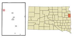
Gary is a city in Deuel County, South Dakota, United States. The population was 240 at the 2020 census. South Dakota Highway 101 serves as the main route of the community. In 2022, the town celebrated its 150th anniversary.

<span class="mw-page-title-main">Toronto, South Dakota</span> Town in South Dakota, United States

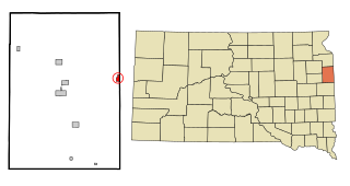
Toronto is a town in Deuel County, South Dakota, United States. The population was 196 at the 2020 census.

<span class="mw-page-title-main">Stockholm, South Dakota</span> Town in South Dakota, United States

Stockholm is a town in Grant County, South Dakota, United States. The population was 102 at the 2020 census.

<span class="mw-page-title-main">Olivet, South Dakota</span> Town in South Dakota, United States

Olivet is a town in and the county seat of Hutchinson County, South Dakota. The population was 64 at the time of the 2020 census.

<span class="mw-page-title-main">Crooks, South Dakota</span> City in South Dakota, United States

Crooks is a city in Minnehaha County, South Dakota, United States and is a suburb of Sioux Falls. The population was 1,362 at the 2020 census. Crooks was named New Hope until 1904. The town's present name honors W. A. Crooks, a local politician.

<span class="mw-page-title-main">Hartford, South Dakota</span> City in South Dakota, United States

Hartford is a suburban American city in Minnehaha County, South Dakota, a few miles northwest of Sioux Falls. Its population was 3,354 at the 2020 census.

<span class="mw-page-title-main">Peever, South Dakota</span> Town in South Dakota, United States

Peever is a town in Roberts County, South Dakota, United States. The population was 180 at the 2020 census.

<span class="mw-page-title-main">Tulare, South Dakota</span> Town in South Dakota, United States

Tulare is a town in Spink County, South Dakota, United States. The population was 211 at the 2020 census.

References

  1. "ArcGIS REST Services Directory". United States Census Bureau. Retrieved October 15, 2022.
  2. 1 2 U.S. Geological Survey Geographic Names Information System: Goodwin, South Dakota
  3. 1 2 "Census Population API". United States Census Bureau. Retrieved October 15, 2022.
  4. 1 2 "U.S. Census website". United States Census Bureau . Retrieved January 31, 2008.
  5. "U.S. Census Bureau: Goodwin town, South Dakota". www.census.gov. United States Census Bureau. Retrieved February 20, 2022.
  6. 1 2 Chicago and North Western Railway Company (1908). A History of the Origin of the Place Names Connected with the Chicago & North Western and Chicago, St. Paul, Minneapolis & Omaha Railways. p. 78.
  7. Federal Writers' Project (1940). South Dakota place-names, v.1-3. University of South Dakota. p. 40.
  8. "Deuel County". Jim Forte Postal History. Retrieved March 18, 2015.
  9. "US Gazetteer files 2010". United States Census Bureau. Archived from the original on January 25, 2012. Retrieved June 21, 2012.
  10. "Census of Population and Housing". Census.gov. Retrieved June 4, 2015.
  11. "U.S. Census website". United States Census Bureau . Retrieved June 21, 2012.