
Jefferson Davis Parish is a parish located in the U.S. state of Louisiana. As of the 2020 census, the population was 32,250. The parish seat is Jennings. Jefferson Davis Parish is named after the president of the Confederacy during the American Civil War, Jefferson Davis. It is located in southwestern Louisiana and forms a part of the Acadiana region.

Jefferson Parish is a parish in the U.S. state of Louisiana. As of the 2020 census, the population was 440,781. Its parish seat is Gretna, its largest community is Metairie, and its largest incorporated city is Kenner. Jefferson Parish is included in the Greater New Orleans area.

Grand Isle is a town in Jefferson Parish in the U.S. state of Louisiana, located on a barrier island of the same name in the Gulf of Mexico. The island is at the mouth of Barataria Bay where it meets the gulf. The town of Grand Isle is statistically part of the New Orleans−Metairie−Kenner metropolitan statistical area, though it is not connected to New Orleans' continuous urbanized area.

Harvey is a census-designated place (CDP) in Jefferson Parish, Louisiana, United States. Harvey is on the south side of the Mississippi River, within the New Orleans–Metairie–Kenner metropolitan statistical area. The majority-minority population was 20,348 at the 2010 census, down from 22,226 at the 2000 census. The 2020 census determined 22,236 people lived in the CDP.

Kenner is a city in Louisiana, United States. It is the most populous city in Jefferson Parish, and is the largest incorporated suburban city of New Orleans. The population was 66,448 at the 2020 census, making it the sixth-most populous city in Louisiana.
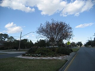
River Ridge is an unincorporated community and census-designated place (CDP) in Jefferson Parish, Louisiana, United States. It is a suburb of New Orleans. The population was 13,591 in 2020.

Godshill is a village and civil parish on the Isle of Wight, England, with a population of 1,459 at the 2011 Census. It lies between Newport and Ventnor in the southeast of the island.

Jefferson Parish Public Schools is a school district based in Harvey in unincorporated Jefferson Parish, Louisiana, United States. The district operates all district public schools in Jefferson Parish. As of 2019 it had 50,582 students, making it the largest public school system in the state.

Louisiana Highway 1 (LA 1) is a state highway in Louisiana. At 431.88 miles (695.04 km), it is the longest numbered highway of any class in Louisiana. It runs diagonally across the state, connecting the oil and gas fields near the island of Grand Isle with the northwest corner of the state, north of Shreveport.

Barataria Bay, also Barrataria Bay, is a bay of the Gulf of Mexico, about 15 miles (24 km) long and 12 miles (19 km) wide, in southeastern Louisiana, in Jefferson Parish and Plaquemines Parish, United States. It is separated from the gulf by two barrier islands, Grand Isle and Grand Terre.

Louisiana Highway 574 is a collection of eight current and four former state-maintained streets in Grand Isle, located in lower Jefferson Parish. All twelve routes were established with the 1955 Louisiana Highway renumbering.
Crosby is a small village located 3+3⁄4 miles west of Douglas in the parish of Marown in the Isle of Man.
Grand Isle Seaplane Base is a private-use seaplane base located three nautical miles (6 km) northeast of the central business district of Grand Isle, in Jefferson Parish, Louisiana, United States. It is owned by the Freeport Sulphur Company.

Grand Isle State Park, lies at the eastern tip of Grand Isle, a barrier island in Jefferson Parish, Louisiana, U.S.A. Grand Isle is the only inhabited barrier island in the state.

Jefferson Parish Library (JPL) is the library system of Jefferson Parish, Louisiana. It has its headquarters in the East Bank Regional Library in Metairie, an unincorporated area in the parish.
The Jefferson Seaway was a proposed deep-draft ship channel to be created in Jefferson Parish, Louisiana, that would establish a route between the Mississippi River at Westwego and the Gulf of Mexico near Grand Isle. The Mississippi River provided the only deep-water access to New Orleans and its neighboring ports. In the mid-20th century, the creation of alternate routes was considered, including the Mississippi River-Gulf Outlet (MR-GO), which was ultimately selected, funded and constructed. The Jefferson Seaway, sometimes referred to as the Arrow to the Americas, the Mississippi Valley Seaway Canal, the Tidewater Ship Canal and the Barataria Canal, was also under consideration but ultimately was never constructed as a deep-draft channel.
Cheniere Caminada was a fishing community located in Jefferson Parish, Louisiana, that was destroyed by what is considered one of the deadliest United States hurricanes, that was unnamed but referred to as the 1893 Cheniere Caminada hurricane. The community was located west of Grand Isle, which was almost destroyed by the same hurricane.
