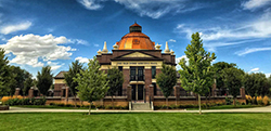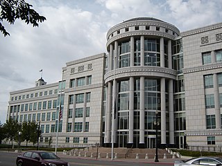
Salt Lake City is the capital and the most populous municipality of the U.S. state of Utah. With an estimated population of 190,884 in 2014, the city is the core of the Salt Lake City metropolitan area, which has a population of 1,153,340. Salt Lake City is further situated within a larger metropolis known as the Salt Lake City–Ogden–Provo Combined Statistical Area, a corridor of contiguous urban and suburban development stretched along a 120-mile (190 km) segment of the Wasatch Front, comprising a population of 2,423,912. It is one of only two major urban areas in the Great Basin.

Juab County is a county in western Utah, United States. As of the 2010 United States Census, the population was 10,246. Its county seat and largest city is Nephi.

Millard County is a county in the U.S. state of Utah. As of the 2010 United States Census, the population was 12,503. Its county seat is Fillmore, and the largest city is Delta.

Weber County is a county in the U.S. state of Utah. As of the 2010 census, the population was 231,236, making it Utah's fourth-most populous county. Its county seat and largest city is Ogden, the home of Weber State University. The county was named for the Weber River.

Bluffdale is a city in Salt Lake County in the U.S. state of Utah, located about 20 miles (32 km) south of Salt Lake City. As of the 2010 census, the city population was 7,598. As of the 2018 census, the city population is 13,484.

Cottonwood Heights is a city located in Salt Lake County, Utah, United States, along the east bench of the Salt Lake Valley. It lies south of the cities of Holladay and Murray, east of Midvale, and north of Sandy within the Salt Lake City, Utah Metropolitan Statistical Area. Following a successful incorporation referendum in May 2004, the city was incorporated on January 14, 2005. Cottonwood Heights had been a Census-designated place (CDP) before incorporation. The population as of the 2010 census was 33,433. This is a significant increase over the CDP's 2000 census count of 27,569.

Riverton is a city in Salt Lake County, Utah, United States. It is part of the Salt Lake City, Utah Metropolitan Statistical Area. The population was 38,753 at the 2010 census, but has since grown to over 43,000. Riverton is located in the rapidly growing southwestern corner of the Salt Lake Valley.

South Jordan is a city in south central Salt Lake County, Utah, 18 miles (29 km) south of Salt Lake City. Part of the Salt Lake City metropolitan area, the city lies in the Salt Lake Valley along the banks of the Jordan River between the 9,000-foot (2,700 m) Oquirrh Mountains and the 12,000-foot (3,700 m) Wasatch Mountains. The city has 3.5 miles (5.6 km) of the Jordan River Parkway that contains fishing ponds, trails, parks, and natural habitats. The Salt Lake County fair grounds and equestrian park, 67-acre (27 ha) Oquirrh Lake, and 27 parks are located inside the city. As of the 2010 Census, its population was 50,418.

South Salt Lake is a city in Salt Lake County, Utah, United States and is part of the Salt Lake City Metropolitan Statistical Area. The population was 23,617 at the 2010 census.

West Jordan is a city in Salt Lake County, Utah, United States. It is a rapidly growing suburb of Salt Lake City and has a mixed economy. According to the 2010 Census, the city had a population of 103,712, placing it as the fourth most populous in the state. The city occupies the southwest end of the Salt Lake Valley at an elevation of 4,330 feet (1,320 m). Named after the nearby Jordan River, the limits of the city begin on the river's western bank and end in the eastern foothills of the Oquirrh Mountains, where Kennecott Copper Mine, the world's largest man-made excavation is located.

West Valley City is a city in Salt Lake County and a suburb of Salt Lake City in the U.S. state of Utah. The population was 129,480 at the 2010 census, making it the second-largest city in Utah. The city incorporated in 1980 from a large, quickly growing unincorporated area, which was variously known as Granger, Hunter, Chesterfield, and Redwood. It is home to the Maverik Center and USANA Amphitheatre.

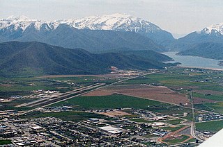
Heber City is a city in northwestern Wasatch County, Utah, United States.

Park City is a city in Summit County, Utah, United States. It is considered to be part of the Wasatch Back. The city is 32 miles (51 km) southeast of downtown Salt Lake City and 20 miles (32 km) from Salt Lake City's east edge of Sugar House along Interstate 80. The population was 7,558 at the 2010 census. On average, the tourist population greatly exceeds the number of permanent residents.

Utah Valley is a valley in North Central Utah located in Utah County, and is considered part of the Wasatch Front. It contains the cities of Provo, Orem, and their suburbs, including Alpine, American Fork, Cedar Hills, Elk Ridge, Genola, Goshen, Highland, Lehi, Lindon, Mapleton, Payson, Pleasant Grove, Salem, Santaquin, Saratoga Springs, Spanish Fork, Springville, Vineyard and Woodland Hills. It is known colloquially as "Happy Valley".

Greer is an unincorporated community and census-designated place in Apache County, Arizona, United States. It lies at an elevation of approximately 8,300 feet (2,500 m) in the White Mountains of Arizona, and is surrounded by the Apache-Sitgreaves National Forest. As of the 2010 census it had a population of 41. Greer was founded around 1879 by Mormon settlers from Utah. The Greer post office has the ZIP code of 85927.

Trout Creek is a small farming unincorporated community, in far western Juab County, Utah, United States.


