
The Lakota are a Native American people. Also known as the Teton Sioux, they are one of the three prominent subcultures of the Sioux people. Their current lands are in North and South Dakota. They speak Lakȟótiyapi—the Lakota language, the westernmost of three closely related languages that belong to the Siouan language family.
The Sioux or Oceti Sakowin are groups of Native American tribes and First Nations peoples in North America. The modern Sioux consist of two major divisions based on language divisions: the Dakota and Lakota; collectively they are known as the Očhéthi Šakówiŋ. The term "Sioux" is an exonym created from a French transcription ("Nadouessioux") of the Ojibwe term "Nadowessi", and can refer to any ethnic group within the Great Sioux Nation or to any of the nation's many language dialects.

Prairies are ecosystems considered part of the temperate grasslands, savannas, and shrublands biome by ecologists, based on similar temperate climates, moderate rainfall, and a composition of grasses, herbs, and shrubs, rather than trees, as the dominant vegetation type. Temperate grassland regions include the Pampas of Argentina, Brazil and Uruguay, and the steppe of Ukraine, Russia and Kazakhstan. Lands typically referred to as "prairie" tend to be in North America. The term encompasses the area referred to as the Interior Lowlands of Canada, the United States, and Mexico, which includes all of the Great Plains as well as the wetter, hillier land to the east.

Minnehaha County is a county on the eastern border of the state of South Dakota. As of the 2020 census, the population was 197,214, making it the state's most populous county. It contains over 20% of the state's population. Its county seat is Sioux Falls, South Dakota's largest city. The county was created in 1862 and organized in 1868. Its name was derived from the Sioux word Mnihaha, meaning "rapid water," or "waterfall".
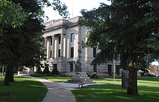
Codington County is a county in the U.S. state of South Dakota. As of the 2020 United States Census, the population was 28,325. Its county seat is Watertown. The county was created in 1877 and organized in 1878. It is named for Rev. George S. S. Codington, Dakota Territory legislator.
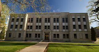
Emmons County is a county in the U.S. state of North Dakota. As of the 2010 census, the population was 3,301. Its county seat has been Linton since 1899.
Burleigh County is a county in the U.S. state of North Dakota. As of the 2020 census, the population was 98,458, making it the second-most populous county in North Dakota. Its county seat is Bismarck, the state capital. The county was named for Dakota Territory political figure Walter A. Burleigh.

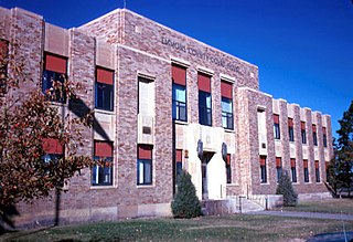
Bottineau County is a county in the U.S. state of North Dakota. As of the 2020 census, the population was 6,379. Its county seat is Bottineau.

Scouting in Minnesota has a long history, from the 1910s to the present day, serving thousands of youth in programs that suit the environment in which they live.

The Moreau River is a tributary of the Missouri River, approximately 200 miles (320 km) long, in South Dakota in the United States. Moreau River has the name of a pioneer trader.

White Horse Hill National Game Preserve is a National Wildlife Refuge and nature center located on the shore of Devils Lake in Benson County, North Dakota, within the Spirit Lake Tribe reservation.
The Missouri National Recreational River is a National Recreational River located on the border between Nebraska and South Dakota. The designation was first applied in 1978 to a 59-mile section of the Missouri River between Gavins Point Dam and Ponca State Park. In 1991, an additional 39-mile section between Fort Randall Dam and Niobrara, Nebraska, was added to the designation. These two stretches of the Missouri River are the only parts of the river between Montana and the mouth of the Missouri that remain undammed or unchannelized. The last 20 miles of the Niobrara River and 6 miles of Verdigre Creek were also added in 1991.
Camp Grafton is the main Army National Guard installation in North Dakota. The base, located near Devils Lake, North Dakota, was founded in 1904 as the Rock Island Military Reservation, but later renamed after Gilbert C. Grafton.
The Drift Prairie is a geographic region of North Dakota and South Dakota.

South Dakota is a state located in the north-central United States. It is usually considered to be in the Midwestern region of the country. The state can generally be divided into three geographic regions: eastern South Dakota, western South Dakota, and the Black Hills. Eastern South Dakota is lower in elevation and higher in precipitation than the western part of the state, and the Black Hills are a low, isolated mountain group in the southwestern corner of the state. Smaller sub-regions in the state include the Coteau des Prairies, Missouri Coteau, James River Valley, the Dissected Till Plains. Geologic formations in South Dakota range in age from two billion-year-old Precambrian granite in the Black Hills to glacial till deposited over the last few million years. South Dakota is the 17th-largest state in the country.
The 1,888-acre (7.64 km2) Florence Lake National Wildlife Refuge, in Burleigh County, North Dakota, United States, has almost 1,000 acres (4.0 km2) of virgin native mixed-grass prairie and a 132-acre (0.53 km2) lake. This high quality prairie habitat attracts grassland birds including grassland passerines that are sought by birders visiting the region. Florence Lake National Wildlife Refuge is administered by Long Lake National Wildlife Refuge as an unstaffed satellite refuge.
Slade National Wildlife Refuge is a 3,000-acre (12 km2) National Wildlife Refuge in Kidder County, North Dakota. It was established in 1941 when the property was donated by G.T. Slade, a Northern Pacific Railroad executive. It is managed under the Long Lake National Wildlife Refuge. It contains Harker Lake and Upper Harker Lake.
Grass Lake is a natural lake in South Dakota, in the United States and Humboldt is the closet town to the lake.
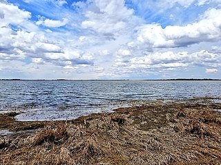
Salt Lake is a natural lake lying between Minnesota and South Dakota in the United States.

