Related Research Articles

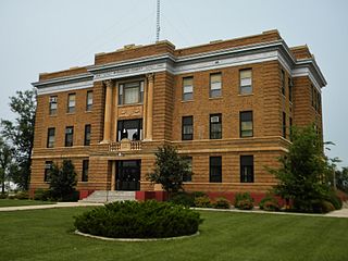
McPherson County is a county in the U.S. state of South Dakota. As of the 2020 census, the population was 2,411. Its county seat is Leola.

Edmunds County is a county in the U.S. state of South Dakota. At the 2020 census, the population was 3,986. Its county seat is Ipswich. The county was established in 1873 and organized in 1883. It is named for Newton Edmunds, the second Governor of Dakota Territory.

Campbell County is a county in the U.S. state of South Dakota. As of the 2020 census, the population was 1,377, making it the fourth-least populous county in South Dakota. Its county seat is Mound City. The county was created in 1873 and organized in 1884. It was named for Norman B. Campbell, a Dakota Territory legislator in 1873 and son of General Charles T. Campbell.

McIntosh County is a county in the U.S. state of North Dakota. As of the 2020 census, the population was 2,530. Its county seat is Ashley. The county is notable for being the county with the highest percentage of German-Americans in the United States, with over 76% of the county's residents being of German descent as of 2010.

Bell Township is a township in Clearfield County, Pennsylvania, United States. The population was 686 at the 2020 census.

Leola is a small city in, and the county seat of, McPherson County, South Dakota, United States. It was founded on May 1, 1884, and named for Leola Haynes, daughter of one of the town's founders. The population was 434 as of the 2020 census.
There are over a dozen lakes named Mud Lake within the U.S. state of South Dakota. According to the Federal Writers' Project, these lakes were so named on account of the muddy condition of the lake bed or lake shore.

Gridley Township is located in McLean County, Illinois. As of the 2010 census, its population was 1,913 and it contained 790 housing units.
Hoffman Township is one of the five townships of McPherson County, South Dakota, United States. It lies in the northeastern part of the county and borders the following other townships within McPherson County:
Wacker Township is one of the five townships of McPherson County, South Dakota, United States. It lies in the northeastern part of the county and borders the following other townships within McPherson County:
Weber Township is one of the five townships of McPherson County, South Dakota, United States. It lies in the northeastern part of the county and borders the following other townships within McPherson County:
Wachter Township is one of the five townships of McPherson County, South Dakota, United States. It lies in the northeastern corner of the county and borders the following other townships within McPherson County:
Carl Township is one of the five townships of McPherson County, South Dakota, United States. It lies in the northeastern part of the county and borders the following other townships within McPherson County:
The 180 MW "Tatanka Wind Farm", is located in Dickey County and McIntosh County, North Dakota, and McPherson County, South Dakota. It is the largest wind farm in North and South Dakota and generates enough renewable energy to power more than 60,000 U.S. homes.

The Civil War Monuments in Washington, D.C. are a group of seventeen outdoor statues which are spread out through much of central and northwest Washington, D.C. The statues depict 11 Union generals and formerly included one Confederate general, Albert Pike, who was depicted as a Mason and not as a general. The Pike statue was torn down on Juneteenth 2020, as part of the George Floyd protests. Two Union admirals are honored, although Admiral Samuel Francis DuPont's statue was removed to Wilmington, Delaware, and he is now honored with a fountain. Other statues depict nuns, peace, emancipation, and the Grand Army of the Republic.
Lyman High School, located in Presho, South Dakota, is the only high school in Lyman County. It is also the only high school in Lyman School District 42–1, which also includes two elementary schools and a middle school. Lyman High School's athletic teams are nicknamed the "Raiders".
Burkmere is an unincorporated community in Faulk County, in the U.S. state of South Dakota.
Beebe is an unincorporated community in Edmunds County, in the U.S. state of South Dakota. Other than a small manufactury, there are no businesses or services at Beebe and only three houses.
Dirt Lodge Creek is a stream in the U.S. state of South Dakota. It was named for an Indian settlement along its course which contained earthen floors.
McPherson Creek is a stream in the U.S. state of South Dakota.
References
- ↑ U.S. Geological Survey Geographic Names Information System: Greenway, South Dakota
- ↑ Federal Writers' Project (1940). South Dakota place-names, v.1-3. University of South Dakota. p. 40.
- ↑ "McPherson County". Jim Forte Postal History. Retrieved January 30, 2015.
45°54′35″N99°42′39″W / 45.90972°N 99.71083°W
