Related Research Articles

The Semi-Automatic Ground Environment (SAGE) was a system of large computers and associated networking equipment that coordinated data from many radar sites and processed it to produce a single unified image of the airspace over a wide area. SAGE directed and controlled the NORAD response to a possible Soviet air attack, operating in this role from the late 1950s into the 1980s. Its enormous computers and huge displays remain a part of cold war lore, and after decommissioning were common props in movies such as Dr. Strangelove and Colossus, and on science fiction TV series such as The Time Tunnel.
Point Arena Air Force Station is a closed United States Air Force General Surveillance Radar station. It is located 3.7 miles (6.0 km) east of Point Arena, California. It was closed in 1998 by the Air Force, and turned over to the Federal Aviation Administration (FAA).
Mount Hebo Air Force Station is a closed United States Air Force General Surveillance Radar station. It is located 5.2 miles (8.4 km) east-southeast of Hebo, Oregon, located at the top of 3,154-foot (961 m) Mount Hebo. It was closed in 1980.
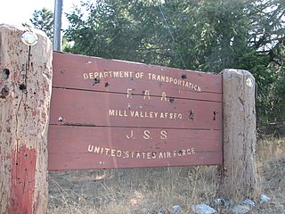
Ground Equipment Facility J-33 is a Federal Aviation Administration (FAA) radar station of the Joint Surveillance System's Western Air Defense Sector (WADS) with an Air Route Surveillance Radar (ARSR-4). The facility was previously a USAF general surveillance radar station during the Cold War.
Finley Air Force Station is a closed United States Air Force General Surveillance Radar station. It is located 1.5 miles (2.4 km) west-northwest of Finley, North Dakota. It was closed in 1979 by the Air Force, and turned over to the Federal Aviation Administration (FAA).
Dickinson Air Force Station is a closed United States Air Force General Surveillance Radar station. It is located 3.8 miles (6.1 km) northeast of Dickinson, North Dakota. It was closed in 1965.
Thomasville Air Force Station is a closed United States Air Force General Surveillance Radar station. It is located 1.9 miles (3.1 km) north-northwest of Thomasville, Alabama. It was closed in 1969.

Tonopah Air Force Station is a closed United States Air Force General Surveillance Radar station. It is located 1.1 miles (1.8 km) south of Tonopah, Nevada. It was closed in 1970.
The SAGE radar stations of Air Defense Command were the military installations operated by USAF squadrons using the 1st automated air defense environment and networked by the SAGE System, a computer network. Most of the radar stations used the Burroughs AN/FST-2 Coordinate Data Transmitting Set (CDTS) to automate the operator environment and provide radar tracks to sector command posts at SAGE Direction Centers (DCs), e.g., the Malmstrom Z-124 radar station was co-located with DC-20. The sector/division radar stations were networked by DCs and Manual Control Centers to provide command, control, and coordination for ground-controlled interception of enemy aircraft by interceptors such as the F-106 developed to work with the SAGE System.

The Joint Surveillance System (JSS) is a joint United States Air Force and Federal Aviation Administration system for the atmospheric air defense of North America. It replaced the Semi Automatic Ground Environment (SAGE) system in 1983.
North Charleston Air Force Station is a closed United States Air Force General Surveillance Radar station. It is located in the City of North Charleston, South Carolina. It was closed in 1980.
Roanoke Rapids Air Force Station was a United States Air Force General Surveillance Radar station. It is 6.1 miles (9.8 km) southwest of Gaston, North Carolina, near the closed Halifax County Airport. It was closed in 1978.
Dauphin Island Air Force Station is a closed United States Air Force General Surveillance Radar station. It is located 1.9 miles (3.1 km) east of Dauphin Island, Alabama, near historic Fort Gaines (Alabama). It was closed in 1980.

Ajo Air Force Station is a closed United States Air Force General Surveillance Radar station. It is located 6.4 miles (10.3 km) northwest of Ajo, Arizona. It was closed in 1969 by the Air Force, and the radar site turned over to the Federal Aviation Administration (FAA).

Mount Lemmon Air Force Station is a closed United States Air Force General Surveillance Radar station. It is located 17.2 miles (27.7 km) north-northeast of Tucson, Arizona. It was closed in 1969.
Boron Air Force Station is a closed United States Air Force General Surveillance Radar station. It is located 6.8 miles (10.9 km) northeast of Boron, California. It was closed by the Air Force in 1975 and turned over to the Federal Aviation Administration (FAA). The radar site is still operated by the FAA as part of the Joint Surveillance System (JSS).
Santa Rosa Island Air Force Station is a closed United States Air Force General Surveillance Radar station. It is located 5.6 miles (9.0 km) south-southwest of Lompoc, California. It was closed in 1968 by the Air Force, and turned over to the Federal Aviation Administration (FAA).

Blaine Air Force Station is a closed United States Air Force General Surveillance Radar station. It is located 5.5 miles (8.9 km) south of Blaine, Washington. It was closed in 1979.

Canadian Forces Station Beaverlodge is a closed General Surveillance Radar station. It is located 4.9 miles (7.9 km) east-northeast of Beaverlodge, Alberta. It was closed in 1988.
Backup Interceptor Control was the Electronic Systems Division 416M System to backup the SAGE 416L System in the United States and Canada. BUIC deployed Cold War command, control, and coordination systems to SAGE radar stations to create dispersed NORAD Control Centers.
References
- ↑ "USA Support Oakdale". epa.gov. Archived from the original on 2012-06-25.
- ↑ "Re: Speaking of AUTOVON" (coldwarcomms message). Yahoo.com. September 21, 2007. Retrieved 2013-02-18.
A previously referenced AT&T training manual on SAGE/BUIC/AUTOVON phone systems does list all the AUTOVON/SAGE Switching Centers & includes their General Purpose (AUTOVON) NNX, their SAGE NNX, and … For example, Delta, Utah had 890 for AUTOVON, 764 for SAGE
- 1 2 3 "Topsham AFS". Cold War Relics. 2009. Archived from the original on 2010-06-12. Retrieved 2013-02-19.
the SAGE block house was bulldozed in 1985.
(image of entrance sign with arrow: "Bangor North American Air Defense Sector") - ↑ "Minot GATR, ND Personnel Roster". radomes.org. Retrieved February 5, 2022.
- ↑ Blackburn, Charles A (2012-06-23). "[anecdote posting]" (PDF). AFdasf.org. Retrieved 2014-02-24.
Keesler for 304x4 training; GATR sites in Cut Bank, MO and Hastings, NE…last assignment to Andrews AFB GAR site at Brandywine, MD
- ↑ "AN/GKA-5 TDDL". www.radomes.org.
- ↑ "AIR FORCE - MIL-T-26439A - TRANSMITTING SET, ELECTRONIC GUIDANCE SIGNALS AN FRT-49( ) | Engineering360". standards.globalspec.com.
- ↑ "QRZ News July 2010" (PDF). k3ir.org. Archived from the original (PDF) on 2018-04-25.
- ↑ "Makah GATR 1977". www.radomes.org.
- 1 2 "AN/ARQ to AN/ARY - Equipment Listing". www.designation-systems.net.
- ↑ "F-106 Delta Dart Automatic Flight Control System". www.f-106deltadart.com.
- ↑ "Federal Register/Vol. 63, No. 91/Tuesday, May 12, 1998/Notices" (PDF). gpo.gov. Retrieved February 5, 2022.
- ↑ "Selfridge AAB TOPO". 57thbombwing.com. Archived from the original on 2014-03-28.
- ↑ "Recent Photos of Selfridge AFB, MI". www.radomes.org.
- 1 2 "Madera Air Force Station Ground Air Transmitter and Receiver (GATR) Site". wikimapia.org.
- ↑ "Almaden Air Force Station Ground-to-Air, Transmit/Receive Site". wikimapia.org.
- ↑ "Information for Minot GATR, ND". radomes.org. Retrieved February 5, 2022.
- ↑ NORAD/CONAD Historical Summary, 1965B