Gruver, Texas

Last updated

Gruver, Texas
TXMap-doton-Gruver.PNG
Location of Gruver, Texas
Hansford County Gruver.svg
Coordinates: 36°15′46″N101°24′20″W / 36.26278°N 101.40556°W / 36.26278; -101.40556
Country United States
State Texas
County Hansford
Area
[1]
  Total1.10 sq mi (2.85 km2)
  Land1.10 sq mi (2.85 km2)
  Water0.00 sq mi (0.00 km2)
Elevation
[2]
3,176 ft (968 m)
Population
 (2010)
  Total1,194
  Estimate 
(2021) [3]
1,108
  Density1,029.95/sq mi (397.68/km2)
Time zone UTC-6 (Central (CST))
  Summer (DST) UTC-5 (CDT)
ZIP code
79040
Area code 806
FIPS code 48-31412 [4]
GNIS feature ID2410671 [2]

Gruver is a city in Hansford County, Texas, United States. The population was 1,162 at the 2010 census. [5] Farwell, in the center of Hansford County, approximately three miles east of what became Gruver, was established in 1880 by the Canott family of Illinois, and was the first town in the county.[ citation needed ] Gruver was established shortly after, and Farwell rapidly fell into oblivion after 1889, when it lost a county seat election to Hansford.[ citation needed ]

Contents

Geography

According to the United States Census Bureau, the city has a total area of 1.1 square miles (2.8 km2), all land.

Demographics

Historical population
CensusPop.Note
1940 350
1950 813132.3%
1960 1,03026.7%
1970 1,26522.8%
1980 1,216−3.9%
1990 1,172−3.6%
2000 1,162−0.9%
2010 1,1942.8%
2019 (est.)1,135 [3] −4.9%
U.S. Decennial Census [6]

2020 census

Gruver racial composition [7]
(NH = Non-Hispanic) [lower-alpha 1]
RaceNumberPercentage
White (NH)59752.83%
Black or African American (NH)10.09%
Native American or Alaska Native (NH)30.27%
Some Other Race (NH)40.35%
Mixed/Multi-Racial (NH)80.71%
Hispanic or Latino 51745.75%
Total1,130

As of the 2020 United States census, there were 1,130 people, 412 households, and 294 families residing in the city.

2000 census

At the 2000 census, [4] 1,162 people, 439 households and 327 families resided in the city. The population density was 1,089.0 inhabitants per square mile (420.5/km2). The 509 housing units averaged 477.0/sq mi (183.7/km2). The racial makeup of the city was 80.12% White, 0.69% Native American, 17.21% from other races, and 1.98% from two or more races. Hispanics or Latinos of any race were 28.31% of the population.

Of the 439 households, 39.9% had children under the age of 18 living with them, 64.9% were married couples living together, 5.7% had a female householder with no husband present, and 25.3% were not families. About 23.9% of all households were made up of individuals, and 12.8% had someone living alone who was 65 years of age or older. The average household size was 2.65 and the average family size was 3.15.

The population was distributed as 31.3% under the age of 18, 6.5% from 18 to 24, 27.0% from 25 to 44, 20.2% from 45 to 64, and 15.0% who were 65 years of age or older. The median age was 35 years. For every 100 females, there were 100.3 males. For every 100 females age 18 and over, there were 99.0 males.

The median household income was $32,031 and the median family income was $37,333. Males had a median income of $26,375 versus $17,143 for females. The per capita income for the city was $18,408. About 12.2% of families and 16.2% of the population were below the poverty line, including 21.5% of those under age 18 and 16.2% of those age 65 or over.

Education

The City of Gruver is served by the Gruver Independent School District and is the location of Gruver High School.

Tornado

On June 9, 1971, the largest observed tornado in history as of that time occurred just to the west-southwest of Gruver. Since then, it has been bested by a 2004 tornado in Hallam, Nebraska, and the May 2013 tornado in El Reno, Oklahoma. The average width of the tornado along its path was estimated at 2,500 yards and the maximum width was approximately two miles along its 15-mile path. The tornado moved very slowly. Visibility was clear and witnesses reported seeing the tornado from as far as 25 miles away. The tornado was reported to have been on a direct track for the City of Gruver, but veered away and spared the town from its effects. In spite of the size of the tornado, damage was minor; total property damage from the tornado was put at $15,000. However, the tornado was accompanied by one- to two-inch hail that did significant damage to the wheat crops near the path of the tornado.

Climate

According to the Köppen climate classification system, Gruver has a semiarid climate, BSk on climate maps. [10]

Related Research Articles

<span class="mw-page-title-main">Hansford County, Texas</span> County in Texas, United States

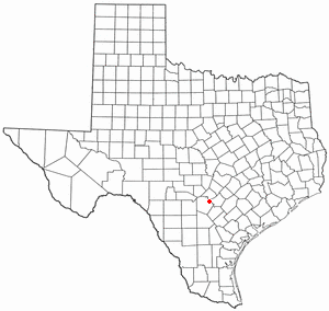
Hansford County is a county located in the U.S. state of Texas. As of the 2020 census, its population was 5,285. Its county seat is Spearman. The county was created in 1876 and organized in 1889. It is named for John M. Hansford, a Texas state congressman and judge.

<span class="mw-page-title-main">McDonald Chapel, Alabama</span> CDP in Alabama, United States

McDonald Chapel is a census-designated place in Jefferson County, Alabama, United States. It is northeast of the Birmingham suburb of Pleasant Grove. At the 2020 census, the population was 739. Large portions of this area were damaged by violent tornadoes in 1956, 1998, and 2011. The 1998 tornado was rated F5 on the Fujita scale.

<span class="mw-page-title-main">Bantam, Connecticut</span> Borough in Connecticut, United States

Bantam is a borough in Litchfield County, Connecticut, United States. The population was 720 at the 2020 census.

<span class="mw-page-title-main">Experiment, Georgia</span> CDP in Georgia, United States

Experiment is a census-designated place (CDP) in Spalding County, Georgia, United States. The population was 3,233 at the 2000 census.

<span class="mw-page-title-main">Gruver, Iowa</span> City in Iowa, United States

Gruver is a city in Emmet County, Iowa, United States. The population was 63 at the time of the 2020 census.

<span class="mw-page-title-main">Grundy Center, Iowa</span> City in Iowa, United States

Grundy Center is a city in Grundy County, Iowa. The population was 2,796 at the time of the 2020 census, a 7.7% increase from 2,596 at the 2000 census. Grundy Center is also the county seat of Grundy County. Grundy Center is part of the Waterloo–Cedar Falls Metropolitan Statistical Area.

<span class="mw-page-title-main">Martensdale, Iowa</span> City in Iowa, United States

Martensdale is a city in Warren County, Iowa, United States. The population was 421 at the time of the 2020 census. It is part of the Des Moines–West Des Moines Metropolitan Statistical Area

<span class="mw-page-title-main">Oshkosh, Nebraska</span> City in Nebraska, United States

Oshkosh is a city in Garden County, Nebraska, United States. The population was 884 at the 2010 census. It is the county seat of Garden County.

<span class="mw-page-title-main">Texico, New Mexico</span> City in New Mexico, United States

Texico is a city in Curry County, New Mexico, United States. Its population was 1,130 at the 2010 census. The city is located on the Texas-New Mexico border with the town of Farwell across the border.

<span class="mw-page-title-main">Centerville, South Dakota</span> City in South Dakota, United States

Centerville is a city in Turner County, South Dakota, United States. The population was 918 at the 2020 census. Centerville is part of the Sioux Falls, South Dakota metropolitan area.

<span class="mw-page-title-main">Live Oak, Texas</span> City in Texas, United States

Live Oak is a city in Bexar County, Texas, United States. The population was 15,781 at the 2020 census. It is part of the San Antonio Metropolitan Statistical Area.

<span class="mw-page-title-main">Meridian, Texas</span> City in Texas, United States

Meridian is a city and the county seat of Bosque County in central Texas, United States. It is forty-seven miles northwest of Waco. The population was 1,493 at the 2010 census.

<span class="mw-page-title-main">Morse, Texas</span> Census-designated place in Texas, United States

Morse is an unincorporated community and census-designated place (CDP) in Hansford County, Texas, United States. The population was 147 at the 2010 census, down from 172 at the 2000 census.

<span class="mw-page-title-main">Spearman, Texas</span> City in Texas, United States

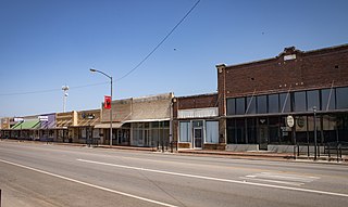
Spearman is a city in and the county seat of Hansford County, Texas, United States. As of the 2010 census, the city population was 3,368. It is known for its collection of windmills from the J.B. Buchanan windmill collection.

<span class="mw-page-title-main">Cactus, Texas</span> City in Texas, United States

Cactus is a city in Moore County, Texas, United States, located along U.S. Route 287. The population was 3,179 at the 2010 census.

<span class="mw-page-title-main">Cushing, Texas</span> City in Texas, United States

Cushing is a city in Nacogdoches County, Texas, United States. The population was 612 at the 2010 census.

<span class="mw-page-title-main">Perryton, Texas</span> City in Texas, United States

Perryton is a city in and the county seat of Ochiltree County, Texas, United States. As of the 2020 census, the population of the city was 8,492. It is located a few miles south of the Texas / Oklahoma state line.

<span class="mw-page-title-main">Onalaska, Texas</span> City in the United States

Onalaska is a city in Polk County, Texas, United States. Situated on a peninsula between the main channel and one arm of Lake Livingston, the population was 3,020 at the 2020 census.

<span class="mw-page-title-main">Olney, Texas</span> City in Texas, United States

Olney is a city in Young County, Texas, United States. Its population was 3,007 in 2020.

<span class="mw-page-title-main">Valley Mills, Texas</span> City in Texas, United States

Valley Mills is a city in Bosque and McLennan counties in central Texas, United States. The population was 1,203 at the 2010 census.

References

  1. "2019 U.S. Gazetteer Files". United States Census Bureau. Retrieved August 7, 2020.
  2. 1 2 U.S. Geological Survey Geographic Names Information System: Gruver, Texas
  3. 1 2 "Population and Housing Unit Estimates". United States Census Bureau. May 24, 2020. Retrieved May 27, 2020.
  4. 1 2 "U.S. Census website". United States Census Bureau . Retrieved January 31, 2008.
  5. Gruver population statistics
  6. "Census of Population and Housing". Census.gov. Retrieved June 4, 2015.
  7. "Explore Census Data". data.census.gov. Retrieved May 20, 2022.
  8. https://www.census.gov/ [ not specific enough to verify ]
  9. "About the Hispanic Population and its Origin". www.census.gov. Retrieved May 18, 2022.
  10. Climate Summary for Gruver, Texas
  1. Note: the US Census treats Hispanic/Latino as an ethnic category. This table excludes Latinos from the racial categories and assigns them to a separate category. Hispanics/Latinos can be of any race. [8] [9]