
Lake Travis is a reservoir on the Colorado River in central Texas in the United States.

Lake Austin, formerly Lake McDonald, is a water reservoir on the Colorado River in Austin, Texas. The reservoir was formed in 1939 by the construction of Tom Miller Dam by the Lower Colorado River Authority. Lake Austin is one of the seven Highland Lakes created by the LCRA, and is used for flood control, electrical power generation, and recreation.

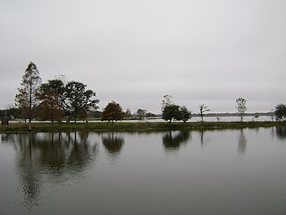
Toledo Bend Reservoir is a reservoir on the Sabine River between Texas and Louisiana. The lake has an area of 185,000 acres (750 km2), the largest man-made body of water partially in both Louisiana and Texas, the largest in the South, and the fifth largest by surface acre in the United States. The dam is capable of generating 92 megawatts of electrical power. The dam itself is located in the northeast corner of Newton County, Texas; however, that county includes very little of the reservoir, as most of it extends northward into parts of Sabine and DeSoto parishes in Louisiana, and Sabine, Shelby, and Panola counties in Texas.

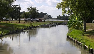
Lake McQueeney is a reservoir on the Guadalupe River located 5 miles (8 km) west of Seguin in Guadalupe County, Texas, United States. It was formed in 1928 by the construction of a dam to provide hydroelectric power to the area. Management of the dam and lake was assumed by the Guadalupe-Blanco River Authority on May 1, 1963. Its prominent feature is Treasure Island, a residential area that has been subjected to major flooding in 1972, 1998, and 2002. Most of it is approximately 10 feet (3 m) deep, with deeper sections along the center channel of the river. It is a venue for outdoor recreation, including fishing, boating, and swimming, and is maintained at a constant level year round. Amid concerns of aging dams along the lower Guadalupe River, the Guadalupe-Blanco River Authority announced that four lakes will be drained including lake McQueeny beginning Sept 16th (2019).
The Comal River is the shortest navigable river in the state of Texas in the United States. Proclaimed the "longest shortest river in the world" by locals, it runs entirely within the city limits of New Braunfels in southeast Comal County. It is a tributary of the Guadalupe River. The Comal begins at Comal Springs in Landa Park and flows 2.5 miles (4.0 km) until its junction with the Guadalupe.

The Guadalupe River runs from Kerr County, Texas, to San Antonio Bay on the Gulf of Mexico, with an average temperature of 17.75 degrees Celsius. It is a popular destination for rafting, fly fishing, and canoeing. Larger cities along it include Kerrville, New Braunfels, Seguin, Gonzales, Cuero, and Victoria. It has several dams along its length, the most notable of which, Canyon Dam, forms Canyon Lake northwest of New Braunfels.

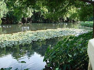
The San Marcos River rises from the San Marcos Springs, the location of Aquarena Springs, in San Marcos, Texas. The springs are home to several threatened or endangered species, including the Texas blind salamander, fountain darter, and Texas wild rice. The river is a popular recreational area, and is frequented for tubing, canoeing, swimming, and fishing.

Amistad Reservoir is a reservoir on the Rio Grande at its confluence with the Devils River 12 miles (19 km) northwest of Del Rio, Texas. The lake is bounded by Val Verde County on the United States side of the international border and by the state of Coahuila on the Mexican side of the border; the American shoreline forms the Amistad National Recreation Area. The reservoir was formed in 1969 by the construction of Amistad Dam. The dam and lake are managed jointly by the governments of the United States and Mexico through the International Boundary and Water Commission. The name of the dam and lake is the Spanish word for "friendship". The reservoir is also known as Lake Amistad.

Inks Lake State Park is a state park located in Burnet County, Texas, United States, next to Inks Lake on the Colorado River. The landscape of the park is hilly, with many cedar, live oak, prickly pear cacti, and yuccas. The ground is rocky, mainly consisting of gneiss rock.

The Blanco River is a river in the Hill Country of Texas in the United States.

Canyon Lake is a reservoir on the Guadalupe River in the Texas Hill Country in the United States. Canyon Lake is a U.S. Army Corps of Engineers reservoir formed on the Guadalupe River in Comal County by Canyon Dam, which is located about sixteen miles northwest of New Braunfels. The dam, lake, and all adjacent property are managed by the U.S. Army Corps Of Engineers. Water rights, waste water treatment, and hydroelectric generating facilities are managed by the Guadalupe-Blanco River Authority. Construction of the dam began in 1958 and was completed in 1964. The reservoir serves to provide flood control and water supply for the communities downstream from the dam. The lake is also a popular recreational destination.
Lake Gonzales is a reservoir on the Guadalupe River 4 miles (6 km) southeast of the town of Belmont in Gonzales County, Texas. The reservoir was formed in 1931 by the construction of a dam to provide hydroelectric power to the area. Management of the dam and lake was assumed by the Guadalupe-Blanco River Authority on May 1, 1963.
Lake Placid is a reservoir on the Guadalupe River one-half mile (0.80 km) southwest of the town of Seguin in Guadalupe County, Texas. The reservoir was formed in 1928 by the construction of a dam on the river. Management of the dam and lake was assumed by the Guadalupe-Blanco River Authority on May 1, 1963. Lake Placid is a venue for outdoor recreation, including fishing, boating, and swimming.
Lake Wood was a reservoir on the Guadalupe River 4 miles (6 km) west of the town of Gonzales in Gonzales County, Texas. The reservoir was formed in 1931 by the construction of a dam to provide hydroelectric power to the area. Management of the dam and lake was assumed by the Guadalupe-Blanco River Authority on May 1, 1963. Lake Wood served as a venue for outdoor recreation, including fishing and boating.
Meadow Lake is a reservoir on the Guadalupe River south of the town of Seguin in Guadalupe County, Texas. The reservoir was formed in 1931 by the construction of a dam to provide hydroelectric power to the area. Management of the dam and lake was assumed by the Guadalupe-Blanco River Authority on May 1, 1963. Meadow Lake also serves as a venue for outdoor recreation, including fishing and boating.
Lake Dunlap was a reservoir on the Guadalupe River near the town of New Braunfels in Guadalupe County, Texas, United States. The reservoir was formed in 1931 by the construction of a dam to provide hydroelectric power to the area. Management of the dam and lake was assumed by the Guadalupe-Blanco River Authority on May 1, 1963. Lake Dunlap serves as a venue for outdoor recreation, including fishing and boating. In 2019, the dam failed, draining the lake, and as of 2020 is under reconstruction.
Coleto Creek Reservoir is a reservoir on Coleto Creek and Perdido Creek located in Fannin, Texas, 15 miles (24 km) southwest of Victoria, Texas. The surface of the lake extends into Victoria and Goliad counties. The reservoir was formed in 1980 by the construction of a dam by the Guadalupe-Blanco River Authority to provide a power station cooling pond for electric power generation. Coleto Creek Reservoir is a venue for outdoor recreation, including fishing and boating.

The Canyon Dam in Texas is a rolled-earth dam on the Guadalupe River in the Hill Country. The water impounded by the dam forms Canyon Lake.

Canyon Lake Gorge is a limestone gorge in Texas, which is around 1 mile (1.6 km) long, hundreds of yards (metres) wide, and up to 50 feet (15 m) or more deep, which was exposed in 2002 when extensive flooding of the Guadalupe River led to a huge amount of water going over the spillway from Canyon Lake reservoir and removing the sediment from the gorge. The gorge provides a valuable exposure of rock strata as old as 111 million years showing fossils and a set of dinosaur tracks, and forms a new ecosystem for wildlife with carp and other creatures in a series of pools fed by springs and waterfalls.

Alamitos Creek or Los Alamitos Creek is a 7.7-mile-long (12.4 km) creek in San Jose, California, which becomes the Guadalupe River when it exits Lake Almaden and joins Guadalupe Creek. Los Alamitos Creek is located in Almaden Valley and originates from the Los Capitancillos Ridge in the Santa Cruz Mountains, near New Almaden. This creek flows through the Valley's Guadalupe Watershed, which is owned by the Santa Clara Valley Water District. The creek flows in a generally northwesterly direction after rounding the Los Capitancillos Ridge and the town of New Almaden, in the southwest corner, before ambling along the Santa Teresa Hills on northeast side of the Almaden Valley. Its environment has some relatively undisturbed areas and considerable lengths of suburban residential character. Originally called Arroyo de los Alamitos, the creek's name is derived from "little poplar", "alamo" being the Spanish word for "poplar" or "cottonwood".