Related Research Articles

Bay County is a county on the Emerald Coast in Northwest Florida. As of the 2020 census, the population was 175,216. Its county seat is Panama City.

Gulf County is a county located in the panhandle of the U.S. state of Florida. As of the 2020 census, the population was 14,192. Its county seat is Port St. Joe.

Mexico Beach is a city in Bay County, Florida, United States. It is located 25 miles (40 km) southeast of Panama City. The population was 1,060 at the 2020 census. The community was extensively damaged by Hurricane Michael on October 10, 2018. The Federal Emergency Management Agency (FEMA) declared the community "wiped out" in the aftermath of the hurricane's devastating impact.
Port St. Joe is a city and the county seat of Gulf County, Florida. It is located at the intersection of U.S. Highway 98 and State Road 71. As of the 2020 census, the population was 3,357, a decline from 3,644 as of the 2000 census.

Wewahitchka is a city in Gulf County, Florida, United States. The population was 2,074 as of the 2020 census. This was up from 1,722 as of the 2000 census. From the creation of Gulf County in 1925 until 1965, it served as the county seat before the county seat was moved to Port St. Joe. The city took its name from an American Indian word meaning "water eyes". Two lakes along the edge of town look like a perfect pair of eyes.
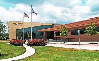
John J. Pershing Middle School is a middle school in Houston, Texas, United States. It is located in the Braeswood Place neighborhood, near the Texas Medical Center.

Heights High School, formerly John H. Reagan High School, is a senior high school located in the Houston Heights in Houston, Texas. It serves students in grades nine through twelve and is a part of the Houston Independent School District.

Maplewood is a community in Houston, Texas located outside the 610 Loop, southwest of Downtown Houston. It consists of 524 houses. They are one-story and two-story houses, as two stories is the limit allowed by the subdivision. The oldest houses were built in the early 1950s. Maplewood is located along Beechnut, Hillcroft, and Renwick.
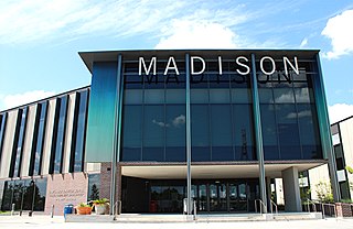
James Madison High School is a public high school located in the Hiram Clarke area of Houston, Texas, United States. The school, located in the Five Corners District, serves grades 9 through 12 and is part of the Houston Independent School District. The school is named after James Madison, the fourth President of the United States.

Clinton Park is a neighborhood located in Houston, Texas. Clinton Park is located outside the 610 Loop in eastern Houston. Clinton Park is predominantly African-American. Carolyn Campbell of KHOU-TV described Clinton Park, close to the Port of Houston, as "small" and "isolated."
Briargrove Park (BGP) is a subdivision in western Houston, Texas, United States. It has about 1,480 houses. It is bounded by Beltway 8, the Buffalo Bayou, Gessner Road, and Westheimer Road.
Magnolia Grove is a small neighborhood located along Buffalo Bayou between downtown Houston and Memorial Park in Houston, Texas. The neighborhood is bounded by Memorial Drive, Shepherd Drive, Washington Avenue, and Waugh Drive.

East Downtown Houston (EaDo) is a district in Houston, Texas. The East Downtown Management District (EDMD), manages the area with offices headquartered at START Houston, a co-working space 1121 Delano Street. The community is located east of Downtown Houston and north of Interstate 45. It is between the George R. Brown Convention Center and the East End district.
Port Houston is a neighborhood located on the East Side of Houston, Texas, United States.

Denver Harbor is a historic community located in eastern Houston, Texas, United States near the Houston Ship Channel. The community, bounded by Wallisville Road, the Union Pacific Railroad, and the Port Terminal Railroad Association, was first settled in the 1890s and platted in 1911 and 1913. The community includes many historic bungalow and cottage homes.

Shenandoah is a subdivision in Houston, Texas, United States.
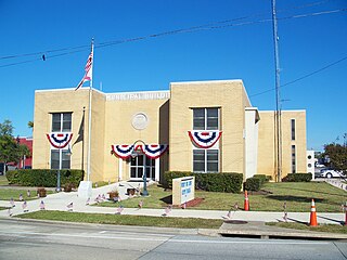
Bay District Schools is a school district headquartered in Panama City, Florida, United States.
The Airline Improvement District is a management district in unincorporated Harris County, Texas in Greater Houston and located entirely within the postal zip code of 77037.
References
- ↑ "Bay District Schools High School Attendance Zones Archived 2009-02-27 at the Wayback Machine ." Bay District Schools . Accessed October 10, 2008.
- ↑ "Bay District Schools Middle School Attendance Zones Archived 2009-02-27 at the Wayback Machine ." Bay District Schools . Accessed October 10, 2008.
- ↑ "Bay District Schools Elementary School Attendance Zones Archived 2008-10-31 at the Wayback Machine ." Bay District Schools . Accessed October 10, 2008.