Hand compass

Last updated
Parts of a hand compass Compass.JPG
Parts of a hand compass

A hand compass (also hand bearing compass or sighting compass) is a compact magnetic compass capable of one-hand use and fitted with a sighting device to record a precise bearing or azimuth to a given target or to determine a location. [1] [2] Hand or sighting compasses include instruments with simple notch-and-post alignment ("gunsights"), prismatic sights, direct or lensatic sights, [3] and mirror/vee (reflected-image) sights. With the additional precision offered by the sighting arrangement, and depending upon construction, sighting compasses provide increased accuracy when measuring precise bearings to an objective. [4]

Contents

The term hand compass is used by some in the forestry and surveying professions to refer to a certain type of hand compass optimized for use in those fields, also known as a forester or cruiser compass. [5] [6] A hand compass may also include the various one-hand or 'pocket' versions of the surveyor's or geologist's transit .

History and use

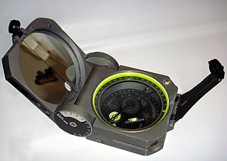
A standard Brunton Geo, used commonly by geologists Brunton.JPG
A standard Brunton Geo, used commonly by geologists

While small portable compasses fitted with mechanical sighting devices have existed for a few hundred years, the first one-hand compass with a sighting device appeared around 1885. [7] These soon evolved into more elaborate and specialized models such as the Brunton Pocket Transit patented in 1894. [8] Hand compasses were soon widely employed in the practice of forestry, geology, archaeology, speleology, preliminary cartography and land surveying.

Compass used by engineering geologists Stratum compass-clar hg.jpg
Compass used by engineering geologists

In the United States, the hand compass became very popular among foresters seeking a compass to plot and estimate stands of timber. While the Pocket Transit was more than adequate for such work, it was relatively expensive. Consequently, a new type of hand compass was introduced: the forester or cruiser compass. Traditionally, cruiser compasses featured a sighting notch, a mechanically-damped [9] or "dry" needle, adjustable declination and a large dial marked in individual degrees using counterclockwise calibration (reversed east and west positions). A screw base for a tripod or jacob staff (monopod) was often fitted as well. [10]

By the late 1960s many foresters had begun using more modern liquid-damped compass designs, including mirror-sight protractor models such as the Silva Type 15 Ranger or the Suunto MC-1 (later, the MC-2). These compasses were fast to use, particularly along straight cruise lines and were sufficiently accurate for most forestry applications. [11] On the other hand, geologists, speleologists, archaeologists, ornithologists, and foresters engaged in precision survey work often used direct-reading models such as the Suunto KB-14, prismatic compasses such as Suunto KB-77 or the traditional Brunton Pocket Transit. [12] [13] Many models featured an optional quadrant (0-90-0 degree) scale instead of an azimuthal (0-360 degree) system. [14]

By using a hand compass in combination with aerial photographs and maps a person can determine his/her location in the field, determine direction to landmarks or destinations, estimate distance, estimate area, and find points of interest (marked boundary lines, USGS marker, plot centers). For increased accuracy, many professional hand compasses continue to be fitted with tripod mounts. [15] While the hand compass continues to be widely employed in such work, it has been increasingly supplanted in recent years by use of the GPS, or Global Positioning System receiver.

Marine hand bearing compass

Floating-card compass with prismatic sight (bearing 220deg through eyepiece) Boussole prisme groupe.jpg
Floating-card compass with prismatic sight (bearing 220° through eyepiece)

The marine hand compass, or hand bearing compass|hand-bearing compass as it is termed in nautical use, has been used by small-boat or inshore sailors since at least the 1920s to keep a running course or to record precise bearings to landmarks on shore in order to determine position via the resection technique. [16] [17] Instead of a magnetized needle or disc, most hand bearing compasses feature liquid damping with a floating card design (a magnetized, degreed float or dial atop a jeweled pivot bearing). [18] Equipped with a viewing prism, the hand bearing compass allows instant reading of forward bearings from the user to an object or vessel, and some provide the reciprocal bearing as well. [19] [20] Modern examples of marine hand bearing compasses include the Suunto KB-14 and KB-77, and the Plastimo Iris 50. [21] [22] These compasses frequently have battery-illuminated or photoluminescent degree dials for use in low light or darkness. [23] [24]

Notes

  1. Frazer, Persifor, A Convenient Device to be Applied to the Hand Compass, Proceedings of the American Philosophical Society, Vol. 22, No. 118 (Mar., 1885), p. 216
  2. SCFC, Get Acquainted With Forestry Tools Article
  3. Johnson, Mark, The Ultimate Desert Handbook: A Manual for Desert Hikers, Campers, and Travelers, McGraw-Hill Professional (2003), ISBN   0-07-139303-X, 9780071393034, p. 134: A direct-sighting compass uses a magnifying viewfinder mounted in the compass body to directly view a degreed dial and superimposed indicator line; it therefore differs from a lensatic sight (which uses a simple magnifying lens on a folding arm positioned over the dial), or a prismatic sight (which uses a magnifying optical prism).
  4. Suunto Oy, The Suunto KB-14 Story, Article Archived 2008-04-09 at the Wayback Machine
  5. Rutstrum, The Wilderness Route Finder, University of Minnesota Press (2000), ISBN   0-8166-3661-3, pp. 47-55, 64-72
  6. Mooers Jr., Robert L. Finding Your Way In The Outdoors, Outdoor Life Press (1972), ISBN   0-943822-41-6, p. 47: The term cruiser compass derives from the practice of foresters cruising or estimating the value of a stand of timber by taking compass readings to ascertain the size of the stand.
  7. Frazor, Persifor, A Convenient Device to be Applied to the Hand Compass, Proceedings of the American Philosophical Society, Vol. 22, No. 118 (Mar., 1885), p. 216
  8. Hudson, William J., The Brunton Pocket Transit, 26 January 2005 Article
  9. Mooers Jr., Robert L. Finding Your Way In The Outdoors, Outdoor Life Press (1972), ISBN   0-943822-41-6, pp. 48-49: Most of the traditional designs used a momentary button lock mechanism that froze the needle in position to stop excessive swing and permit a reading.
  10. Rutstrum, pp. 47-55, 64-72
  11. Bonner Soil & Water Conservation District, Idaho State Forestry Contest (October 2004), p. 25 Article Archived 2008-12-15 at the Wayback Machine
  12. Nix, Steve, The Best Forestry Field Compass Article Archived 2008-08-07 at the Wayback Machine
  13. Suunto Oy, The Suunto KB-14 Story
  14. Rutstrum, pp. 47-55, 197-199
  15. Rutstrum, p. 72
  16. Casey, Don, Using a Hand Bearing Compass Article
  17. Seidman, David, The Complete Sailor: Learning the Art of Sailing, McGraw-Hill Professional (1995), ISBN   0-07-057131-7, ISBN   978-0-07-057131-0, pp. 190-194
  18. Dickison, Dan, Powerboat Reports Guide to Powerboat Gear: Take the Guesswork Out of Gear Buying, Globe Pequot Press (2006), ISBN   1-59228-069-2, ISBN   978-1-59228-069-8, pp. 91-93
  19. Seidman, pp. 190-194
  20. Dickison, pp. 91-93
  21. Suunto Oy, The Suunto KB-14 Story
  22. Dickison, pp. 91-93
  23. Dickison, pp. 91-93
  24. Suunto Oy, The Suunto KB-14 Story

Related Research Articles

<span class="mw-page-title-main">Compass</span> Instrument used for navigation and orientation

A compass is a device that shows the cardinal directions used for navigation and geographic orientation. It commonly consists of a magnetized needle or other element, such as a compass card or compass rose, which can pivot to align itself with magnetic north. Other methods may be used, including gyroscopes, magnetometers, and GPS receivers.
<span class="mw-page-title-main">Bearing (navigation)</span> In navigation, horizontal angle between the direction of an object and another object

In navigation, bearing or azimuth is the horizontal angle between the direction of an object and north or another object. The angle value can be specified in various angular units, such as degrees, mils, or grad. More specifically:

<span class="mw-page-title-main">Theodolite</span> Optical surveying instrument

A theodolite is a precision optical instrument for measuring angles between designated visible points in the horizontal and vertical planes. The traditional use has been for land surveying, but it is also used extensively for building and infrastructure construction, and some specialized applications such as meteorology and rocket launching.
<span class="mw-page-title-main">Magnetic declination</span> Angle on the horizontal plane between magnetic north and true north

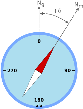
Magnetic declination is the angle between magnetic north and true north at a particular location on the Earth's surface. The angle can change over time due to polar wandering.

Piloting or pilotage is the process of navigating on water or in the air using fixed points of reference on the sea or on land, usually with reference to a nautical chart or aeronautical chart to obtain a fix of the position of the vessel or aircraft with respect to a desired course or location. Horizontal fixes of position from known reference points may be obtained by sight or by radar. Vertical position may be obtained by depth sounder to determine depth of the water body below a vessel or by altimeter to determine an aircraft's altitude, from which its distance above the ground can be deduced. Piloting a vessel is usually practiced close to shore or on inland waterways. Pilotage of an aircraft is practiced under visual meteorological conditions for flight.

<span class="mw-page-title-main">Monopod</span> Photographic equipment

A monopod, also called a unipod, is a single staff or pole used to help support cameras, binoculars, rifles or other precision instruments in the field.

<span class="mw-page-title-main">Sight (device)</span> Visual aiming device

A sight or sighting device is any device used to assist in precise visual alignment of weapons, surveying instruments, aircraft equipment, optical illumination equipment or larger optical instruments with the intended target. Sights can be a simple set or system of physical markers that serve as visual references for directly aligning the user's line of sight with the target, or optical instruments that provide an optically enhanced—often magnified—target image aligned in the same focus with an aiming point. There are also sights that actively project an illuminated point of aim onto the target itself so it can be observed by anyone with a direct view, such as laser sights and infrared illuminators on some night vision devices, as well as augmented or even virtual reality-enabled digital cameras with software algorithms that produce digitally enhanced target images.

<span class="mw-page-title-main">Suunto</span> Finnish manufacturer of compasses, dive computers and sports watches

Suunto Oy is a Finnish company that manufactures and markets sports watches, dive computers, compasses and precision instruments. Headquartered in Vantaa, Finland, Suunto employs more than 300 people worldwide, and its products are sold in over 100 countries. Although globally active, the headquarters is placed next to the factory, in which most of the work stages are still handcrafted. Suunto was a subsidiary of Amer Sports, owned since 2019 by the Chinese group Anta Sports, with sister brands Wilson, Atomic, Sports Tracker, Salomon, Precor, Arc'teryx. In May 2022, Chinese technology company Liesheng acquired Suunto from Amer Sports.
<span class="mw-page-title-main">Strike and dip</span> Orientation of a geologic feature

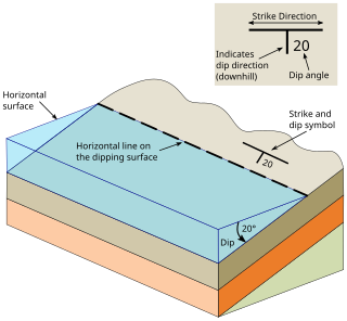
In geology, strike and dip is a measurement convention used to describe the plane orientation or attitude of a planar geologic feature. A feature's strike is the azimuth of an imagined horizontal line across the plane, and its dip is the angle of inclination measured downward from horizontal. They are used together to measure and document a structure's characteristics for study or for use on a geologic map. A feature's orientation can also be represented by dip and dip direction, using the azimuth of the dip rather than the strike value. Linear features are similarly measured with trend and plunge, where "trend" is analogous to dip direction and "plunge" is the dip angle.

<span class="mw-page-title-main">Brunton compass</span> Precision compass made by Brunton, Inc. of Riverton, Wyoming

A Brunton compass, properly known as the Brunton Pocket Transit, is a precision compass made by Brunton, Inc. of Riverton, Wyoming. The instrument was patented in 1894 by Canadian-born geologist David W. Brunton. Unlike most modern compasses, the Brunton Pocket Transit utilizes magnetic induction damping rather than fluid to damp needle oscillation. Although Brunton, Inc. makes many other types of magnetic compasses, the Brunton Pocket Transit is a specialized instrument used widely by those needing to make accurate navigational and slope-angle measurements in the field. Users are primarily geologists, but archaeologists, environmental engineers, mining engineers and surveyors also make use of the Brunton's capabilities. The United States Army has adopted the Pocket Transit as the M2 Compass for use by crew-served artillery.
<span class="mw-page-title-main">Osborne Fire Finder</span> A line-of-sight device for locating fires

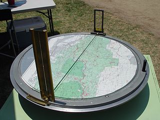
The Osborne Fire Finder is a type of alidade used by fire lookouts to find a directional bearing (azimuth) to smoke in order to alert fire crews to a wildland fire.
<span class="mw-page-title-main">Silva compass</span>

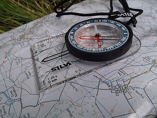
Silva Sweden AB is an outdoors products company that sells handheld compasses and other navigational equipment including GPS tools, mapping software, aircraft altimeters, and marine navigation tools. Silva's founders - Gunnar Tillander, Alvar Kjellström, Arvid Kjellström, and Björn Kjellström - invented the hugely popular orienteering baseplate or protractor compass used around the world for outdoors navigation.

<span class="mw-page-title-main">Brunton, Inc.</span>

Brunton Inc. is now Brunton International LLC after its recent acquisition in late 2021. They are a manufacturer of navigation tools including recreational compasses, navigational equipment, and geology and survey instruments. They are located in Riverton, Wyoming.

Position resection and intersection are methods for determining an unknown geographic position by measuring angles with respect to known positions. In resection, the one point with unknown coordinates is occupied and sightings are taken to the known points; in intersection, the two points with known coordinates are occupied and sightings are taken to the unknown point.

<span class="mw-page-title-main">Dumaresq</span> Mechanical calculating device

The Dumaresq is a mechanical calculating device invented around 1902 by Lieutenant John Dumaresq of the Royal Navy. It is a computer that relates vital variables of the fire control problem to the movement of one's own ship and that of a target ship.

<span class="mw-page-title-main">Course Setting Bomb Sight</span> Vector bombsight

The Course Setting Bomb Sight (CSBS) is the canonical vector bombsight, the first practical system for properly accounting for the effects of wind when dropping bombs. It is also widely referred to as the Wimperis sight after its inventor, Harry Wimperis.

<span class="mw-page-title-main">Geological compass</span> Type of compass

There are a number of different specialized magnetic compasses used by geologists to measure orientation of geological structures, as they map in the field, to analyze and document the geometry of bedding planes, joints, and/or metamorphic foliations and lineations. In this aspect the most common device used to date is the analogue compass.
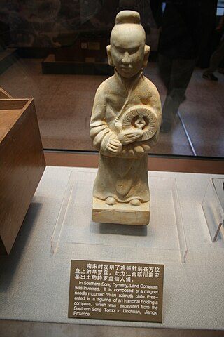
<span class="mw-page-title-main">History of the compass</span> History of the Compass

The compass is a magnetometer used for navigation and orientation that shows direction in regards to the geographic cardinal points. The structure of a compass consists of the compass rose, which displays the four main directions on it: East (E), South (S), West (W) and North (N). The angle increases in the clockwise position. North corresponds to 0°, so east is 90°, south is 180° and west is 270°.

<span class="mw-page-title-main">Burt's solar compass</span> Surveying instrument that uses the Suns direction instead of magnetism

Burt's solar compass or astronomical compass/sun compass is a surveying instrument that makes use of the Sun's direction instead of magnetism. William Austin Burt invented his solar compass in 1835. The solar compass works on the principle that the direction to the Sun at a specified time can be calculated if the position of the observer on the surface of the Earth is known, to a similar precision. The direction can be described in terms of the angle of the Sun relative to the axis of rotation of the planet.
<span class="mw-page-title-main">Bearing compass</span> Nautical instrument

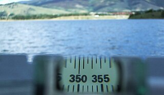
A bearing compass, is a nautical instrument used to determine the bearing of observed objects.. Used in navigation to determine the angle between the direction of an object and north or another reference point. Provides the absolute bearing, which is the clockwise angle between magnetic north or true north and the object. For example, an object to the east would have an absolute bearing of 90º, if it is relative to the magnetic north than it is called magnetic bearing. It is commonly used by geologists and surveyors to obtain precise bearings on the ground.

References