Harmony, Minnesota

Last updated
Harmony
Motto: 
"Biggest Little Town in Southern Minnesota" [1]
Fillmore County Minnesota Incorporated and Unincorporated areas Harmony Highlighted.svg
Location of Harmony, Minnesota
Coordinates: 43°33′10″N92°0′34″W / 43.55278°N 92.00944°W / 43.55278; -92.00944 Coordinates: 43°33′10″N92°0′34″W / 43.55278°N 92.00944°W / 43.55278; -92.00944
Country United States
State Minnesota
County Fillmore
Area
[2]
  Total1.11 sq mi (2.89 km2)
  Land1.11 sq mi (2.89 km2)
  Water0.00 sq mi (0.00 km2)
Elevation
1,352 ft (412 m)
Population
 (2020)
  Total1,043
  Density935.43/sq mi (361.19/km2)
Time zone UTC-6 (Central (CST))
  Summer (DST) UTC-5 (CDT)
ZIP code
55939
Area code 507
FIPS code 27-27188 [3]
GNIS feature ID0644677 [4]
Website http://www.harmony.mn.us/
Main Avenue, Harmony 2009-0528-Harmony.jpg
Main Avenue, Harmony
Greenfield Lutheran Church 2009-0528-MN-IA10-Harmony-church.jpg
Greenfield Lutheran Church
Harmony, Minnesota signpost Harmony, Minnesota signpost.JPG
Harmony, Minnesota signpost

Harmony is a city in Fillmore County, Minnesota, United States. The population was 1,020 at the 2010 census. [5] The town bills itself as the "Biggest Little Town in Southern Minnesota" [1] and features the largest Amish community in the state.

Contents

History

Harmony was founded in 1880. [6]

Amish came to Fillmore County in 1974 from Ohio, seeking cheaper land.

Geography

Harmony is located at 43°33′37″N92°0′35″W / 43.56028°N 92.00972°W / 43.56028; -92.00972 . According to the United States Census Bureau, the city has a total area of 1.13 square miles (2.93 km2), all of it land. [7]

U.S. Highway 52 and Minnesota Highway 139 are two of the main routes in the community.

Demographics

Historical population
CensusPop.
1900 517
1910 65526.7%
1920 7189.6%
1930 82114.3%
1940 8908.4%
1950 1,02214.8%
1960 1,21418.8%
1970 1,130−6.9%
1980 1,1330.3%
1990 1,081−4.6%
2000 1,080−0.1%
2010 1,020−5.6%
2020 1,0432.3%
U.S. Decennial Census [8]

2010 census

As of the census [9] of 2010, there were 1,020 people, 479 households, and 273 families living in the city. The population density was 902.7 inhabitants per square mile (348.5/km2). There were 541 housing units at an average density of 478.8 per square mile (184.9/km2). The racial makeup of the city was 98.1% White, 0.3% African American, 0.2% Native American, 0.2% Asian, and 1.2% from two or more races. Hispanic or Latino of any race were 1.0% of the population.

There were 479 households, of which 20.5% had children under the age of 18 living with them, 47.8% were married couples living together, 6.3% had a female householder with no husband present, 2.9% had a male householder with no wife present, and 43.0% were non-families. 38.8% of all households were made up of individuals, and 22.7% had someone living alone who was 65 years of age or older. The average household size was 2.02 and the average family size was 2.63.

The median age in the city was 53.3 years. 17.4% of residents were under the age of 18; 4.7% were between the ages of 18 and 24; 18.1% were from 25 to 44; 26.5% were from 45 to 64; and 33.2% were 65 years of age or older. The gender makeup of the city was 47.9% male and 52.1% female.

2000 census

As of the census [3] of 2000, there were 1,080 people, 477 households, and 299 families living in the city. The population density was 948.9 inhabitants per square mile (366.4/km2). There were 500 housing units at an average density of 439.3 per square mile (169.6/km2). The racial makeup of the city was 98.98% White, 0.19% African American, 0.09% Asian, 0.46% from other races, and 0.28% from two or more races. Hispanic or Latino of any race were 0.56% of the population.

There were 477 households, out of which 24.5% had children under the age of 18 living with them, 51.8% were married couples living together, 10.1% had a female householder with no husband present, and 37.3% were non-families. 34.4% of all households were made up of individuals, and 19.7% had someone living alone who was 65 years of age or older. The average household size was 2.16 and the average family size was 2.75.

In the city the population was spread out, with 20.6% under the age of 18, 5.0% from 18 to 24, 21.2% from 25 to 44, 22.6% from 45 to 64, and 30.6% who were 65 years of age or older. The median age was 48 years. For every 100 females there were 87.5 males. For every 100 females age 18 and over, there were 77.1 males.

The median income for a household in the city was $30,260, and the median income for a family was $38,750. Males had a median income of $27,188 versus $22,768 for females. The per capita income for the city was $16,859. About 8.4% of families and 9.8% of the population were below the poverty line, including 7.9% of those under age 18 and 16.0% of those age 65 or over.

Arts and culture

Museums and other points of interest

The Amish are the focal point of local tourism & shopping with many Amish owned businesses in the surrounding area.

The JEM Theatre, a movie theater built in 1940, is the only one operating in Fillmore County. There are three antique shops in town. Generations of Harmony- A 50 dealer mall on hwy 52- North side of town. OLD Crow Antiques on hwy 52/corner of Main-A house full of primitives & garden decor(w/a Furniture warehouse on Main st).I Love Antiques-on South Main across from the bank- a traditional antique store.

Nearby Niagara Cave is one of the largest caves in the Midwest, and is rated among the top 10 best caves by various nationally recognized organizations. Niagara Cave features a 60-foot (18 m) waterfall in the largest room in the cave, 200 feet below ground level. [10] It also has ancient fossils embedded in limestone that predate the dinosaurs, and a wedding chapel where there have been over 400 weddings performed since it opened. Outside the cave there is a gift shop, 10 acres (40,000 m2) of picnic grounds, an 18-hole mini golf course, and a sluice box where people can mine for gems and fossils. The cave, containing 5 miles of passageways, was accidentally discovered in 1926 by a local pig farmer. It has been open to the public since 1933. [10]

Harmony is the southern terminus of the Harmony-Preston Valley segment of the Blufflands State Trail. The Harmony-Preston State Trail connects the town to the renowned Root River Trail system.

Amish

In 1974, Amish from Wayne County, Ohio started a new settlement near Harmony. They belong to the Swartzentruber Amish affiliation, which are much more conservative than most other of the Old Order Amish affiliations. The total population of the Amish community near Harmony is about 1000 people. Besides farming they operate low-tech businesses, that produce and sell furniture, baskets, rugs, quilts, jams, baked goods and cashew crunch. The Amish are the focal point of local tourism attraction and shopping, with many Amish-owned businesses in the surrounding area. [11]

Education

Fillmore Central School District (#2198) is a public district that has one school in Harmony, the High School (7-12th grade). The Elementary (PK-4th grade) and the Middle School (5-6th grade) are located in nearby Preston. Fillmore Central's total enrollment for the school years of 2005-2006 are 641 students.

The Harmony Public Library is the public library in Harmony. [12] It is a member of Southeastern Libraries Cooperating, the SE Minnesota library region. [13]

Notable people

Related Research Articles

<span class="mw-page-title-main">Olmsted County, Minnesota</span> County in Minnesota, United States

Olmsted County is a county in the U.S. state of Minnesota. As of the 2020 census, the population is 162,847. Its county seat and most populous city is Rochester.

<span class="mw-page-title-main">Fillmore County, Minnesota</span> County in Minnesota, United States

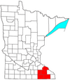
Fillmore County is a county in the U.S. state of Minnesota. As of the 2020 census, the population was 21,228. Its county seat is Preston. Fillmore County is included in the Rochester metropolitan area.

<span class="mw-page-title-main">Kalona, Iowa</span> City in Iowa, United States

Kalona is a city in Washington County, Iowa. It is part of the Iowa City metropolitan area. The population was 2,630 at the time of the 2020 census. Kalona is the second-largest city in Washington County.

<span class="mw-page-title-main">Smyrna, Maine</span> Town in the state of Maine, United States

Smyrna is a town in Aroostook County, Maine, United States. The population was 439 at the 2020 census.

<span class="mw-page-title-main">Watson, Minnesota</span> City in Minnesota, United States

Watson is a city in Chippewa County, Minnesota, United States. The population was 205 at the 2010 census. Lac Qui Parle State Park is nearby.

<span class="mw-page-title-main">Canton, Minnesota</span> City in Minnesota, United States

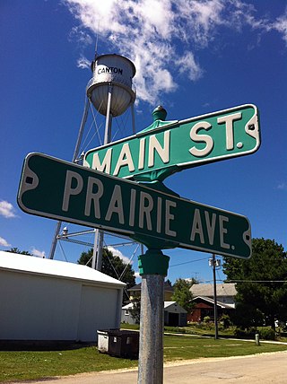
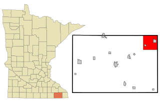
Canton is a city in Fillmore County, Minnesota, United States. The population was 346 at the 2010 census.

<span class="mw-page-title-main">Forestville Township, Fillmore County, Minnesota</span> Township in Minnesota, United States

Forestville Township is a township in Fillmore County, Minnesota, United States. The population was 356 as of the 2010 census. It contains historic Forestville, which is now a living history museum within Forestville/Mystery Cave State Park.

Harmony Township is a township in Fillmore County, Minnesota, United States. The population was 396 at the 2000 census.

<span class="mw-page-title-main">Mabel, Minnesota</span> City in Minnesota, United States

Mabel is a city in Fillmore County, Minnesota, United States. The population was 780 at the 2010 census.

<span class="mw-page-title-main">Ostrander, Minnesota</span> City in Minnesota, United States

Ostrander is a city in Fillmore County, Minnesota, United States. The population was 254 at the 2010 census.

<span class="mw-page-title-main">Peterson, Minnesota</span> City in Minnesota, United States

Peterson is a city in Fillmore County, Minnesota, United States. The population was 199 at the 2010 census.

<span class="mw-page-title-main">Preston, Minnesota</span> City in Minnesota, United States

Preston is a city in Fillmore County, Minnesota, United States. The population was 1,325 at the 2010 census. It is the county seat of Fillmore County. The Root River runs through it, and Mystery Cave State Park is nearby. It bills itself as "America's Trout Capital," with a 20-foot trout placed along Minnesota State Highway 16.

Preston Township is a township in Fillmore County, Minnesota, United States. The population was 374 at the 2000 census.

<span class="mw-page-title-main">Rushford Village, Minnesota</span> City in Minnesota, United States

Rushford Village is a city in Fillmore County, Minnesota, United States. The population was 807 at the 2010 census. It surrounds the city of Rushford.

<span class="mw-page-title-main">Spring Valley, Minnesota</span> City in Minnesota, United States

Spring Valley is a city in Fillmore County, Minnesota, United States. The population was 2,479 at the 2010 census.

<span class="mw-page-title-main">Whalan, Minnesota</span> City in Minnesota, United States

Whalan is a city in Fillmore County, Minnesota, United States. The population was 63 at the 2010 census.

<span class="mw-page-title-main">Madison, Minnesota</span> City in Minnesota, United States

Madison is a city in Lac qui Parle County, Minnesota, United States, along the 45th parallel. The population was 1,518 at the 2020 census. It is the county seat of Lac qui Parle County. It proclaims itself to be the "lutefisk capital of the USA."

<span class="mw-page-title-main">Stewartville, Minnesota</span> City in Minnesota, United States

Stewartville is a city in Olmsted County, Minnesota, United States. The population was 5,916 at the 2010 census, and was estimated to have grown to a population of 6,125 as of 2018. Stewartville has experienced growth as a result of its location just south of Rochester.

<span class="mw-page-title-main">Tintah, Minnesota</span> City in Minnesota, United States

Tintah is a city in Traverse County, Minnesota, United States. The population was 67 at the 2020 census.

<span class="mw-page-title-main">Chatfield, Minnesota</span> City in Minnesota, United States

Chatfield is a city in Fillmore and Olmsted counties in the U.S. state of Minnesota. The population was 2,779 at the 2010 census. The city's area is split almost equally between the two counties. Chatfield is known as "The Gateway to Bluff Country" and "The Chosen Valley".

References

  1. 1 2 "Harmony Minnesota Chamber of Commerce". Harmony Minnesota Chamber of Commerce. Archived from the original on August 24, 2012. Retrieved October 8, 2012.
  2. "2020 U.S. Gazetteer Files". United States Census Bureau. Retrieved July 24, 2022.
  3. 1 2 "U.S. Census website". United States Census Bureau . Retrieved 2008-01-31.
  4. "US Board on Geographic Names". United States Geological Survey. 2007-10-25. Retrieved 2008-01-31.
  5. "2010 Census Redistricting Data (Public Law 94-171) Summary File". American FactFinder. United States Census Bureau . Retrieved 27 April 2011.[ dead link ]
  6. Upham, Warren (1920). Minnesota Geographic Names: Their Origin and Historic Significance. Minnesota Historical Society. p.  193.
  7. "US Gazetteer files 2010". United States Census Bureau . Retrieved 2012-11-13.
  8. "Census of Population and Housing". Census.gov. Retrieved June 4, 2015.
  9. "U.S. Census website". United States Census Bureau . Retrieved 2012-11-13.
  10. 1 2 WPA Guide to Minnesota. Saint Paul, Minnesota: Minnesota Historical Society. 1985 [1938]. p. 369. ISBN   0873517121.
  11. "Minnesota Amish" at amishamerica.com
  12. Address: 225 3rd Avenue SE, Harmony, MN 55919. Phone number: 507-886-8133
  13. Southeastern Libraries Cooperating (SELCO)
  14. Fosdick, Carol (2004). Rochester Sesquicentennial Authors: catalog of authors, past and present, with Rochester Connections. Rochester, Minnesota: Author Recognition Committee for Rochester's Sesquicentennial. p. 19.