Hart District

Last updated

Hart
Fleet - Fleet Road - geograph.org.uk - 3370688.jpg
Fleet town centre
Hart UK locator map.svg
Hart shown within Hampshire
Sovereign state United Kingdom
Constituent country England
Region South East England
Non-metropolitan county Hampshire
Status Non-metropolitan district
Admin HQ Fleet
Incorporated1 April 1974
Government
  TypeNon-metropolitan district council
  BodyHart District Council
   MPs Ranil Jayawardena
Leo Docherty
Area
  Total83.1 sq mi (215.3 km2)
  Rank140th (of 296)
Population
 (2022)
  Total100,910
  Rank241st (of 296)
  Density1,200/sq mi (470/km2)
Ethnicity (2021)
[1]
   Ethnic groups
List
Religion (2021)
[1]
   Religion
List
Time zone UTC0 (GMT)
  Summer (DST) UTC+1 (BST)
ONS code 24UG (ONS)
E07000089 (GSS)
OS grid reference SU8047254050

Hart is a local government district in Hampshire, England, named after the River Hart. Its council is based in Fleet. The district also contains the towns of Blackwater and Yateley, along with numerous villages and surrounding rural areas.

Contents

In the English indices of deprivation for 2019, Hart was ranked as the least deprived district in England; [2] a position it had also held in the 2015 index. [3]

For five years running (2011–2015), an annual study conducted by the Halifax bank named Hart as the UK's most desirable place to live for quality of life. The study took into account jobs, housing, health, crime, weather, traffic and broadband access. It found that in 2014 97% of people in the local authority area were in good health, and in 2011 tended to have incomes 40% above the national average. [4] [5]

History

The district was created on 1 April 1974 under the Local Government Act 1972, covering the area of two former districts, which were both abolished at the same time: [6]

The new district was initially going to be named Hartley Wintney, after the rural district which covered most of the area, which in turn was named after the village of the same name. [7] The shadow authority elected to oversee the transition to the new system requested a change of name to Hart, after the River Hart which runs through the area. The change of name was approved by the government on 17 January 1974, before the new district formally came into being. [8]

The River Hart is said to derive its name from the number of deer in the area, with a hart being an old term for an adult male deer, synonymous with "stag". The area historically had several deer parks. Hart District Council uses a profile of a stag as its logo.

Governance

Hart District Council
Hart District Council logo.svg
Type
Type
Leadership
Peter Wildsmith,
Liberal Democrat
since 18 May 2023 [9]
David Neighbour,
Liberal Democrat
since 25 May 2017
Daryl Phillips
Structure
Seats33 councillors
Hart District Council 2024.svg
Political groups
Administration (21)
  Liberal Democrat (12)
  CCH (11)
Other parties (12)
  Conservative (9)
  Independent (1)
Length of term
4 years
Elections
Last election
2 May 2024
Next election
May 2026
Meeting place
Civic Offices, Harlington Way, Fleet, GU51 4AE
Website
www.hart.gov.uk

Hart District Council provides district-level services. County-level services are provided by Hampshire County Council. The whole district is also covered by civil parishes, which form a third tier of local government. [10]

Political control

The council has been under no overall control since 2012. Since 2017 the council has been run by a coalition of the Liberal Democrats and local party Community Campaign (Hart), led by Liberal Democrat councillor David Neighbour.

The first election to the council was held in 1973, initially acting as a shadow authority alongside the outgoing authorities until the new arrangements took effect on 1 April 1974. Political control since 1974 has been as follows: [11] [12] [13]

Party in controlYears
Independent 1974–1979
Conservative 1979–1983
No overall control 1983–2000
Conservative 2000–2005
No overall control 2005–2010
Conservative 2010–2012
No overall control 2012–present

Leadership

The leaders of the council since 2008 have been: [14]

CouncillorPartyFromTo
Ken Crookes [15] Conservative 200828 Nov 2014
Stephen Parker [16] Conservative 18 Dec 201425 May 2017
David Neighbour [17] Liberal Democrats 25 May 2017

Composition

Following the 2024 election, the composition of the council is: [18]

PartyCouncillors
Liberal Democrats 12
Community Campaign 11
Conservative 9
Independent 1
Total33

No party has majority control of the council; currently the Liberal Democrats and Community Campaign (Hart), a local residents' association, run the council as a joint administration. The next election is due in 2026.

Elections

Since the last boundary changes in 2014 the council has comprised 33 councillors representing 11 wards, with each ward electing three councillors. Elections are held three years out of every four, with a third of the council (one councillor for each ward) elected at a time for a four year term of office. Hampshire County Council elections are held in the fourth year of the cycle when there are no district council elections. [19]

Premises

The council is based at the Civic Offices on Harlington Way in Fleet. [20] The building was purpose-built for the council in 1986. [21]

Demography

In mid-2003 Hart had an estimated 85,700 residents. This compares with the 2001 Census figure of 83,505 residents. The 2001 Census also reported that there were 32,470 households, with 77% of residents describing their health as 'good'. In the twenty years between 1982 and 2002 the population of Hart grew by 19 per cent, compared with an increase of 11 per cent for the South East region as a whole.

Parishes and town councils

The whole district is divided into civil parishes, listed below. The parish councils for Blackwater and Hawley, Fleet, and Yateley have declared their parishes to be towns, allowing them to take the style "town council". Whilst Hook is a post town it retains a parish council rather than a town council. [22]

Related Research Articles

<span class="mw-page-title-main">Bracknell Forest</span> District in Berkshire, England

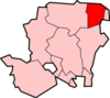
Bracknell Forest is a unitary authority area in Berkshire, southern England. It covers the two towns of Bracknell and Sandhurst and the village of Crowthorne and also includes the areas of North Ascot, Binfield, Warfield, and Winkfield. The borough borders Wokingham and the Royal Borough of Windsor & Maidenhead in Berkshire, and also parts of Surrey and Hampshire.

<span class="mw-page-title-main">Sandhurst, Berkshire</span> Human settlement in England

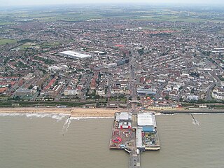
Sandhurst is a town and civil parish in the Bracknell Forest borough in Berkshire, England. It is in the south eastern corner of Berkshire, and is situated 32 miles (51 km) west-southwest of central London, 2.5 miles (4.0 km) north west of Camberley and 5 miles (8.0 km) south of Bracknell. Sandhurst is known worldwide as the location of the Royal Military Academy Sandhurst. Despite its close proximity to Camberley, Sandhurst is also home to a large and well-known out-of-town mercantile development. The site is named "The Meadows" and has a Tesco Extra hypermarket and a Marks & Spencer, two of the largest in the country. A large Next clothing and homeware store is open on the site of the old Homebase.

<span class="mw-page-title-main">Fleet, Hampshire</span> Human settlement in England

Fleet is a town and civil parish in the Hart District of Hampshire, England, centred 38 miles (61 km) south-west of London and 13 miles (21 km) east of Basingstoke.

Church Crookham is a large suburban village and civil parish, contiguous with the town of Fleet, in northeast Hampshire, England. It is 38 miles (61 km) west-southwest of London. Formerly a separate village, it figures as a southern suburb of Fleet.

<span class="mw-page-title-main">Tendring District</span> Non-metropolitan district in England

Tendring District is a local government district in north-east Essex, England. Its council is based in Clacton-on-Sea, the largest town. Other towns are Brightlingsea, Harwich, Frinton-on-Sea and Walton-on-the-Naze.

<span class="mw-page-title-main">City of Winchester</span> Place in England

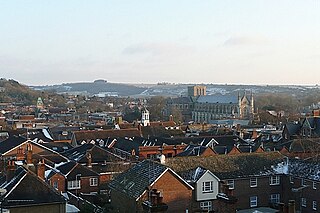
Winchester, or the City of Winchester, is a local government district with city status in Hampshire, England.

<span class="mw-page-title-main">Braintree District</span> Non-metropolitan district in England

Braintree District is a local government district in Essex, England. The district is named after the town of Braintree, where the council is based. The district also includes the towns of Halstead and Witham and surrounding rural areas.

<span class="mw-page-title-main">Hartley Wintney</span> Human settlement in England

Hartley Wintney is a large village and civil parish in the Hart district of Hampshire, England. It lies about 3 miles (5 km) northwest of Fleet and 8 miles (13 km) east of Basingstoke. The parish includes the smaller contiguous village of Phoenix Green as well as the hamlets of Dipley, Elvetham, Hartfordbridge, and West Green.

<span class="mw-page-title-main">Aldershot (UK Parliament constituency)</span> Parliamentary constituency in the United Kingdom

Aldershot is a constituency in Hampshire represented in the House of Commons of the UK Parliament since 2017 by Leo Docherty, a Conservative.

<span class="mw-page-title-main">North East Hampshire (UK Parliament constituency)</span> UK Parliament constituency since 1997

North East Hampshire is a constituency represented in the House of Commons of the UK Parliament by Ranil Jayawardena, a Conservative.

<span class="mw-page-title-main">Winchfield</span> Village in Hampshire, England

Winchfield is a small village in the Hart District of Hampshire in the South-East of England. It is situated 1 mile (1.6 km) south-west of Hartley Wintney, 8 miles (13 km) east of Basingstoke, 2 miles (3.2 km) north-east of Odiham and 38 miles (61 km) west of London. It is connected to London Waterloo and Basingstoke by the South West Main Line.

Blackwater is a small town in the northeastern corner of Hampshire, England, lying in the county's Hart District. Considered to be part of the Farnborough/Aldershot Built-up Area and almost contiguous with Camberley, Surrey, it is centred 32 miles (51 km) WSW from London.

<span class="mw-page-title-main">Crookham Village</span> Human settlement in England

Crookham Village is located south-west of Fleet, in northeast Hampshire, England and lies within the Hart District.

<span class="mw-page-title-main">Hart District Council elections</span>

One third of Hart District Council in Hampshire, England is elected each year, followed by one year without election. Since the last boundary changes in 2014, 33 councillors have been elected from 11 wards.

<span class="mw-page-title-main">2002 Hart District Council election</span> 2002 UK local government election

The 2002 Hart Council election took place on 2 May 2002 to elect members of Hart District Council in Hampshire, England. The whole council was up for election with boundary changes since the last election in 2000. The Conservative Party gained overall control of the council from no overall control.

<span class="mw-page-title-main">2017 Hampshire County Council election</span>

The 2017 Hampshire County Council election took place on 4 May 2017 as part of the 2017 local elections in the United Kingdom. All councillors were elected from electoral divisions by first-past-the-post voting for a four-year term of office. The electoral divisions were somewhat changed from the previous election, with some being split, merged or with boundary changes. No elections were held in Portsmouth and Southampton, which are unitary authorities and hold their elections in other years. Similarly the districts within Hampshire did also not hold elections this year.

<span class="mw-page-title-main">Community Campaign (Hart)</span> Political party in the United Kingdom

Community Campaign (Hart) (CCH) is a minor localist political party based in the district of Hart in the north east of Hampshire. Founded in 2003, it has contested both district and county elections within Hart, and has successfully gained representation in both the district council and county council. The first Community Campaign Hart councillors were elected in 2004, with numbers increasing over the next few years; as of 2022 there are now ten. The party is currently in administration of the council in coalition with the Liberal Democrats, with 21 seats between them out of 33. Councillor James Radley is currently the Deputy Leader of the council, as well as holding portfolio for Finance & Corporate Services.

<span class="mw-page-title-main">2010 Hart District Council election</span>

The 2010 Hart District Council election took place on 6 May 2010, on the same day as the United Kingdom General Election. One third of the council was up for re-election, the Conservatives gained three seats, one from Community Campaign Hart and the two independent seats, whilst the Liberal Democrats remained on 10 seats. With an increase from 17 seats to 20, the Conservatives gained a majority and administration of the council, which had been under no overall control since 2005.After the election, the composition of the council was:

References

  1. 1 2 UK Census (2021). "2021 Census Area Profile – Hart Local Authority (E07000089)". Nomis. Office for National Statistics . Retrieved 5 January 2024.
  2. "English indices of deprivation 2019". 10 November 2023.
  3. "English indices of deprivation 2015: File 10 local authority district summaries". Department for Communities and Local Government. 30 September 2015.
  4. "Hart in Hampshire named as UK's most desirable place". BBC News. 24 December 2011.
  5. "Hart in Hampshire remains UK's most desirable place". BBC News. 20 December 2014.
  6. "The English Non-metropolitan Districts (Definition) Order 1972", legislation.gov.uk , The National Archives, SI 1972/2039, retrieved 31 May 2023
  7. "The English Non-metropolitan Districts (Names) Order 1973", legislation.gov.uk , The National Archives, SI 1973/551, retrieved 31 May 2023
  8. "Historical information from 1973 onwards". Boundary-Line support. Ordnance Survey. Retrieved 10 November 2023.
  9. "Council minutes, 18 May 2023". Hart District Council. Retrieved 9 November 2023.
  10. "Local Government Act 1972", legislation.gov.uk , The National Archives, 1972 c. 70, retrieved 31 May 2023
  11. "Compositions calculator". The Elections Centre. Retrieved 8 November 2023.
  12. "Hart". BBC News Online . 19 April 2009. Retrieved 7 May 2010.
  13. "Councillor admits fiddling his council tax". gethampshire. 19 May 2005. Archived from the original on 4 October 2011. Retrieved 23 April 2010.
  14. "Council minutes". Hart District Council. Retrieved 19 July 2022.
  15. "Cllr Ken Crookes 'disappointed' with decision to test new settlement at Winchfield". Basingstoke Gazette. 1 December 2014. Retrieved 19 July 2022.
  16. "New man appointed to lead Hart District Council". Basingstoke Gazette. 19 December 2014. Retrieved 19 July 2022.
  17. "Neighbour wins leadership race". Farnham Herald. 6 June 2017. Retrieved 19 July 2022.
  18. "Hart results". BBC News. 3 May 2024. Retrieved 14 May 2024.
  19. "The Hart (Electoral Changes) Order 2012", legislation.gov.uk , The National Archives, SI 2012/1395, retrieved 11 November 2023
  20. "Contact us". Hart District Council. Retrieved 10 November 2023.
  21. "Praise for council office builders". Fleet News. 15 August 1986. p. 7. Retrieved 10 November 2023.
  22. "Parish council contact details". Hart District Council. Retrieved 10 November 2023.

51°16′46″N0°50′46″W / 51.2794°N 0.8461°W / 51.2794; -0.8461