Hartrandt, Wyoming

Last updated
Hartrandt, Wyoming
CDP
USA Wyoming location map.svg
Red pog.svg
Hartrandt, Wyoming
Location within the state of Wyoming
Coordinates: 42°53′42″N106°20′38″W / 42.89500°N 106.34389°W / 42.89500; -106.34389 Coordinates: 42°53′42″N106°20′38″W / 42.89500°N 106.34389°W / 42.89500; -106.34389
Country United States
State Wyoming
County Natrona
Area
  Total1.56 sq mi (4.0 km2)
  Land1.56 sq mi (4.0 km2)
  Water0.0 sq mi (0.0 km2)
Elevation
5,285 ft (1,611 m)
Population
 (2010) [1]
  Total693
  Density440/sq mi (170/km2)
Time zone UTC-7 (Mountain (MST))
  Summer (DST) UTC-6 (MDT)
Area code(s) 307
FIPS code 56-35552 [2]
GNIS feature ID1853202 [3]

Hartrandt is a census-designated place (CDP) in Natrona County, Wyoming, United States. It is part of the Casper, Wyoming Metropolitan Statistical Area and the population was 693 at the 2010 census.

Contents

Geography

Hartrandt is located at 42°53′42″N106°20′38″W / 42.89500°N 106.34389°W / 42.89500; -106.34389 (42.894865, -106.343957). [4]

According to the United States Census Bureau, the CDP has a total area of 1.56 square miles (4.0 km2), all land. [5]

Demographics

As of the census [2] of 2000, there were 682 people, 248 households, and 183 families residing in the CDP. The population density was 446.3 people per square mile (172.1/km2). There were 269 housing units at an average density of 176.0/sq mi (67.9/km2). The racial makeup of the CDP was 93.40% White, 0.15% African American, 1.03% Native American, 0.44% Asian, 0.15% Pacific Islander, 0.73% from other races, and 4.11% from two or more races. Hispanic or Latino of any race were 2.20% of the population.

There were 248 households, out of which 35.9% had children under the age of 18 living with them, 57.7% were married couples living together, 8.9% had a female householder with no husband present, and 26.2% were non-families. 17.3% of all households were made up of individuals, and 6.5% had someone living alone who was 65 years of age or older. The average household size was 2.74 and the average family size was 3.09.

In the CDP, the population was spread out, with 26.8% under the age of 18, 8.7% from 18 to 24, 31.1% from 25 to 44, 24.8% from 45 to 64, and 8.7% who were 65 years of age or older. The median age was 34 years. For every 100 females, there were 110.5 males. For every 100 females age 18 and over, there were 107.1 males.

The median income for a household in the CDP was $25,694, and the median income for a family was $35,000. Males had a median income of $24,943 versus $15,625 for females. The per capita income for the CDP was $12,340. About 15.3% of families and 28.0% of the population were below the poverty line, including 55.0% of those under age 18 and 14.1% of those age 65 or over.

Related Research Articles

Meridianville, Alabama Census-designated place in Alabama, United States

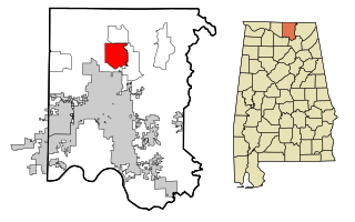
Meridianville is an unincorporated community and census-designated place (CDP) in Madison County, Alabama, United States, and is included in the Huntsville-Decatur Combined Statistical Area. As of the 2020 census, the population of the CDP was 8,209.

St. James, Maryland CDP in Maryland, United States

St. James is a census-designated place (CDP) in Washington County, Maryland, United States. The population was 1,657 at the 2000 census. It is also the home of St. James School, Hagerstown, a small, Episcopalian, boarding school. St. James was formerly named "Lydia."

Albany, Wyoming CDP in Wyoming, United States

Albany is a census-designated place (CDP) in Albany County, Wyoming, United States. The population was 55 at the 2010 census.

Woods Landing-Jelm, Wyoming CDP in Wyoming, United States

Woods Landing-Jelm is a census-designated place (CDP) in Albany County, Wyoming, United States. The population was 97 at the 2010 census.

Sleepy Hollow, Wyoming Census-designated place in Wyoming, United States

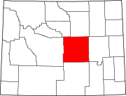
Sleepy Hollow is a census-designated place (CDP) in Campbell County, Wyoming, United States. The population was 1,308 at the 2010 census.

Smoot, Wyoming Census-designated place in Wyoming, United States

Smoot is a census-designated place (CDP) in Lincoln County, Wyoming, United States. The population was 195 at the 2010 census.

Turnerville, Wyoming Census-designated place in Wyoming, United States

Turnerville is a census-designated place (CDP) in Lincoln County, Wyoming, United States. The population was 192 at the 2010 census.

Antelope Hills is a census-designated place in Natrona County, Wyoming, United States. It is part of the Casper, Wyoming Metropolitan Statistical Area. The population was 97 at the 2010 census.

Bessemer Bend is a census-designated place (CDP) in Natrona County, Wyoming, United States. It is part of the Casper, Wyoming Metropolitan Statistical Area. The population was 199 at the 2010 census.

Brookhurst, Wyoming CDP in Wyoming, United States

Brookhurst is a census-designated place (CDP) in Natrona County, Wyoming, United States. It is part of the Casper, Wyoming Metropolitan Statistical Area. The population was 185 at the 2010 census.

Casper Mountain, Wyoming CDP in Wyoming, United States

Casper Mountain is a census-designated place (CDP) on Casper Mountain in Natrona County, Wyoming, United States. It is part of the Casper, Wyoming Metropolitan Statistical Area. The population was 401 at the 2010 census.

Homa Hills is a census-designated place (CDP) in Natrona County, Wyoming, United States. It is part of the Casper, Wyoming Metropolitan Statistical Area. The population was 278 at the 2010 census.

Meadow Acres is a census-designated place (CDP) in Natrona County, Wyoming, United States. It is part of the Casper, Wyoming Metropolitan Statistical Area. The population was 198 at the 2010 census.

Mountain View is a census-designated place in Natrona County, Wyoming, United States. It is part of the Casper, Wyoming Metropolitan Statistical Area. The population was 96 at the 2010 census.

Red Butte is a census-designated place (CDP) in Natrona County, Wyoming, United States. It is part of the Casper, Wyoming Metropolitan Statistical Area. The population was 449 at the 2010 census.

Vista West is a census-designated place (CDP) in Natrona County, Wyoming, United States. It is part of the Casper, Wyoming Metropolitan Statistical Area. The population was 951 at the 2010 census.

Chugcreek, Wyoming CDP in Wyoming, United States

Chugcreek is a census-designated place (CDP) in Platte County, Wyoming, United States. The population was 156 at the 2010 census.

Westview Circle, Wyoming CDP in Wyoming, United States

Westview Circle is a census-designated place (CDP) in Platte County, Wyoming, United States. The population was 52 at the 2010 census.

Clearview Acres is a census-designated place (CDP) in Sweetwater County, Wyoming, United States. The population was 795 at the 2010 census.

Osage, Wyoming CDP in Wyoming, United States

Osage is a census-designated place (CDP) in Weston County, Wyoming, United States. The population was 151 at the 2020 census.

References

  1. "2010 City Population and Housing Occupancy Status". U.S. Census Bureau. Retrieved July 13, 2012.[ dead link ]
  2. 1 2 "U.S. Census website". United States Census Bureau . Retrieved 2008-01-31.
  3. "US Board on Geographic Names". United States Geological Survey. 2007-10-25. Retrieved 2008-01-31.
  4. "US Gazetteer files: 2010, 2000, and 1990". United States Census Bureau. 2011-02-12. Retrieved 2011-04-23.
  5. "2010 Wyoming Place Names". U.S. Census Bureau. Retrieved July 13, 2012.