
Honolulu is the capital and most populous city of the U.S. state of Hawaii, which is in the Pacific Ocean. It is the unincorporated county seat of the consolidated City and County of Honolulu, situated along the southeast coast of the island of Oʻahu, and is the westernmost and southernmost major U.S. city. Honolulu is Hawaii's main gateway to the world. It is also a major hub for business, finance, hospitality, and military defense in both the state and Oceania. The city is characterized by a mix of various Asian, Western, and Pacific cultures, reflected in its diverse demography, cuisine, and traditions.

Hawaii County is a county in the U.S. state of Hawaii in the Hawaiian Islands. It is coextensive with the Island of Hawaii, often called the "Big Island" to distinguish it from the state as a whole. The 2020 Census population was 200,629. The county seat is Hilo. There are no incorporated cities in Hawaii County. The Hilo Micropolitan Statistical Area includes all of Hawaii County. Hawaii County has a mayor–council form of government. Hawaii County is the largest county in the state in terms of geography.

Kailua-Kona is an unincorporated community and census-designated place (CDP) in Hawaii County, Hawaii, United States. It is also known as Kailua, as Kona and as Kona Town. Kailua-Kona is the second-largest settlement on the island of Hawaii and the largest on the island's west side, where it is the center of commerce and the tourist industry. Kailua-Kona is served by Kona International Airport, just to the north in the adjacent CDP of Kalaoa. The population was 19,713 at the 2020 census, up from 11,975 at the 2010 census.

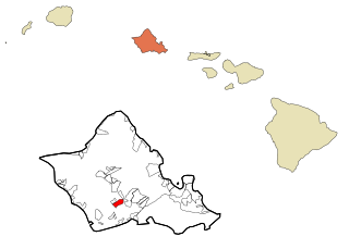
ʻAiea is a census-designated place (CDP) located in the City and County of Honolulu, Hawaii, United States. As of the 2010 Census, the CDP had a total population of 9,338.

Halawa is a census-designated place (CDP) in the ‘Ewa District of Honolulu County, Hawaii, United States. Halawa Stream branches into two valleys: North and South Halawa; North Halawa is the larger stream and fluvial feature. Their confluence is within the H-3/H-201 highways exchange. Most of Halawa Valley is undeveloped. As of the 2020 census, the CDP had a population of 15,016.

Kahuku is a census-designated place (CDP) in Honolulu, Hawaii, United States. In the Hawaiian language, ka huku means "the projection", presumably a reference to Kahuku Point nearby, the northernmost point of land on the island of Oahu. As of the 2010 Census, Kahuku had a population of 2,614.

Kailua is a census-designated place (CDP) in Honolulu County, Hawaii, United States. It lies in the Koʻolaupoko District of the island of Oʻahu on the windward coast at Kailua Bay. It is in the judicial district and the ahupua'a named Ko'olaupoko. It is 12 miles (19 km) northeast of Honolulu – over Nu‘uanu Pali.

Maunawili is a residential census-designated place (CDP) in the City & County of Honolulu, Koʻolaupoko District, Island of Oʻahu, Hawaii, United States. As of the 2020 census, the CDP had a population of 2,026. Situated mauka of Kalanianaʻole Highway between Castle Junction and Castle Hospital, Maunawili is nearly all private homes, schools, and a few churches; horse stables complete the rural setting. There are no commercial establishments. However, residents are only minutes from Kailua.

Mililani is a city located near the center of the island of Oʻahu in Honolulu County, Hawaiʻi, United States. It consists of two census-designated places, Mililani Town, with a population of 28,121 at the 2020 census, and Mililani Mauka, with a 2020 census population of 21,075.
Pearl City is an unincorporated community and census-designated place (CDP) in the ʻEwa District and City & County of Honolulu on the Island of Oʻahu. As of the 2010 census, the CDP had a population of 47,698. Pearl City is along the north shore of Pearl Harbor. Waimalu borders Pearl City to the east and Waipahu borders the west. The U.S. postal code for Pearl City is 96782.
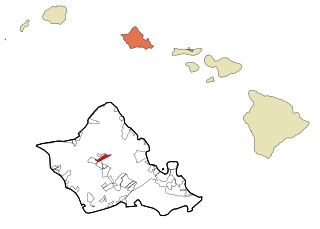
Wahiawa is a census-designated place (CDP) in Honolulu County, Hawaii, United States, on the island of Oahu. It is in the Wahiawā District, on the plateau or "central valley" between the two volcanic mountains that bookend the island. In Hawaiian, wahi a wā means "place of the wa people". The population was 18,658 at the 2020 census.
Waipahu is a former sugarcane plantation town and now census-designated place (CDP) located in the ʻEwa District on the island of Oʻahu in the City & County of Honolulu, Hawaiʻi, United States. As of the 2020 census, the CDP population was 43,485. The U.S. postal code for Waipahu is 96797.

Kapolei is a planned community in Honolulu County, Hawaiʻi, United States, on the island of Oʻahu. It is colloquially known as the "second city" of Oʻahu, in relation to Honolulu. For statistical purposes, the United States Census Bureau has defined Kapolei as a census-designated place (CDP) within the consolidated city-county of Honolulu.

Hawaii Route 61, often called the Pali Highway, is in Honolulu County, Hawaii, United States, that is the main highway connecting downtown Honolulu with the windward side of Oʻahu island. From downtown, it traverses up Nuʻuanu Valley and the residential neighborhood of Nuʻuanu, passes through the Nuʻuanu Pali Tunnels, and descends to the major windward communities of Kāneʻohe and Kailua.

The Hawaii Department of Public Safety is a department within the executive branch of the government of the U.S. state of Hawaii. It is headquartered in the 919 Ala Moana Boulevard building in Honolulu, Hawaii. The Department of Public Safety is made up of three divisions: Administration, Corrections, and Law Enforcement.

Honolulu County, officially known as the City and County of Honolulu, is a consolidated city-county in the U.S. state of Hawaii. The city-county includes both Urban Honolulu and the rest of the neighborhoods on the island of Oʻahu, as well as several minor outlying islands, including all of the Northwestern Hawaiian Islands except Midway Atoll.
Olomana High & Intermediate School part of Hawaii Department of Education, is an alternative-education school which offers classes for students in seventh grade through twelfth grade. Located at 42-471 Kalanianaole Highway Kailua, Hawaii 96734, United States, the school has about 250 students attending.
