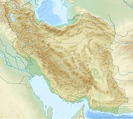
The Iranian Plateau or the Persian Plateau is a geological feature in Central Asia, South Asia, and Western Asia. It is the part of the Eurasian Plate wedged between the Arabian and Indian plates, situated between the Zagros Mountains to the west, the Caspian Sea and the Kopet Dag to the north, the Armenian Highlands and the Caucasus Mountains in the northwest, the Strait of Hormuz and the Persian Gulf to the south and the Indo-Gangetic Plain to the east in Pakistan.

The Zagros Mountains are a long mountain range in Iran, northern Iraq and southeastern Turkey. This mountain range has a total length of 1,600 km (990 mi). The Zagros mountain range begins in northwestern Iran and roughly follows Iran's western border, while covering much of southeastern Turkey and northeastern Iraq. From this border region, the range roughly follows Iran's coast on the Persian Gulf. It spans the whole length of the western and southwestern Iranian plateau, ending at the Strait of Hormuz. The highest point is Mount Dena, at 4,409 metres (14,465 ft).

The Karkas mountain chain is a mountain range which is located almost in central Iran. Having a northwest-southeast direction, it is stretched from Kashan to Ardestan for more than 100 kilometres. With an elevation of 3895 metres, the highest peak of the Karkas Mountains is Mount Karkas which is situated close to Natanz.

Bazman is a dormant stratovolcano in a remote desert region of Sistan and Baluchestan Province in south-eastern Iran. A 500-m-wide crater caps the summit of the dominantly andesitic-dacitic volcano, the flanks of which are covered by monogenetic centres especially to the northwest. Bazman is a geologically young volcano which formed mainly in the Quaternary, with the oldest dated rocks being 11.7 million years old and the youngest 0.6 million years. Although no historic eruptions have been reported from Bazman, it does contain fumaroles. Thus Bazman may be regarded as dormant, rather than extinct. Its satellite cones have been the source of basaltic lava flows.

Shir Kuh or Shirkuh is a high peak in the central part of Iran about 40 km (25 mi) south-west of the city of Yazd in Yazd Province. The first woman to climb the mountain was Banoo Khosrawy.

ʿAlam-Kūh – Mount Alam – is a mountain in Alborz mountain range in north of Iran, Mazandaran Province, forming a peak of Takht-e Suleyman Massif. It is located in Kelardasht District of Mazandaran Province of Iran. With an elevation of 4,805 meters, it is the second-highest peak in Iran after Mount Damavand.

Taftan is an active stratovolcano in south-eastern Iran situated in the Sistan and Baluchestan province. With variable heights reported, all around 4,000 metres (13,000 ft) above sea level, it is the highest mountain in south-eastern Iran. The nearest city is Khash.
Tapeh Yahya is an archaeological site in Kermān Province, Iran, some 220 kilometres (140 mi) south of Kerman city, 90 kilometres (56 mi) south of Baft city and 90 km south-west of Jiroft.
The Jebal Barez is a mountain chain in the Kerman Province of Iran. This mountain range stretches for some 100 km north-west to south-east, parallel to the Halil Rud, to the north-east of Jiroft and to the south-west of Bam, rising to a maximal elevation of 3,750 m. The mountains of this range are continued by other mountains such as Mount Shahsavaran and Mount Hudian to the south-east. They separate the plain of Hamun-e Jaz Murian from that of Namakzar-e Shahdad and Lut desert.
Hajjiabad or Hajiabad may refer to:
Qal'eh Hasan Ali is a maar-producing volcanic field located southeast of Kerman Province, Iran. The field is presumed of Quaternary age, though it has produced no historic eruptions. Consisting of 14 maars each of different size, its most significant crater is Great Crater, about 1.2 kilometres (0.75 mi) in width and 200–300 metres (660–980 ft) in depth.

The Qarinvand dynasty, or simply the Karenids, was an Iranian dynasty that ruled in parts of Tabaristan (Mazandaran) in what is now northern Iran from the 550s until the 11th-century. They considered themselves as the inheritors of the Dabuyid dynasty, and were known by their titles of Gilgilan and Ispahbadh. They were descended from Sukhra, a Parthian nobleman from the House of Karen, who was the de facto ruler of the Sasanian Empire from 484 to 493.

The main points that are discussed in the geology of Iran include the study of the geological and structural units or zones; stratigraphy; magmatism and igneous rocks; ophiolite series and ultramafic rocks; and orogenic events in Iran.
Mount Bahr Aseman is a mountain that is located approximately 15 kilometres south of the town of Sarduiyeh and about 60 kilometres east of the city of Baft in Kerman Province. With an elevation of 3886 metres, this mountain is among high peaks of Iran. Made chiefly of Eocene pyroclastic rocks, Mount Bahr Aseman is situated in a central Iranian range, Sahand-Bazman volcanic range or belt, a mountain range which was formed mainly during Eocene volcanism and that stretches approximately from Sahand Volcano in the north-west of Iran to Bazman Volcano in the south-east of Iran.
The Sahand-Bazman Volcanic and Plutonic Belt or the Sahand-Bazman Igneous Arc or the Central Iranian Range is a mountain range that is made by igneous and pyroclastic rocks. Located East and almost parallel to the Zagros Mountains, the Central Iranian Range is stretched in a north-west-southeast direction from Mount Sahand in Azerbaijan in the north-west to Mount Bazman in Baluchistan in the Southeastern part of Iran. This range was mainly formed during the Tertiary volcanic and orogenic phase and especially in the Eocene volcanism and plutonism. The Central Iranian Range or the Sahand-Bazman Volcanic Belt includes famous mountains such as the Sahand in East Azerbaijan Province, Mount Karkas in the Karkas Mountains and Mount Marshenan in Isfahan Province, the Jebal Barez, Mount Hezar and Mount Lalehzar in Kerman Province, and the Bazman in the Sistan va Baluchestan Province of Iran.
Golovinsky, Golovinskaya, or Golovinskoye is the name of several rural localities in Russia.