Hardin County is a county located in the west central portion of the U.S. state of Ohio. As of the 2020 census, the population was 30,696. Its county seat and largest city is Kenton. The county was created in 1820 and later organized in 1833. It is named for John Hardin, an officer in the American Revolution.

Lees Creek, also known as Centerville, is an unincorporated community in central Wayne Township, Clinton County, Ohio, United States. It lies at the intersection of State Route 729 with Cox Road, 6 miles south of Sabina and 12 miles (19 km) southeast of Wilmington, the county seat of Clinton County. It lies between the headwaters of the Middle Fork of Lees Creek, to the southeast, and the Anderson Fork of Caesar Creek. it had a post office, with the ZIP code 45138. The Post Office closed in 2012 and the town, including East Clinton High School, now carries a Sabina mailing address.

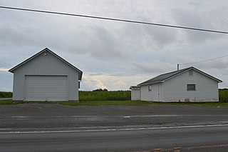
Roundhead is an unincorporated community in southeastern Roundhead Township, Hardin County, Ohio, United States. It has a post office with the ZIP code 43346.

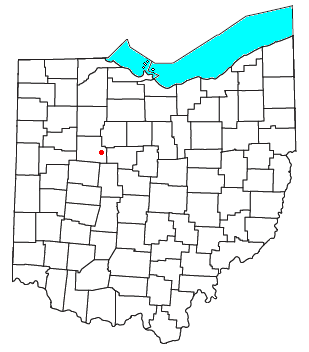
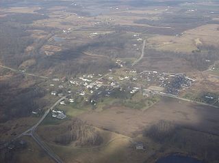
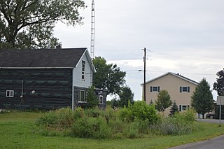
Dola is a census-designated place in central Washington Township, Hardin County, Ohio, United States. As of the 2020 United States Census it had a population of 143. It has a post office with the ZIP code 45835.
Springhills is an unincorporated community in northwestern Harrison Township, Champaign County, Ohio, United States. It lies at the intersection of State Route 245 with Crowl and Springhill-DeGraff Roads. Graves Creek, a subsidiary of the Great Miami River through Stony Creek, runs along the western edge of Springhills. It is located 6 miles (9.5 km) west of West Liberty and 11.5 miles (18.5 km) northwest of Urbana, the county seat of Champaign County.

Kennard is an unincorporated community in eastern Salem Township, Champaign County, Ohio, United States. It lies at the intersection of Gray and Kennard Roads, less than 2 miles southwest of State Route 245. The headwaters of Kings Creek, a tributary of the Mad River, flow past Kennard. It is located approximately 10 miles (16 km) northwest of the city of Urbana, the county seat of Champaign County.

Millerstown is an unincorporated community in eastern Johnson Township, Champaign County, Ohio, United States. It lies at the intersection of Heck Hill, Ward, and Zimmerman Roads, 2+1⁄2 miles (4.0 km) north of U.S. Route 36. Nettle Creek, a tributary of the Mad River, flows past Millerstown. It is located approximately 4 miles northeast of the city of St. Paris and 10 miles (16 km) west-northwest of the city of Urbana, the county seat of Champaign County.

Brokensword is an unincorporated community on the border between the Holmes and Lykens townships of Crawford County, Ohio, United States. Located at the intersection of the concurrent State Routes 19 and 100 with Brokensword Road, it is six miles north and two miles west of the city of Bucyrus, the county seat. Broken Sword Creek flows a short distance to the south of the community.

Tawawa is an unincorporated community in northeastern Green Township, Shelby County, Ohio, United States. It lies along State Route 29 less than one mile away from the Champaign County border. Mosquito Creek, a tributary of the Great Miami River, flows northwestward along the southern edge of Tawawa. The community lies 8 miles southeast of the city of Sidney, the county seat of Shelby County.

Mexico is an unincorporated community in northeastern Tymochtee Township, Wyandot County, Ohio, United States. Located at 40°59′11″N83°11′36″W, it lies at an elevation of 810 feet.

Thackery is an unincorporated community in southeastern Jackson and southwestern Mad River Townships in Champaign County, Ohio, United States. It lies along State Route 55, southwest of the city of Urbana, the county seat of Champaign County.

Blanchard is an unincorporated community in Hardin County, in the U.S. state of Ohio.

Grant is an unincorporated community in Hardin County, in the U.S. state of Ohio.
Grassy Point is an unincorporated community in Hardin County, in the U.S. state of Ohio.

Holden is an unincorporated community on the border of Wayne Township in Auglaize County and Roundhead Township in Hardin County, in the U.S. state of Ohio.
Jumbo is an unincorporated community in Hardin County, in the U.S. state of Ohio.
Jump is an unincorporated community in Hardin County, in the U.S. state of Ohio.

Maysville is an unincorporated community in Allen and Hardin counties, in the U.S. state of Ohio.

Pfeiffer is an unincorporated community in Hardin County, in the U.S. state of Ohio.
Yelverton is an unincorporated community in Hardin County, in the U.S. state of Ohio.