Hisar district

Last updated

Hisar district
Firoz Shah Palace And Tehkhana 01.jpg
Sheela Mata Temple Agroha.jpg
Main gate from front side.jpg
Rakhigarhi Harappan civilization.jpg
Balaji mandir Hisar.jpg
Clockwise from top-left: Palace of Firoz Shah, Sheela Mata Temple in Agroha, mounds at Rakhigarhi, Balaji Mandir at Hisar, Asigarh Fort
India - Haryana - Hisar.svg
Location in Haryana
Country India
State Haryana
Division Hisar
Established1815
Headquarters Hisar (city)
Tehsils Adampur, Agroha, Barwala, Hisar, Balsamand, Bass, Narnaund and Uklanamandi
Government
  Deputy CommissionerUttam Singh, IAS
Area
  Total3,983 km2 (1,538 sq mi)
Population
 (2011)
  Total1,743,931
  Density438/km2 (1,130/sq mi)
Demographics
   Literacy 64.83%
Languages
  Official Hindi, English
  Regional Bagri language
Time zone UTC+05:30 (IST)
Major highways NH-9 (formerly NH-10) and NH-52 (formerly NH-65)
Lok Sabha constituencies Hisar
Website hisar.nic.in

Hisar district is one of the 22 districts of Haryana, India. Hisar city serves as the district headquarters. Hisar district has four sub-divisions that is, Hisar, Barwala, Hansi and Narnaud, each headed by an SDM. The district is also part of Hisar division. Hisar was founded by Firuz Shah Tughlaq.

Contents

The largest district in Haryana until its 1966 reorganization, some parts of Hisar were transferred to the newly created Jind district. In 1974, the Tehsils of Bhiwani and Loharu were transferred to Bhiwani district. Hisar was further bifurcated when Sirsa district was formed. Fatehabad district was later created as well. [1]

Hisar is a divisional headquarters of the Hisar division and also the headquarters of Police Range. It is also a battalion headquarters of B.S.F. 3rd Bn. H.A.P. and commando force. In order to accommodate all of these departments, a five-storey District Administrative Complex was built, with the offices transferred in 1980. It adjoins the new Judiciary Complex, which is also made functional. This administrative and judiciary complex is the largest in Haryana; as a district headquarters it may be one of the largest in the country.

It is one of the five cities belonging to Sarasvati Valley Civilization while its name is cited in the history books in the context of Indus civilization and in general knowledge books as the location of Banawali, one of five sheep farms. As of 2011 it is the second most populous of the 21 districts of Haryana, after Faridabad. [2]

Hisar is also known as the steel city because of the Jindal Stainless Steel Factories. It is also the largest producer of galvanized iron in India.[ citation needed ]

Geography

In any doab, khadar land (green) lies next to a river, while bangar land (olive) has greater elevation and lies further from the river Khadir-and-bangar.jpg
In any doab, khadar land (green) lies next to a river, while bangar land (olive) has greater elevation and lies further from the river

North Hisar district falls in doab between Ghagghar river flowing through fatehabad district and paleo channel of Dhrishadvati river flowing through the Narnaul tehsil. Eastern, central and south-eastern Hisar district falls in doab between Dhrishadvati river and Yamuna river. Western Hisar district is part of bagar tract. The regions of the doabs near the rivers consist of low-lying, flood-prone, but usually very fertile khadir and the higher-lying land away from the rivers consist of bangar, less prone to flooding but also less fertile on average. [3] For the purpose of irrigation, Hisar district has been classified into 5 circles, namely barani (low rain area where rain-fed dry farming is practiced which nowadays are dependent on tubewells for the irrigation), [4] bagar (dry sandy tract of land on the border of Rajasthan state adjoining the states of Haryana and Punjab) [4] nahri (canal-irrigated land), nali or naili (fertile prairie tract between the Ghaggar river and the southern limits of the Saraswati channel depression in northern Hissar district of Haryana that gets flooded during the rains), [5] and Rangoi tract (an area irrigated by the Rangoi canal made for the purpose of carrying flood waters of Ghagghar river to dry areas). [6] [7]

Hisar has fertile alluvial soil interspersed with highly permeable very sandy tracts in bagar region several with water table more than 100 feet below ground containing brackish water usually unfit for human consumption, where dust storms frequent during the warm summer months from April till the end of July when monsoon arrives. Previously, Hisar was solely based on the rain and irrigation was possible only in the nali region where the season Ghaggar river flows in North Hisar. After the opening of Bhakra Nangal Dam canal system in 1963 as well as the earlier Western Yamuna Canal now irrigate most of Haryana including all of the Bagar region falling in Haryana on its western border. Opening of Indira Gandhi Canal in 1983 (specially Hansi Butana branches) brought the water of Sutlej and Beas rivers to the fields of Rajasthan including its Bagar tract stabilizing the sand dunes and soil erosion by preventing the expansion of desert. [4]

Climate

Hisar
Climate chart (explanation)
J
F
M
A
M
J
J
A
S
O
N
D
 
 
13
 
 
6
6
 
 
16
 
 
8
8
 
 
12
 
 
31
14
 
 
5.6
 
 
37
19
 
 
20
 
 
41
24
 
 
43
 
 
50
28
 
 
141
 
 
48
27
 
 
147
 
 
35
26
 
 
65
 
 
35
24
 
 
15
 
 
34
18
 
 
6.1
 
 
29
11
 
 
7.3
 
 
24
7
Average max. and min. temperatures in °C
Precipitation totals in mm
Source: IMD
Imperial conversion
JFMAMJJASOND
 
 
0.5
 
 
44
42
 
 
0.6
 
 
46
47
 
 
0.5
 
 
87
57
 
 
0.2
 
 
98
67
 
 
0.8
 
 
105
76
 
 
1.7
 
 
122
82
 
 
5.5
 
 
118
81
 
 
5.8
 
 
95
79
 
 
2.6
 
 
96
75
 
 
0.6
 
 
94
64
 
 
0.2
 
 
84
52
 
 
0.3
 
 
74
44
Average max. and min. temperatures in °F
Precipitation totals in inches

Hisar has a warm climate.

History

A skeleton from Rakhigarhi, Indus Valley civilisation site in Hisar on display in the National Museum, New Delhi Skeleton harappa.JPG
A skeleton from Rakhigarhi, Indus Valley civilisation site in Hisar on display in the National Museum, New Delhi

The district suffered famine in 1783-84 (Chalisa famine), [8] 1838, [9] 1860-61, [9] 1896-97 [10] and 1899-1900. [10]

Administrative divisions

Hisar continued to be the District Headquarters of the largest District in the state until its reorganization in 1966 when parts were carved out to create the new Jind District. The Tehsil Bhiwani and Loharu estate were later transferred to Bhiwani district on its creation in 1974. It was further bifurcated when Sirsa district was created entirely out of Hisar District. Fatehabad district has now been carved out of this district.

At present Hisar district consists of the eight tehsils of Adampur, Agroha, Barwala, Hisar, Hansi-1, Hansi-2, Narnaund and Uklanamandi,
two Sub-Tehsils of Balsamand and Bass. Vehicle registration numbers for Hisar district are: Hisar HR 20 and HR 39 (commercial no), Hansi HR 21 and Barwala HR 80.

Hisar is a divisional headquarters of the Divisional Commissioner and also the headquarters of the Police Range. It is also a battalion Headquarters of Border Security Force, 3rd battalion of Haryana Armed Police and police commando force. All these departments are now housed in a five storied District Administrative Complex completed in 1980, which adjoins the new Judiciary Complex.

The district has seven Vidhan Sabha constituencies, namely, Adampur, Uklana, Narnaund, Hansi, Barwala, Hisar and Nalwa. All of these are part of Hisar Lok Sabha constituency

Demographics

Historical population
YearPop.±% p.a.
1951423,390    
1961577,887+3.16%
1971774,265+2.97%
1981985,769+2.44%
19911,209,238+2.06%
20011,537,117+2.43%
20111,743,931+1.27%
source: [11]

the 2011 census the district had a population of 1,743,931, [2] roughly equal to the nation of The Gambia [12] or the US state of Nebraska. [13] This gave it a ranking of 276th in India out of a total of 640 districts. [2] The district has a population density of 438 inhabitants per square kilometre (1,130/sq mi) . [2] Its population growth rate over the decade 2001-2011 was 13.38%. [2] Hisar has a sex ratio of 871 females for every 1000 males, [2] and a literacy rate of 73.2%. Scheduled Castes make up 23.44% of the population. [2]

Hisar is 98% Hindu, only about 40,000 are Muslims, [14] rest are mostly Jain and Sikhs. Nearly all Muslims of Hisar left for Pakistan during Partition.

Languages of Hisar district (2011) [15]

   Haryanvi (68.76%)
   Hindi (26.40%)
   Punjabi (2.41%)
  Others (2.43%)

At the time of the 2011 Census of India, 68.76% of the population in the district spoke Haryanvi, 26.40% Hindi and 2.41% Punjabi as their first language. [15] Haryanvi is the most spoken dialect in the district.

The important social groups in the district are Jats, Bishnois, Brahmins, Banias, Agrawal Jains, Aroras, Sainis, Ahirs, Gujjars, Kumhars, Chamars and Balmikis. [16] Jat is the largest social group in the city. [16] Bishnois have migrated from Rajasthan. [16] There are three sections of Brahmins in the district, i.e., Gaur, Bias and Khandelwal. Most of the Aroras are migrant from West Punjab after the partition of the country in 1947. [16] Banias are divided into Aggarwals, Oswals and Maheshwaris. The Aggarwals are said to be the descendants of the inhabitants of Agroha. [16] They hold Agroha in great reverence. Oswals and Maheshwaris trace their origin to the Rajasthan. [16] The Gujjars of Hisar trace their origin to Rajasthan. [16] Hisar is also the origin place of Agrawal Jain Community, with Hansi being an important Jain pilgrimage town.

Religion

Religion in Hisar district (2011) [17]
ReligionPercent
Hinduism
97.54%
Islam
1.24%
Sikhism
0.70%
Other or not stated
0.52%
Religion in Hisar District
Religious
group
2011 [17]
Pop. %
Hinduism Om.svg 1,701,061
Islam Star and Crescent.svg 21,650
Sikhism Khanda.svg 12,270
Christianity Christian cross.svg 1,945
Others7,005
Total Population1,743,931
Religious groups in Hisar district (British Punjab province era)
Religious
group
1901 [18] 1911 [19] [20] 1921 [21] 1931 [22] 1941 [23]
Pop. %Pop.%Pop.%Pop.%Pop.%
Hinduism Om.svg [lower-alpha 1] 544,799541,720548,351583,429652,842
Islam Star and Crescent.svg 202,009218,600215,943253,784285,208
Sikhism Khanda.svg 28,64238,50845,61555,16960,731
Jainism Jain Prateek Chihna.svg 6,0035,7675,8745,9886,126
Christianity Christian cross.svg 2532731,0241,1071,292
Zoroastrianism Faravahar.svg 1110324
Judaism Star of David.svg 08001
Buddhism Dharma Wheel (2).svg 03000
Others0000505
Total population781,717804,889816,810899,4791,006,709
Note: British Punjab province era district borders are not an exact match in the present-day due to various bifurcations to district borders — which since created new districts — throughout the historic Punjab Province region during the post-independence era that have taken into account population increases.
Religion in the Tehsils of Hisar District (1941) [23]
Tehsil Hinduism Om.svg [lower-alpha 1] Islam Star and Crescent.svg Sikhism Khanda.svg Christianity Christian cross.svg Jainism Jain Prateek Chihna.svg Others [lower-alpha 2] Total
Pop. %Pop.%Pop.%Pop.%Pop.%Pop.%Pop.%
Hisar Tehsil157,05864,49915,7125721,99224239,857
Hansi Tehsil175,76145,551165562,8361224,370
Bhiwani Tehsil127,74029,5545331695874158,587
Fatehabad Tehsil94,12267,5567,664181247169,491
Sirsa Tehsil98,16178,04836,657420587531214,404
Note1: British Punjab province era tehsil borders are not an exact match in the present-day due to various bifurcations to tehsil borders — which since created new tehsils — throughout the historic Punjab Province region during the post-independence era that have taken into account population increases.

Note2: Tehsil religious breakdown figures for Christianity only includes local Christians, labeled as "Indian Christians" on census. Does not include Anglo-Indian Christians or British Christians, who were classified under "Other" category.

Education

Universities
Govt colleges
Private colleges
Schools

Hisar also has several renowned schools including Leading Angel Public School, Hisar (LAPS), Indus Public School, Hisar (IPS), Army Public School, Hisar (APS), Thakur Dass Bhargava Senior Secondary Model School , Vidya Devi Jindal School and O.P.JINDAL MODERN SCHOOL .

Notable individuals

Over the past three centuries Hisar had been the birthplace of individuals including Sardar Ishri Singh, Sardar Harji Ram and Rai Bahadur Sardar Nau Nihal Singh who were honorary magistrates in pre-Independence Hisar. Noteworthy individuals include the Lala Lajpat Rai (freedom fighter, elected member of Hisar municipal committee, founder of Hisar district congress (1986), Arya samaj (1986) and district bar council), Captain Abhimanyu Sindhu (entrepreneur, journalist, BJP national spokesperson and Minister in Haryana from Narnaund assembly constituency), late Dr. Gopi Chand Bhargava (First Chief Minister of joint Punjab), Om Prakash Jindal (former chairperson of Jindal Industries and Minister in Haryana government) and his wife Savitri Jindal (chairperson of Jindal Industries and Minister in Haryana government), Subhash Chandra (Chairman of Essel Group and Zee Network and BJP MP in Rajya Sabha), Amit Munjal, founder and CEO of Doctor Insta and Former CFO of Citi Holdings, Yash Tonk (Bollywood actor), Manish Joshi Bismil (theatre director), General V.K. Singh (Former Army Chief and Union Minister from BJP]], General Dalbir Singh Suhag (former Army Chief).

See also

Related Research Articles

<span class="mw-page-title-main">Haryana</span> State in northern India

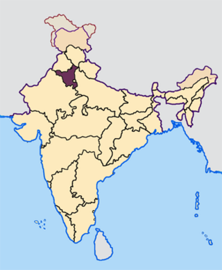
Haryana is an Indian state located in the northern part of the country. It was carved out of the former state of East Punjab on 1 November 1966 on a linguistic basis. It is ranked 21st in terms of area, with less than 1.4% of India's land area. The state capital is Chandigarh, which it shares with the neighbouring state of Punjab; and the most populous city is Faridabad, which is a part of the National Capital Region. The city of Gurgaon is among India's largest financial and technology hubs. Haryana has 6 administrative divisions, 22 districts, 72 sub-divisions, 93 revenue tehsils, 50 sub-tehsils, 140 community development blocks, 154 cities and towns, 7,356 villages, and 6,222 villages panchayats.

<span class="mw-page-title-main">Hisar (city)</span> City in Haryana, India

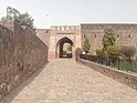
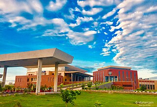
Hisar also known as Hissar is the administrative headquarters of Hisar district in the state of Haryana in northwestern India. It is located 164 km (102 mi) to the west of New Delhi, India's capital, and has been identified as a counter-magnet city for the National Capital Region to develop as an alternative center of growth to Delhi.

<span class="mw-page-title-main">Rohtak district</span> District of Haryana in India

Rohtak district is a district in the Indian state of Haryana. It is located in the southeast of the state and northwest of Delhi, bounded by Jind and Sonipat districts to the north, Jhajjar and Sonipat districts to the east, and Hissar, Charkhi Dadri, and Bhiwani districts to the west. Rohtak city is the district headquarters.

<span class="mw-page-title-main">Jind district</span> District of Haryana in India

Jindo district is one of the 22 districts of Haryana state in northern India. Jindo town is the administrative headquarters of the district. It is part of Hisar Division and was created in 1966.

<span class="mw-page-title-main">Fatehabad district</span> District of Haryana in India

Fatehabad district is one of the twenty two districts of the state of Haryana, India. Fatehabad was founded by Firuz Shah Tughlaq. Fatehabad district was carved out of Hisar district on 15 July 1997.

<span class="mw-page-title-main">Patiala district</span> District in Punjab, India

Patiala district is one of the twenty three districts in the state of Punjab in north-west India.

<span class="mw-page-title-main">Nalwa</span> Village in Haryana, India

Nalwa is a village, as well as an Assembly Constituency in Haryana Legislative Assembly, located in Hisar district in the state of Haryana in India.

Rania is a town and a municipal committee in Sirsa district located on the upper bank of Ghaggar River in the Indian state of Haryana. Rania Town is a grain market in Sirsa district. Nearby cities to Rania includes Sirsa and Ellenabad. It shares it's RTO office with Ellenabad which is also has its headquarters in Ellenabad. Earlier it was a part of Ellenabad subdivision but later carved out separately as a subdivision in Sirsa district of Haryana. It is at a distance of 22 km each from Sirsa and Ellenabad in opposite direction on Haryana State Highway 32A i.e. Bhambhoor-Jiwan Nagar Road which connects to Haryana State Highway 32 in Jiwan Nagar on one end and Haryana State Highway 23 in Bhambhoor on the other end.

<span class="mw-page-title-main">Administrative divisions of Haryana</span> Regional divisions in Haryana

Haryana, formed on 1 November 1966, is a state in North India. For the administrative purpose, Haryana is divided into 6 revenue divisions which are further divided into 22 districts. For Law and Order maintenance, it is divided into 5 Police Ranges and 4 Police Commissionerates.

<span class="mw-page-title-main">Kanwari</span> Village in Haryana, India

Kanwari, also spelled Kunwari, or Kwari, is a village of 7,000 population, in Hansi-I Tehsil, Hisar-1 Rural Development Block, Hansi and Hisar of Hisar District of Hisar Division in the Haryana state of India. It is part of the saat bas bhaichara grouping of 7 villages. The village has 4 panna/patti (subdivisions), named as Nangalia Panna , upparla Panna , parla Panna , etc. with a total revenue land area of 43903 kanal or 5487 acre as per HALRIS records.

<span class="mw-page-title-main">Outline of Haryana</span> Overview of and topical guide to Haryana

The following outline is provided as an overview of and topical guide to Haryana.

<span class="mw-page-title-main">Barwala, Hisar</span> Town in Hisar District in Haryana, India

Barwala is a town situated 30 km northeast of Hisar city. It is one of the 4 sub-division of Hisar district in the state of Haryana, India.

Bidhwan is a village and administrative unit with a democratically elected panchayat samiti in the Loharu, Siwani Tehsil of Bhiwani District under Bhiwani-Mahendragarh Lok Sabha constituency and Hisar Division of Haryana state.

Hansi block is a cluster of villages and Hansi is a small town/ city and a municipal council in Hisar district in the Indian state of Haryana. Its 2011 population is estimated to be 134,568. It is located at a distance of 16 miles (26 km) east of Hisar on National Highway 09.Village Sorkhi is located on NH 09, almost between Hansi and Meham. The name of this village has been taken from Sorukhi -100 trees. When this village came into existence, there was a pond surrounded by 100 trees. ThandiRam Berwal alias Thandiya and Rajmal Sheoran came to this place in 1755 and named village the name of Sorukhi. In the documents of the British Government, it has been registered under the name of Surkhi.Jat is main caste of this village. Apart from Jat Brahmin, Bania, Khati, Naai, Jogi, Kumhar, Lohar, Jhimar, Dhanak, Chamar, Balmiki, Sansi etc. live in this village. The main language here is Harianvi Boli and people used to Hindi and Urdu also. Hisar District has Seven blocks and Hansi is one of them and villages of Hansi Mandal are as under-

Bagar, also Bagad (बागड़) a term meaning the "dry country", is a region refers in north-western India and north Rajasthan, West Haryana

south west Punjab, India where the Bagri language is spoken and which is inhabited by Bagri people. The region is characterised by sandy tracks and shifting sand dunes which are now irrigated by canals.

Western Yamuna Canal is canal in river Yamuna that was dug out and renovated in 1335 CE by Firoz Shah Tughlaq. In 1750 CE, excessive silting caused it to stop flowing. The British raj undertook a three-year renovation in 1817 by Captain GR Blane of the Bengal Engineer Group. In 1832-33 Tajewala Barrage dam at Yamunanagar was also built to regulate the flow of water, and later Pathrala barrage at Dadupur,Yamuna Nagar and Somb river dam downstream of canal were constructed in 1875-76. In 1889-95 the largest branch of the canal Sirsa branch was constructed. The modern Hathni Kund Barrage was built in 1999 to handle the problem of silting to replace the older Tajewala Barrage.

Kalali is a village and administrative unit with a democratically elected panchayat samiti in the Loharu, Siwani Tehsil of Bhiwani District under Bhiwani-Mahendragarh Lok Sabha constituency and Hisar Division of Haryana state.

Mandholi Kalan, next to Mandholi Khurd, Rambass situated 5 km from Mandholi Gopalwas, Kasni Kalan and Isharwal, is a village and administrative unit with a democratically elected panchayat samiti in the Loharu, Loharu Tehsil of Bhiwani District under Bhiwani-Mahendragarh Lok Sabha constituency and Hisar Division of Haryana state.

Mandholi Khurd, next to Mandholi Kalan, is a village and administrative unit with a democratically elected panchayat samiti in the Loharu, Siwani Tehsil of Bhiwani District under Bhiwani-Mahendragarh Lok Sabha constituency and Hisar Division of Haryana state.

References

  1. "Hissar district of Haryana - Haryana Online - Website - Portal - India". Archived from the original on 3 January 2010. Retrieved 19 November 2009.
  2. 1 2 3 4 5 6 7 "District Census 2011". Census2011.co.in. 2011. Retrieved 30 September 2011.
  3. Pakistan: Soils, Encyclopædia Britannica, 2010, ... khaddar soils. Away from the river, toward the middle of the doabs, older alluvial soils (called bangar) are widely distributed ...
  4. 1 2 3 E. Walter Coward, 1980, "Irrigation and Agricultural Development in Asia: Perspectives from the social sciences", Cornell University press, page 302, ISBN   0801498716.
  5. https://archive.org/stream/imperialgazettee14grea/imperialgazettee14grea_djvu.txt "The imperial gazeteers of India, 1908"], British Raj, page 288.]
  6. 1987, "gazetteer of India: Hisar District" Archived 1 May 2014 at the Wayback Machine , page 7.
  7. 1987, "Gazeteers of Hisar district, 1987" Archived 7 November 2017 at the Wayback Machine , Government of Haryana, page 162.]
  8. Grove, Richard H. (2007), "The Great El Nino of 1789–93 and its Global Consequences: Reconstructing an Extreme Climate Even in World Environmental History", The Medieval History Journal, 10 (1&2): 75–98, doi:10.1177/097194580701000203, hdl: 1885/51009 , S2CID   162783898
  9. 1 2 Fieldhouse, David (1996), "For Richer, for Poorer?", in Marshall, P. J. (ed.), The Cambridge Illustrated History of the British Empire, Cambridge: Cambridge University Press. Pp. 400, pp. 108–146, ISBN   0-521-00254-0
  10. 1 2 C.A.H. Townsend, Final report of thirds revised revenue settlement of Hisar district from 1905-1910, Gazetteer of Department of Revenue and Disaster Management, Haryana, point 22, page 11.
  11. Decadal Variation In Population Since 1901
  12. US Directorate of Intelligence. "Country Comparison:Population". Archived from the original on 13 June 2007. Retrieved 1 October 2011. Gambia, The 1,797,860 July 2011 est.
  13. "2010 Resident Population Data". U. S. Census Bureau. Archived from the original on 1 January 2011. Retrieved 30 September 2011. Nebraska 1,826,341
  14. Times of India. "Free burial grounds of encroachments: Panel to Wakf Board". The Times of India . Retrieved 25 November 2015.
  15. 1 2 "Table C-16 Population by Mother Tongue: Haryana". Census of India . Registrar General and Census Commissioner of India..
  16. 1 2 3 4 5 6 7 "Hisar gazetteer" (PDF). Haryana Gazetteers Organisation. Archived from the original (PDF) on 1 May 2014. Retrieved 23 May 2012.
  17. 1 2 "Table C-01 Population by Religion: Haryana". censusindia.gov.in. Registrar General and Census Commissioner of India.
  18. "Census of India 1901. [Vol. 17A]. Imperial tables, I-VIII, X-XV, XVII and XVIII for the Punjab, with the native states under the political control of the Punjab Government, and for the North-west Frontier Province". 1901. p. 34. JSTOR   saoa.crl.25363739 . Retrieved 10 March 2024.
  19. "Census of India 1911. Vol. 14, Punjab. Pt. 2, Tables". 1911. p. 27. JSTOR   saoa.crl.25393788 . Retrieved 3 March 2024.
  20. Kaul, Harikishan (1911). "Census Of India 1911 Punjab Vol XIV Part II". p. 27. Retrieved 3 March 2024.
  21. "Census of India 1921. Vol. 15, Punjab and Delhi. Pt. 2, Tables". 1921. p. 29. JSTOR   saoa.crl.25430165 . Retrieved 17 February 2024.
  22. "Census of India 1931. Vol. 17, Punjab. Pt. 2, Tables". 1931. p. 277. JSTOR   saoa.crl.25793242 . Retrieved 4 February 2024.
  23. 1 2 "Census of India, 1941. Vol. 6, Punjab". 1941. p. 42. JSTOR   saoa.crl.28215541 . Retrieved 22 July 2022.
  1. 1 2 1931-1941: Including Ad-Dharmis
  2. Including Anglo-Indian Christians, British Christians, Buddhism, Zoroastrianism, Judaism, Tribals, others, or not stated

    29°10′00″N75°43′00″E / 29.1667°N 75.7167°E / 29.1667; 75.7167